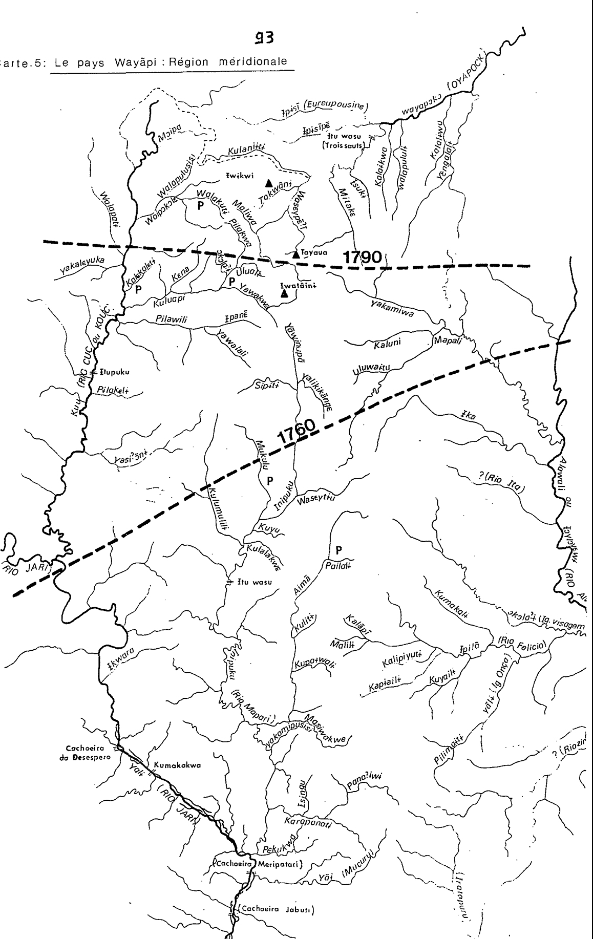
Peoples
- WAYAPI
Citation
Grenand, Pierre. Ainsi parlaient nos ancêtres : essai d'ethnohistoire « waŷapi ». Paris: ORSTOM, 1982.
![Sementerio [Semen-tary]](https://dnet8ble6lm7w.cloudfront.net/art_sm/ACOL018.png)
Sementerio [Semen-tary]
Artwork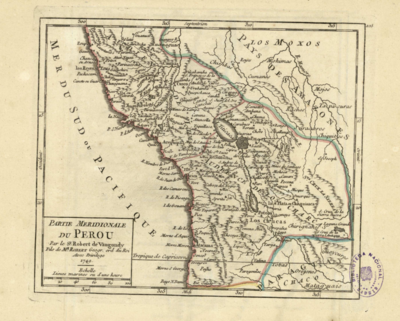
PARTIE MERIDIONALE DU PEROU
Map 1749
Railroad Map of British Honduras Transportation Department of the United States Department of Commerce. Library of Congress Geography and Map Division. https://hdl.loc.gov/loc.wdl/wdl.11329
Map 1900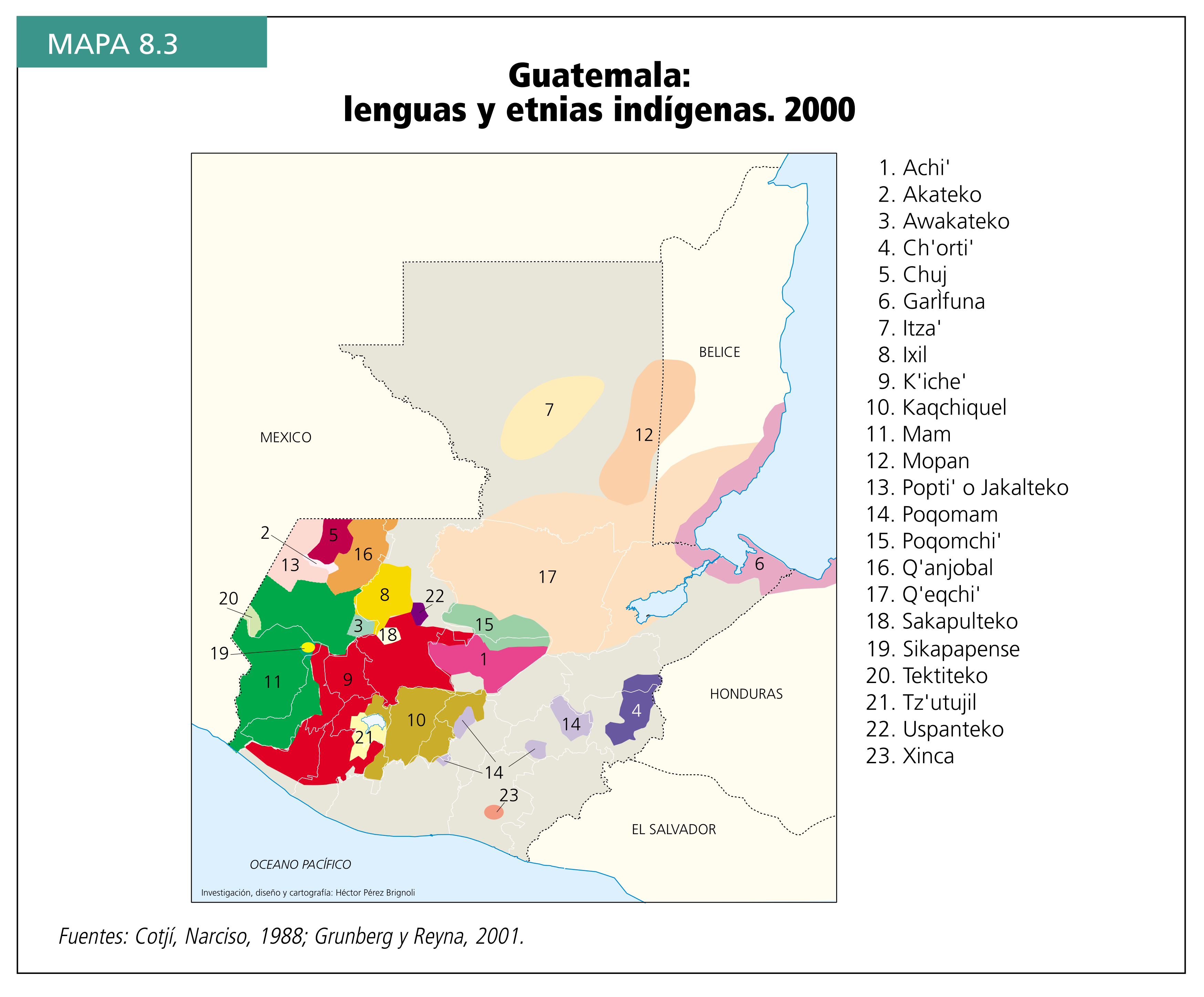
Guatemala: lenguas y etnias indígenas. 2000
Map 2000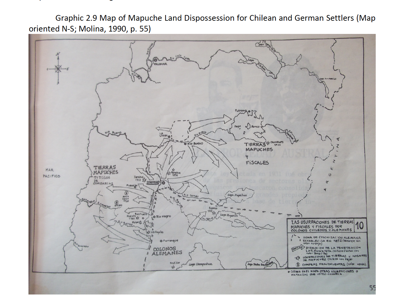
Map of Mapuche Land Dispossession for Chilean and German Settlers
Map 1911 - 1952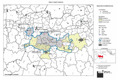
REGIÓN PUREPECHA
Map 2000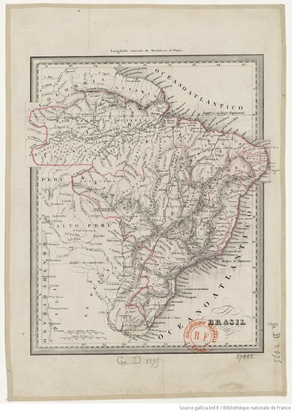
BRASIL
Map 1835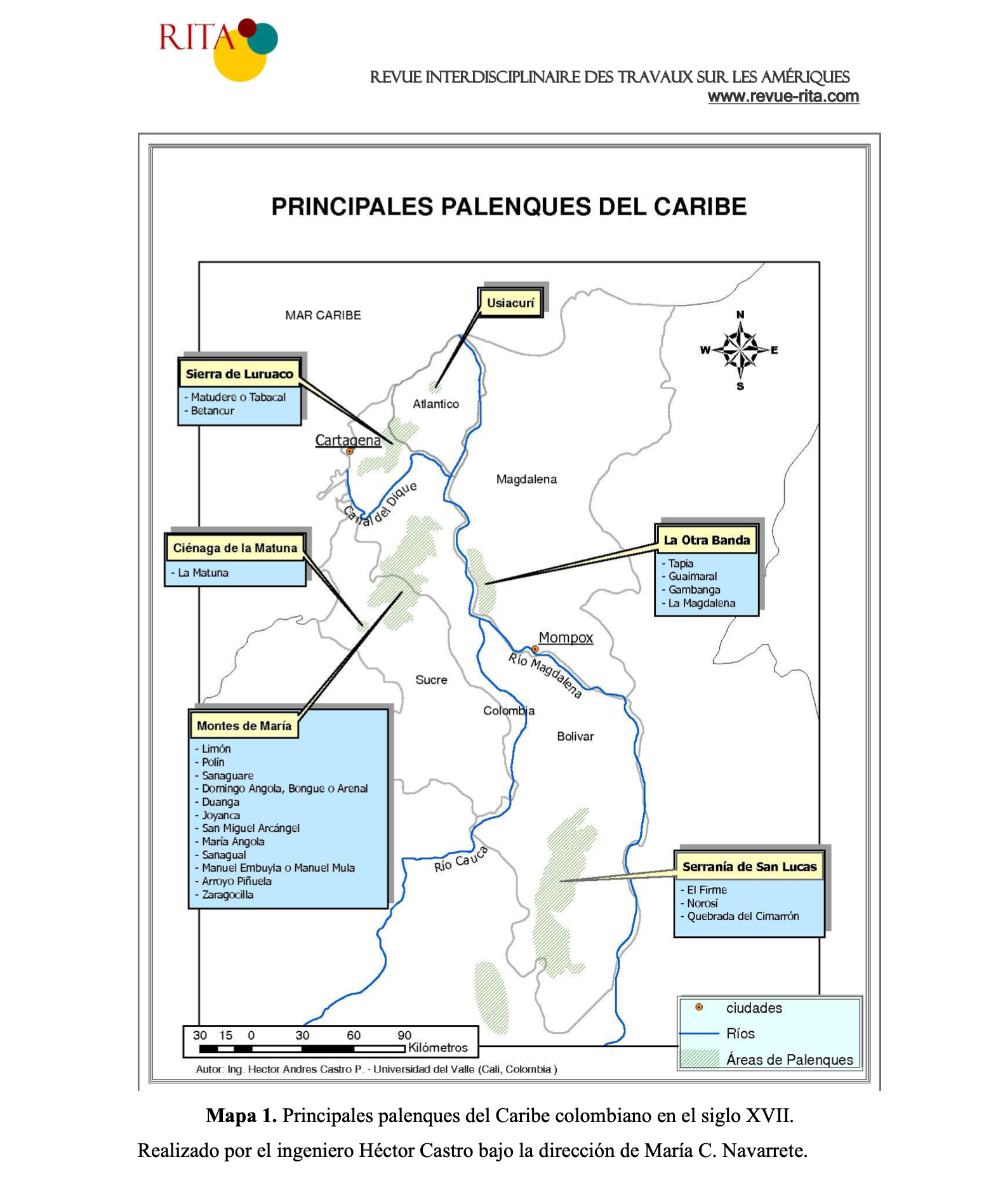
PRINCIPALES PALENQUES DEL CARIBE
Map 1600 - 1699