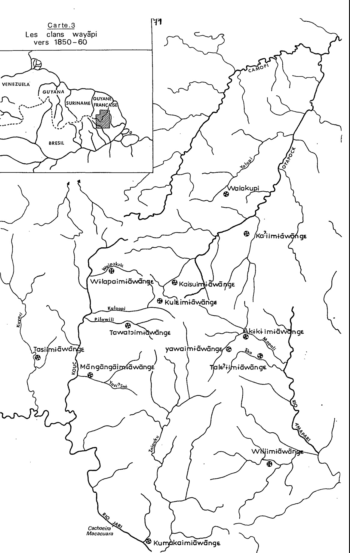
Peoples
- WAYAPI
Citation
Grenand, Pierre. Ainsi parlaient nos ancêtres : essai d'ethnohistoire « waŷapi ». Paris: ORSTOM, 1982.
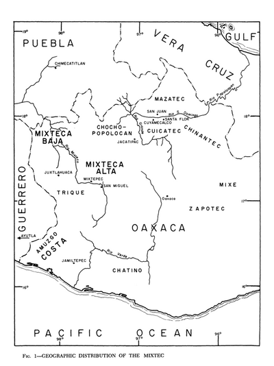
Geographic Distribution of the Mixtec
Map 1969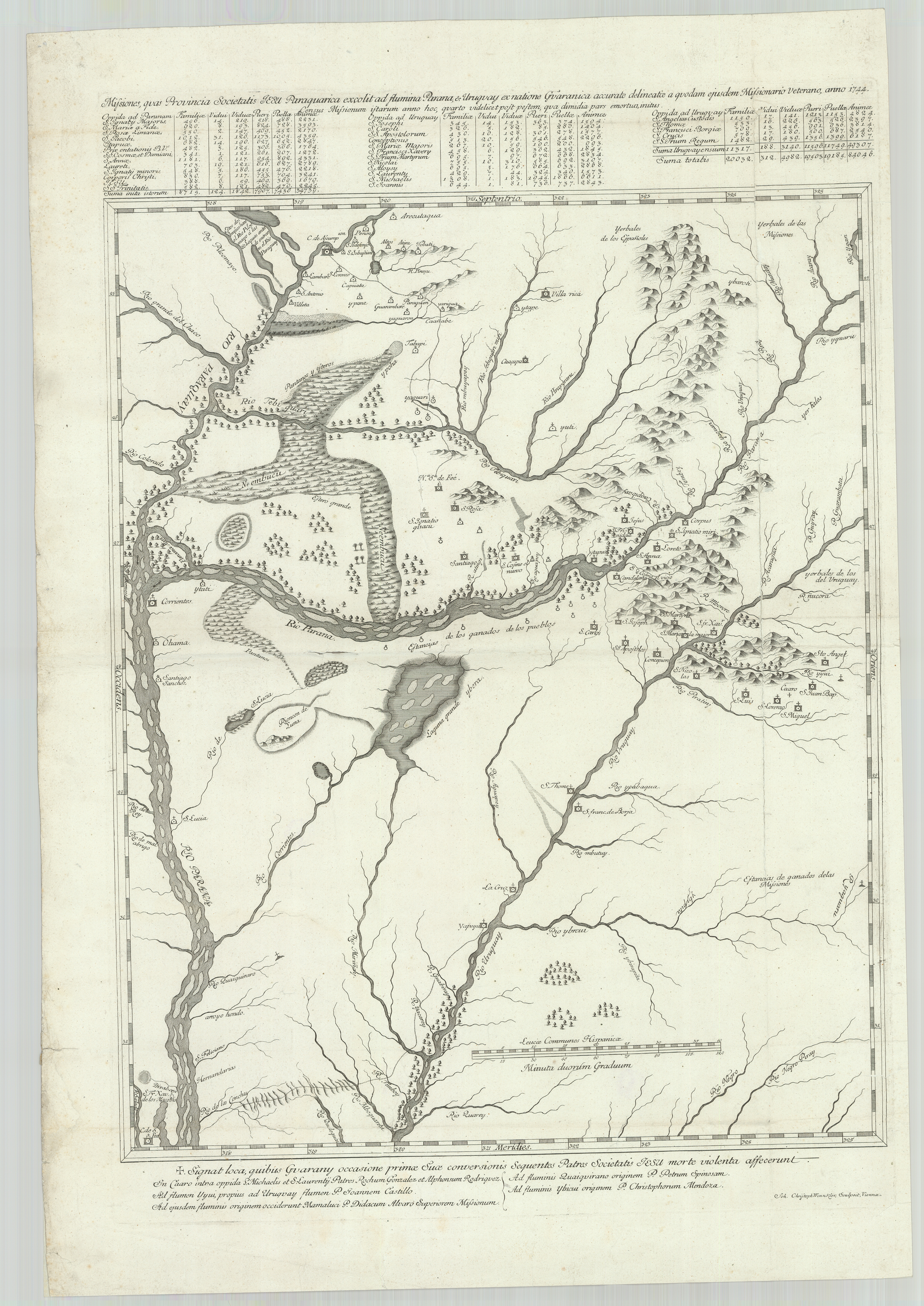
Missiones;quas Provincia Societatis Jesu Paraquarica excolit ad flumina Parana et Urugvay ex natione Guaranica accurate delineatice a quodam ejusdem Missionario Veterano;anno 1744
Map 1744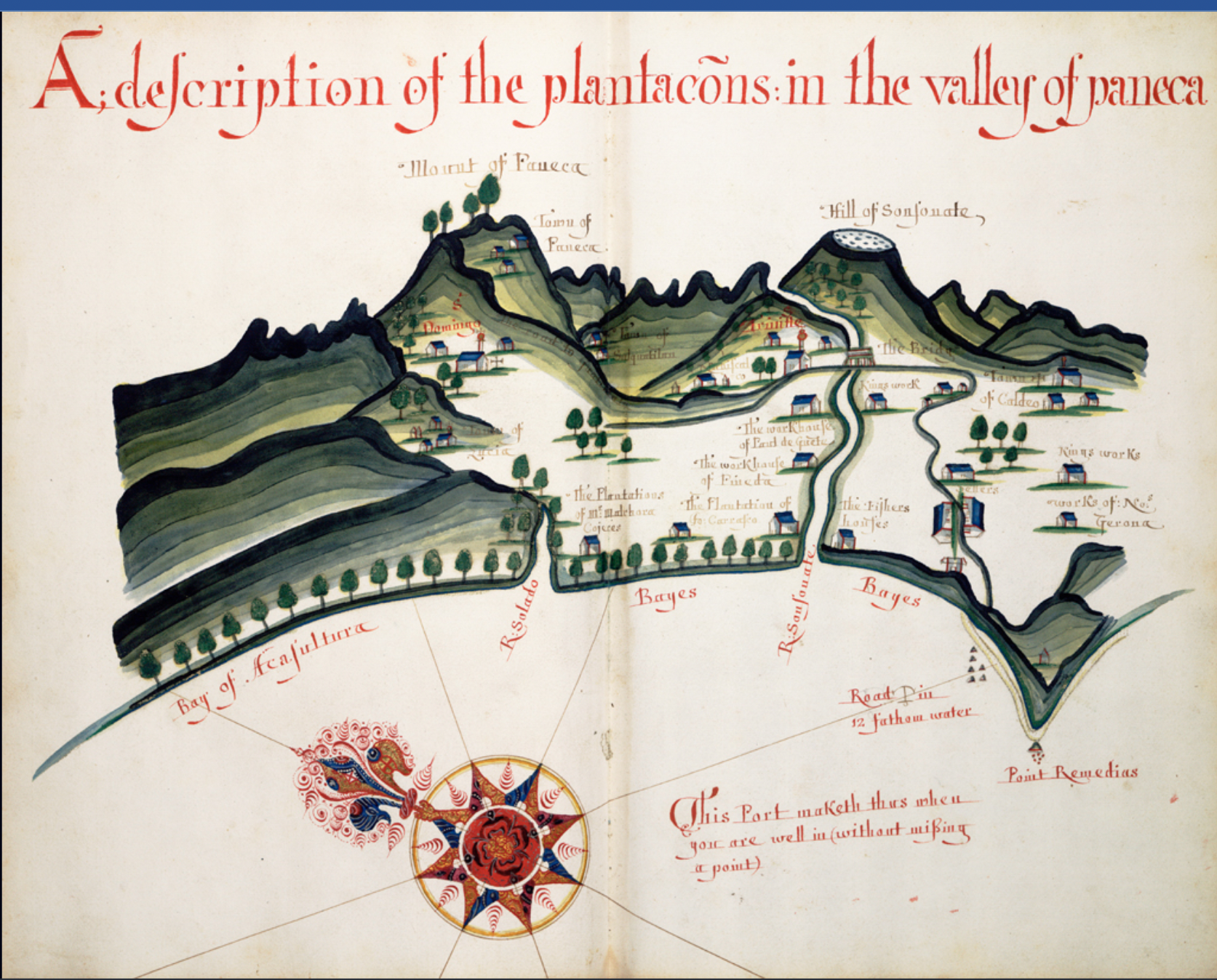
A Description of the Plantations in the Valley of Paneca
Map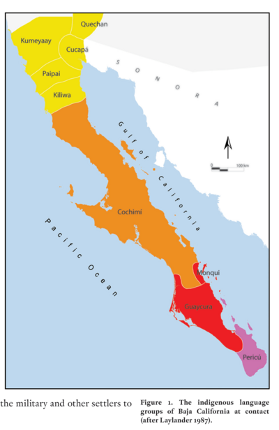
The indigenous language groups of Baja California at contact
Map 1530
SIDA / AIDS
Artwork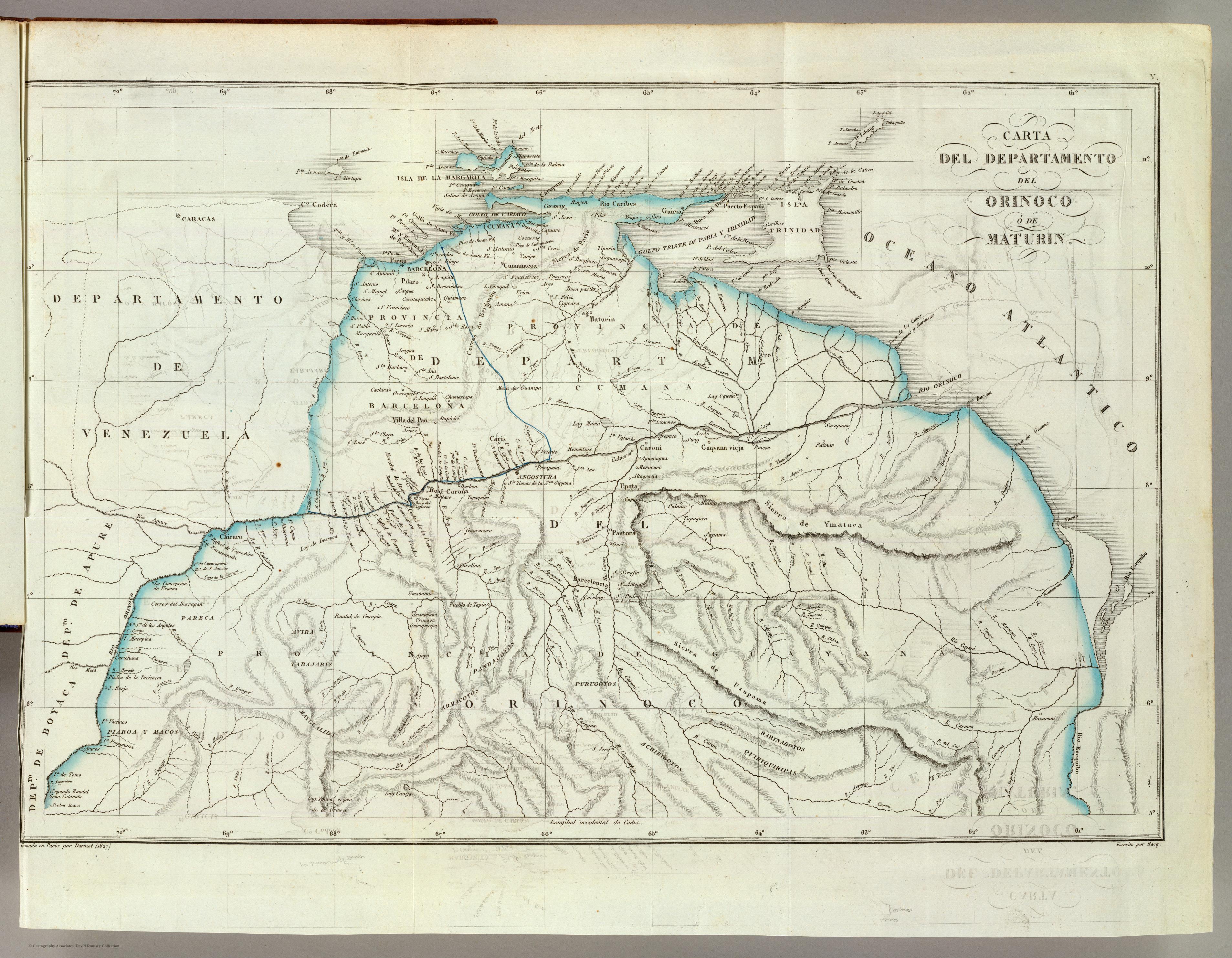
CARTA DEL DEPARTAMENTO DEL ORINOCO O DE MATURIN
Map 1827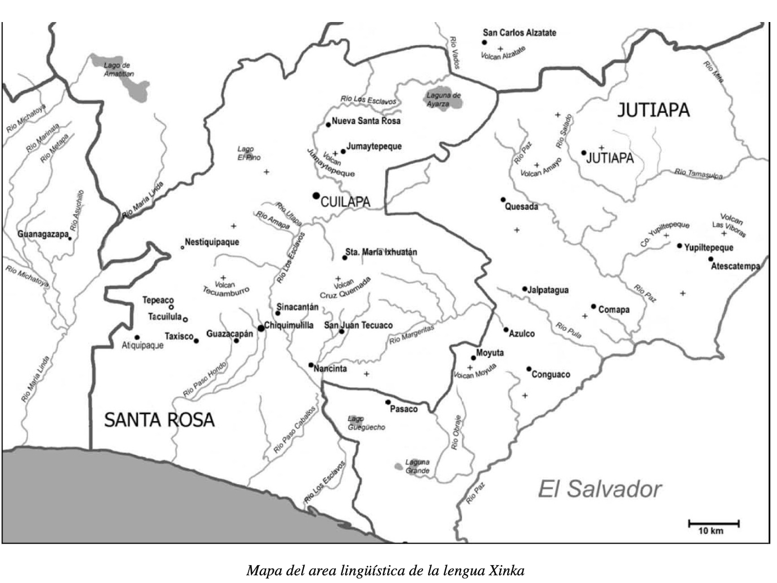
Mapa del area lingüística de la lengua Xinka
Map 2015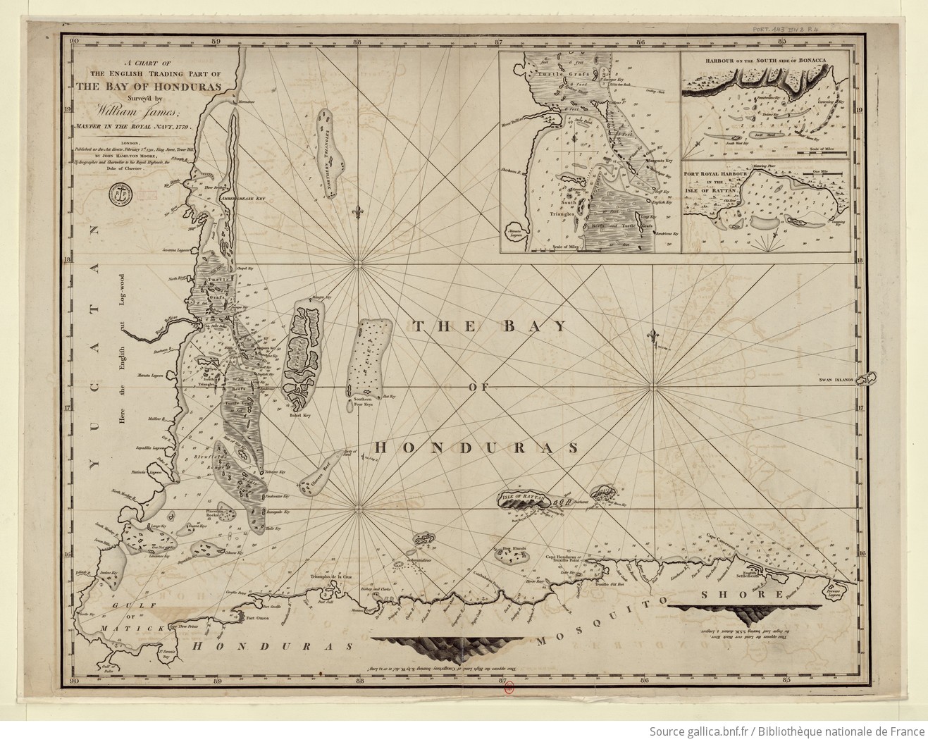
A chart of the English trading part of the bay of Honduras
Map 1791