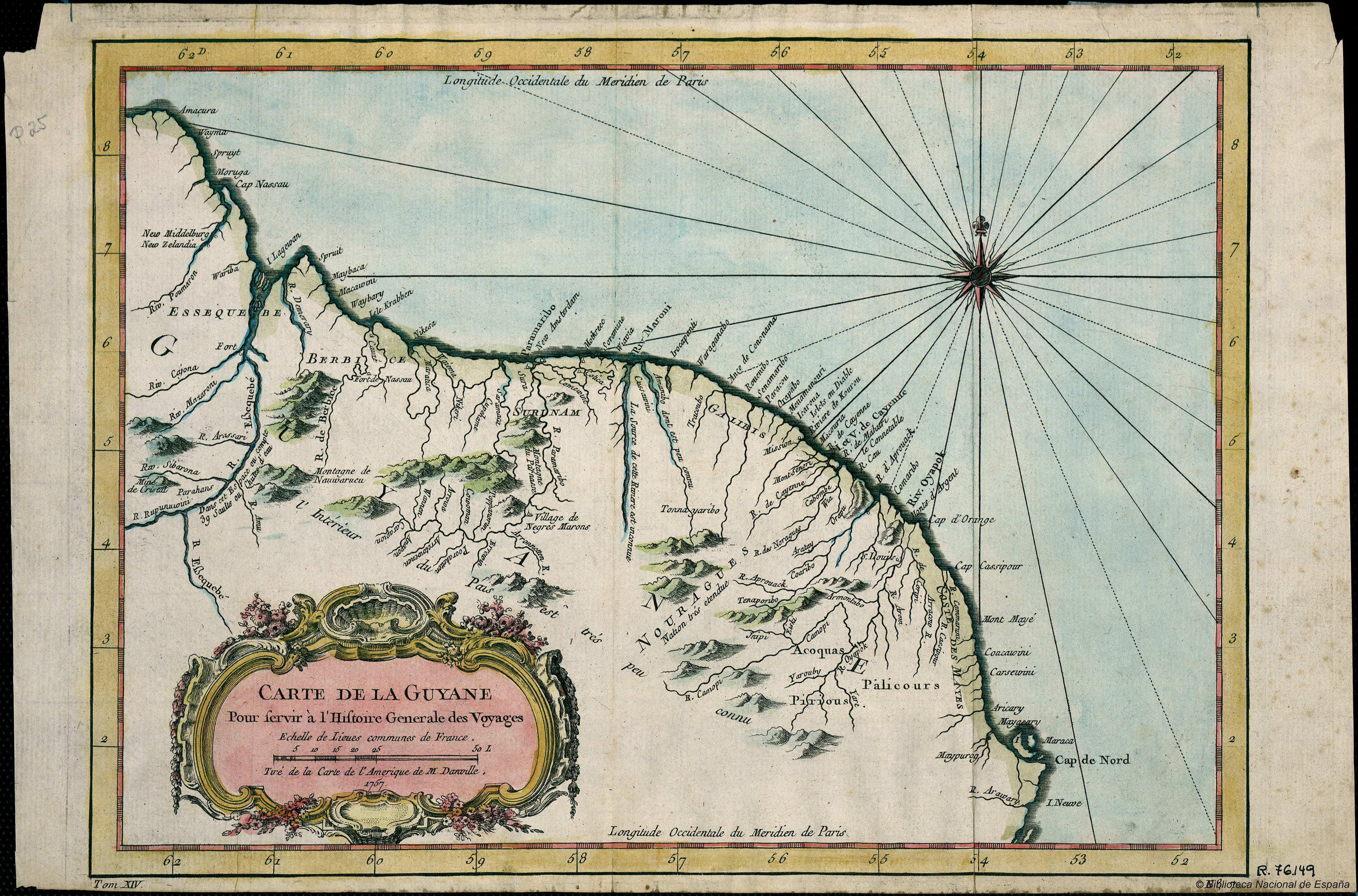
Peoples
- ACOQUAS
- GALIBIS
- NOURAGUES
- PALICOURS
- PIRIOUS
Citation
Guyana Mapas generales 1757. Biblioteca Nacional de España. Accessed, August 14, 2023. http://bdh.bne.es/bnesearch/detalle/bdh0000018259
![La viruela del mono [Monkeypox]](https://dnet8ble6lm7w.cloudfront.net/art/APER056.jpg)
La viruela del mono [Monkeypox]
Artwork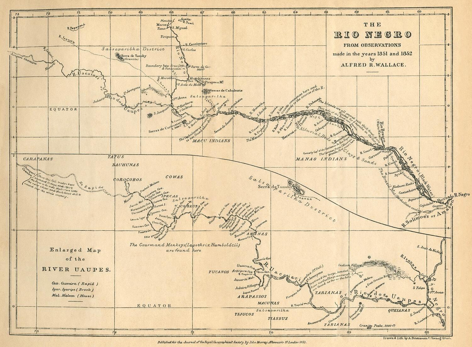
THE RÍO NEGRO
Map 1851 - 1852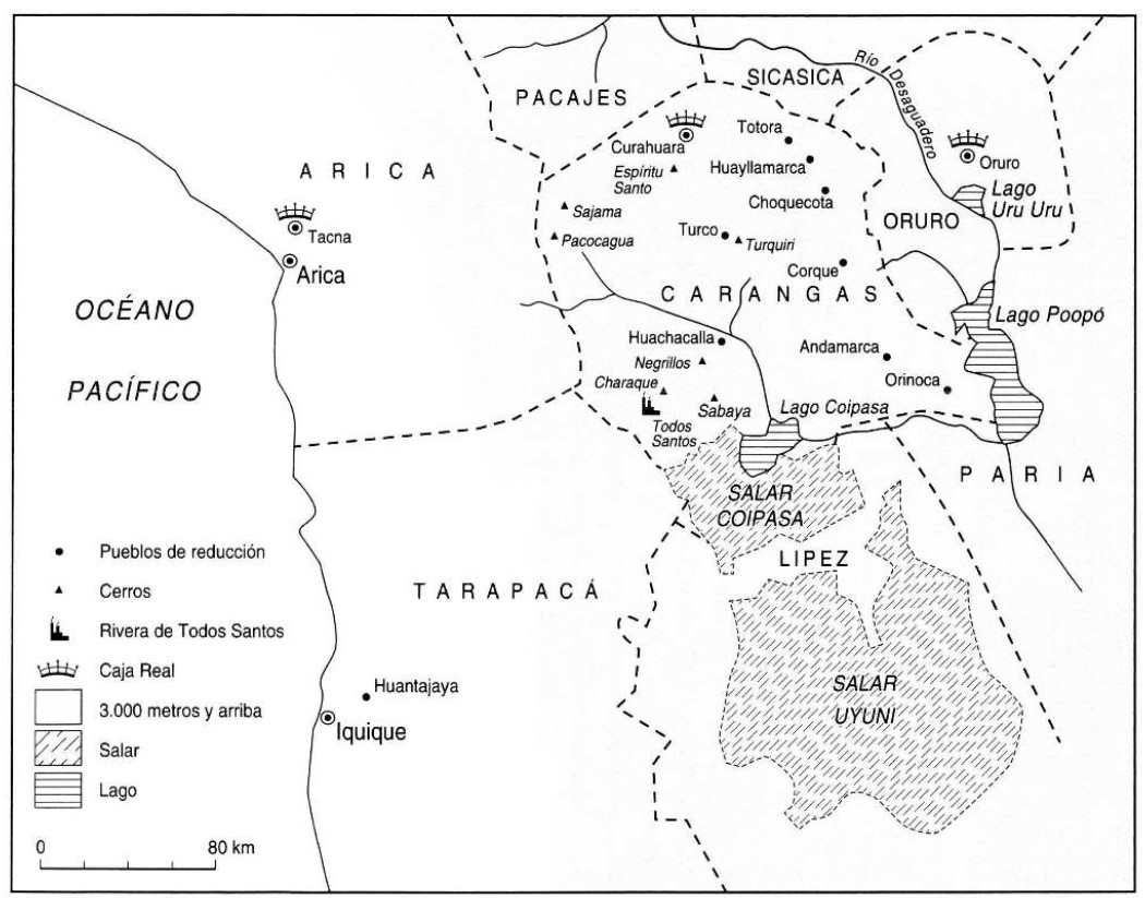
THE KARANQAS AYMARA POLITY UNDER SPANISH COLONIAL RULE IN THE 18TH CENTURY
Map 1750 - 1804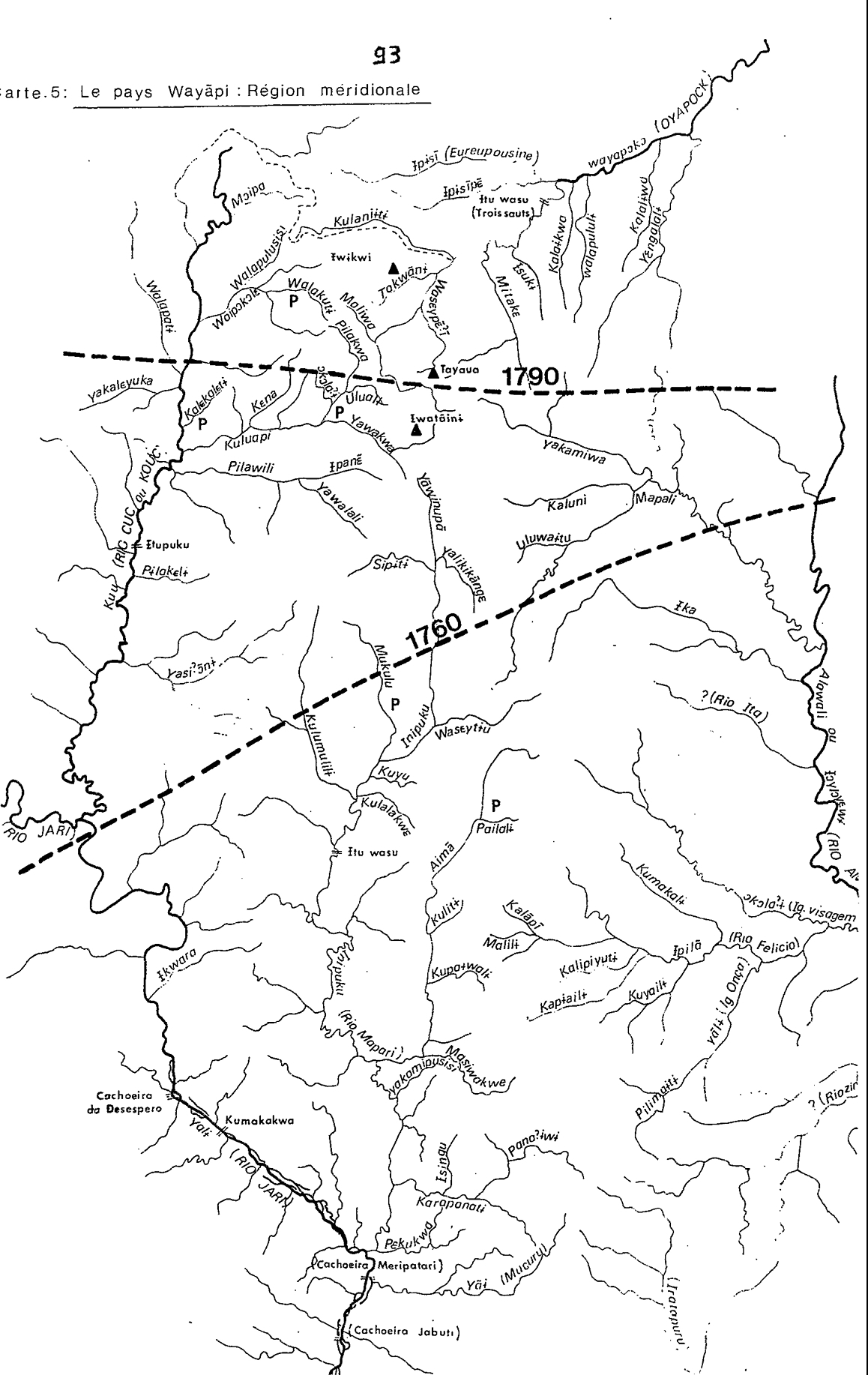
Carte 5: Le pays Wayãpi: Région méridionale
Map 1760 - 1790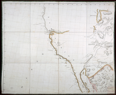
A New Map of Mexico and Adjacent Provinces Compiled From Original Documents
Map 1810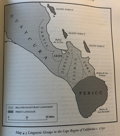
Linguistic Groups in the Cape Region of California
Map 1730![Kowkülen [Liquid being]](https://dnet8ble6lm7w.cloudfront.net/art_sm/AECU003.png)
Kowkülen [Liquid being]
Artwork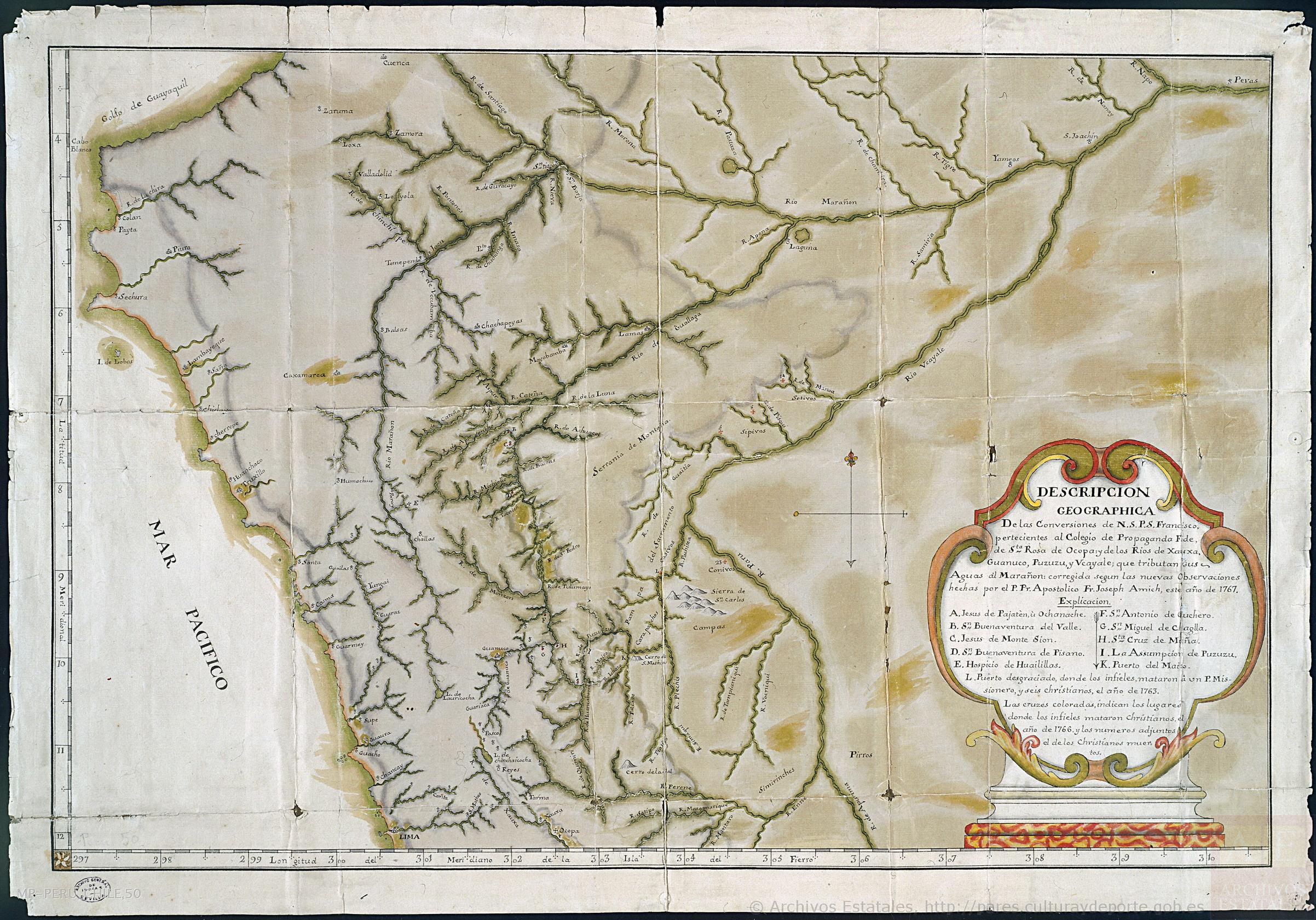
Descripción geográfica de las conversiones de Nuestro Señor Padre San Francisco, pertenecientes al Colegio de Propaganda Fide de Santa Rosa de Ocopa y de los Ríos de Xauxa, Guanuco, Puzuzu y Ucayali, que tributan sus aguas al Marañón;corregida según las nuevas observaciones hechas por el P. Pr. Apostólico Fr. Joseph Amich, este año de 1767.
Map 1767