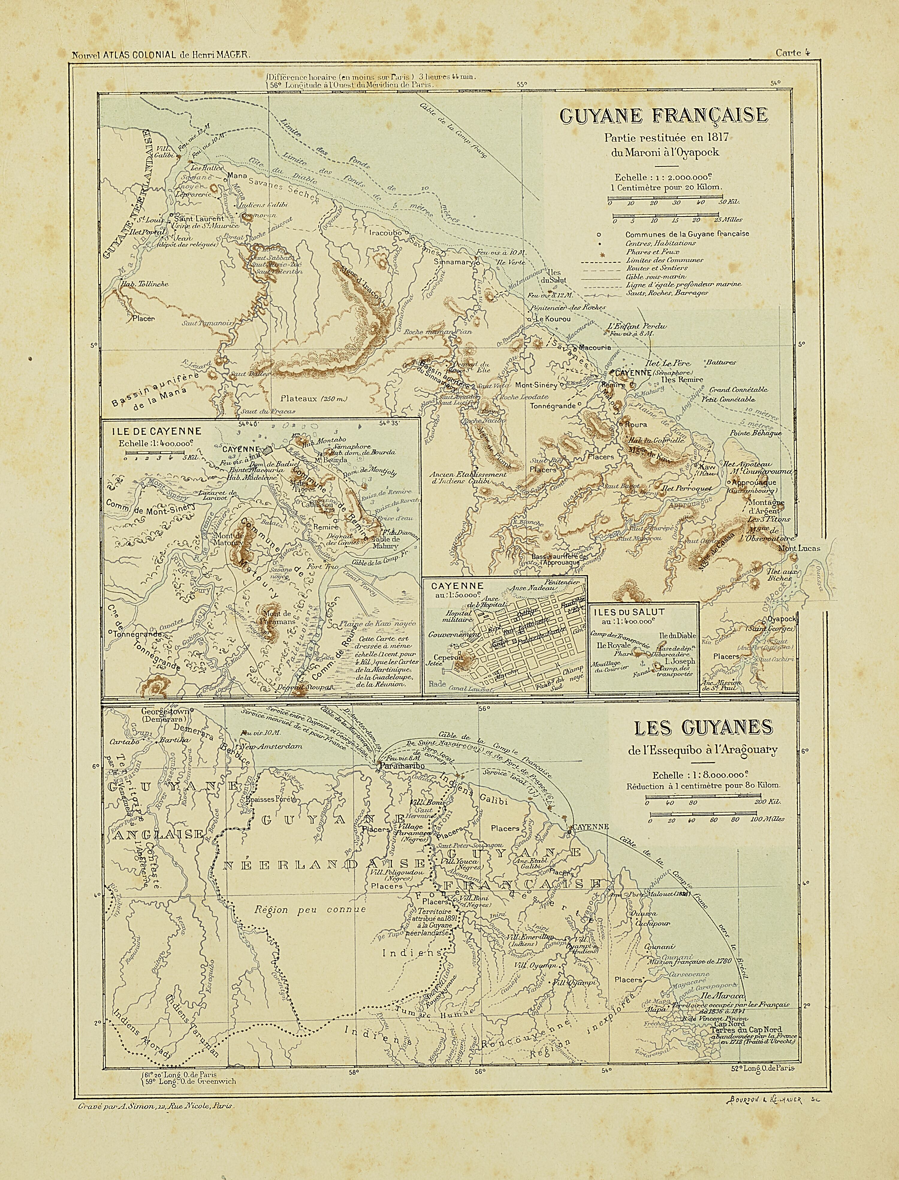
Peoples
- ATORADI
- EMERILLON
- GALIBI
- OYAMPI
- ROUCOUYENNE
- TARUMAN
Citation
Nouvel Atlas colonial. Gallica. Last modified: May 24, 2020. Accessed, August 1, 2023. https://gallica.bnf.fr/ark:/12148/bpt6k1100234w/f8.item
![A Cobra Grande manda para sua filha a noz de Tucunã [The Great Snake sends the Tucunã nut to her daughter]](https://dnet8ble6lm7w.cloudfront.net/art_sm/ABRA048.png)
A Cobra Grande manda para sua filha a noz de Tucunã [The Great Snake sends the Tucunã nut to her daughter]
Artwork
The modern departments of Ahuachapán, La Libertad, Santa Ana, and Sonsonate (highlighted in red) now contain the highest concentration of Indigenous communities in El Salvador.
Map 2010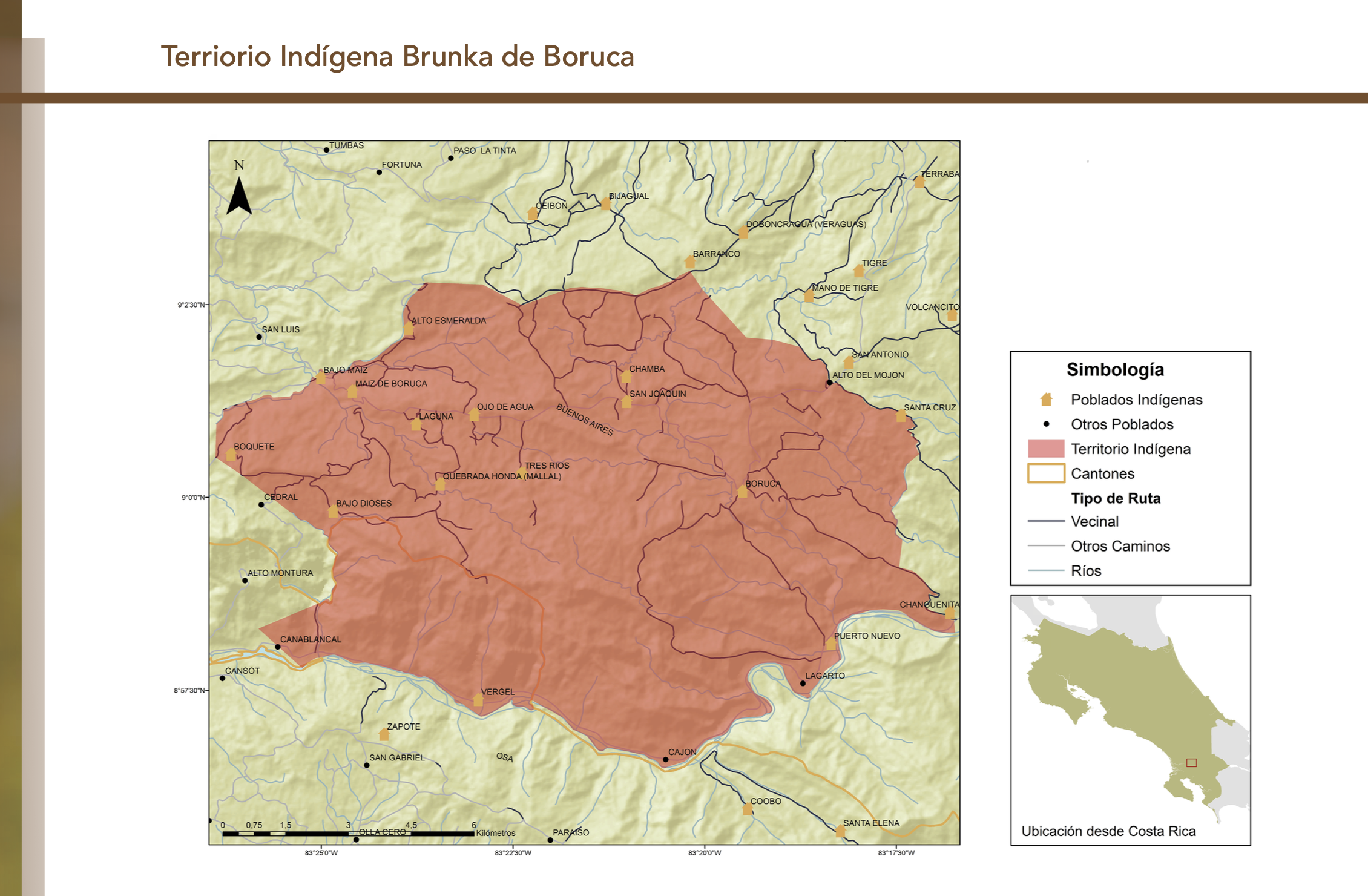
"Territorio Indígena Brunka de Boruca"
Map 2010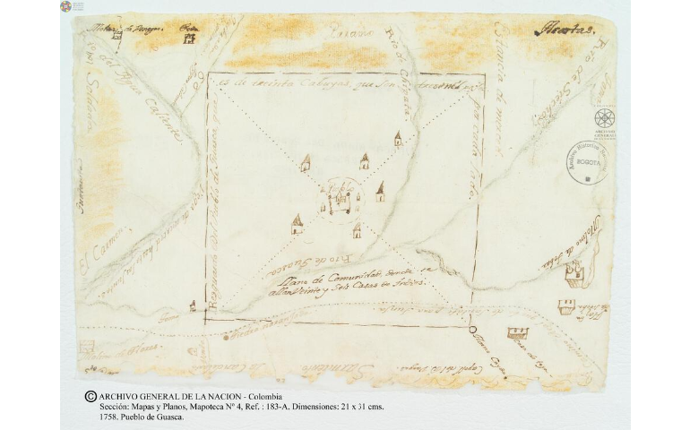
Pueblo de Guasca
Map 1758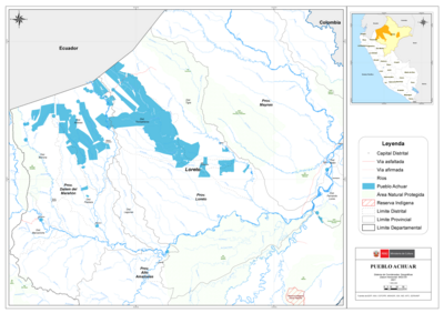
PUEBLO ACHUAR
Map 2021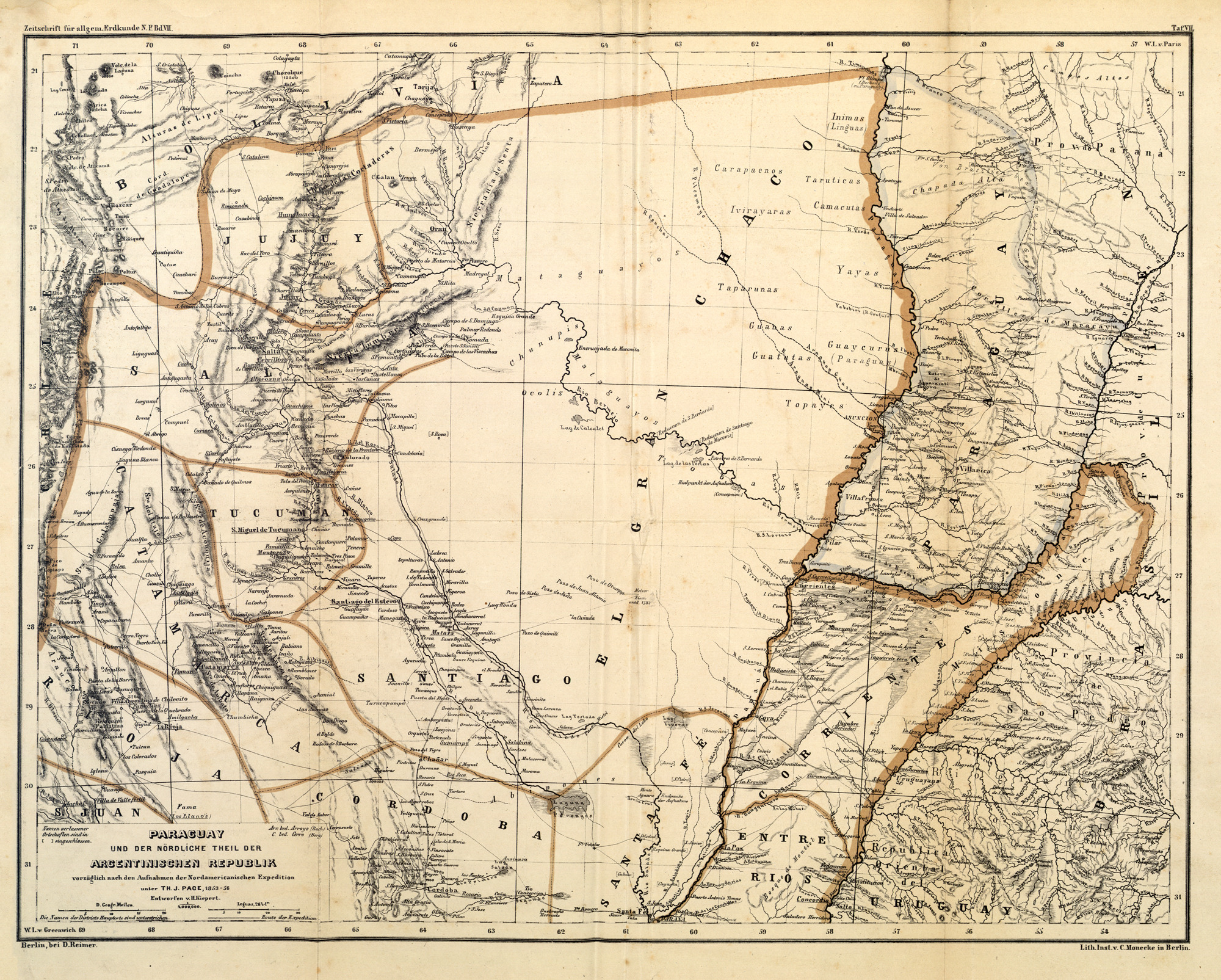
PARAGUAY UND DER NÖRDLICHE THEIL DER ARGENTINISCHEN REPUBLIK
Map 1853 - 56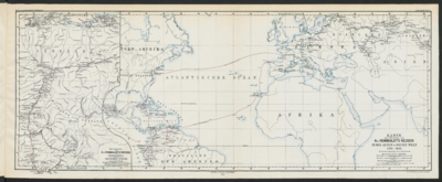
Specialkarte von A. v. HUMBOLDT’S REISEN in VENEZUELA und am ORINOKO-STROM
Map 1799 - 1800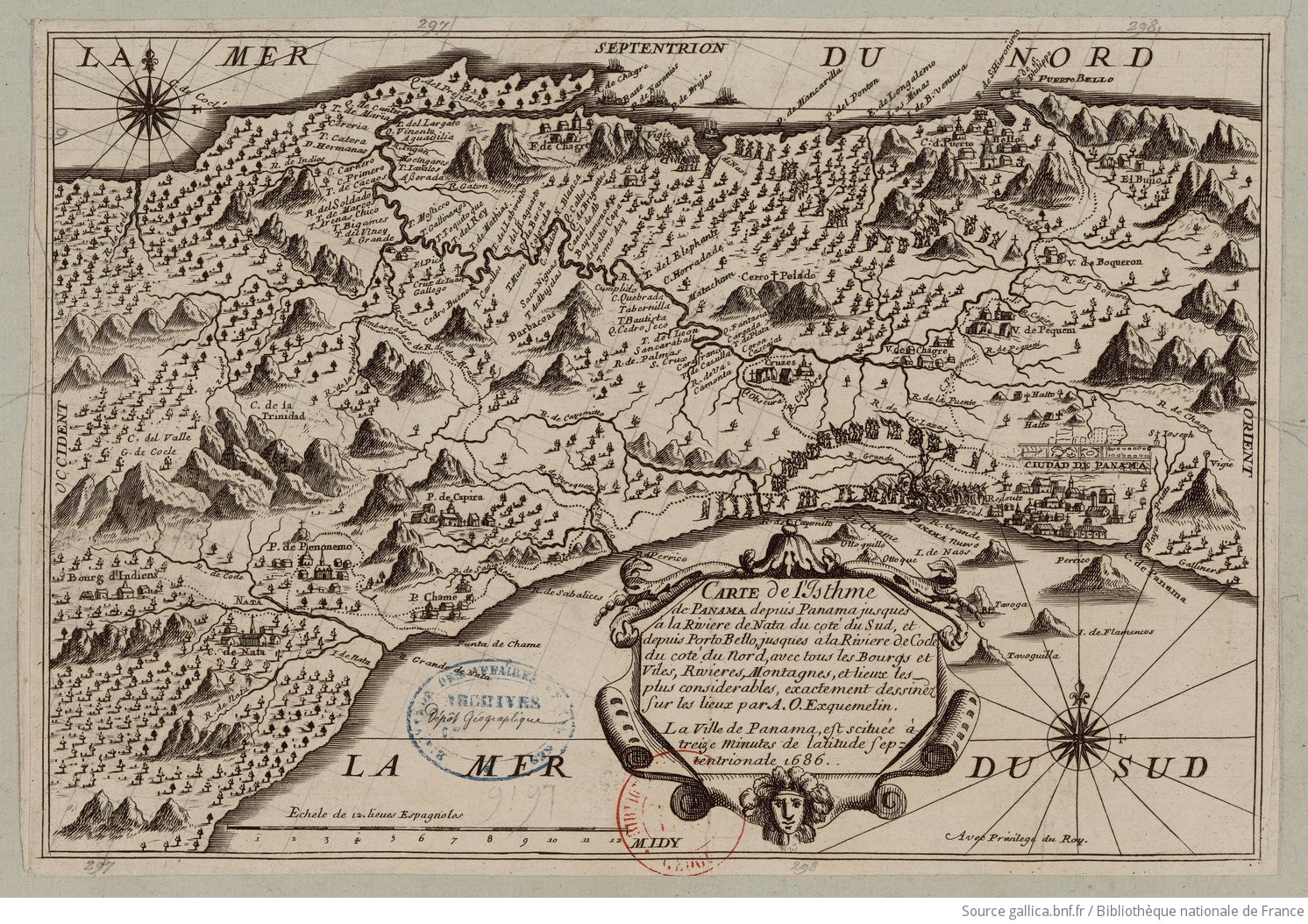
Carte de l'Isthme de Panama depuis Panama jusques à la Riviere de Nata du coté du Sud, et depuis Porto Betto, jusques à la Riviere de Codé du coté du Nord
Map 1686