Peoples
- HABITATIONS D'INDIENS
Citation
France équinoctiale Partie méridionale et Isle de Cayenne. Gallica. Last modified: September 28, 2015. Accessed, July 31, 2023. https://gallica.bnf.fr/ark:/12148/btv1b53103446c
"Territorio Indígena Cabécar de Nairi Awari"
Map 2010
Carte de la Guyane d'après les termes du traité d'Utrecht / publiée par la Société d'études pour la colonisation de la Guyane française
Map 1843
PUEBLO PAME
Map 2020![El sonido del río animado: peque peque [The Sound of the Animated River: Peque Peque]](https://dnet8ble6lm7w.cloudfront.net/art_sm/APER065.png)
El sonido del río animado: peque peque [The Sound of the Animated River: Peque Peque]
Artwork![Jornadas de limpieza (tercera jornada) [Cleaning Sessions (Third Day)]](https://dnet8ble6lm7w.cloudfront.net/art_sm/ACOL013.png)
Jornadas de limpieza (tercera jornada) [Cleaning Sessions (Third Day)]
Artwork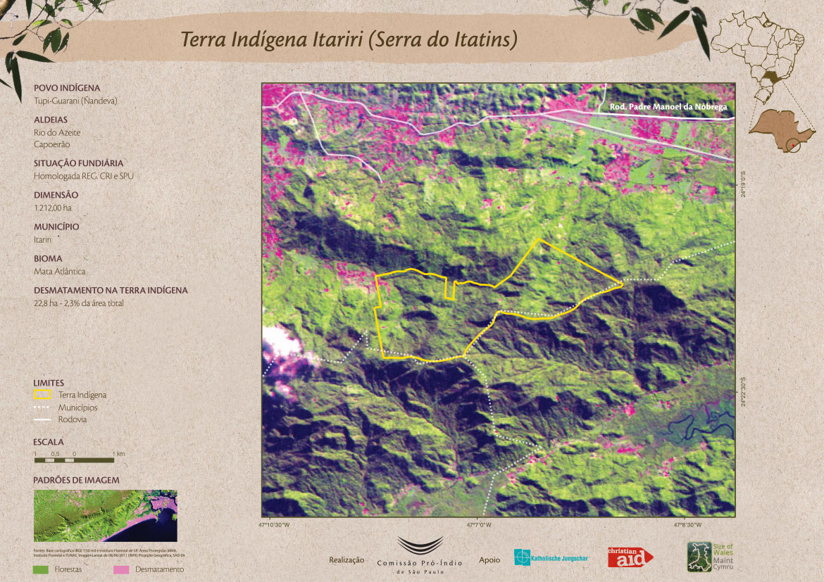
Terra Indígena Itariri (Serra do Itatins)
Map 2011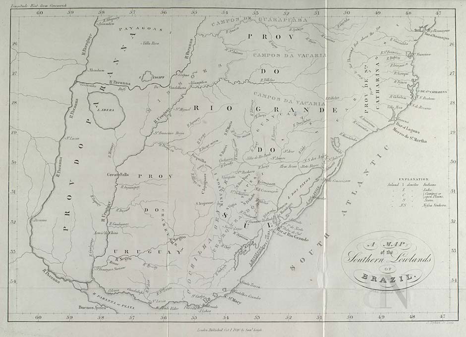
A MAP of the Southern Lowlands of BRAZIL
Map 1808 - 1818![1. Angustia #1
2. Angustia #2
3. Angustia #7
4. Angustia #8
5. Angustia #10
6. Angustia #12 [Anguish]](https://dnet8ble6lm7w.cloudfront.net/art_sm/ACOL025.png)
1. Angustia #1 2. Angustia #2 3. Angustia #7 4. Angustia #8 5. Angustia #10 6. Angustia #12 [Anguish]
Artwork