Peoples
- GALIBIS
- MAOURIO
- MARRONE
- ROUAS
- TOCOIENNES
- TOKOIENNES
Citation
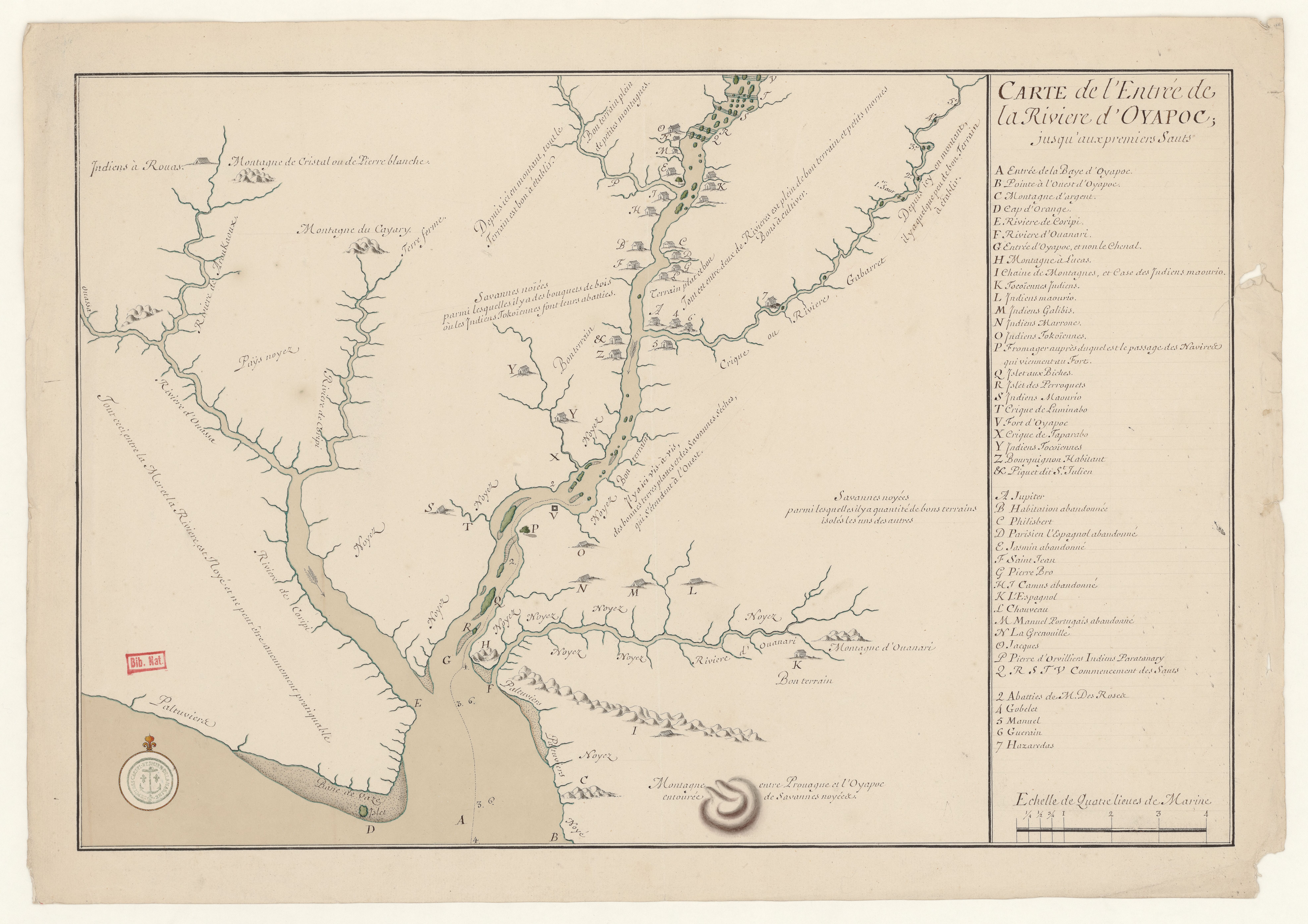
Carte de l'entrée de la Rivière d'Oyapoc jusqu'aux premiers sauts. Gallica. Last modified: September 28, 2015. Accessed, July 31, 2023. https://gallica.bnf.fr/ark:/12148/btv1b531036642