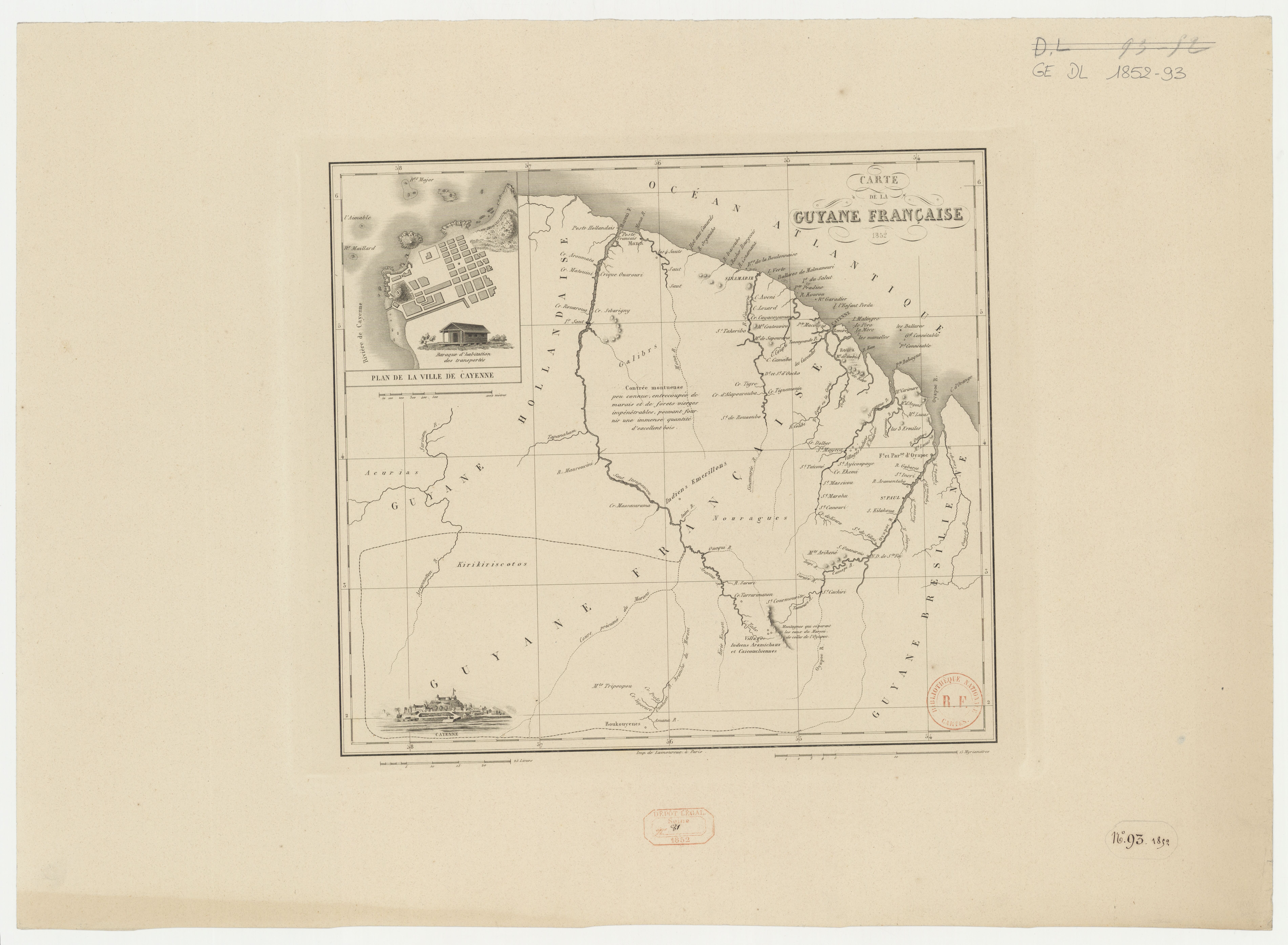
Peoples
- ACURIAS
- ARAMICHAUX
- BOUKOUYENES
- CAICOUCHIENNES
- EMERILLONS
- GALIBYS
- KIRIKIRISCOTOS
Citation
Carte de la Guyane française. Gallica. Last modified: January 3, 2017. Accessed, June 27, 2023. https://gallica.bnf.fr/ark:/12148/btv1b53136304d
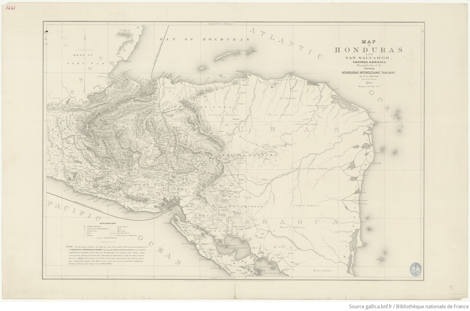
Map of Honduras and San Salvador, Central America, Showing the line of the proposed Honduras Interoceanic Railway
Map 1854![Serie Esclavas de la fiebre de oro [Series Slaves of the Golden Fever]](https://dnet8ble6lm7w.cloudfront.net/art_sm/APER063-0.png)
Serie Esclavas de la fiebre de oro [Series Slaves of the Golden Fever]
Artwork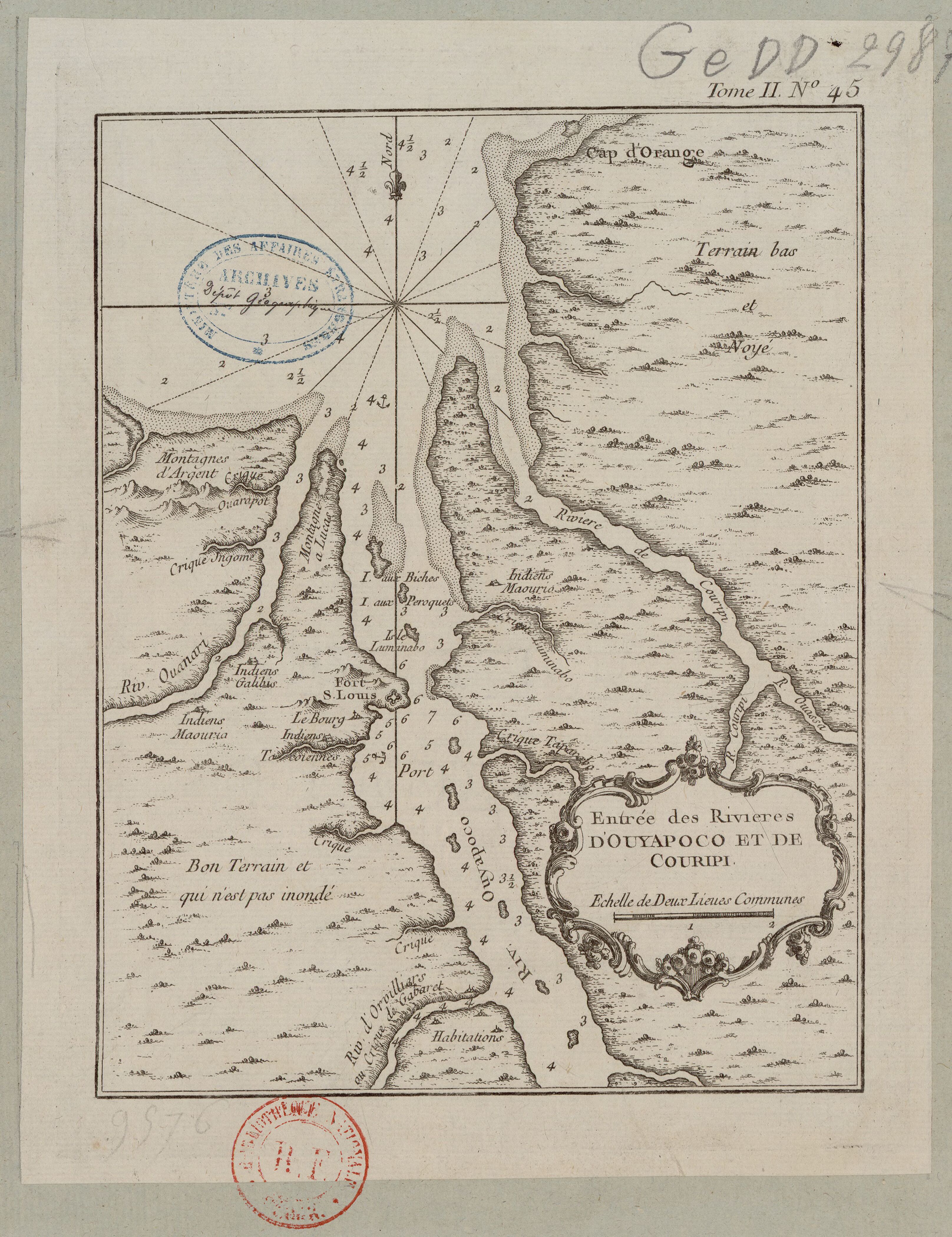
Entrée des rivières d'Ouyapoco et de Couripi.
Map 1764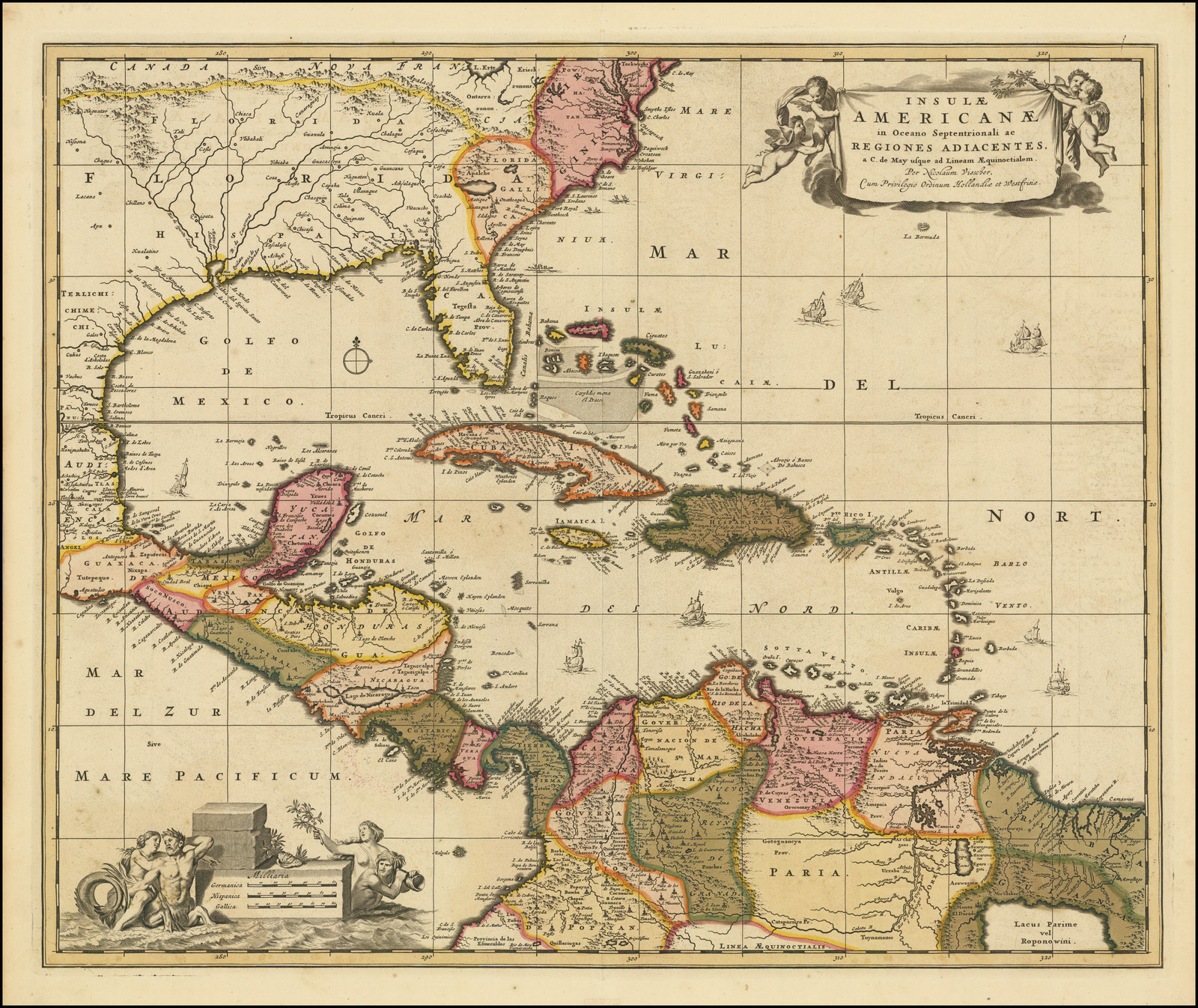
Insulae Americanae in Oceano Septentrionali ac Regiones Adiacentes, a C. de May usque ad Lineam Aequinoctialem.
Map 1700 - 1799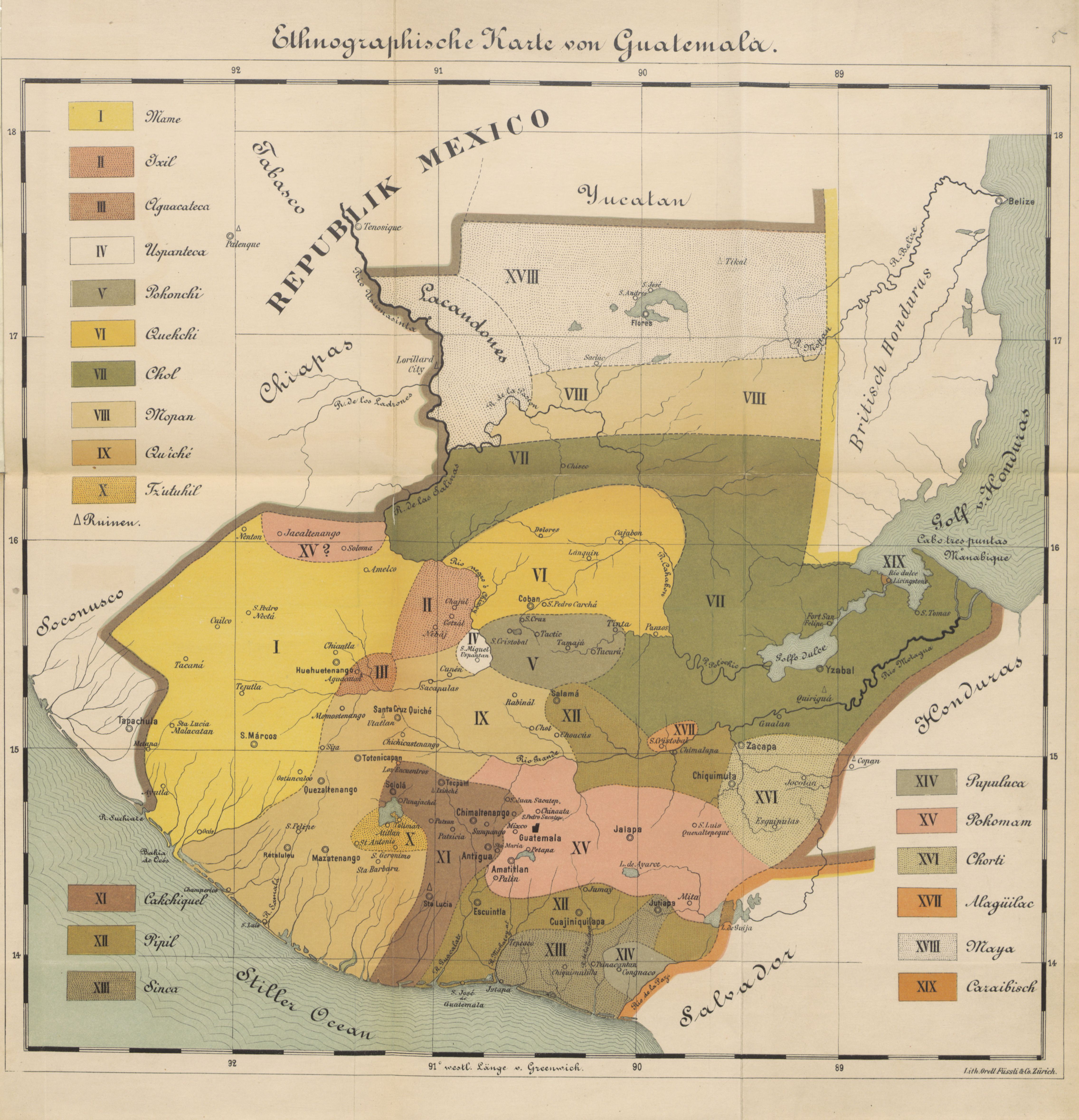
Ethnographische Karte von Guatemala
Map 1884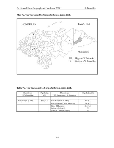
The Tawahka: Most important municipios, 2001
Map 2001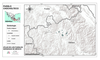
PUEBLO CHOCHOLTECO
Map 2020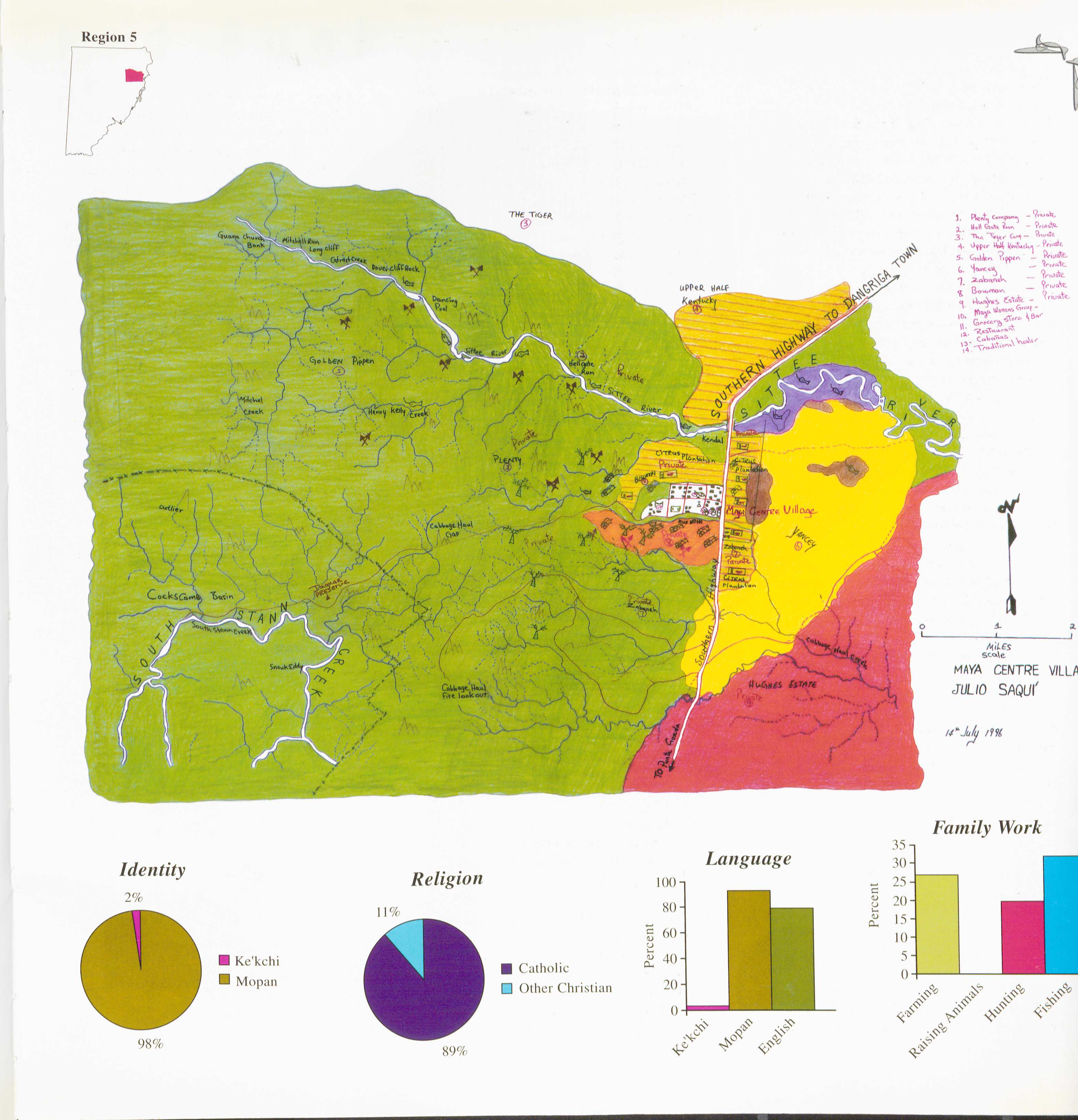
Maya Centre
Map 1997