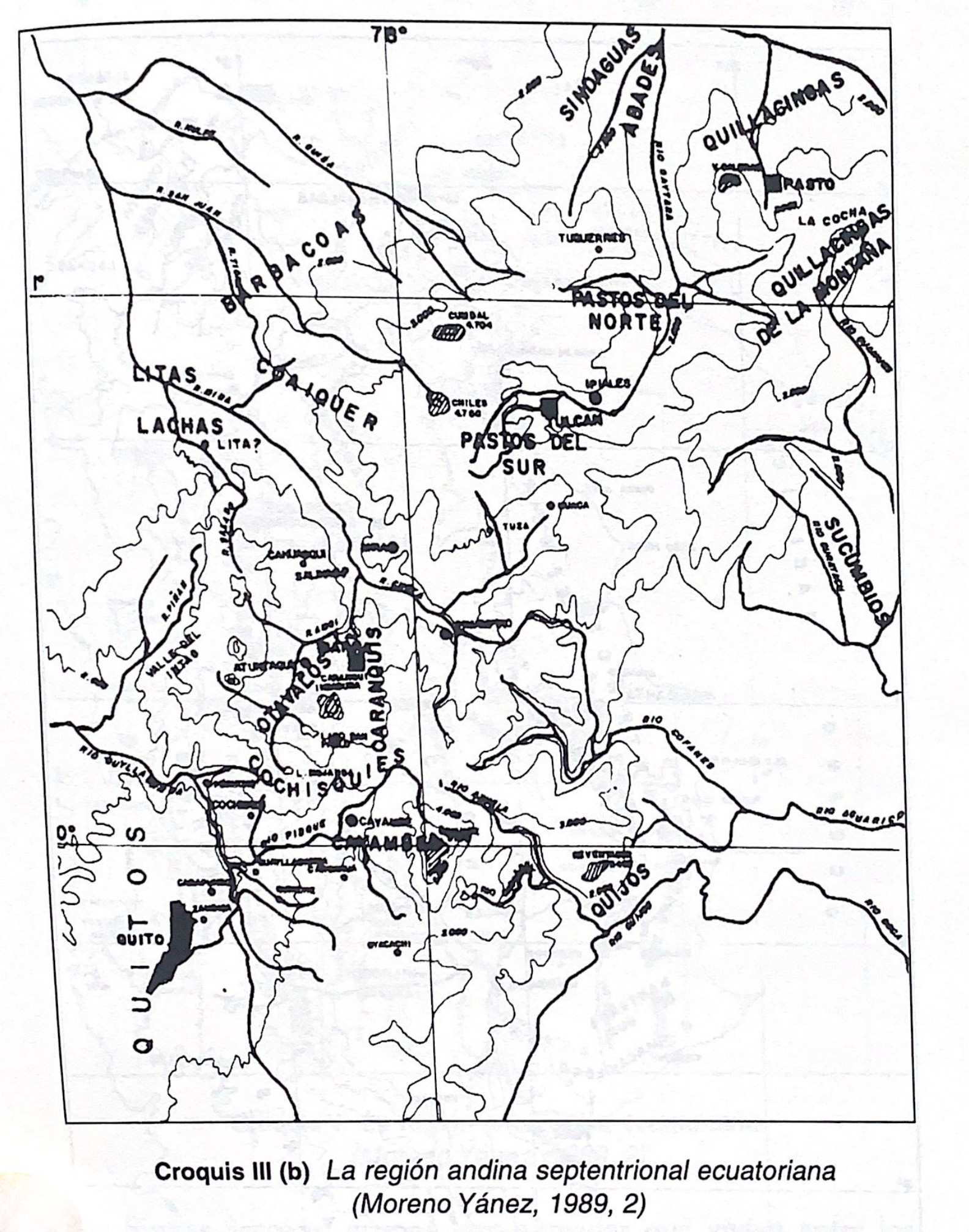
Dispossesions in the Americas

Dispossesions in the Americas

  • Home
  • Explore
  • About
  • Authors
  • Art
  • Bodies
  • Curricula
  • Cultural Heritage
  • Maps
  • Territories
Back to Explore
Map -500 - 1530

Croquis III. (b) La región andina septentrional ecuatoriana (Moreno Yanez;1989;2)

  • SEGUNDO E. MORENO YANEZ

Published: 1989

  • Download Image

Peoples

  • BARBACOAS
  • AWA
  • PASTOS DEL NORTE
  • PASTOS DEL SUR
  • OTAVALOS
  • CARANQUIS
  • QUIJOS
  • SINOAGUAS
  • ABADES
  • QUILLACINSAS DE LA MONTANA
  • SUCUMBIOS
  • LITAS
  • LACHAS
  • CAYAMBES
  • COCHISQUIES

Citation

Borchart de Moreno;Christiana Renate;and Segundo. Moreno Yáñez. Crónica indiana del Ecuador antiguo. Quito: Proyecto EBI-GTZ;1997. https://upenn.alma.exlibrisgroup.com/discovery/fulldisplay?vid=01UPENN_INST:Services&id=9923438013503681&inst=01UPENN_INST&context=L

  • Download Image

Reading in Spanish

Map -500 - 1530

Croquis III. (b) La región andina septentrional ecuatoriana (Moreno Yanez;1989;2)

  • SEGUNDO E. MORENO YANEZ

Published: 1989

  • Download Image
  • Download Image

Related Content

Argentina, Paraguay and Uruguay 1648 CE

Argentina, Paraguay and Uruguay 1648 CE

Map 1648
TERRITORIOS ANCESTRALES DE LOS CUATRO PUEBLOS INDIGENAS DE LA SSNM (MAPA APROXIMATIVO DE REFERENCIA)

TERRITORIOS ANCESTRALES DE LOS CUATRO PUEBLOS INDIGENAS DE LA SSNM (MAPA APROXIMATIVO DE REFERENCIA)

Map 2009
Linguistic Groups in the Cape Region of California

Linguistic Groups in the Cape Region of California

Map 1730
Lengua Pilagá - Ubicación geográfica

Lengua Pilagá - Ubicación geográfica

Map 2021
Figure 10.1. Map of Ecuador showing the Western Pichincha research region and the site of Palmitopamba.

Figure 10.1. Map of Ecuador showing the Western Pichincha research region and the site of Palmitopamba.

Map -700 - 1534
Localización Territorial de los Collas Hacia Fines del Siglo XIX y Principios de Siglo XX."

Localización Territorial de los Collas Hacia Fines del Siglo XIX y Principios de Siglo XX."

Map 1800 - 1900
Maya Communal Lands, Reservations, and Logging Concessions

Maya Communal Lands, Reservations, and Logging Concessions

Map 1997
Carte générale de Colombie, de la Guyane Française, Hollandaise et Anglaise.

Carte générale de Colombie, de la Guyane Française, Hollandaise et Anglaise.

Map 1800 - 1899

Dispossessions in the Americas

A project by

University of Pennsylvania

Copyright 2024

With support from

Mellon Foundation

Site design & development

Element 84

Art Credits

Borchart de Moreno;Christiana Renate;and Segundo. Moreno Yáñez. Crónica indiana del Ecuador antiguo. Quito: Proyecto EBI-GTZ;1997. https://upenn.alma.exlibrisgroup.com/discovery/fulldisplay?vid=01UPENN_INST:Services&id=9923438013503681&inst=01UPENN_INST&context=L

Site Pages

  • Home
  • Explore
  • About
  • Authors
  • Art
  • Bodies
  • Curricula
  • Cultural Heritage
  • Maps
  • Territories