Peoples
- KANARI
Citation
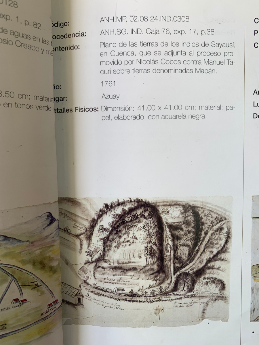
Archivo Nacional del Ecuador. "Plano de las Tierras de Sayausí;en Cuenca que se adjunta al proceso promovido por Nicolás Cobos contra Manuel Tacuri sobre tierras denomidas Mapán". Pichincha;Ecuador. 1903. ANH.MP.02.06.16.NT4P.0161
![Serie Historia de la peruvian corporaishion [History of the Peruvian Corporaishion Series]](https://dnet8ble6lm7w.cloudfront.net/art_sm/APER037.png)
![Una de las Postales Mentía [One of the Postcards Lied]](https://dnet8ble6lm7w.cloudfront.net/art_sm/AMEX014.png)