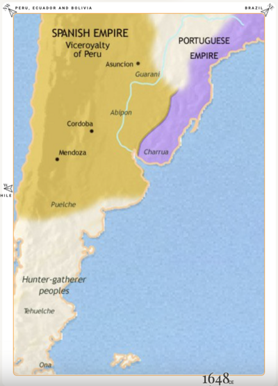
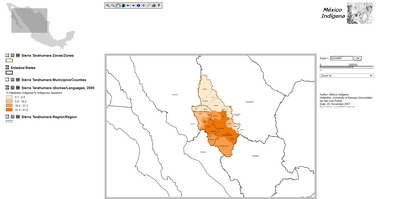
Peoples
- QUECHUA
Citation
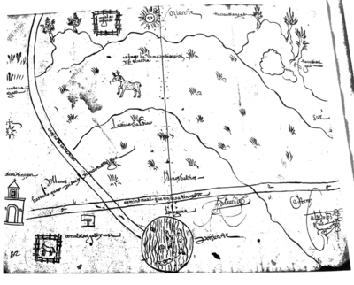
Archivo Nacional del Ecuador. "Representación en forma de tríptico de las tierras de Tepal;Cuenca;correspondiente al expediente promovido por posesión de tierras entre los indígenas de Santa Ana de Pichacay contra María y Francisca Cazar". Azuay;Ecuador. 1828. ANH.MP.01.04.11.CIV.0106