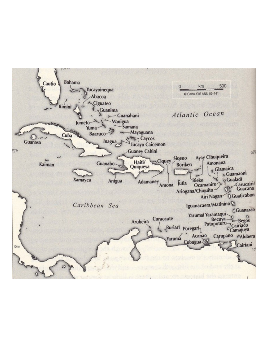
Peoples
- TAINO
Citation
"Taino Names of the Caribbean Islands." Map. The Decolonial Atlas. February 2, 2015. Accessed March 31, 2021. https://decolonialatlas.wordpress.com/2015/02/02/taino-names-of-the-caribbean-islands/.
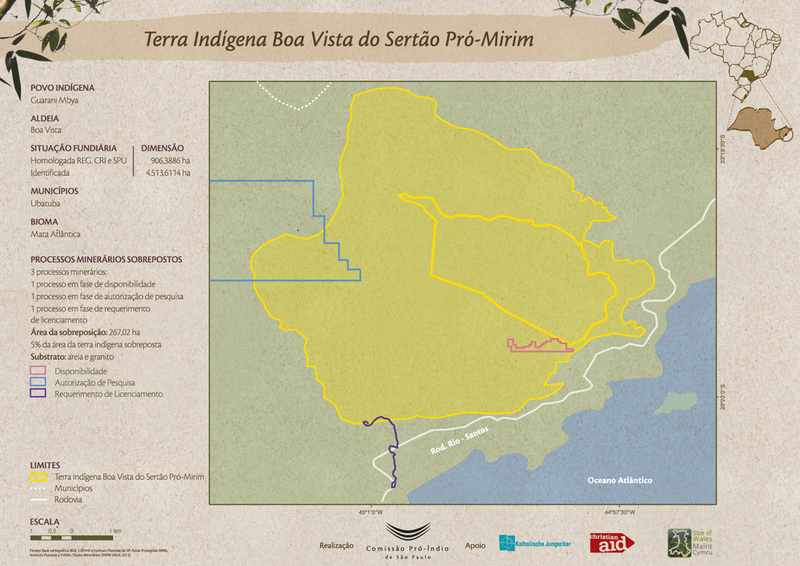
Terra Indígena Boa Vista do Sertão Pró-Mirim
Map 2012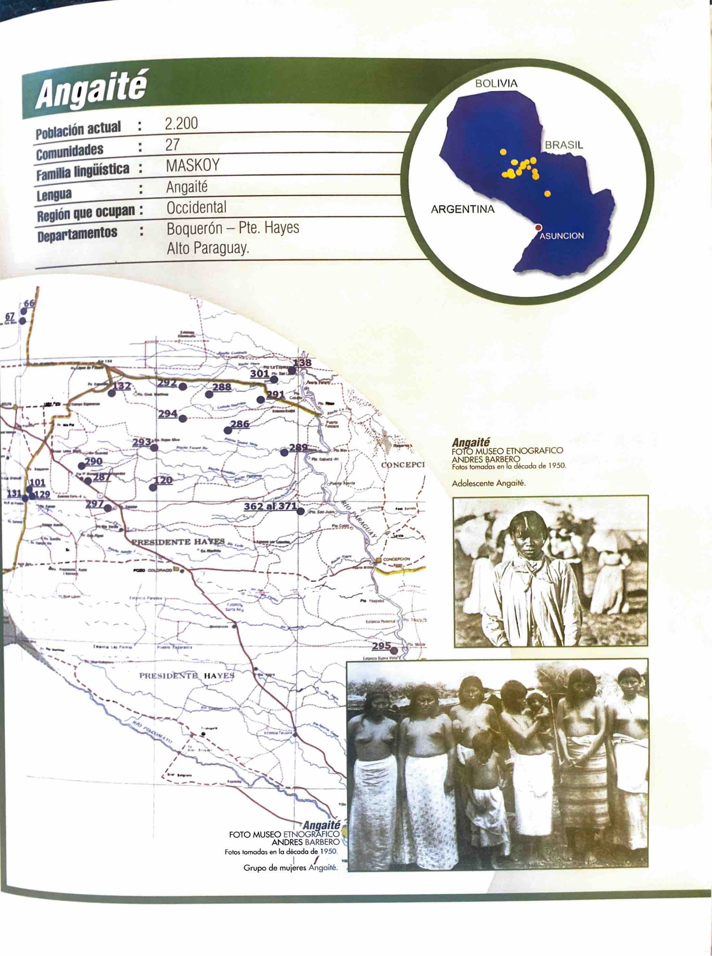
Angaité
Map 2001
VISTA DE LA NUEVA POBLACION DE SAN FERNANDO DE GUADALUPE EN EL SALTO DE AGUA DEL RIO TULIJA, QUE LLEVA SU CORRIENTE A LAS LAGUNAS DE CHICHICASTE Y DE TÉRMINOS
Map 1795
MAPA COMUNITARIA DE INDIGENAS WUANANA
Map 1996![[Côtes de la Guyane].](https://dnet8ble6lm7w.cloudfront.net/maps/CNT/CNT0171.jpeg)
[Côtes de la Guyane].
Map 1700 - 1799
BRASILIA
Map 1500 - 1599
Caerte van de rivier Demerary van ouds Immenary gelegen op Suyd Americaes noordkust op de noorder breedte van 6 gr: 40 min: 1759
Map 1759
Plano del pueblo de Nuestra Señora de Altagracia y del reparto de tierras a los indios, con vista de Cumaná y de la fortaleza de Araya.
Map 1704