
Citation
INSTITUTO GEOGRAFICO AGUSTIN CODAZZI, MAPA DE TIERRAS DE COMUNIDADES NEGRAS (2012) https://geoportal.igac.gov.co/sites/geoportal.igac.gov.co/files/geoportal/mapa_comunidades_negras_v1_2012.pdf
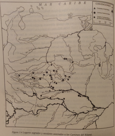
Lugares sagrados y seculares asociados a los caminos del Kuwai
Map 1399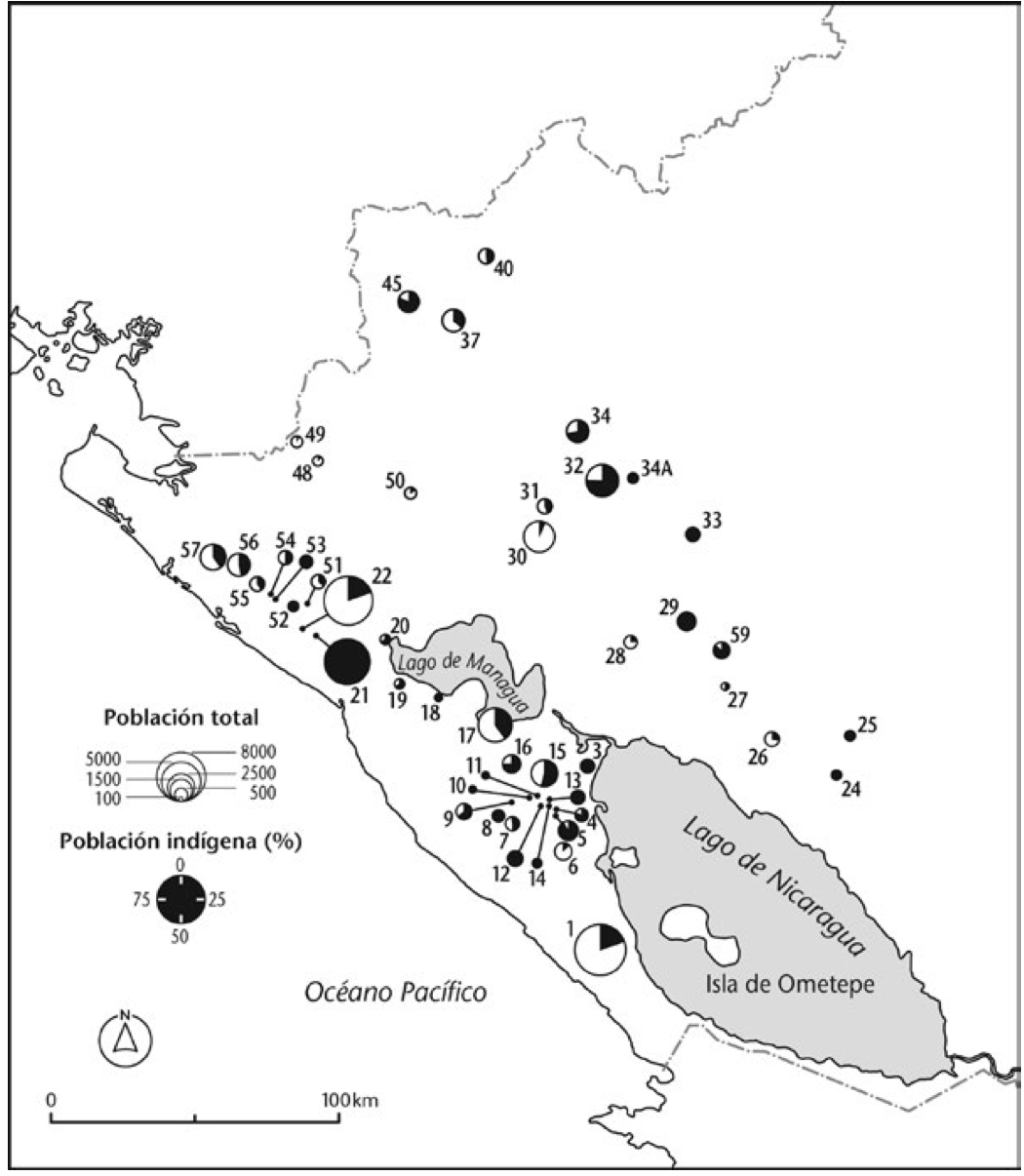
Mapa de la población total y porcentaje de indios;1776
Map 1776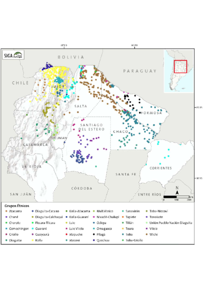
Etnias Norte Grande
Map 2015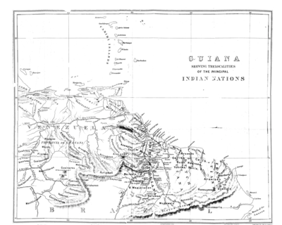
Guiana Shewing the Localities of the Principal Indian Nations
Map 1800 - 1899
Carte 23: Guyane
Map 1900 - 1999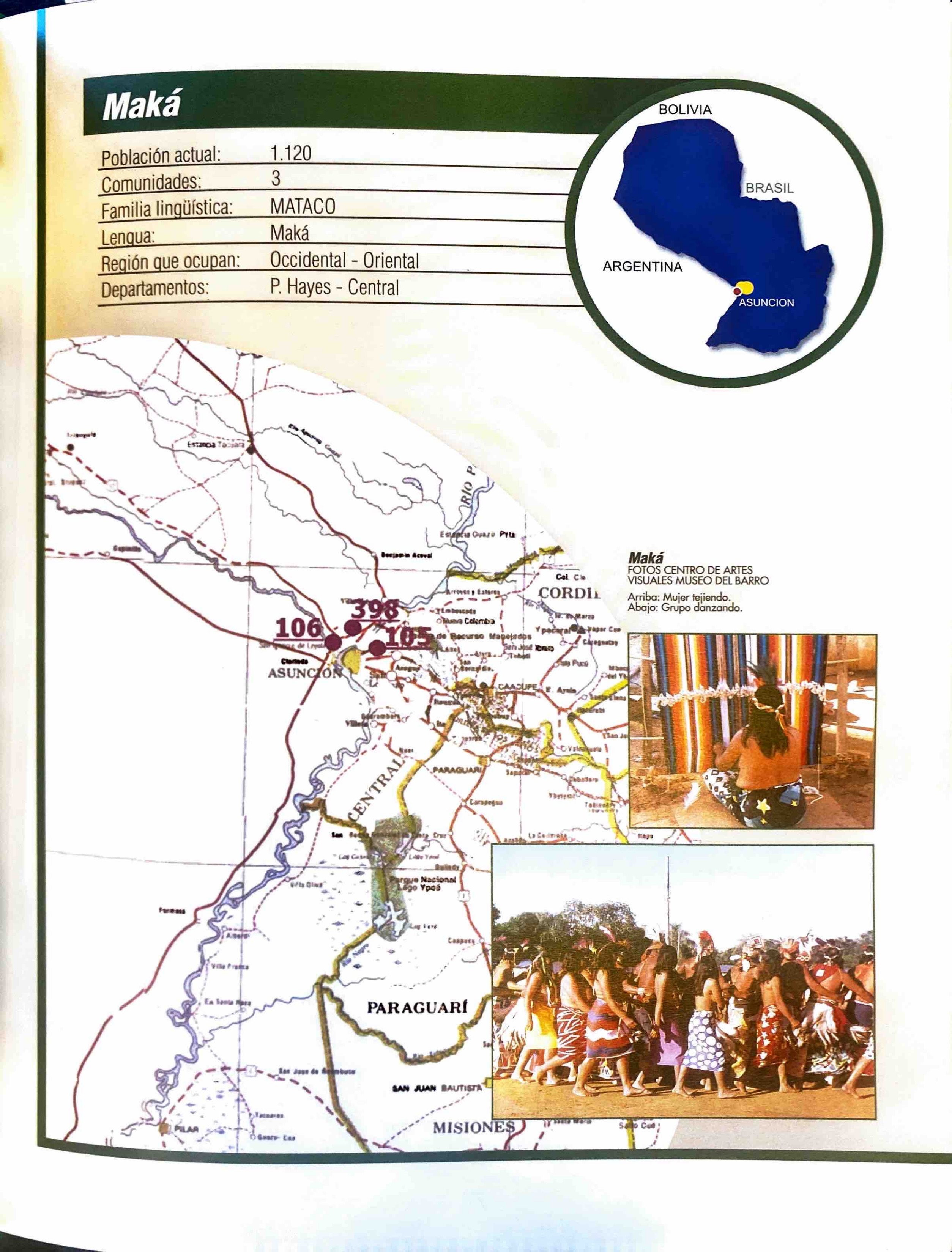
Maká
Map 2001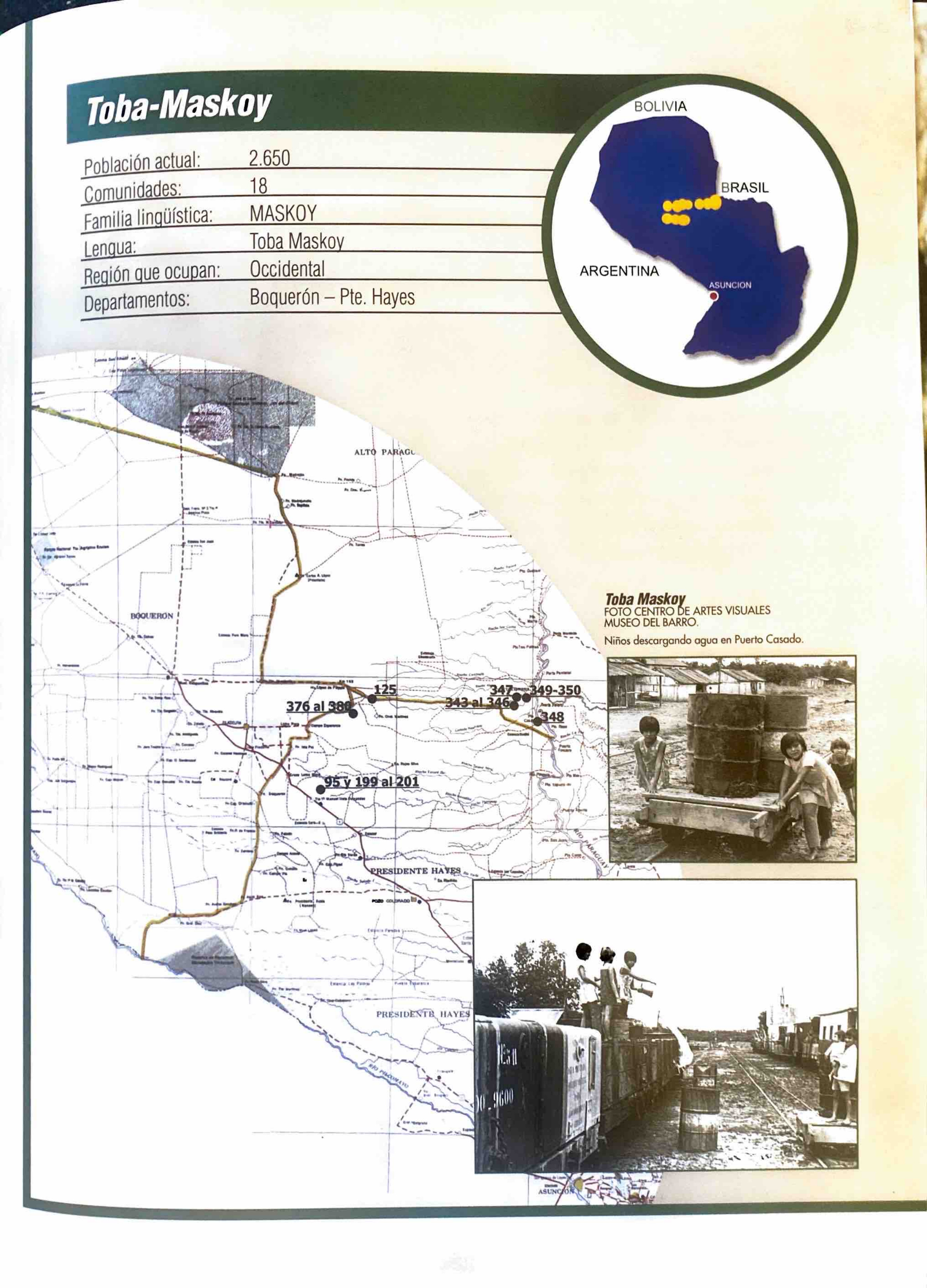
Toba-Maskoy
Map 2001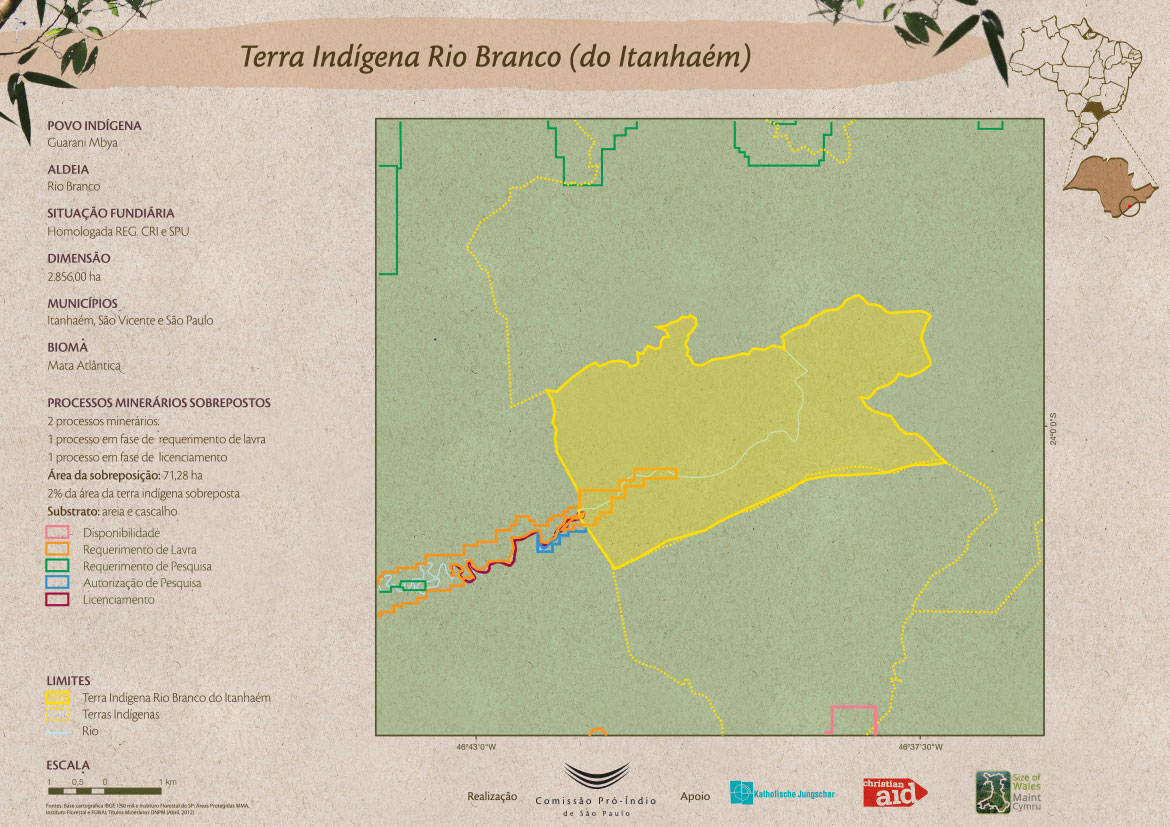
Terra Indígena Rio Branco (do Itanhaém)
Map 2012