Peoples
- YUKPA
Citation
Pineda, Andrés. Territorio Yukpa de Iroka. Map. Resguardo Indígena Iroka, 2018. Accessed June 17, 2021. https://www.mineducacion.gov.co/1759/articles-378922_recurso_1.pdf
CARTA DO RIO IÇA
Map 1868
Le Paraguay
Map 1733
Plan de l'isle de Pin
Map 1692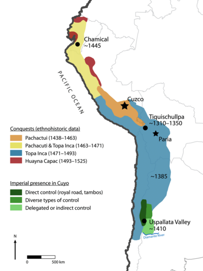
Map of the Inca Empire in western South America
Map 1310 - 1525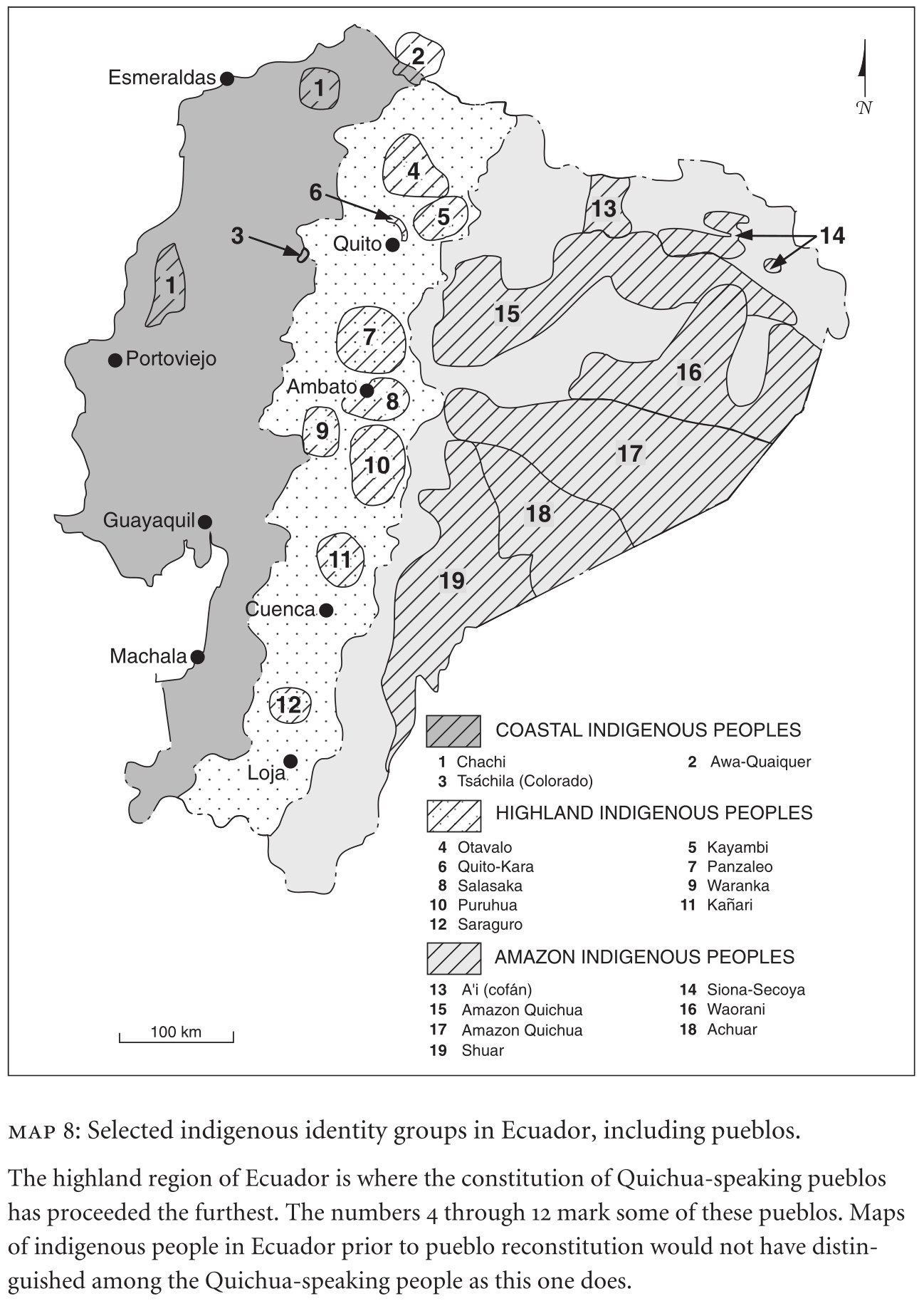
MAP 8: SELECTED INDIGENOUS IDENTITY GROUPS IN ECUADOR;INCLUDING PUEBLOS
Map 2009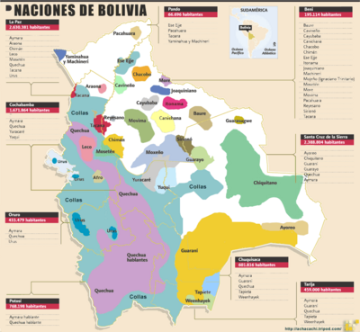
Naciones de Bolivia
Map 2009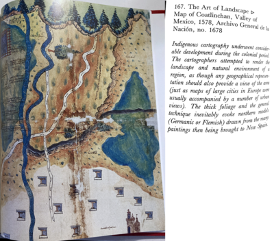
Map of Coatlinchan, Valley of Mexico, 1578, Archivo General de la Nación, no. 1678
Map 1578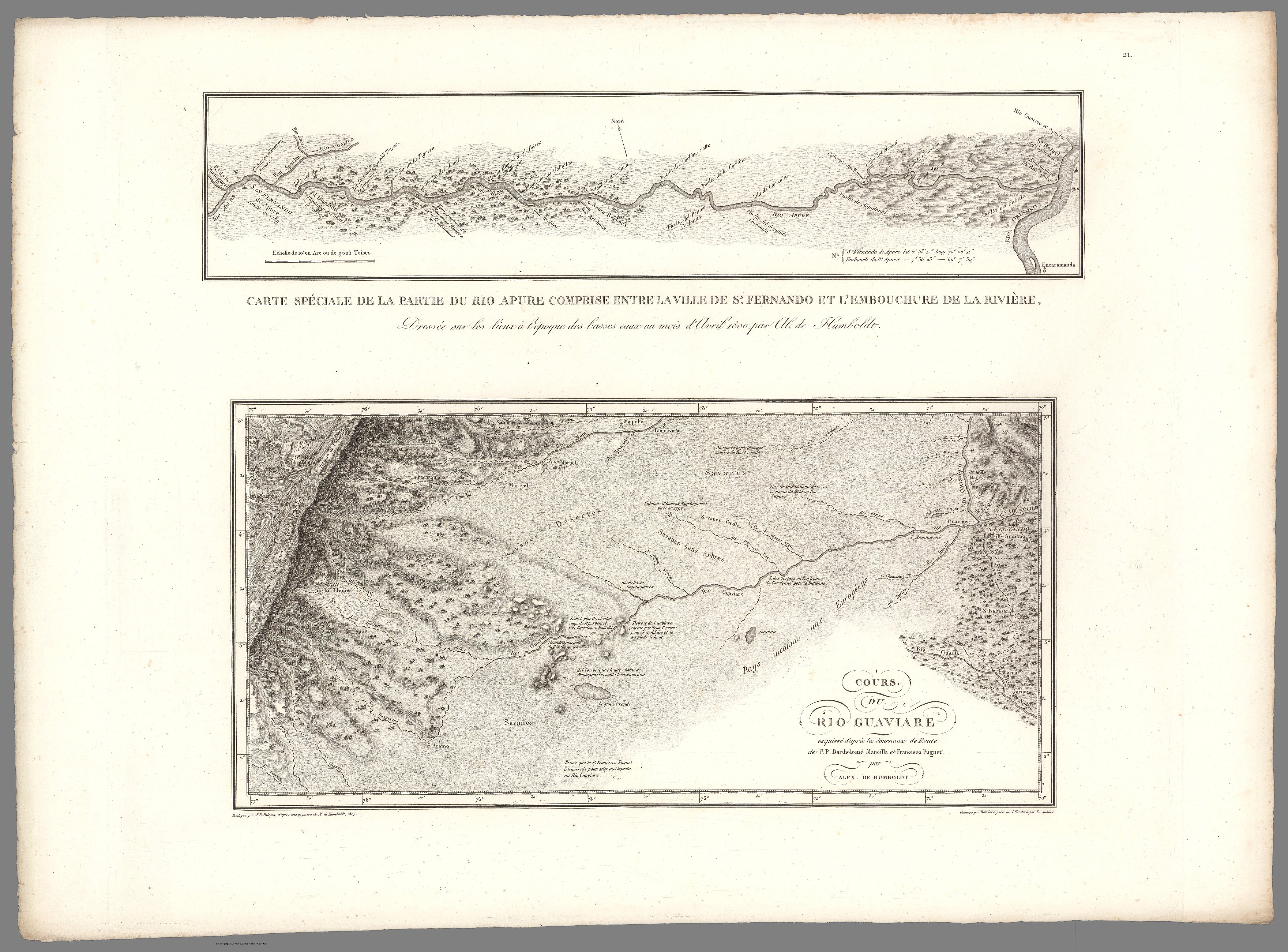
XXI. Cours du Rio Guaviare et de la partie de l'Apure comprise entre la ville de San-Fernando et le confluent de l'Apure avec l'Orenoque.
Map 1799 - 1804