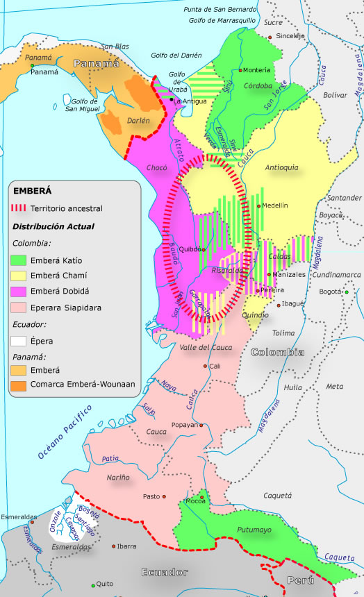
Peoples
- EMBERA KATIO
- EMBERA CHAMI
- EMBERA DOBIDA
- EMBERA SIAPIDARA
- EPERA
- EMBERA
- COMARCA EMBERA-WOUNAAN
Citation
"Grupo aborigen Emberá." Pueblos Originarios. Accessed June 18, 2021. https://pueblosoriginarios.com/sur/caribe/embera/embera.html.
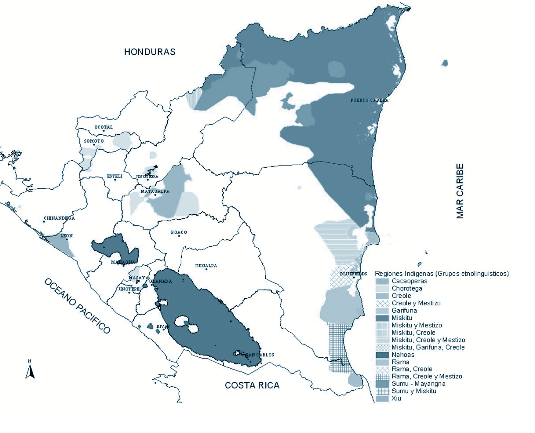
Regiones indígenas;afrodescendientes;y mestizas de Nicaragua
Map
A MAZO
Artwork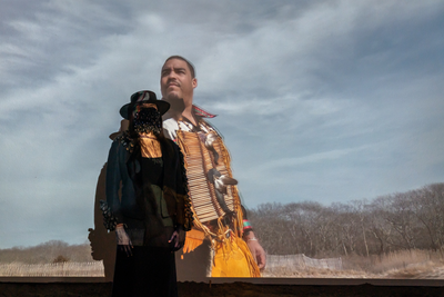
Hecatombe II
Artwork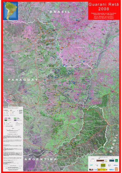
Guaraní Reta 2008: Pueblos guaraníes en las fronteras de Argentina, Brasil y Paraguay
Map 2008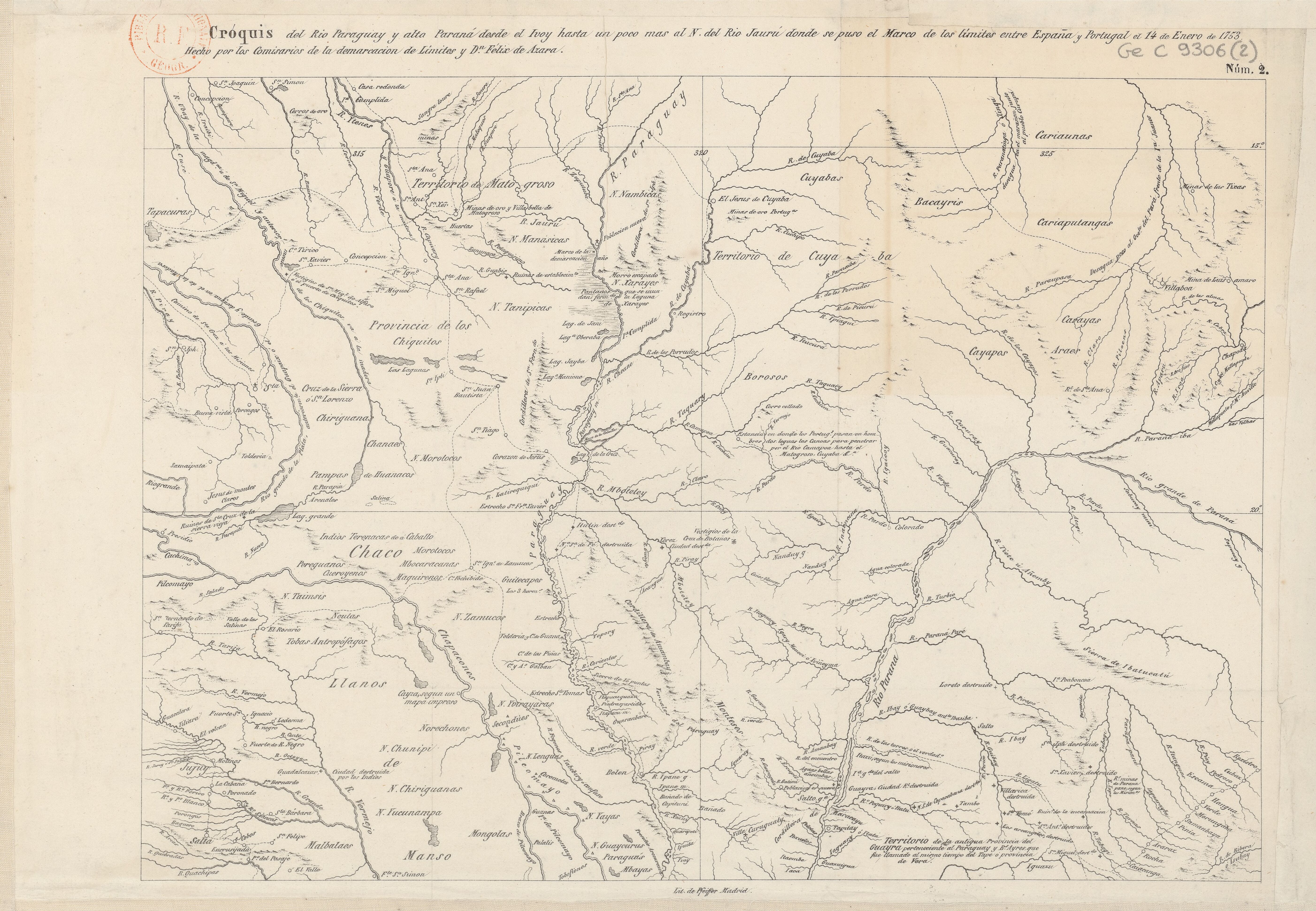
Cróquis del Rio Paraguay y alta Paraná desde el Ivoy hasta un poco más al N. del Rio Jaurú donde se puso el Marco de los límites entre España y Portugal el 14 de Enero de 1753.
Map 1750 - 1850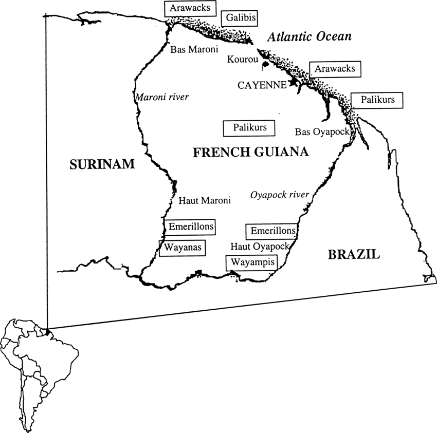
Fig. 1. Map of French Guiana with locations of the various Amerindian groups
Map 1999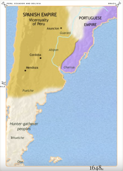
Argentina, Paraguay and Uruguay 1648 CE
Map 1648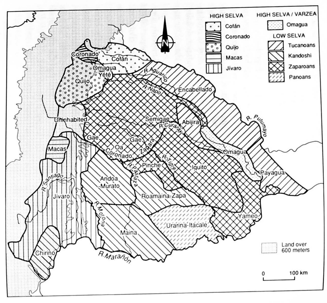
MAP 4. DISTRIBUTION OF ETHNIC GROUPS IN THE ORIENTE ON THE EVE OF SPANISH CONQUEST
Map 1535