Dispossesions in the Americas

Dispossesions in the Americas

  • Home
  • Explore
  • About
  • Authors
  • Art
  • Bodies
  • Curricula
  • Cultural Heritage
  • Maps
  • Territories
Back to Explore
Map 2000 - 2024

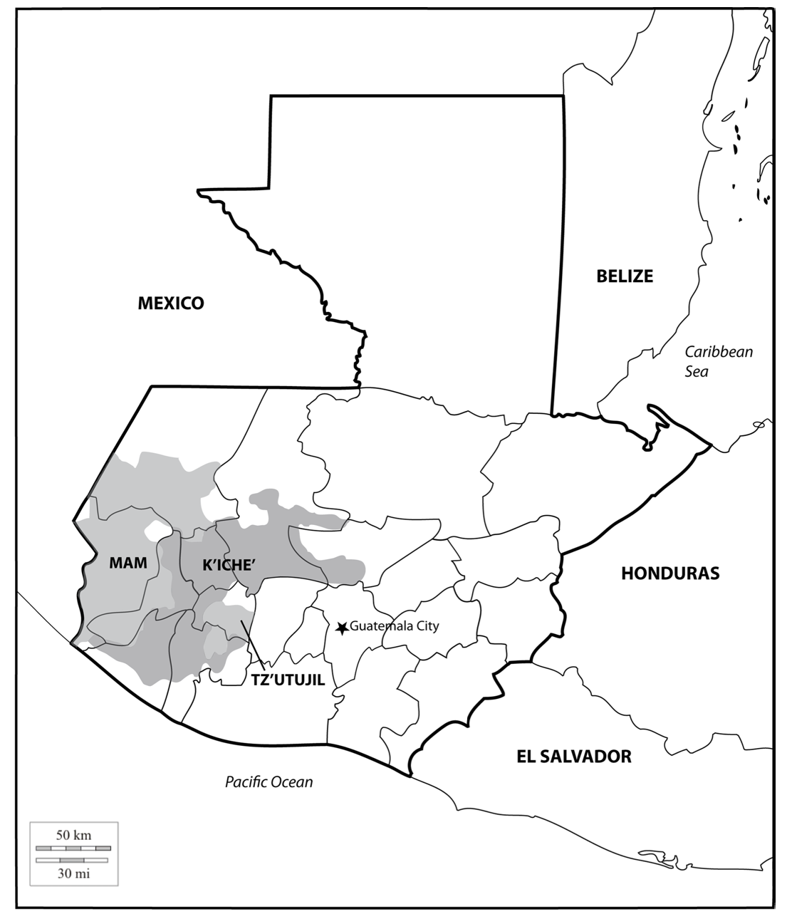
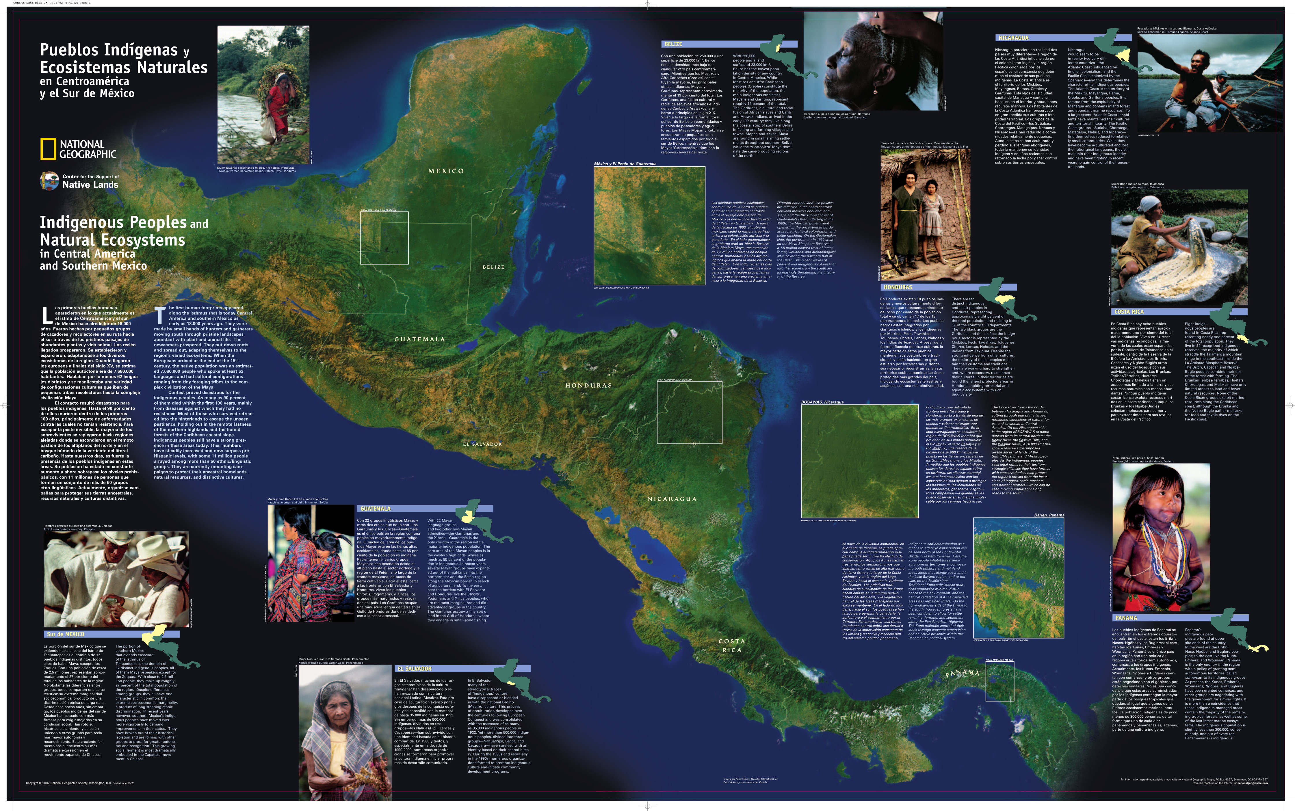
Pueblos Indígenas y Ecosistemas Naturales en Centroamérica y el Sur de México

  • NATIONAL GEOGRAPHIC SOCIETY

Published: 2002

  • Download Image

Peoples

  • QEQCHI
  • ITZA
  • MOPAN
  • CHORTI
  • POQOMAM
  • XINCA
  • KAQCHIQUEL
  • TZUTUJIL
  • SIPAKAPENSE
  • MAM
  • TEKTITEKO
  • KICHE
  • ACHI
  • AWAKATECO
  • SAKAPULTEKO
  • POQOMCHI
  • POPTI
  • AKATEKO
  • IXIL
  • QANJOBAL
  • USPANTEKO
  • CHUJ
  • GARIFUNA

Citation

National Geographic Society. "Pueblos Indígenas y Ecosistemas Naturales en Centroamérica y el Sur de México" [Indigenous Peoples and Natural Ecosystems in Central America and the South of Mexico]. ENVIRONMENTAL LAW INSTITUTE. Last modified June 2002. Accessed August 22, 2021. https://www.eli.org/sites/default/files/eli-pubs/3801.pdf.
  • Download Image

Reading in Spanish

Map 2000 - 2024

Pueblos Indígenas y Ecosistemas Naturales en Centroamérica y el Sur de México

  • NATIONAL GEOGRAPHIC SOCIETY

Published: 2002

  • Download Image
  • Download Image

Related Content

INTENDENCIA DE TABASCO

INTENDENCIA DE TABASCO

Map 1800
Plano del valle del río de San Miguel, desde sus fuentes hasta San Francisco de Chamacuero

Plano del valle del río de San Miguel, desde sus fuentes hasta San Francisco de Chamacuero

Map 1580
PUEBLO LACANDON

PUEBLO LACANDON

Map 2020
Territorios del Pueblo Barí reconocidos por el Estado Colombiano (2017)

Territorios del Pueblo Barí reconocidos por el Estado Colombiano (2017)

Map 2017
Population Speaking Indigenous Languages in Nicaragua

Population Speaking Indigenous Languages in Nicaragua

Map 2000
CARTE DU COURS DE L'AMAZONE DEPUIS L'OCÉAN JUSQU'À MANAOS ET DE LA GUYANE BRÉSILIENNE

CARTE DU COURS DE L'AMAZONE DEPUIS L'OCÉAN JUSQU'À MANAOS ET DE LA GUYANE BRÉSILIENNE

Map 1892 - 1906
REGIÓN TUXTLAS, POPOLUCA-NÁHUATL DE VERACRUZ

REGIÓN TUXTLAS, POPOLUCA-NÁHUATL DE VERACRUZ

Map 2000
MAYAN TRADE

MAYAN TRADE

Map -2500 - 1520

Dispossessions in the Americas

A project by

University of Pennsylvania

Copyright 2024

With support from

Mellon Foundation

Site design & development

Element 84

Art Credits

National Geographic Society. “Pueblos Indígenas y Ecosistemas Naturales en Centroamérica y el Sur de México” [Indigenous Peoples and Natural Ecosystems in Central America and the South of Mexico]. ENVIRONMENTAL LAW INSTITUTE. Last modified June 2002. Accessed August 22, 2021. https://www.eli.org/sites/default/files/eli-pubs/3801.pdf.
Site Pages

  • Home
  • Explore
  • About
  • Authors
  • Art
  • Bodies
  • Curricula
  • Cultural Heritage
  • Maps
  • Territories