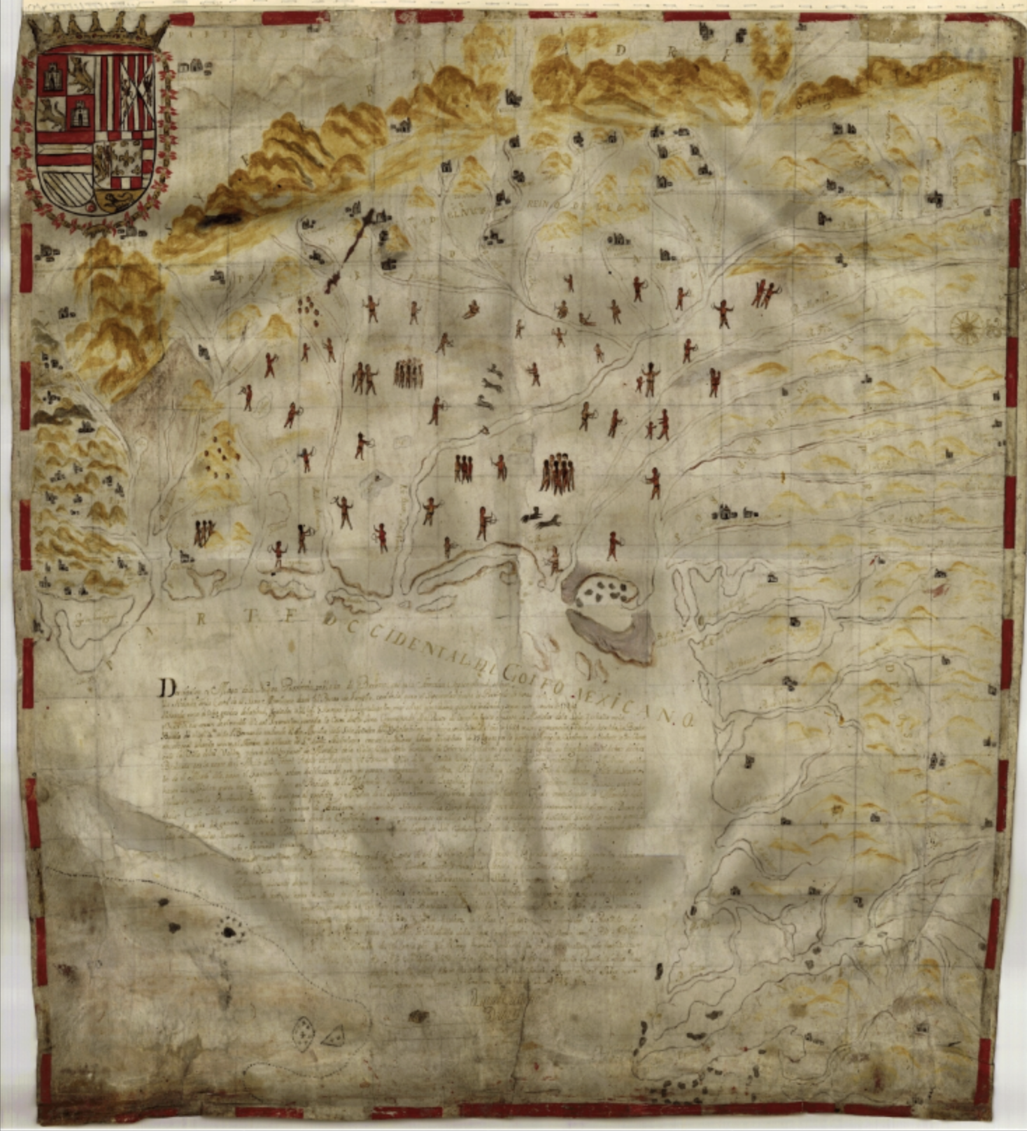
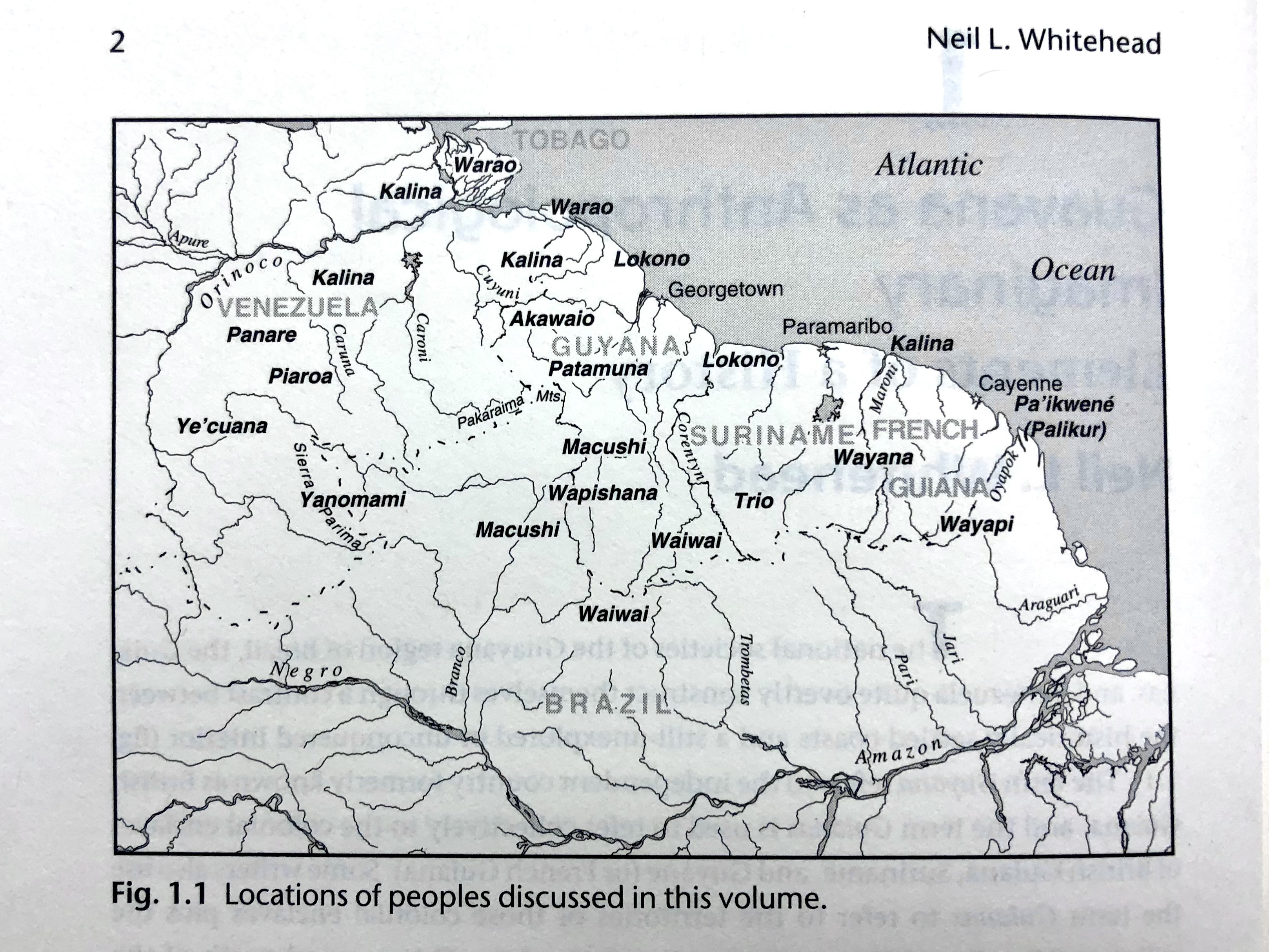
Dispossesions in the Americas

Dispossesions in the Americas

  • Home
  • Explore
  • About
  • Authors
  • Art
  • Bodies
  • Curricula
  • Cultural Heritage
  • Maps
  • Territories
Back to Explore
Map 1900 - 1999

Fig. 1.1 Locations of peoples discussed in this volume

  • Whitehead, Neil L.

Published: 2009

  • Download Image

Peoples

  • AKAWAIO
  • KALINA
  • LOKONO
  • MACUSHI
  • PA'IKWENE
  • PALIKUR
  • PANARE
  • PATAMUNA
  • PIAROA
  • TRIO
  • WAIWAI
  • WAPISHANA
  • WARAO
  • WAYANA
  • WAYAPI
  • YANOMAMI
  • YE'CUANA

Citation

Neil L. Whitehead, and Stephanie W. Alemán (eds.), Anthropologies of Guayana: Cultural Spaces in Northeastern Amazonia. (Tucson: University of Arizona Press, 2009), 2.

  • Download Image

Reading in Spanish

Map 1900 - 1999

Fig. 1.1 Locations of peoples discussed in this volume

  • Whitehead, Neil L.

Published: 2009

  • Download Image
  • Download Image

Reading in Portuguese

Map 1900 - 1999

Fig. 1.1 Locations of peoples discussed in this volume

  • Whitehead, Neil L.

Published: 2009

  • Download Image

Peoples

  • AKAWAIO
  • KALINA
  • LOKONO
  • MACUSHI
  • PA'IKWENE
  • PALIKUR
  • PANARE
  • PATAMUNA
  • PIAROA
  • TRIO
  • WAIWAI
  • WAPISHANA
  • WARAO
  • WAYANA
  • WAYAPI
  • YANOMAMI
  • YE'CUANA

Citation

Neil L. Whitehead, and Stephanie W. Alemán (eds.), Anthropologies of Guayana: Cultural Spaces in Northeastern Amazonia. (Tucson: University of Arizona Press, 2009), 2.

  • Download Image

Related Content

Orí Odé

Orí Odé

Artwork
WESTINDIEN CENTRAL-AMERICA UND DAS NOERDLICHE UND NOERDWESTLICHE SUED AMERICA;NUEVA GRANADA UND VENEZUELA

WESTINDIEN CENTRAL-AMERICA UND DAS NOERDLICHE UND NOERDWESTLICHE SUED AMERICA;NUEVA GRANADA UND VENEZUELA

Map 1866
SUITE DU BRESIL depuis la Baye de Tous les Saints jusqu’a St. Paul

SUITE DU BRESIL depuis la Baye de Tous les Saints jusqu’a St. Paul

Map 1700 - 1750
Mosquitia or The Mosquito Shore with The Eastern Part of Yucatán as far as the 20th Degree of North Latitude

Mosquitia or The Mosquito Shore with The Eastern Part of Yucatán as far as the 20th Degree of North Latitude

Map 1787
MAPA DE LA NUEVA PROVINCIA POBLADA DE BARBAROS, SITUADA EN LA COSTA DEL SENO MEXICANO, DESDE EL PUERTO DE TAMPICO HASTA LA PROVINCIA DE TEXAS

MAPA DE LA NUEVA PROVINCIA POBLADA DE BARBAROS, SITUADA EN LA COSTA DEL SENO MEXICANO, DESDE EL PUERTO DE TAMPICO HASTA LA PROVINCIA DE TEXAS

Map 1744
CARTA GEOGRAFICA DE LAS MISIONES DE SUCUMBIOS;MAINAS Y MARAÑON

CARTA GEOGRAFICA DE LAS MISIONES DE SUCUMBIOS;MAINAS Y MARAÑON

Map 1740
PUEBLO CHUJ

PUEBLO CHUJ

Map 2020
PUEBLO CUCAPA

PUEBLO CUCAPA

Map 2020

Dispossessions in the Americas

A project by

University of Pennsylvania

Copyright 2024

With support from

Mellon Foundation

Site design & development

Element 84

Art Credits

Neil L. Whitehead, and Stephanie W. Alemán (eds.), Anthropologies of Guayana: Cultural Spaces in Northeastern Amazonia. (Tucson: University of Arizona Press, 2009), 2.

Site Pages

  • Home
  • Explore
  • About
  • Authors
  • Art
  • Bodies
  • Curricula
  • Cultural Heritage
  • Maps
  • Territories