Peoples
- AROWACA
- ARWACCAS
- ASSAPANE
Citation
Raleigh, Walter, Tabula geographica regni Guiane Navigationes Gualteri Ralegh vi[delicet]. Gallica. Last modified: June 26, 2012. Accessed, August 12, 2023. https://gallica.bnf.fr/ark:/12148/btv1b84584892
Plan topográfico de las Provincias de Chocó, Antioquia y Popayán
Map 1700
Guyanes. Amér. Mérid. no. 7. (Dresse par Ph. Vandermaelen, lithographie par H. Ode. Cinquième partie. - Amer. merid. Bruxelles. 1827)
Map 1800 - 1899
PRIMERAS CULTURAS QUITENAS - LA AMAZONIA - GENEALOGÍA - INVASIONES MAYAS
Map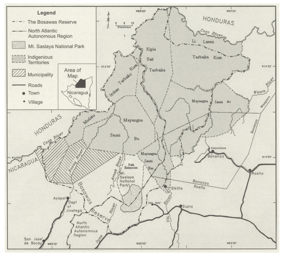
The Bosawa Reserve and Indigenous Territories;Nicaragua.
Map 2000 - 2003![[Embouchures de l'Oyapock et de diverses rivières].](https://dnet8ble6lm7w.cloudfront.net/maps/FGU/FGU0056.jpeg)
[Embouchures de l'Oyapock et de diverses rivières].
Map 1700 - 1799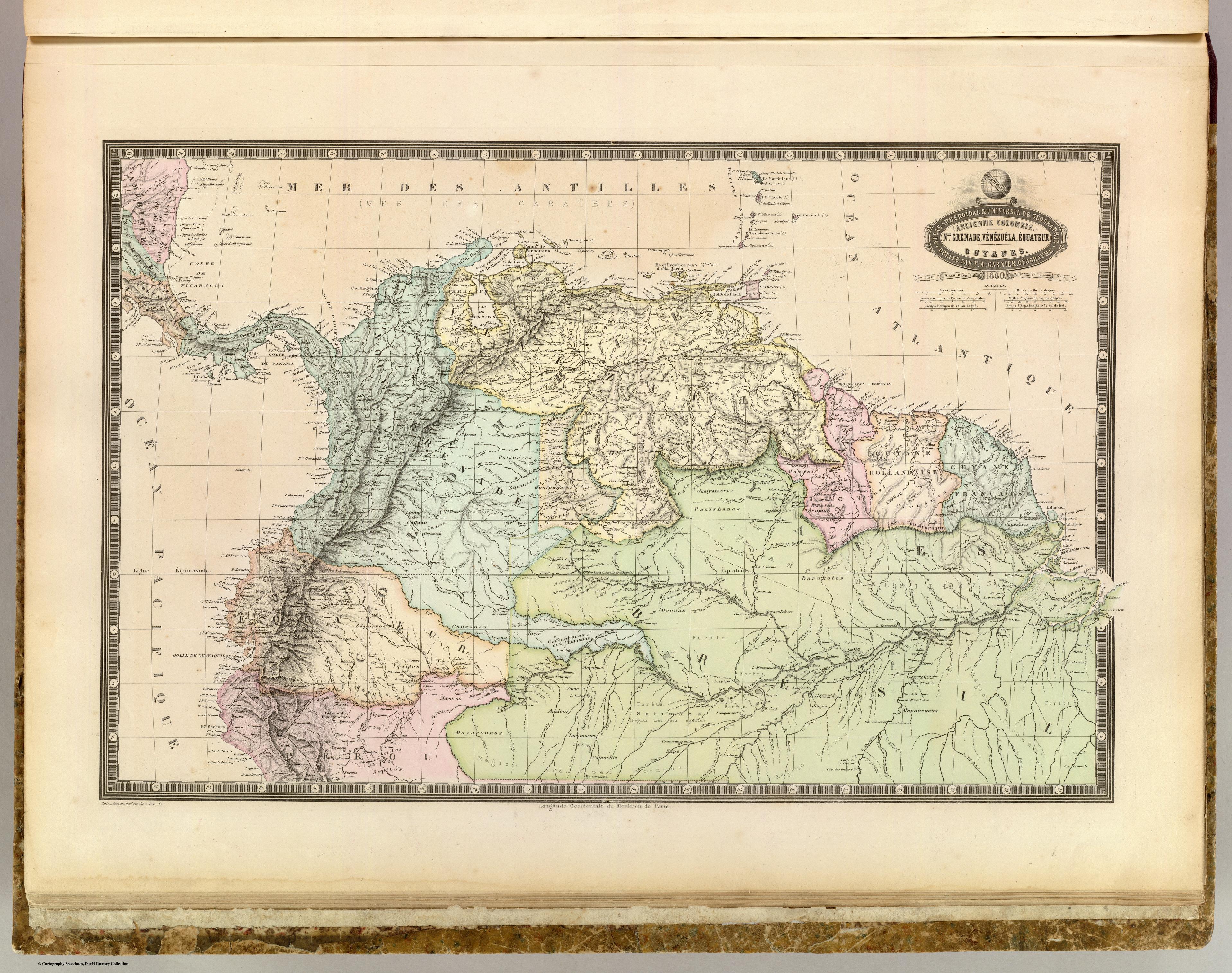
NLE. GRENADE;VENEZUELA;EQUATEUR;GUYANES.
Map 1860
"Territorio Indígena Kekoldi (Bribri)"
Map 2010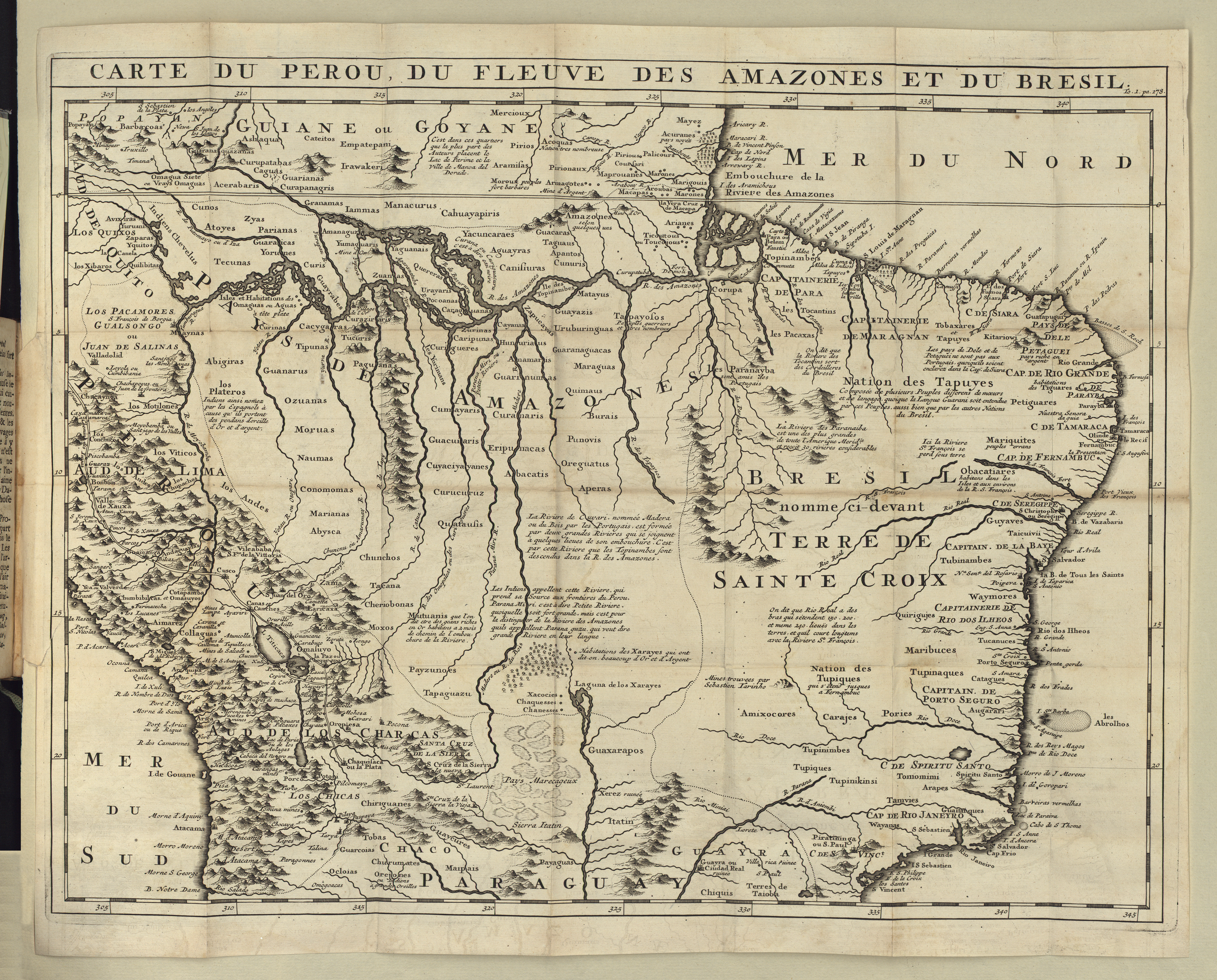
CARTE DU PEROU DU FLEUVE DES AMAZONES ET DU BRESIL
Map 1700 - 1799