Dispossesions in the Americas

Dispossesions in the Americas

  • Home
  • Explore
  • About
  • Authors
  • Art
  • Bodies
  • Curricula
  • Cultural Heritage
  • Maps
  • Territories
Back to Explore
Map 1700 - 1799

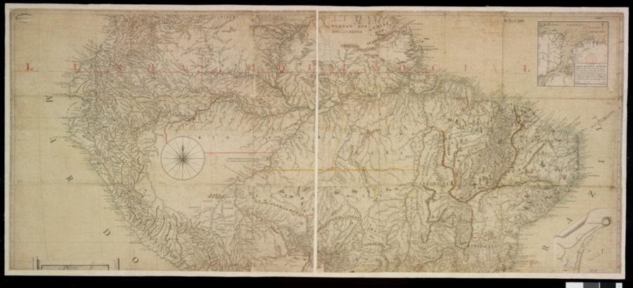
[Carte de l'Amérique équinoxiale et du Brésil]

  • Lopes Santo, Jose;Silva Pontes, Antonio Pires da

Published: 1798

  • Download Image

Peoples

  • ABIJAS
  • ACANEJOS
  • ACOQUAS
  • AMICOUANES
  • ANDAJIES
  • AYMARAES
  • BARBADOS
  • BRACAMOROS
  • CAMBAS
  • CAYUBABAS
  • CHACHAPOYAS
  • CHUMANOS
  • CHUNCHU
  • COCAMAS
  • CUNIVOS
  • GAMELLAS
  • GAYES
  • GILBOES
  • GUAMALIES
  • GUARAYOS
  • GUARUSVACUS
  • GUEGUEZES
  • GUIGOENS
  • IXINORES
  • JANDAYZES
  • KIRIRIS
  • LAMAS
  • MANAMABOBOS
  • MAYPURES
  • MOBIMAS
  • MOJOS
  • MURA
  • PACANOA
  • PAYAGUAS
  • PIROS
  • RACHES
  • RAMANOS
  • ROAMAYNAS
  • SUCUMBOS
  • TAPACURAS
  • TROMONAS
  • TURA
  • XIBAROS
  • XAVANTE
  • XIMBIVA
  • YMACARA
  • ZENZEGUAJES

Citation

Lopes Santo, José, Carte de l'Amérique équinoxiale et du Brésil. Gallica. Last modified: June 29, 2009. Accessed, July 25, 2023. https://gallica.bnf.fr/ark:/12148/btv1b72002588
  • Download Image

Reading in Spanish

Map 1700 - 1799

[Carte de l'Amérique équinoxiale et du Brésil]

  • Lopes Santo, Jose;Silva Pontes, Antonio Pires da

Published: 1798

  • Download Image
  • Download Image

Related Content

Guiana Shewing the Localities of the Principal Indian Nations

Guiana Shewing the Localities of the Principal Indian Nations

Map 1800 - 1899
CÓDICE XOLOTL

CÓDICE XOLOTL

Map 1100 - 1499
PROVINCIA DE MINAS GERAES

PROVINCIA DE MINAS GERAES

Map 1873
Plan view map of features and terrace breaks at Maima East

Plan view map of features and terrace breaks at Maima East

Map 1500 - 1599
A la France Partie de la Guyane

A la France Partie de la Guyane

Map 1732
Carte particulière des costes de la Capitainerie de Siara au Brésil

Carte particulière des costes de la Capitainerie de Siara au Brésil

Map 1700 - 1750
LA PLATA

LA PLATA

Map 1658
REGIÓN HUICOT O GRAN NAYAR

REGIÓN HUICOT O GRAN NAYAR

Map 2000

Dispossessions in the Americas

A project by

University of Pennsylvania

Copyright 2024

With support from

Mellon Foundation

Site design & development

Element 84

Art Credits

Lopes Santo, José, Carte de l’Amérique équinoxiale et du Brésil. Gallica. Last modified: June 29, 2009. Accessed, July 25, 2023. https://gallica.bnf.fr/ark:/12148/btv1b72002588

Site Pages

  • Home
  • Explore
  • About
  • Authors
  • Art
  • Bodies
  • Curricula
  • Cultural Heritage
  • Maps
  • Territories