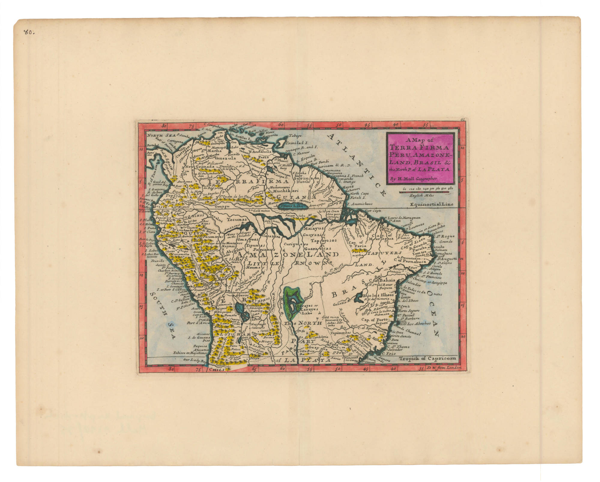
Dispossesions in the Americas

Dispossesions in the Americas

  • Home
  • Explore
  • About
  • Authors
  • Art
  • Bodies
  • Curricula
  • Cultural Heritage
  • Maps
  • Territories
Back to Explore
Map 1700 - 1799

A Map of TERRA FIRMA PERU, AMAZONELAND, BRASIL and the North P. of LA PLATA

  • MOLL, HERMAN

Published: 1736

  • Download Image

Peoples

  • MARONES
  • COUSSARI
  • ARINAGOTES
  • MOROUX
  • MUCHIKERI
  • ACAMACORI
  • OMAGUAS
  • TECUNAS
  • CHEVELUS
  • QUIXOS
  • PACAMORES
  • MAYNAS
  • ABIGIRAS
  • PLATEROS
  • MAUMAS
  • PAGUANAS
  • TIPUNAS
  • CURAZIRA
  • CURIGUERO
  • MAIAYUS
  • GUAYAZIS
  • TAPAJOSOS
  • GUARAOCAS
  • TAPUYERS
  • TAPUYERES
  • MOXOS
  • TUPINIMBES

Citation

Moll, Herman. A Map of Terra Firma Peru, Amazoneland, Brasil and the North P. of La Plata. Map. London, 1736. Accessed July 6, 2023. https://babel.banrepcultural.org/digital/collection/p17054coll13/id/6/rec/4.

  • Download Image

Reading in Spanish

Map 1700 - 1799

A Map of TERRA FIRMA PERU, AMAZONELAND, BRASIL and the North P. of LA PLATA

  • MOLL, HERMAN

Published: 1736

  • Download Image
  • Download Image

Reading in Portuguese

Map 1700 - 1799

A Map of TERRA FIRMA PERU, AMAZONELAND, BRASIL and the North P. of LA PLATA

  • MOLL, HERMAN

Published: 1736

  • Download Image

Peoples

  • MARONES
  • COUSSARI
  • ARINAGOTES
  • MOROUX
  • MUCHIKERI
  • ACAMACORI
  • OMAGUAS
  • TECUNAS
  • CHEVELUS
  • QUIXOS
  • PACAMORES
  • MAYNAS
  • ABIGIRAS
  • PLATEROS
  • MAUMAS
  • PAGUANAS
  • TIPUNAS
  • CURAZIRA
  • CURIGUERO
  • MAIAYUS
  • GUAYAZIS
  • TAPAJOSOS
  • GUARAOCAS
  • TAPUYERS
  • TAPUYERES
  • MOXOS
  • TUPINIMBES

Citation

Moll, Herman. A Map of Terra Firma Peru, Amazoneland, Brasil and the North P. of La Plata. Map. London, 1736. Accessed July 6, 2023. https://babel.banrepcultural.org/digital/collection/p17054coll13/id/6/rec/4.

  • Download Image

Related Content

COLOMBIA AND GUIANA

COLOMBIA AND GUIANA

Map 1830
Atlas de Cartas Geográficas de los Países de la América Meridional en que estuvieron situadas las más importantes misiones de los jesuitas;como también de los territorios sobre cuya posesión versaron allí las principales cuestiones entre España y Portugal ;acompañado de varios documentos sobre estas últimas, y precedido de una introducción histórica

Atlas de Cartas Geográficas de los Países de la América Meridional en que estuvieron situadas las más importantes misiones de los jesuitas;como también de los territorios sobre cuya posesión versaron allí las principales cuestiones entre España y Portugal ;acompañado de varios documentos sobre estas últimas, y precedido de una introducción histórica

Map 1750 - 1850
La región andina meridional ecuatoriana

La región andina meridional ecuatoriana

Map -500 - 1550
Sitios arqueológicos del Lago de Amatitlán, con lugares de ofrendas acuáticas.

Sitios arqueológicos del Lago de Amatitlán, con lugares de ofrendas acuáticas.

Map 2011
Transversiva Post Andina Revolucionaria: El Regreso [Revolutionary Post-Andean Transversiva: The Return]

Transversiva Post Andina Revolucionaria: El Regreso [Revolutionary Post-Andean Transversiva: The Return]

Artwork
Conversion of Ejidos into Private Property, Sajcabaja and Jocotenango, Guatemala, Late 18th Century through 19th Century

Conversion of Ejidos into Private Property, Sajcabaja and Jocotenango, Guatemala, Late 18th Century through 19th Century

Map 1700 - 1800
Mapa Mundi

Mapa Mundi

Map 1615
Dialect geography of K'ichee'

Dialect geography of K'ichee'

Map

Dispossessions in the Americas

A project by

University of Pennsylvania

Copyright 2024

With support from

Mellon Foundation

Site design & development

Element 84

Art Credits

Moll, Herman. A Map of Terra Firma Peru, Amazoneland, Brasil and the North P. of La Plata. Map. London, 1736. Accessed July 6, 2023. https://babel.banrepcultural.org/digital/collection/p17054coll13/id/6/rec/4.

Site Pages

  • Home
  • Explore
  • About
  • Authors
  • Art
  • Bodies
  • Curricula
  • Cultural Heritage
  • Maps
  • Territories