Peoples
- PATAGONES
- OREJONES
- TOBAS
- MATARAES
Citation
De Vaugondy, Robert. "Paraguay, Chili, Terre Magellan." Map. 1770. Accessed June 30, 2023. https://digital.iai.spk-berlin.de/viewer/image/630121583/1/LOG_0000/.
Efeitos do garimpo no território Omágua São Paulo de Olivença-AM
Map 2000 - 2099
TABULA geographica del rio Maranon o Amazonas
Map 1690
Do Rio das Preguiças ate a barra do Perreya sao catorze ate quinze legoas
Map 1600 - 1640![Carta Particular de la Costa de Mosquitos;con sus Baxos;Escollos;Canales;Sonadas & c.a.[Material cartogáfico]:Para el Uso Delos Navios de Guerra Yngleses;y de la que sirve el Almirantasgo para su govierno.](https://dnet8ble6lm7w.cloudfront.net/maps_sm/NIC/NIC0039.png)
Carta Particular de la Costa de Mosquitos;con sus Baxos;Escollos;Canales;Sonadas & c.a.[Material cartogáfico]:Para el Uso Delos Navios de Guerra Yngleses;y de la que sirve el Almirantasgo para su govierno.
Map 1764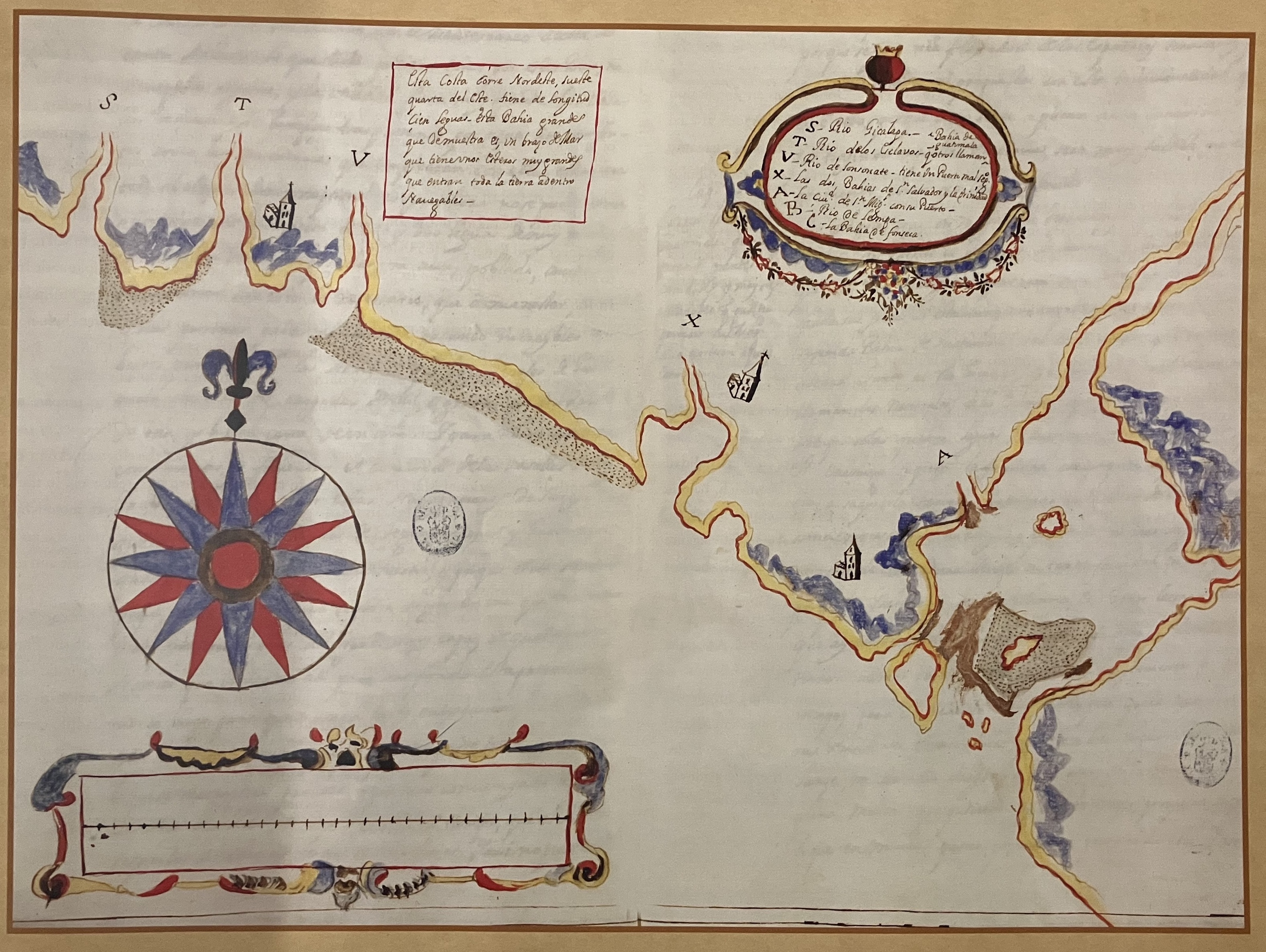
Estado eclesiástico, político y militar de la América (o grandeza de las Indias)
Map 1683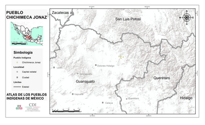
PUEBLO CHICHIMECA JONAZ
Map 2020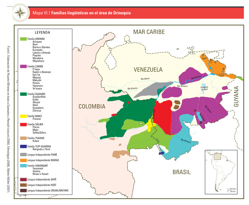
Mapa VI.1 Familias lingüísticas en el área de Orinoquía
Map 2009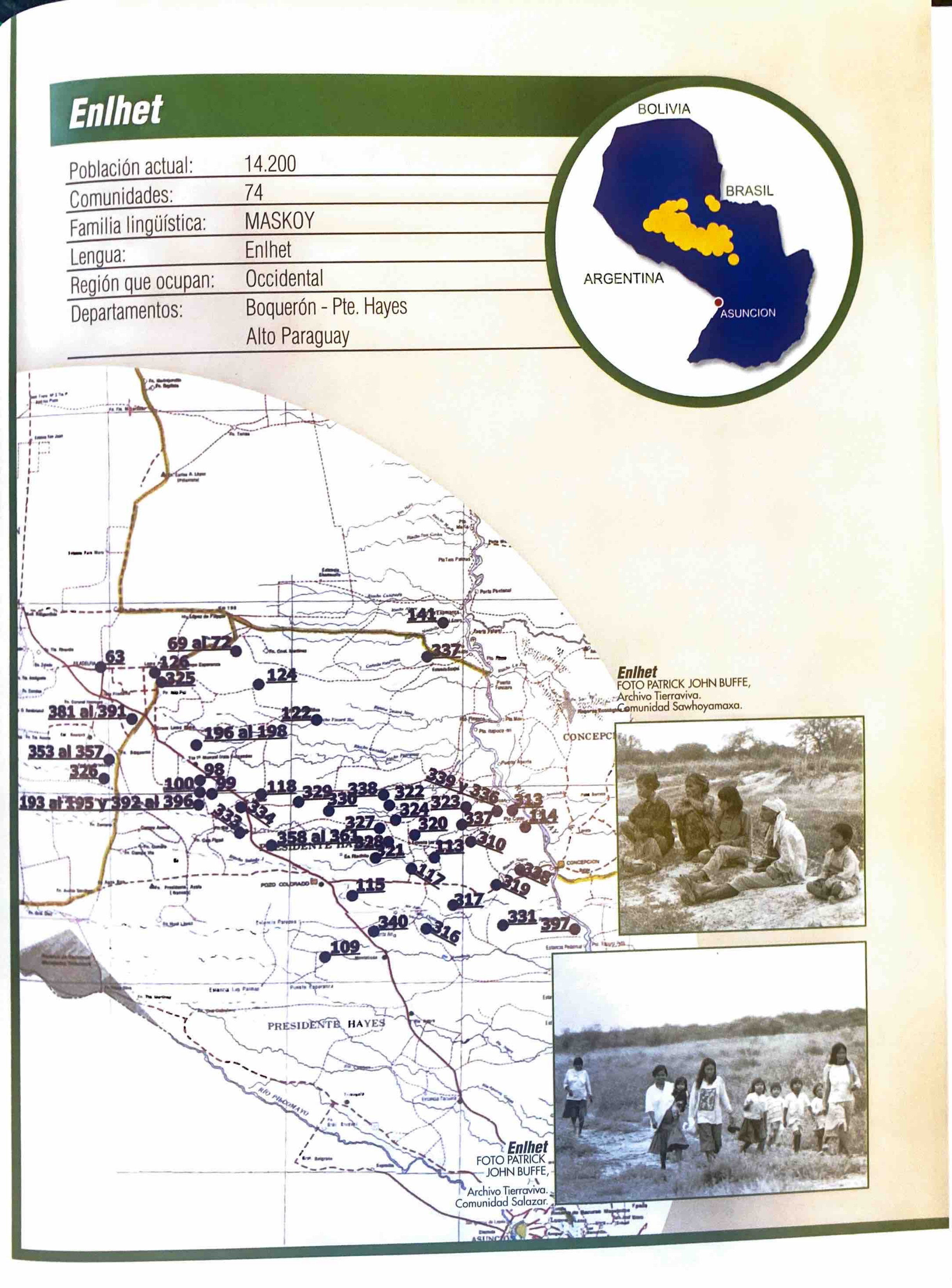
Enlhet
Map 2001