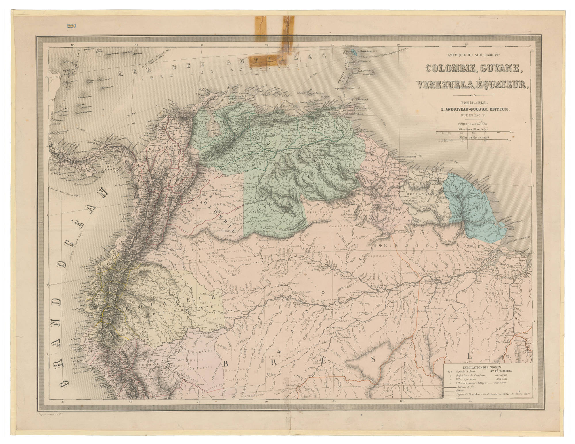
Dispossesions in the Americas

Dispossesions in the Americas

  • Home
  • Explore
  • About
  • Authors
  • Art
  • Bodies
  • Curricula
  • Cultural Heritage
  • Maps
  • Territories
Back to Explore
Map 1868

COLOMBIE;GUYANE;VENEZUELA;ÉQUATEUR

    Published: 1868

    • Download Image

    Peoples

    • JIVI
    • MACOS
    • PIAROA
    • AYANOS
    • MAPOJOS
    • ARNACOTO
    • GUARUANA
    • WAIKAS
    • ARAWAK
    • MAKUSHI
    • PURIGOTOS
    • KIRISHANA
    • YABANOS
    • CURIARANAS
    • YEKUANA
    • GUAIPUNAYOS
    • AZANENI

    Citation

    Colombie, Guyane, Venezuela, Equateur. Map. Paris, 1868. Accessed February 3, 2023. https://babel.banrepcultural.org/digital/collection/p17054coll13/id/149/rec/26.

    • Download Image

    Reading in Spanish

    Map 1868

    COLOMBIE;GUYANE;VENEZUELA;ÉQUATEUR

      Published: 1868

      • Download Image
      • Download Image

      Reading in Portuguese

      Map 1868

      COLOMBIE;GUYANE;VENEZUELA;ÉQUATEUR

        Published: 1868

        • Download Image

        Peoples

        • JIVI
        • MACOS
        • PIAROA
        • AYANOS
        • MAPOJOS
        • ARNACOTO
        • GUARUANA
        • WAIKAS
        • ARAWAK
        • MAKUSHI
        • PURIGOTOS
        • KIRISHANA
        • YABANOS
        • CURIARANAS
        • YEKUANA
        • GUAIPUNAYOS
        • AZANENI

        Citation

        Colombie, Guyane, Venezuela, Equateur. Map. Paris, 1868. Accessed February 3, 2023. https://babel.banrepcultural.org/digital/collection/p17054coll13/id/149/rec/26.

        • Download Image

        Related Content

        NOVA CARTA COROGRAPHICA DO IMPERIO DO BRAZIL

        NOVA CARTA COROGRAPHICA DO IMPERIO DO BRAZIL

        Map 1857
        DISTRIBUTION OF PRINCIPAL NATIONS AFTER 1300 AD

        DISTRIBUTION OF PRINCIPAL NATIONS AFTER 1300 AD

        Map 1300
        Territorio Rama y Kriol: Mapa de Zonas Territoriales. Three Zones proposed by the PADA to ensure a sustainable future for the communities of Rama and Kriol

        Territorio Rama y Kriol: Mapa de Zonas Territoriales. Three Zones proposed by the PADA to ensure a sustainable future for the communities of Rama and Kriol

        Map 2000
        Plata, Chili, Paraguay Et Patagonie

        Plata, Chili, Paraguay Et Patagonie

        Map 1800 - 1880
        TERRITORIOS DE LOS PUEBLOS Y NACIONALIDADES;TERRITORIOS DE VIDA Y AREAS PROTEGIDAS EN EL ECUADOR CONTINENTAL

        TERRITORIOS DE LOS PUEBLOS Y NACIONALIDADES;TERRITORIOS DE VIDA Y AREAS PROTEGIDAS EN EL ECUADOR CONTINENTAL

        Map 2016 - 2018
        Property Ownership in 1900, Verapaz Guatemala

        Property Ownership in 1900, Verapaz Guatemala

        Map 1900
        Libro para visitas para Seropositivo [Guestbook for Seropositive]

        Libro para visitas para Seropositivo [Guestbook for Seropositive]

        Artwork
        MAPPA DO IMPERIO DO BRAZIL

        MAPPA DO IMPERIO DO BRAZIL

        Map 1878

        Dispossessions in the Americas

        A project by

        University of Pennsylvania

        Copyright 2024

        With support from

        Mellon Foundation

        Site design & development

        Element 84

        Art Credits

        Colombie, Guyane, Venezuela, Equateur. Map. Paris, 1868. Accessed February 3, 2023. https://babel.banrepcultural.org/digital/collection/p17054coll13/id/149/rec/26.

        Site Pages

        • Home
        • Explore
        • About
        • Authors
        • Art
        • Bodies
        • Curricula
        • Cultural Heritage
        • Maps
        • Territories