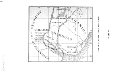
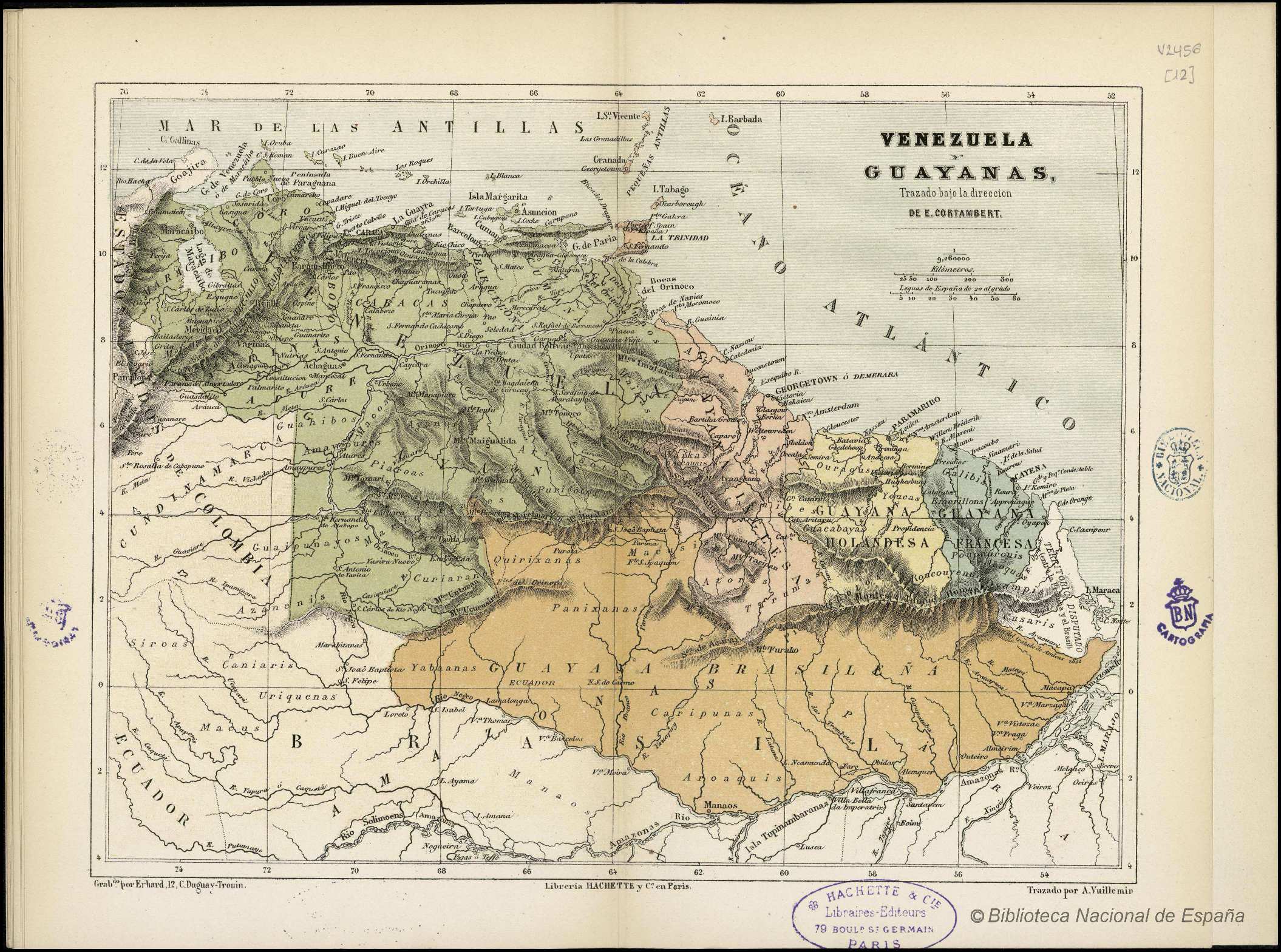
Dispossesions in the Americas

Dispossesions in the Americas

  • Home
  • Explore
  • About
  • Authors
  • Art
  • Bodies
  • Curricula
  • Cultural Heritage
  • Maps
  • Territories
Back to Explore
Map 1800 - 1899

VENEZUELA Y GUAYANAS

  • CORTAMBERT;EUGÈNE

Published: ND

  • Download Image

Peoples

  • GUARUANA
  • ARAWAK
  • CARIBE
  • WAIKAS
  • ARNACOTO
  • PURIGOTOS
  • PIAROA
  • MACOS
  • AYANOS
  • MAIPURE
  • JIVI
  • AZANENI
  • GUAIPUNAYOS
  • YE'KUANA
  • YABANOS
  • CURIARANAS
  • KIRISHANA
  • MAKUSHI
  • GALIBIS
  • TOUCAS
  • OURAGAS
  • SIROAS
  • TARUMAS
  • RONCOUYENUE
  • POUPOUROUIS
  • ACOQUAS
  • OVAMPIS
  • CUSARIS
  • URIQUENAS
  • MACUS
  • CANIARIS
  • ATORAS
  • GUACABAYAS
  • PANIXANAS
  • CARIPUNAS
  • AROAQUIS
  • MANAOS

Citation

Cortambert, Eugène. "Venezuela y Guayanas." Map. In Pequeño atlas de Geografía Moderna, 28. París: Librería de Hachette y Cía, n.d. Accessed January 2, 2023. http://bdh.bne.es/bnesearch/detalle/bdh0000000261.

  • Download Image

Reading in Spanish

Map 1800 - 1899

VENEZUELA Y GUAYANAS

  • CORTAMBERT;EUGÈNE

Published: ND

  • Download Image
  • Download Image

Reading in Portuguese

Map 1800 - 1899

VENEZUELA Y GUAYANAS

  • CORTAMBERT;EUGÈNE

Published: ND

  • Download Image

Peoples

  • GUARUANA
  • ARAWAK
  • CARIBE
  • WAIKAS
  • ARNACOTO
  • PURIGOTOS
  • PIAROA
  • MACOS
  • AYANOS
  • MAIPURE
  • JIVI
  • AZANENI
  • GUAIPUNAYOS
  • YE'KUANA
  • YABANOS
  • CURIARANAS
  • KIRISHANA
  • MAKUSHI
  • GALIBIS
  • TOUCAS
  • OURAGAS
  • SIROAS
  • TARUMAS
  • RONCOUYENUE
  • POUPOUROUIS
  • ACOQUAS
  • OVAMPIS
  • CUSARIS
  • URIQUENAS
  • MACUS
  • CANIARIS
  • ATORAS
  • GUACABAYAS
  • PANIXANAS
  • CARIPUNAS
  • AROAQUIS
  • MANAOS

Citation

Cortambert, Eugène. "Venezuela y Guayanas." Map. In Pequeño atlas de Geografía Moderna, 28. París: Librería de Hachette y Cía, n.d. Accessed January 2, 2023. http://bdh.bne.es/bnesearch/detalle/bdh0000000261.

  • Download Image

Related Content

Carte particulière des costes de la Capitainerie de Siara au Brésil

Carte particulière des costes de la Capitainerie de Siara au Brésil

Map 1700 - 1750
GUARANÍ ÑANDÉVA

GUARANÍ ÑANDÉVA

Map 2015
Big Falls

Big Falls

Map 1997
Serie Esclavas de la fiebre de oro [Series Slaves of the Golden Fever]

Serie Esclavas de la fiebre de oro [Series Slaves of the Golden Fever]

Artwork
MAPA ÉTNICO DEL RÍO DE LA PLATA

MAPA ÉTNICO DEL RÍO DE LA PLATA

Map 1500 - 1900
MAPA DE SAN PEDRO AZCAPOTZALTONGO

MAPA DE SAN PEDRO AZCAPOTZALTONGO

Map 1500 - 1599
LAS TRES OLAS DE COLONIZACION DE LA SNSM

LAS TRES OLAS DE COLONIZACION DE LA SNSM

Map 1900 - 1999
Derrotero de las cartas de América desde la ciudad de Compostela hasta el estrecho Magallanes, con el de las islas de Juan Fernández y las de Salomón

Derrotero de las cartas de América desde la ciudad de Compostela hasta el estrecho Magallanes, con el de las islas de Juan Fernández y las de Salomón

Map 1601

Dispossessions in the Americas

A project by

University of Pennsylvania

Copyright 2024

With support from

Mellon Foundation

Site design & development

Element 84

Art Credits

Cortambert, Eugène. “Venezuela y Guayanas.” Map. In Pequeño atlas de Geografía Moderna, 28. París: Librería de Hachette y Cía, n.d. Accessed January 2, 2023. http://bdh.bne.es/bnesearch/detalle/bdh0000000261.

Site Pages

  • Home
  • Explore
  • About
  • Authors
  • Art
  • Bodies
  • Curricula
  • Cultural Heritage
  • Maps
  • Territories