Peoples
- QUAQUAS
- ANDARIES
- XIPIXAPA
- XIBARO
- ORONIES
- URABA
- ZINU
- ACHAGUAS
- ANDAJIES
- ANAGUAJES
- ABIJIRAS
- YXINOSOS
- ROAMAYNAS
- XEBEROS
- MAYONUNAS
- PAYAGUAS
- OROMIRA
- OMAGUAS
- CAVACHIS
- PEVAS
- ACANEJOS
- ABANOS
- MOTILONES
- QUIRIQUIRES
- SARURAS
- SALIVAS
- MAYPURES
- ORELLUDOS
- YURIMAGUAS
- MANAOS
- OTOMACAS
- PAOS
- GUAJIRO
Citation
Archivo Cartográfico de Estudios Geográficos del Centro Geográfico del Ejército — Ubicación: AR — Signatura: Ar.J-T.7-C.1_9 — Código de barras: 2201365 https://bibliotecavirtual.defensa.gob.es/BVMDefensa/es/consulta/registro.do?id=91578
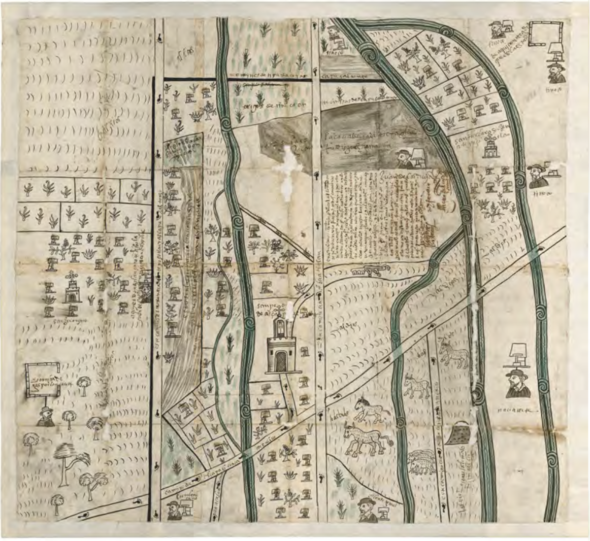
![El lugar de los espíritus [The Place of the Spirits]](https://dnet8ble6lm7w.cloudfront.net/art_sm/APER084-0.png)
![Carta ó Mapa Geográfico de una gran parte del Reino de N. E. [Nueva España], comprendido entre los 19 y 42 grados de latitud Septentrional y entre 249 y 289 grados de longitud del Meridiano de Tenerife, formado de orden del Exc[elentísi]mo S[eño]r B[eilí]o Fr[ey] D[o]n Ant[oni]o Maria Bucarely y Vrsúa p[ar]a indicar la division del Virreinato de México y de las Provincias internas erigidas en Comandancia General en virtud de Reales Órdenes el año 1770](https://dnet8ble6lm7w.cloudfront.net/maps_sm/MEX/MEX0190.png)