Peoples
- CARIBE
- CASSIPAGOTES
- EPUREMI
- ASSAWAI
- MORPION
- CARION
- TIMBU
- CHANE
- NAPERS
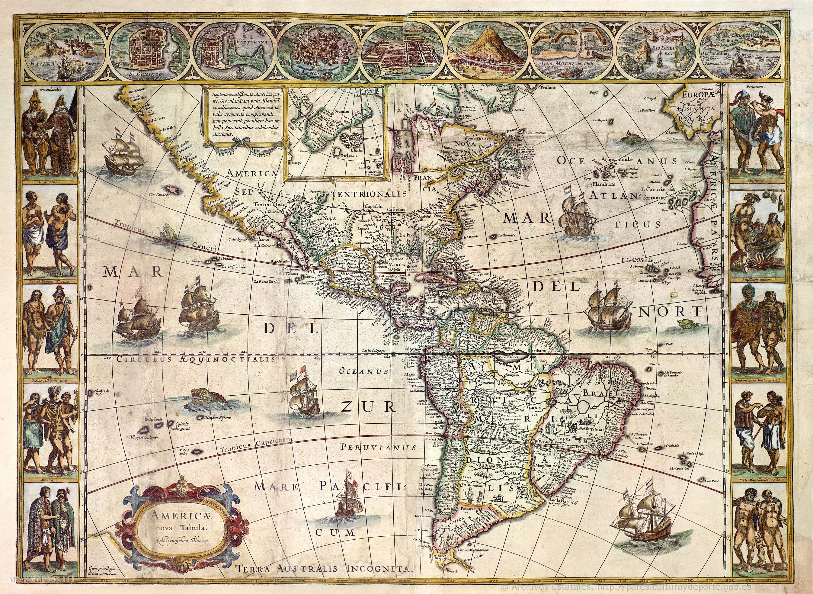
Citation
Blaeu, Willem Janszoon. Americae Nova Tabula. Map. Amsterdam, 1640. Accessed July 22, 2022. http://pares.mcu.es/ParesBusquedas20/catalogo/description/6972860.
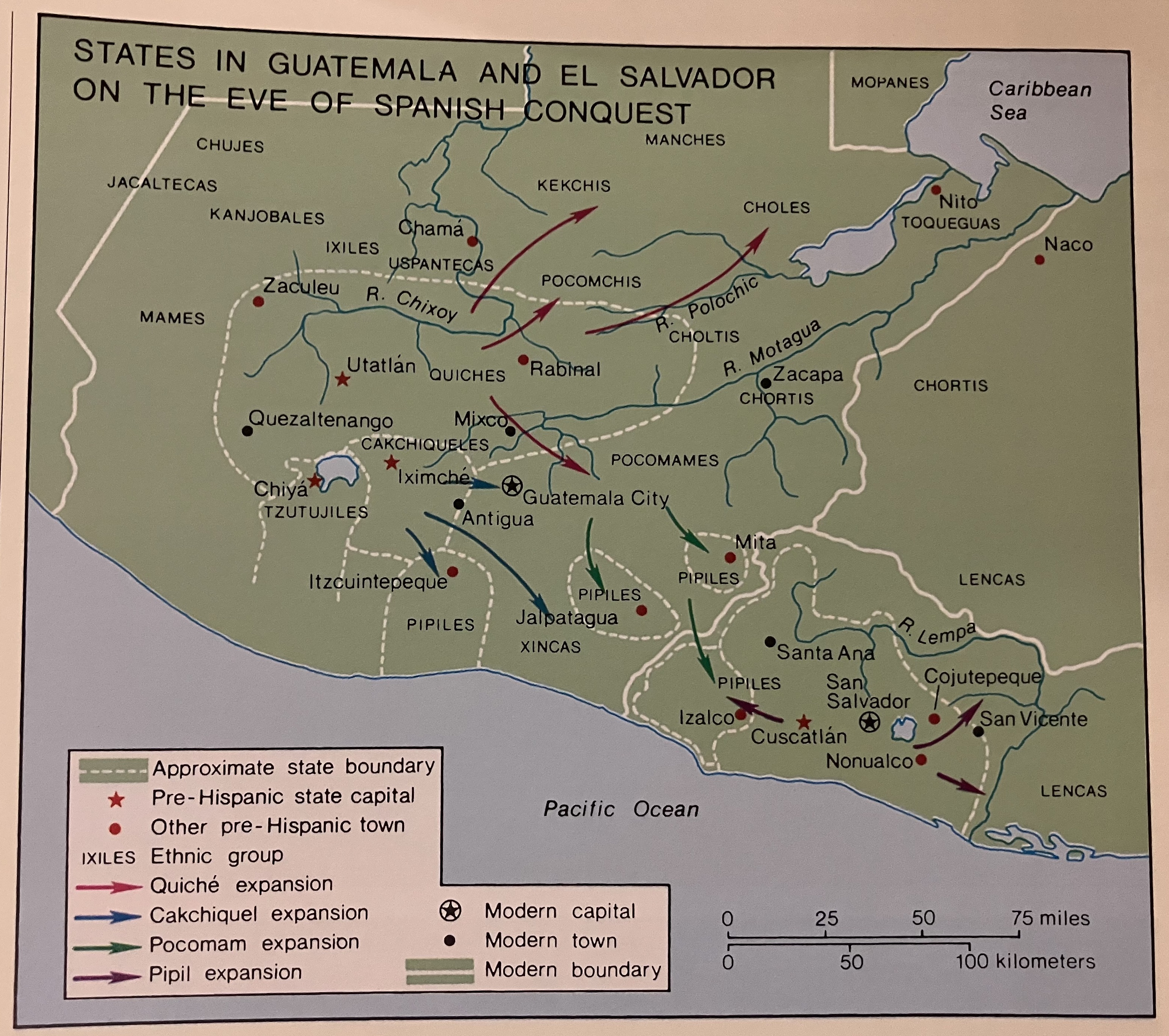
States in Guatemala and el Salvador on the Eve of Spanish Conquest.
Map 1524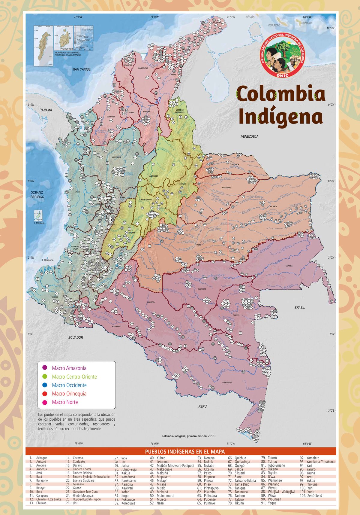
Colombia Indígena - ONIC
Map 2015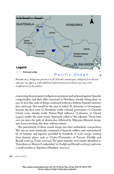
Indigenous provinces in El Salvador around 1500. (Adapted from Fowler 1989140-141, figure 5, with additional information from Lehman 1920:719, with modifications by the author.)
Map 1500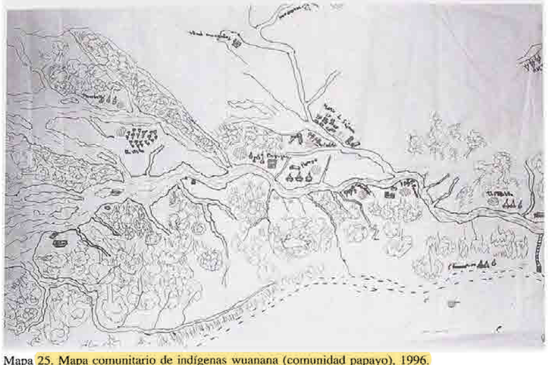
MAPA COMUNITARIA DE INDIGENAS WUANANA
Map 1996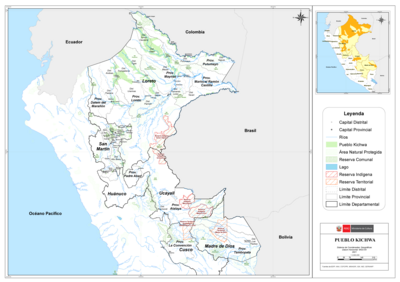
PUEBLO KICHWA
Map 2021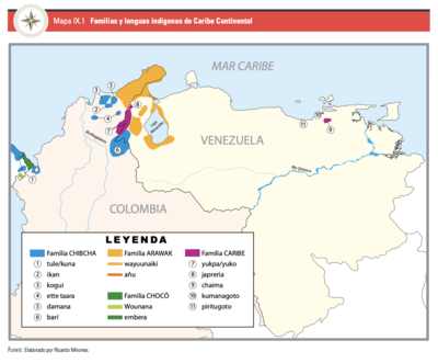
Mapa IX.1 Familias y lenguas indígenas del Caribe Continental
Map 2009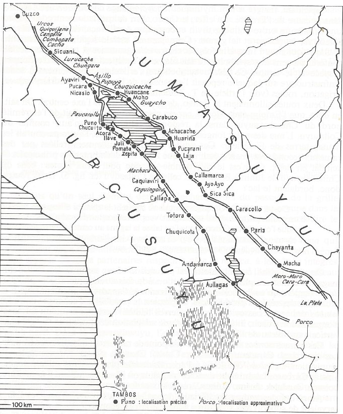
INCA ROADS AND TAMBOS in the 16th CENTURY
Map 1530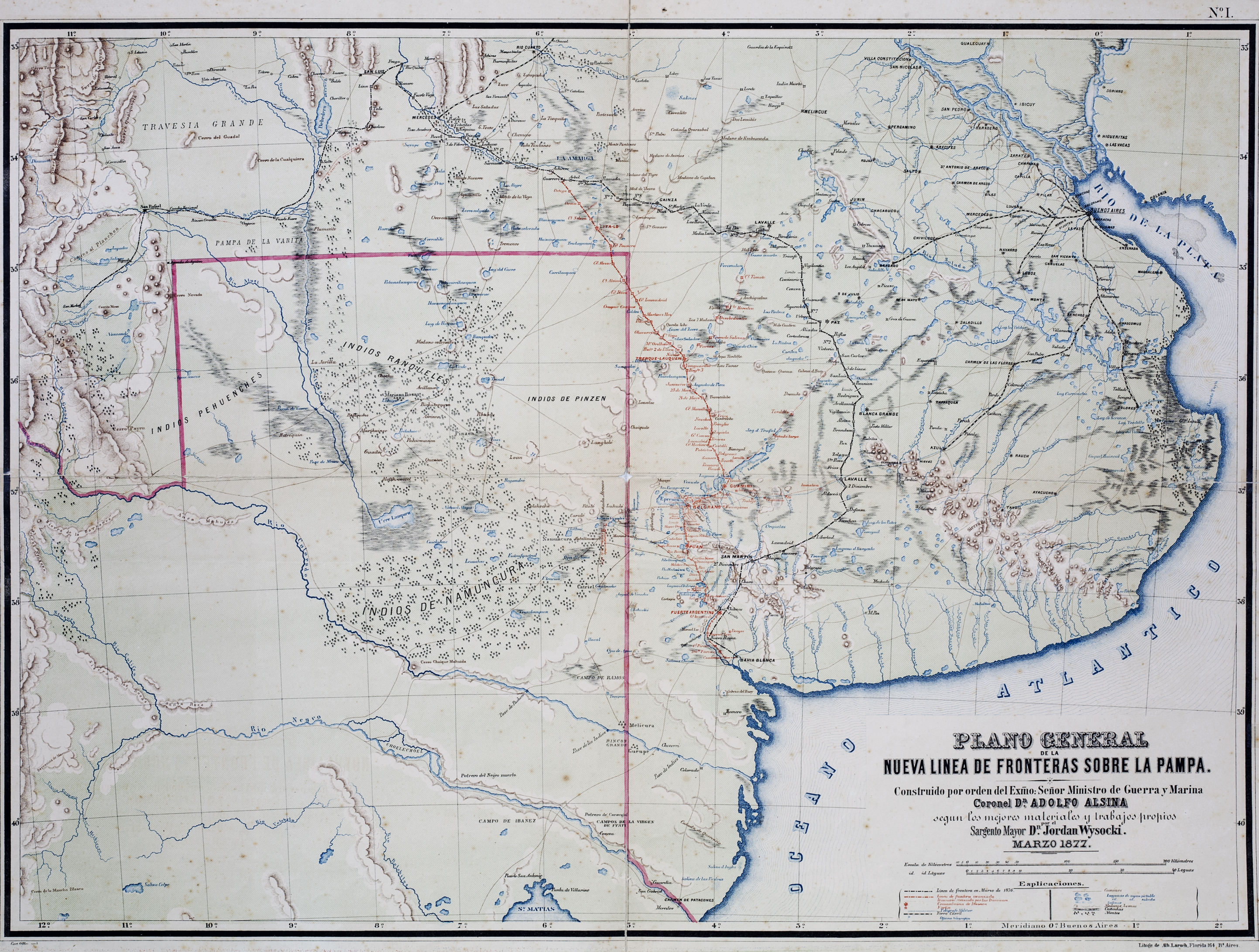
Plano General de las Nuevas Fronteras sobre La Pampa.
Map 1877