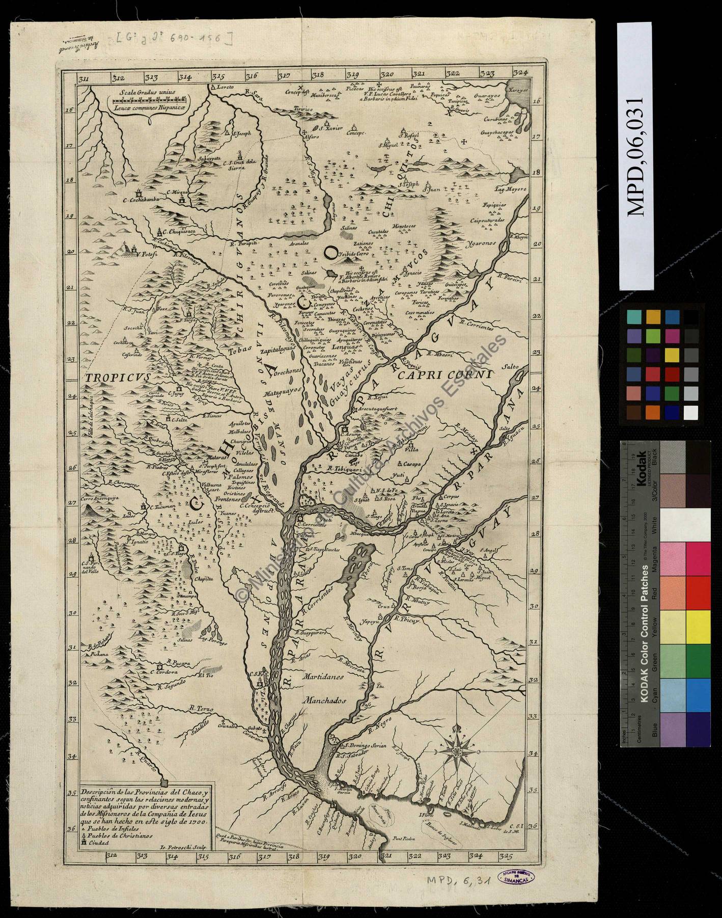
Peoples
- MANCHADOS
- MARTIDANES
- ABIPONES
- MOCOBIS
- TOBAS
- ZAPATALAGUAS
- ORECHONES
- MARAGUAYOS
- CHIRIGUANOS
- VAYAS
- GUAYCURUS
- ZAMUCOS
- CHIQUIITOS
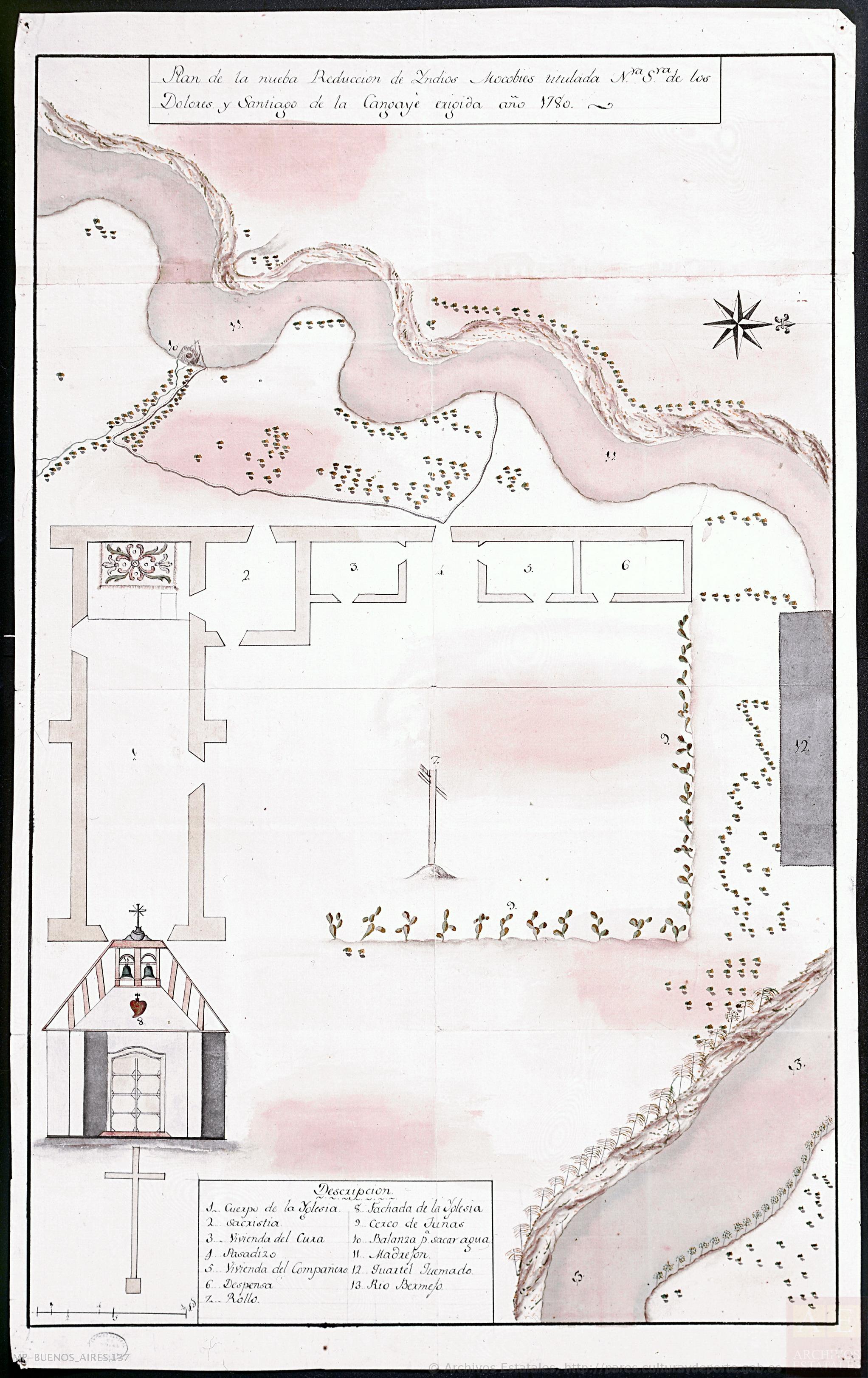
Citation
Archivo General de Simancas. Signatura: MPD, 06, 031. Signatura anterior: GYJ, 00690, 156. Nº de registro: AGS03780. Código de barras: 1111110716565 http://www.mcu.es/ccbae/es/consulta/registro.do?id=178752