Dispossesions in the Americas

Dispossesions in the Americas

  • Home
  • Explore
  • About
  • Authors
  • Art
  • Bodies
  • Curricula
  • Cultural Heritage
  • Maps
  • Territories
Back to Explore
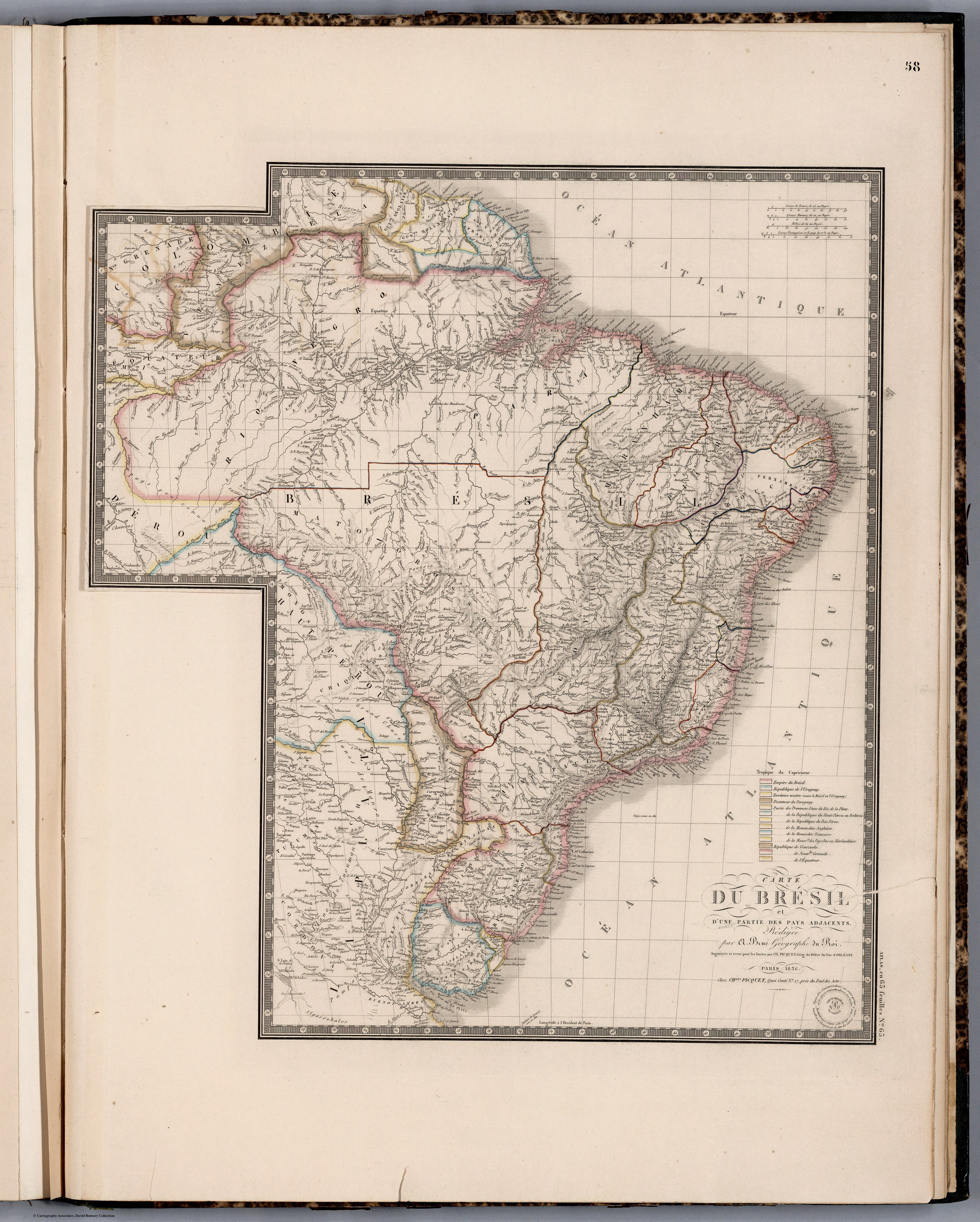
Map 1836

CARTE DU BRÉSIL

  • PICQUET;CHLES;ET AL.

Published: 1854

  • Download Image

Peoples

  • GALIBIS
  • EMERILLONS
  • OYAMPIS
  • MANAOS
  • TAPIRAPEQUES
  • MUNDRUCUS
  • PARESIS
  • BOROROS
  • PEREGUANOS
  • CURROYENOS
  • CHORARACUS
  • CHIRIVONES
  • IBITAYAS
  • IGARONES
  • CAMACULAS
  • AYUQUILITERAS
  • AGUSE
  • BOYAUNAS
  • GUAROCANOS
  • CHIQUINOS
  • AGUAYES
  • OJOTUTAS
  • TOBETIONOS
  • MONGOLAS
  • TAPES
  • TRACANOS
  • ABIPONES

Citation

Picquet, Chles, and Brue. Carte du Bresil. Map. Chez J. Andriveau-Goujon, 1836. Accessed April 30, 2022. https://www.davidrumsey.com/luna/servlet/detail/RUMSEY~8~1~284532~90057074:Carte-du-Bresil-?sort=pub_list_no_initialsort%2Cpub_list_no_initialsort%2Cpub_date%2Cpub_date&qvq=w4s:/where%2FURU,sort:pub_list_no_initialsort%2Cpub_list_no_initialsort%2Cpub_date%2Cpub_date,lc:RUMSEY~8~1&mi=36&trs=95.
  • Download Image

Reading in Spanish

Map 1836

CARTE DU BRÉSIL

  • PICQUET;CHLES;ET AL.

Published: 1854

  • Download Image
  • Download Image

Related Content

PUEBLO TLAHUICA

PUEBLO TLAHUICA

Map 2020
Carte de la Moskitie oú se fonde la Neustrie

Carte de la Moskitie oú se fonde la Neustrie

Map 1830
Sketch of the country from reduction to Buenos Ayres, shewing the movements of B. Genl. Beresford, when he captured that place June 1806. Drawn from memorandums furnished by Capt: Donnelly

Sketch of the country from reduction to Buenos Ayres, shewing the movements of B. Genl. Beresford, when he captured that place June 1806. Drawn from memorandums furnished by Capt: Donnelly

Map 1806
Indigenous peoples of the coast of Brazil, (c. 16th C.)

Indigenous peoples of the coast of Brazil, (c. 16th C.)

Map 1500 - 1599
Terra Indígena Vale do Javarí

Terra Indígena Vale do Javarí

Map 2000 - 2099
XI RONDA PETROLERA Y TERRITORIOS INDIGENAS

XI RONDA PETROLERA Y TERRITORIOS INDIGENAS

Map 2011
Map of the North Atlantic Autonomous Region (RAAN);Northeastern Nicaragua.

Map of the North Atlantic Autonomous Region (RAAN);Northeastern Nicaragua.

Map 1900
A TERRE FERME ET LE PEROU AVEC LE PAYS DES AMAZONES ET LE BRESIL

A TERRE FERME ET LE PEROU AVEC LE PAYS DES AMAZONES ET LE BRESIL

Map 1705

Dispossessions in the Americas

A project by

University of Pennsylvania

Copyright 2024

With support from

Mellon Foundation

Site design & development

Element 84

Art Credits

Picquet, Chles, and Brue. Carte du Bresil. Map. Chez J. Andriveau-Goujon, 1836. Accessed April 30, 2022. https://www.davidrumsey.com/luna/servlet/detail/RUMSEY~8~1~284532~90057074:Carte-du-Bresil-?sort=pub_list_no_initialsort%2Cpub_list_no_initialsort%2Cpub_date%2Cpub_date&qvq=w4s:/where%2FURU,sort:pub_list_no_initialsort%2Cpub_list_no_initialsort%2Cpub_date%2Cpub_date,lc:RUMSEY~8~1&mi=36&trs=95.
Site Pages

  • Home
  • Explore
  • About
  • Authors
  • Art
  • Bodies
  • Curricula
  • Cultural Heritage
  • Maps
  • Territories