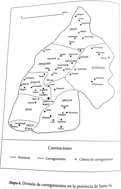
Peoples
- YURACARAS
- MOSETENE
- CHIRIHUANO
- CAYAPO
- TEHUELCHES
- HUILLICHES
- RANQUELES
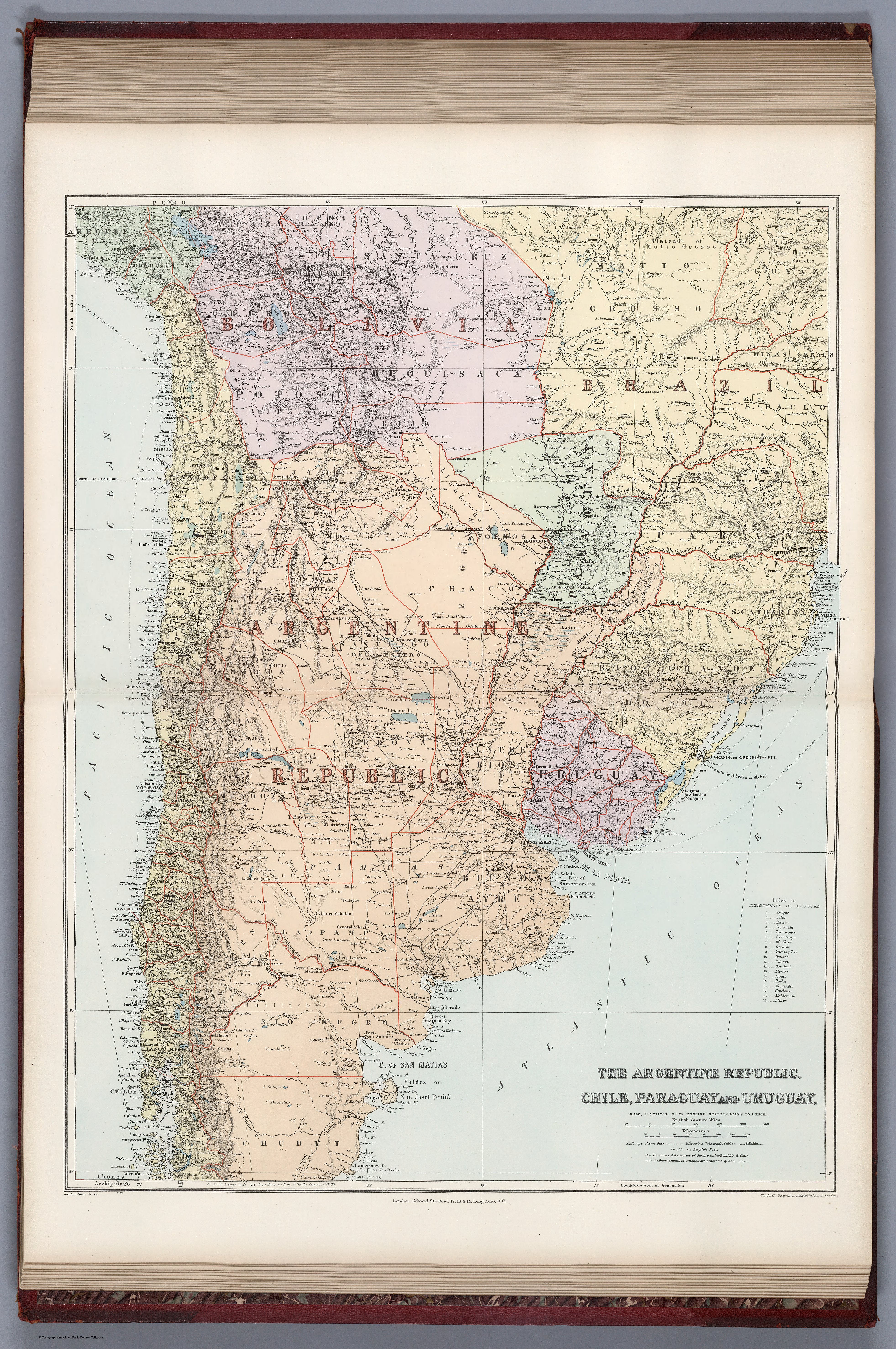
Citation
Stanford, Edward. Argentine Republic, Chile, Paraguay, Uruguay. Map. London: Edward Stanford, 1904. Accessed April 30, 2022. https://www.davidrumsey.com/luna/servlet/detail/RUMSEY~8~1~314746~90083534:Argentine-Republic,-CHI,-PAR?sort=pub_list_no_initialsort%2Cpub_list_no_initialsort%2Cpub_date%2Cpub_date&qvq=w4s:/where%2FURU,sort:pub_list_no_initialsort%2Cpub_list_no_initialsort%2Cpub_date%2Cpub_date,lc:RUMSEY~8~1&mi=24&trs=95.
![Ani Xeati de los animales [Ani Xeati of the Animals]](https://dnet8ble6lm7w.cloudfront.net/art_sm/APER062.png)