Dispossesions in the Americas

Dispossesions in the Americas

  • Home
  • Explore
  • About
  • Authors
  • Art
  • Bodies
  • Curricula
  • Cultural Heritage
  • Maps
  • Territories
Back to Explore
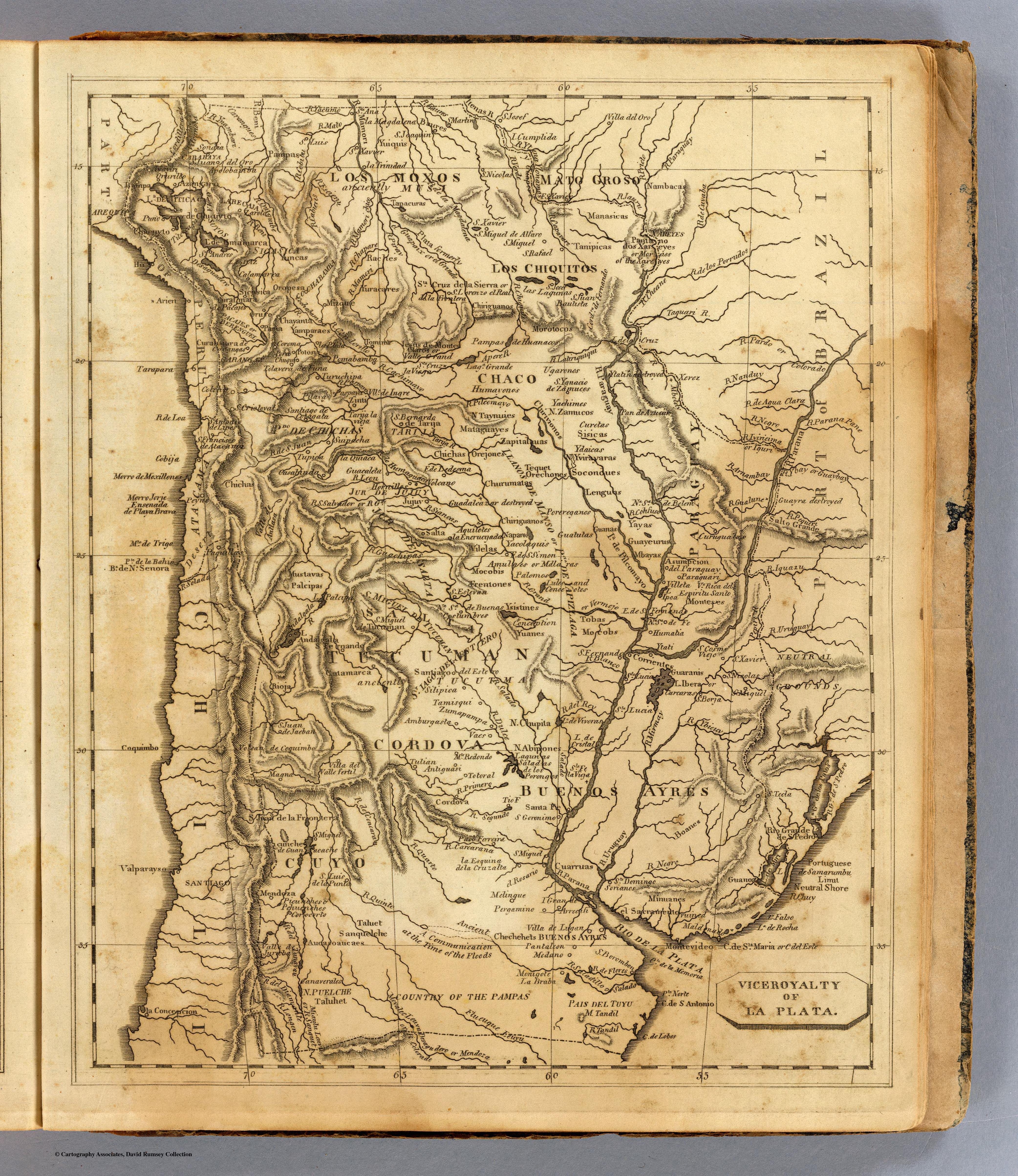
Map 1812

Viceroyalty of La Plata

  • ARROWSMITH;AARON;ET AL.

Published: 1812

  • Download Image

Peoples

  • PAMPAS
  • YUIQUIS
  • NAMBACAS
  • MANASICAS
  • TANIPICAS
  • MOROTOCOS
  • CHIRIGUANOS
  • OREJONES
  • LENGUAS
  • MBAYAS
  • TOBAS
  • GUARANIS
  • YTATI
  • MOCOBIS
  • MATAGUAYES
  • UGARONOS
  • ZAMUCOS
  • YACHIMES
  • CHIRIVIONOS
  • ORECHONES
  • TEQUET
  • CHURUMATAS
  • NAPAROS
  • VILELAS
  • AQUILOTES
  • SOCONDUES
  • POREREGANOS
  • GUATUTAS
  • GUANAS
  • YAYAS
  • CARCARAS
  • MOCOBS
  • LULES
  • CONOEOTES
  • GUAYEURUS
  • CAPITALAUAS
  • YACOLAQUIS
  • CURETAS
  • SISICAS
  • YDAICAS
  • YVIRAYARAS
  • RACHES
  • YURACARES
  • YUNCAS
  • OROPESA
  • MOXOS
  • CHIQUITOS
  • CHICHAS
  • HUMAYONOS
  • TAYNUIES
  • FRENTONES
  • YSISTINES
  • TUANES
  • ABIPONES
  • CHIPITA
  • PALOMOS
  • CATAMARCA
  • PALCIPAS
  • MUSTAVAS
  • TALUET
  • TALUHET
  • PUELCHE
  • SANQUELCHE
  • AUCASOAUCAES
  • PICUNCHES
  • PEHUENCHES
  • CHECHEHETS
  • CUARRUAS
  • MINUANES
  • BOANES
  • GUANOA

Citation

Arrowsmith, Aaron. Viceroyalty of La Plata. Map. Boston: Thomas & Andrews, 1812. Accessed April 24, 2022. https://www.davidrumsey.com/luna/servlet/detail/RUMSEY~8~1~31723~1150518:La-Plata-?qvq=w4s%3A%2Fwhere%2FURU%3Bsort%3Apub_list_no_initialsort%2Cpub_list_no_initialsort%2Cpub_date%2Cpub_date%3Blc%3ARUMSEY%7E8%7E1&mi=4&trs=88.
  • Download Image

Reading in Spanish

Map 1812

Viceroyalty of La Plata

  • ARROWSMITH;AARON;ET AL.

Published: 1812

  • Download Image
  • Download Image

Related Content

Carte de la dépendance du Yapok jusqu'à la Rivière des Amazones;par François Duvillard garde magazin du Roy au Yapok

Carte de la dépendance du Yapok jusqu'à la Rivière des Amazones;par François Duvillard garde magazin du Roy au Yapok

Map 1700 - 1799
AMER. MÈR. PARTIE DE LA PLATA. N. 31.

AMER. MÈR. PARTIE DE LA PLATA. N. 31.

Map 1825
Vom Roroima zum Orinoco

Vom Roroima zum Orinoco

Map 1923 - 1928
La France Antarctique autrement le Rio de Janeiro

La France Antarctique autrement le Rio de Janeiro

Map 1557 - 1558
[Carte manuscrite de l'Isthme et la Baye de Panama et contrées adjacentes]

[Carte manuscrite de l'Isthme et la Baye de Panama et contrées adjacentes]

Map 1730 - 1760
Linguistic Map of Southern Mexican Highlands and Adjacent Regions at Contact Period

Linguistic Map of Southern Mexican Highlands and Adjacent Regions at Contact Period

Map 1969
PUEBLO IXIL

PUEBLO IXIL

Map 2020
REGIÓN HUICOT O GRAN NAYAR

REGIÓN HUICOT O GRAN NAYAR

Map 2000

Dispossessions in the Americas

A project by

University of Pennsylvania

Copyright 2024

With support from

Mellon Foundation

Site design & development

Element 84

Art Credits

Arrowsmith, Aaron. Viceroyalty of La Plata. Map. Boston: Thomas & Andrews, 1812. Accessed April 24, 2022. https://www.davidrumsey.com/luna/servlet/detail/RUMSEY~8~1~31723~1150518:La-Plata-?qvq=w4s%3A%2Fwhere%2FURU%3Bsort%3Apub_list_no_initialsort%2Cpub_list_no_initialsort%2Cpub_date%2Cpub_date%3Blc%3ARUMSEY%7E8%7E1&mi=4&trs=88.
Site Pages

  • Home
  • Explore
  • About
  • Authors
  • Art
  • Bodies
  • Curricula
  • Cultural Heritage
  • Maps
  • Territories