Peoples
- WAYUU
- ARAWAK
- BARI
- OTOMACO
- SALIVA
- CABERRE
- MAIPURE
- GUAIPUNABE
- AREVIRIANA
- YAVARANA
- YEKUANA
- CARIBE
- XIBAROS
- MAYNAS
- ROAMAYNAS
- OMAGUAS
- CURINAS
- MAMAYANAS
- ORELLUDOS
- ABANOS
- ENCABELLADOS
- CANELOS
- ACANEJOS
- GUYPUNAVIS
- CABRES
- MANETIBITANNAS
- MACUSIAS
- MAJANAOS
- IBASIDANOS
- ARINACUTOS
- NORAGUES
- MACRINAVIS
- MOTILONES
Citation
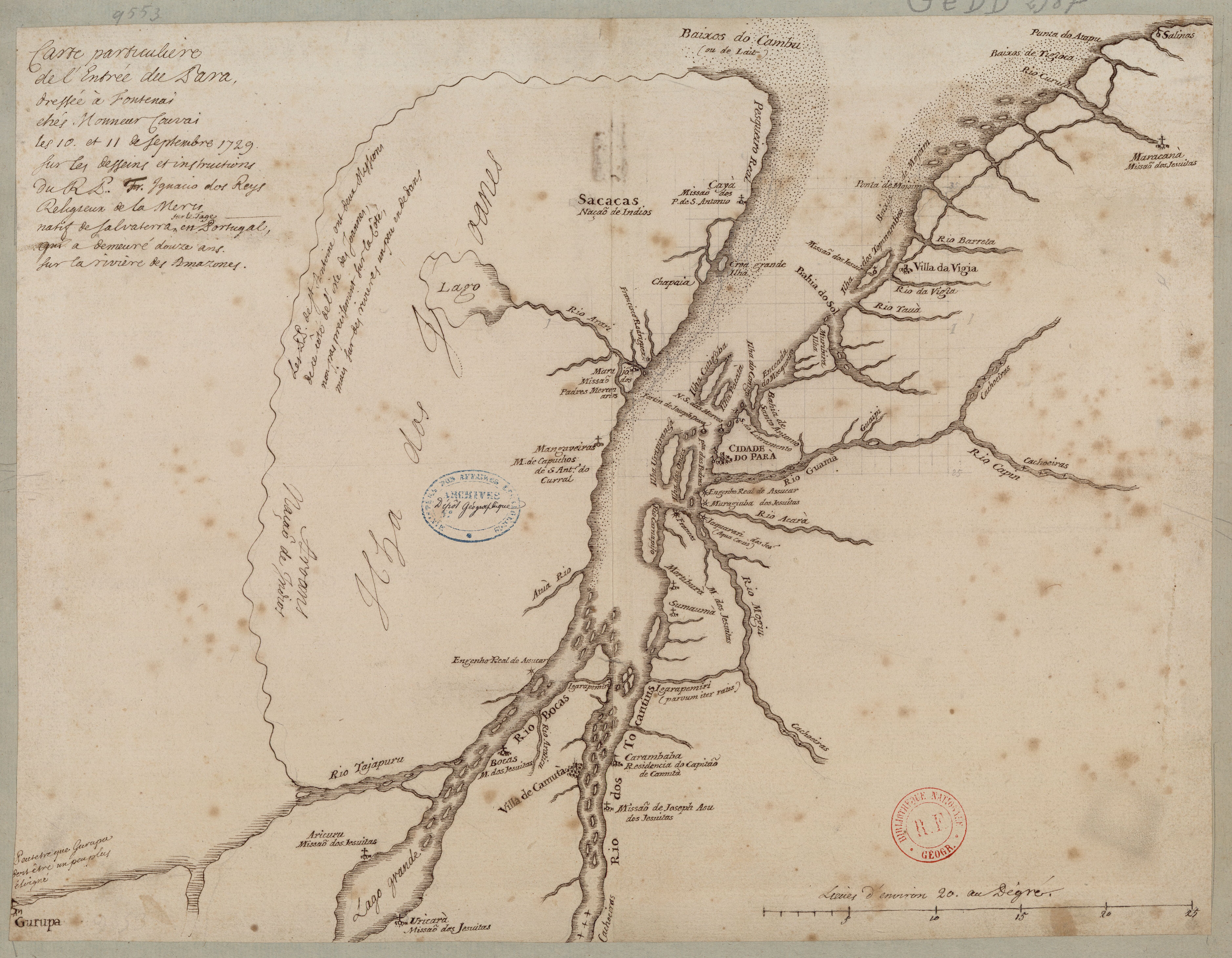
Bonne, Rigobert. Carte du Nouveau Royaume de Grenade, de la Nouvelle Andalousie, et de la Guyane, avec les Pays limitrophes qui en sont au Sud, 1770. Accessed April 11, 2022. https://babel.banrepcultural.org/digital/collection/p17054coll13/id/88
![Nos roban las palabras o A Calzón quitado, o Insurrecciones que son heréticas resurrecciones [They steal our words or Barefaced, or Insurrections that are Heretical Resurrections]](https://dnet8ble6lm7w.cloudfront.net/art_sm/AMEX006.png)
![La sirena del Ucayali [The Ucayali Mermaid]](https://dnet8ble6lm7w.cloudfront.net/art_sm/APER044.png)