Peoples
- URUAK
- YANOMAMI
- OMAGUA
Citation
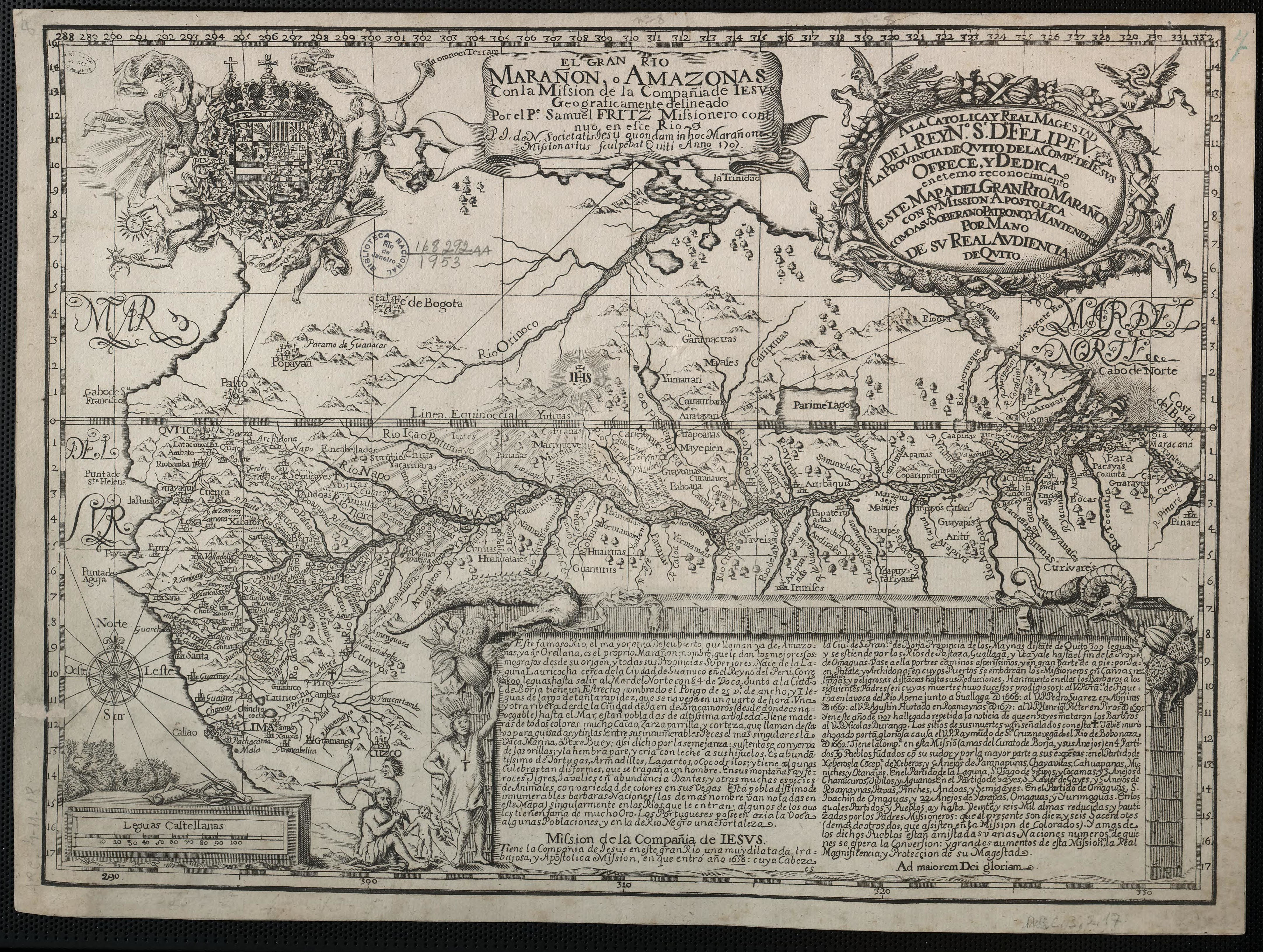
Fritz, Samuel. The Marañon or Amazon River with the Mission of the Society of Jesus. Map. Quito, ECU, 1707. Accessed November 28, 2021. https://www.loc.gov/item/2021668377/.
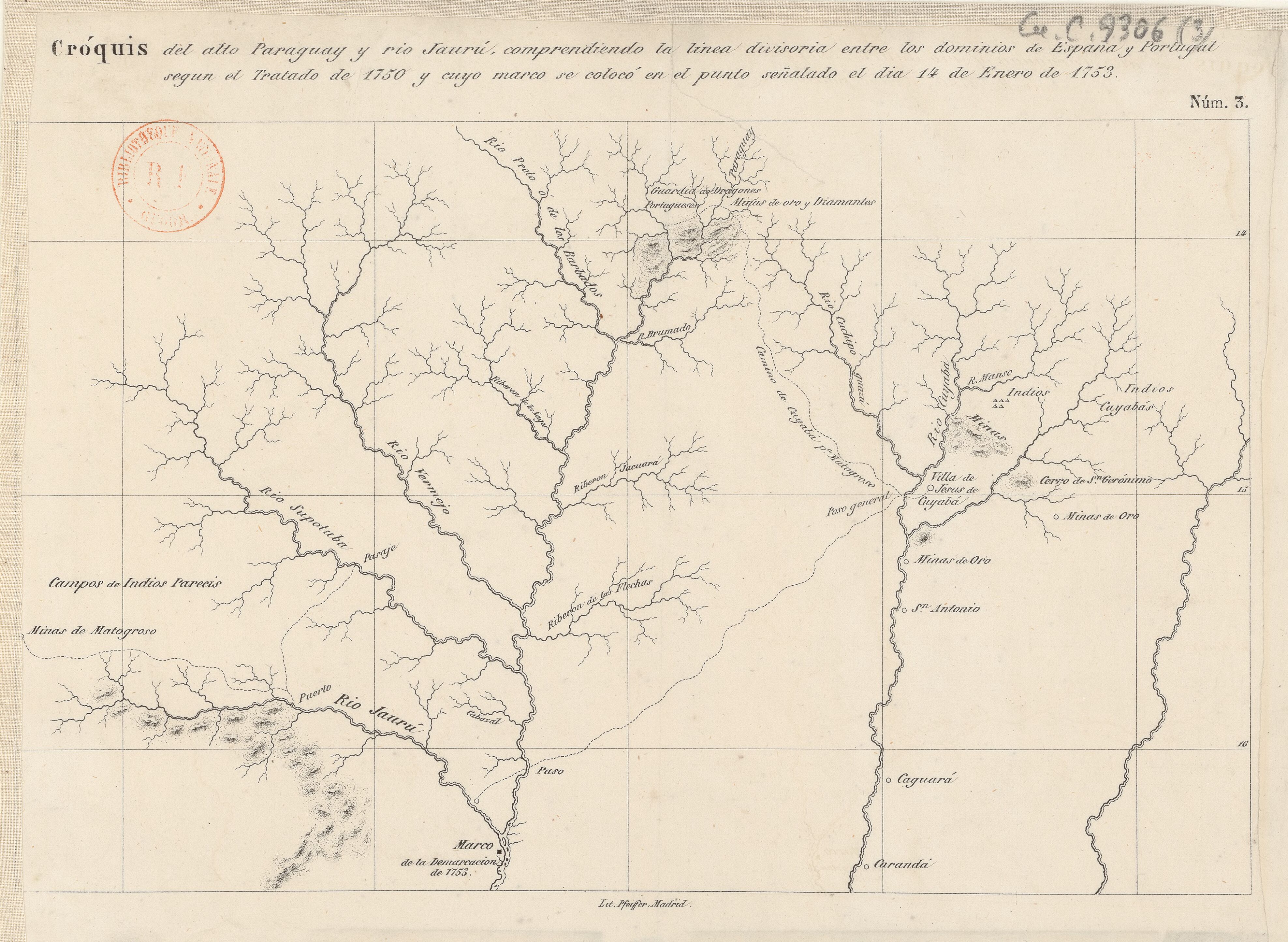
Cróquis del alto Paraguay y rio Jaurú, comprendiendo la linea divisoria entre los dominios de España y Portugal según el Tratado de 1750 y cuyo marco se colocó en el punto señalado el día 14 de Enero de 1753.
Map 1750 - 1850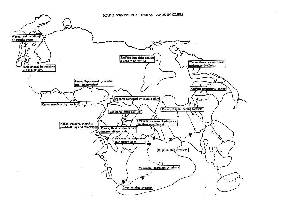
VENEZUELA: INDIAN LANDS IN CRISIS
Map 1995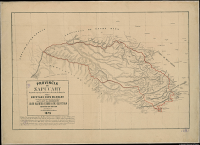
PROVINCIA DE SAPUCAHY
Map 1873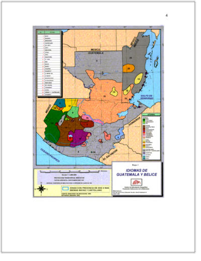
IDIOMAS DE GUATEMALA Y BELICE
Map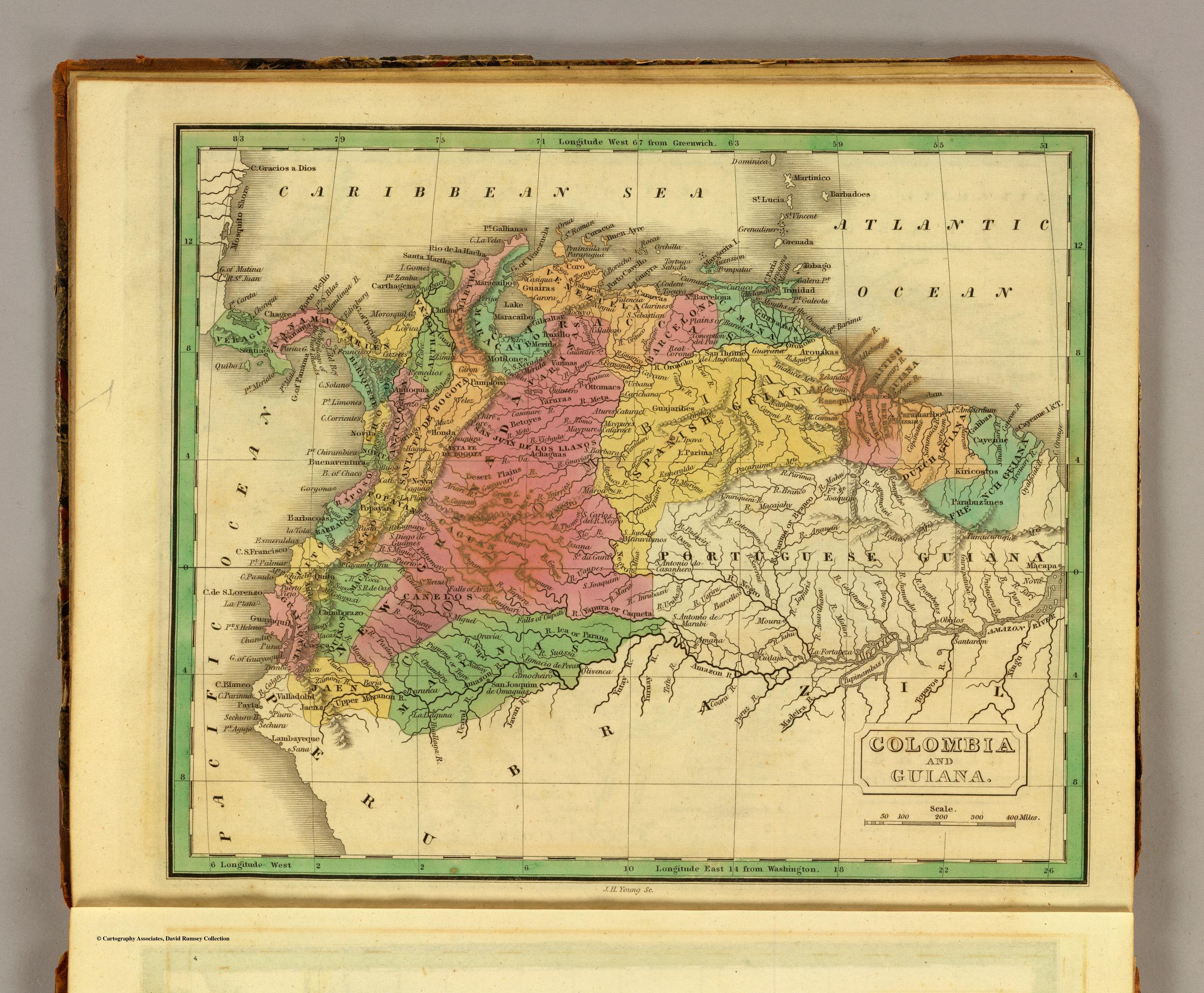
COLOMBIA AND GUIANA
Map 1830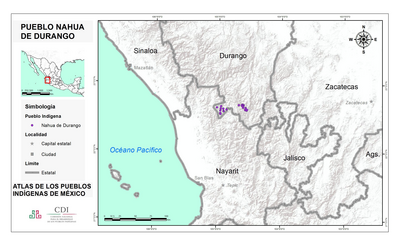
PUEBLO NAHUA DE DURANGO
Map 2020![Tierra de nadie [No Man's Land]](https://dnet8ble6lm7w.cloudfront.net/art_sm/AMEX011.png)
Tierra de nadie [No Man's Land]
Artwork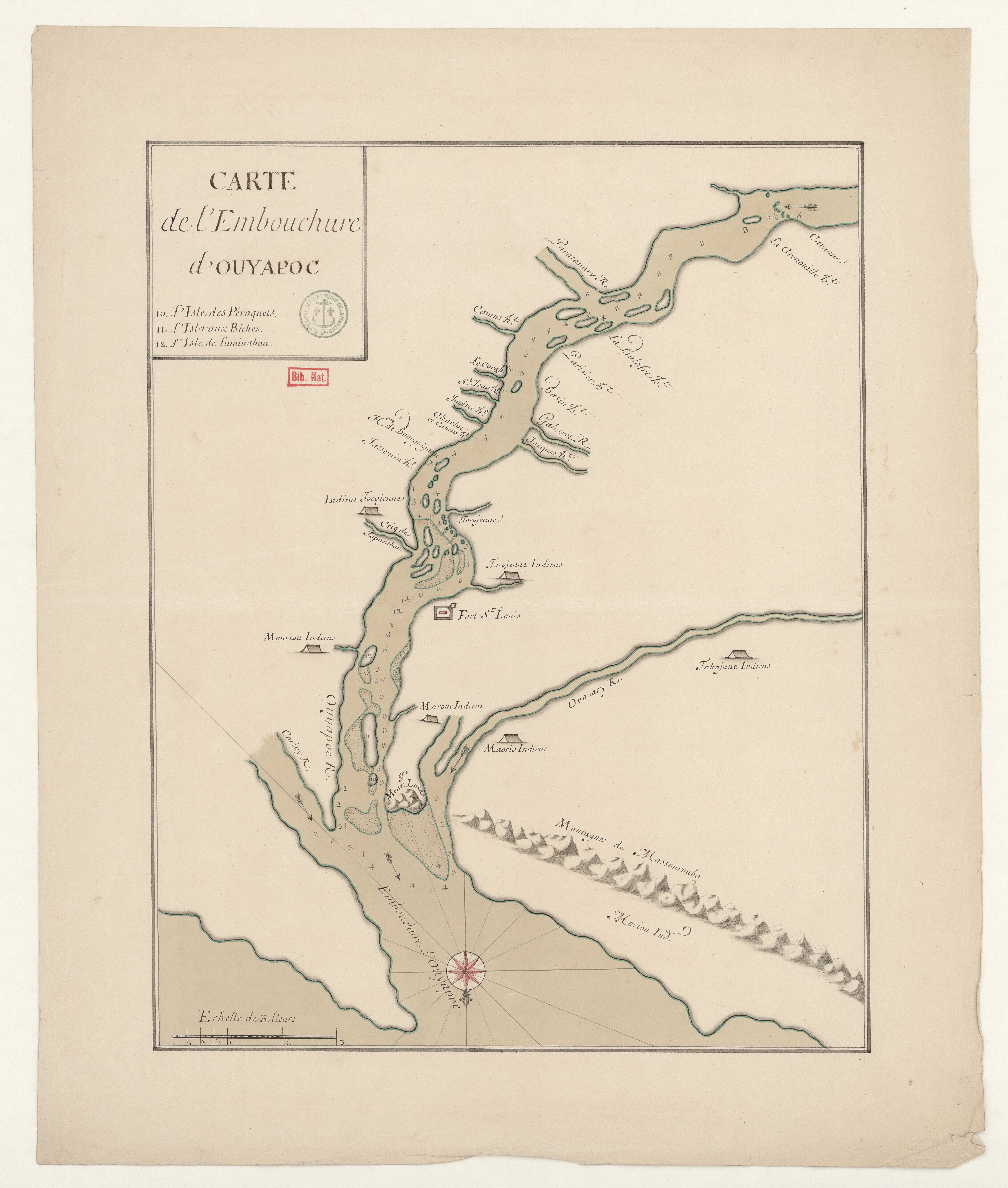
Carte de l'embouchure d'Ouyapoc
Map 1700 - 1799