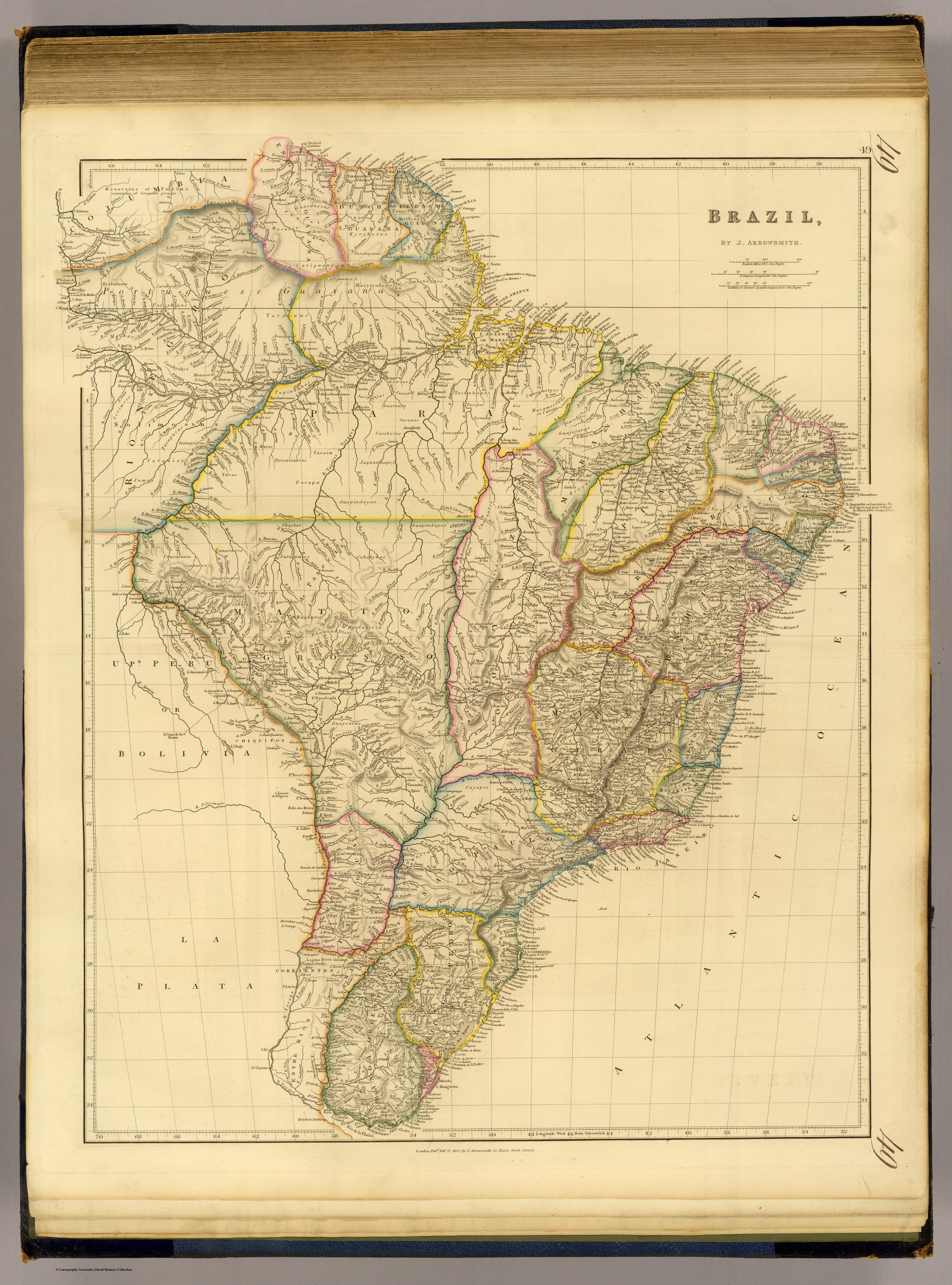
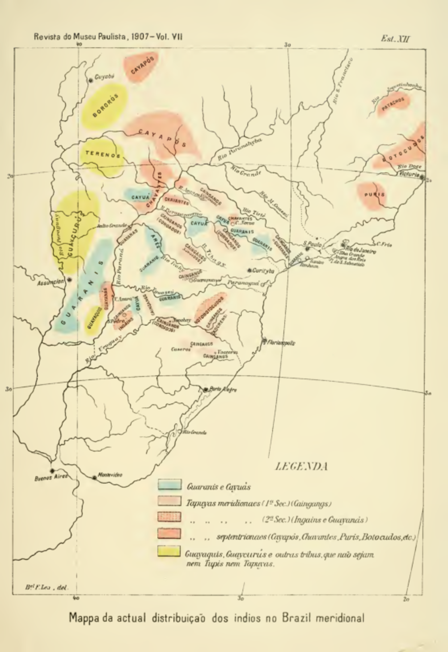
Dispossesions in the Americas

Dispossesions in the Americas

  • Home
  • Explore
  • About
  • Authors
  • Art
  • Bodies
  • Curricula
  • Cultural Heritage
  • Maps
  • Territories
Back to Explore
Map 1857 - 1907

Mappa da actual distribuição dos indios no Brazil meridional

  • IHERING;HERMANN VON

Published: 1907

  • Download Image

Peoples

  • GUARANI
  • CAYUAS
  • TAPUYAS
  • PAI TAVYTERA
  • TAPUYAS
  • MINUANES
  • GUENOAS
  • INGAINS
  • GUY
  • TAPUYAS
  • CAYAPOS
  • CHAVANTES
  • PURIS
  • BOTOCUDOS
  • ACHE
  • GUAICURU

Citation

Ihering, Hermann von. "A antropologia do estado de São Paulo." Revista do Mueseu Paulista 7 (1907): 202-57. Accessed December 29, 2021. http://etnolinguistica.wdfiles.com/local--files/biblio%3Aihering-1907-anthropologia/ihering_1907_anthropologia_archive.pdf.

  • Download Image

Reading in Spanish

Map 1857 - 1907

Mappa da actual distribuição dos indios no Brazil meridional

  • IHERING;HERMANN VON

Published: 1907

  • Download Image
  • Download Image

Reading in Portuguese

Map 1857 - 1907

Mappa da actual distribuição dos indios no Brazil meridional

  • IHERING;HERMANN VON

Published: 1907

  • Download Image

Peoples

  • GUARANI
  • CAYUAS
  • TAPUYAS
  • PAI TAVYTERA
  • TAPUYAS
  • MINUANES
  • GUENOAS
  • INGAINS
  • GUY
  • TAPUYAS
  • CAYAPOS
  • CHAVANTES
  • PURIS
  • BOTOCUDOS
  • ACHE
  • GUAICURU

Citation

Ihering, Hermann von. "A antropologia do estado de São Paulo." Revista do Mueseu Paulista 7 (1907): 202-57. Accessed December 29, 2021. http://etnolinguistica.wdfiles.com/local--files/biblio%3Aihering-1907-anthropologia/ihering_1907_anthropologia_archive.pdf.

  • Download Image

Related Content

PUEBLO Q'EQCHI'

PUEBLO Q'EQCHI'

Map 2020
Location of three ethno-linguistic groups in the highlands of Guatemala in which joint InHerit-Riecken community-participant mapping took place. Adapted from http://d-maps. com/carte.php?num_car=1717&lang=en)

Location of three ethno-linguistic groups in the highlands of Guatemala in which joint InHerit-Riecken community-participant mapping took place. Adapted from http://d-maps. com/carte.php?num_car=1717&lang=en)

Map 2000
Mapa del Orinoco con planta y dos perfiles del castillo de San Francisco de Asís, en la Guayana.

Mapa del Orinoco con planta y dos perfiles del castillo de San Francisco de Asís, en la Guayana.

Map 1736
Brazil.

Brazil.

Map 1838
PUEBLO IKITU

PUEBLO IKITU

Map 2021
Mapa histórico-geográfico de Perú, Chile y Buenos Aires

Mapa histórico-geográfico de Perú, Chile y Buenos Aires

Map 1830
DESCRIPCIÓN GEOGRÁFICA DEL RIO MAMORE O MADERA EN LA AMERICA AUSTRAL DEL DOMINIO DE LA CORONA ESPAÑOLA

DESCRIPCIÓN GEOGRÁFICA DEL RIO MAMORE O MADERA EN LA AMERICA AUSTRAL DEL DOMINIO DE LA CORONA ESPAÑOLA

Map 1782
PARAQVARIA vulgo PARAGVAY.

PARAQVARIA vulgo PARAGVAY.

Map 1600 - 1699

Dispossessions in the Americas

A project by

University of Pennsylvania

Copyright 2024

With support from

Mellon Foundation

Site design & development

Element 84

Art Credits

Ihering, Hermann von. “A antropologia do estado de São Paulo.” Revista do Mueseu Paulista 7 (1907): 202-57. Accessed December 29, 2021. http://etnolinguistica.wdfiles.com/local--files/biblio%3Aihering-1907-anthropologia/ihering_1907_anthropologia_archive.pdf.

Site Pages

  • Home
  • Explore
  • About
  • Authors
  • Art
  • Bodies
  • Curricula
  • Cultural Heritage
  • Maps
  • Territories