Peoples
- NAHUAPIPIL
- CHORTI
- LENCA
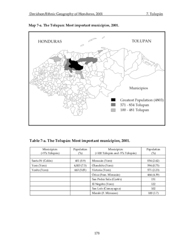
- TOLUPAN
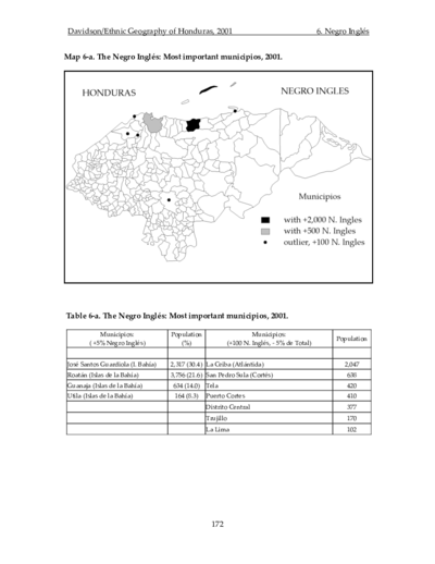
- GARIFUNA
- ULWAS
- MISKITO
- TAWAHKA
- MAYANGNA
- RAMA
- KUNA
- BUGLERE
- GUAYMI
- TJERDI
- PECH
- MALECU
- BRUNKA
- CABECAR
- BRIBRI
- WOUNANA
- EMBERA
Citation
Gobierno de España Ministerio de Asuntos Exteriores y de Cooperación. Atlas Sociolingü̈ístico de Pueblos Indígenas en América Latina. By UNICEF and FUNPROEIB Andes. Report no. 2. Pg. 738. 2009. Accessed November 7, 2021. https://www.unicef.org/lac/media/9796/file/Atlas%20sociolinguistico%20de%20pueblos%20ind%C3%ADgenas%20en%20ALC-Tomo%202.pdf.
![[Carte manuscrite de l'embouchure de Rio da Prata]](https://dnet8ble6lm7w.cloudfront.net/maps/URU/URU0025.jpeg)