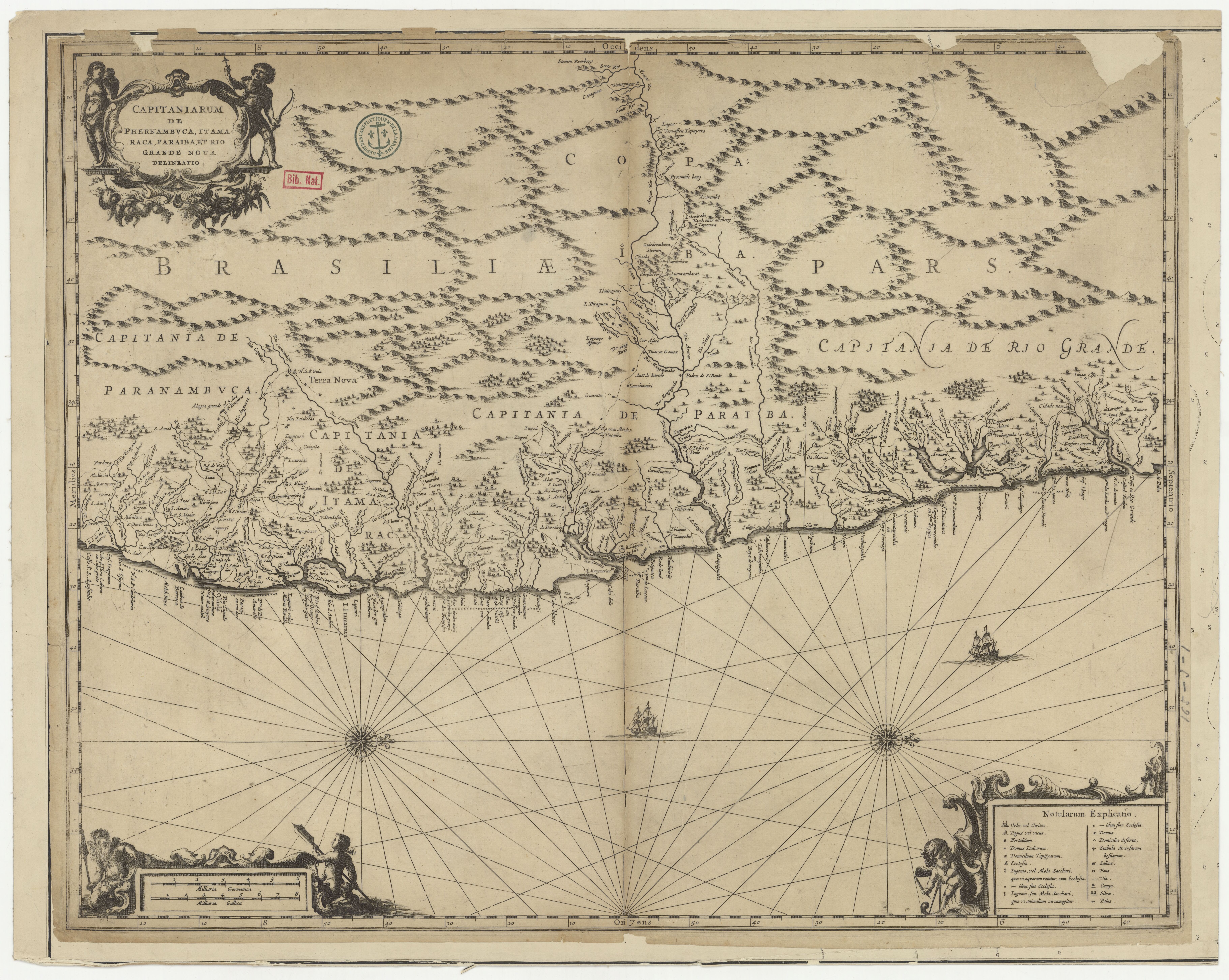
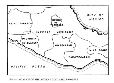
Dispossesions in the Americas

Dispossesions in the Americas

  • Home
  • Explore
  • About
  • Authors
  • Art
  • Bodies
  • Curricula
  • Cultural Heritage
  • Maps
  • Territories
Back to Explore
Map 1500 - 1800

Cartografía hispano colonial de Chile

  • MEDINA, JOSE

Published: 1924

  • Download Image

Peoples

  • PUELCHES
  • PEHUENCHES
  • CHIQUILLANES

Citation

Medina, Jose Toribio. Cartografía hispano colonial de Chile. Map. Taller de Fotolitografía de la Inspección de Geografía, 1924. Accessed July 9, 2023. https://digital.iai.spk-berlin.de/viewer/image/630120943/1/LOG_0000/.

  • Download Image

Reading in Spanish

Map 1500 - 1800

Cartografía hispano colonial de Chile

  • MEDINA, JOSE

Published: 1924

  • Download Image
  • Download Image

Reading in Portuguese

Map 1500 - 1800

Cartografía hispano colonial de Chile

  • MEDINA, JOSE

Published: 1924

  • Download Image

Peoples

  • PUELCHES
  • PEHUENCHES
  • CHIQUILLANES

Citation

Medina, Jose Toribio. Cartografía hispano colonial de Chile. Map. Taller de Fotolitografía de la Inspección de Geografía, 1924. Accessed July 9, 2023. https://digital.iai.spk-berlin.de/viewer/image/630120943/1/LOG_0000/.

  • Download Image

Related Content

PLANTA DA MARCHA DO 2º CORPO DO EXERCITO BRAZILEIRO DO RIO URUGUAY AO PARANÀ em 1866

PLANTA DA MARCHA DO 2º CORPO DO EXERCITO BRAZILEIRO DO RIO URUGUAY AO PARANÀ em 1866

Map 1866
Location of the Ancient Cuitlatec Province

Location of the Ancient Cuitlatec Province

Map 1969
MAPA DE TEPETLAOZTOC

MAPA DE TEPETLAOZTOC

Map 1500 - 1599
Río Corrientes [Corrientes River]

Río Corrientes [Corrientes River]

Artwork
La Mirada Bizca [The Cross-Eyed Gaze]

La Mirada Bizca [The Cross-Eyed Gaze]

Artwork
CAPITANIARUM DE PHERNAMBUCA, ITAMARACA, PARAIBA ET RIO GRANDE NOVA DELINEATIO

CAPITANIARUM DE PHERNAMBUCA, ITAMARACA, PARAIBA ET RIO GRANDE NOVA DELINEATIO

Map 1650
MAP SHOWING SACRED PLACES VISITED BY THE HUICHOL INDIANS

MAP SHOWING SACRED PLACES VISITED BY THE HUICHOL INDIANS

Map 1902
Comunidad Aborigen Misión Federico Pérez - Pueblo Wichí

Comunidad Aborigen Misión Federico Pérez - Pueblo Wichí

Map 2020

Dispossessions in the Americas

A project by

University of Pennsylvania

Copyright 2024

With support from

Mellon Foundation

Site design & development

Element 84

Art Credits

Medina, Jose Toribio. Cartografía hispano colonial de Chile. Map. Taller de Fotolitografía de la Inspección de Geografía, 1924. Accessed July 9, 2023. https://digital.iai.spk-berlin.de/viewer/image/630120943/1/LOG_0000/.

Site Pages

  • Home
  • Explore
  • About
  • Authors
  • Art
  • Bodies
  • Curricula
  • Cultural Heritage
  • Maps
  • Territories