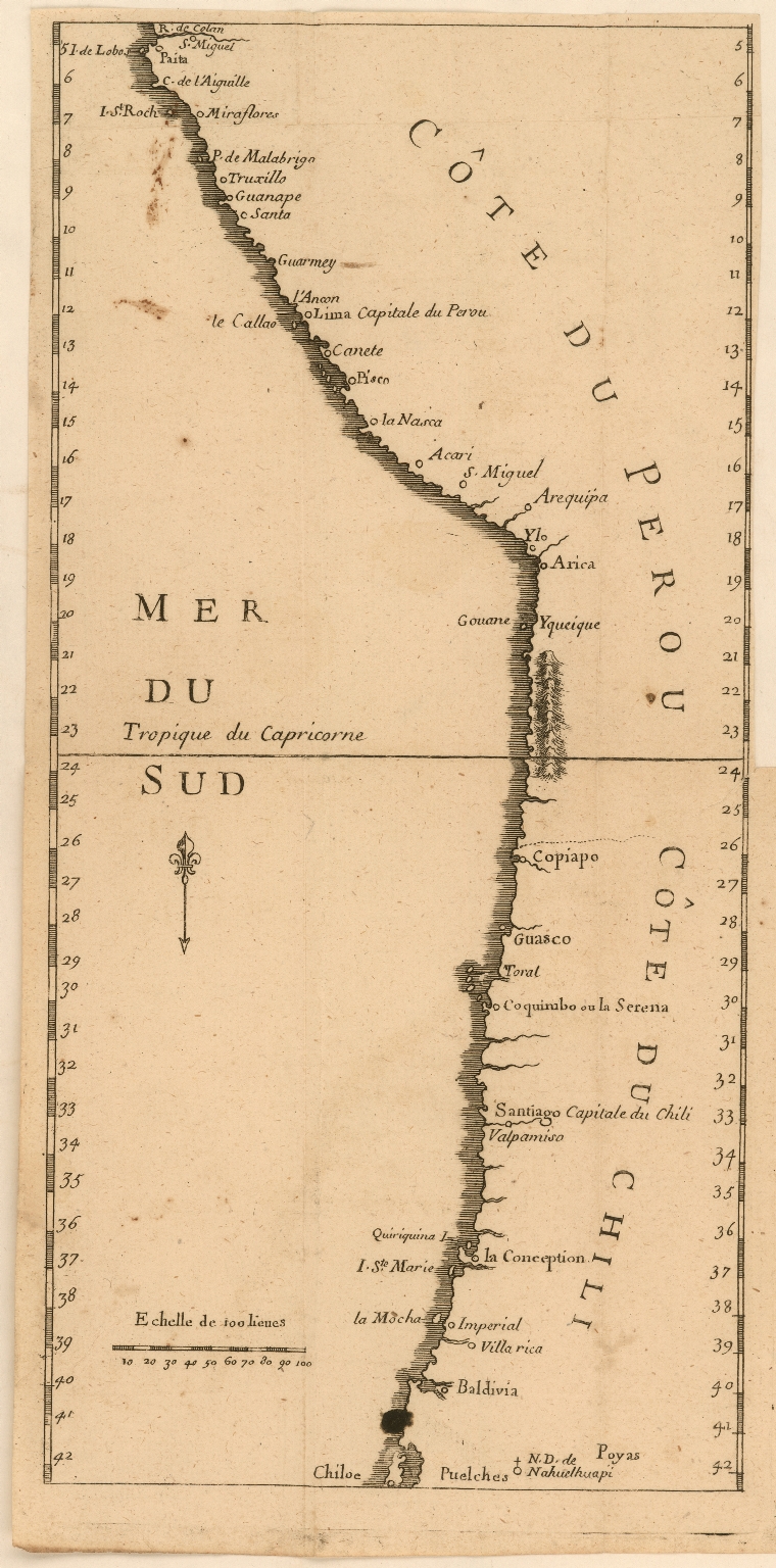
Dispossesions in the Americas

Dispossesions in the Americas

  • Home
  • Explore
  • About
  • Authors
  • Art
  • Bodies
  • Curricula
  • Cultural Heritage
  • Maps
  • Territories
Back to Explore
Map 1707

Côte du Perou

  • Jesuits

Published: 1707

  • Download Image

Peoples

  • PUELCHES
  • POYAS

Citation

Jesuits. "Côte du Perou." Map. 1707. Accessed March 10, 2022. https://jcb.lunaimaging.com/luna/servlet/detail/JCBMAPS~1~1~6170~115902293:C%C3%B4te-du-Perou?sort=normalized_date%2Cfile_name%2Csource_author%2Csource_title#

  • Download Image

Reading in Spanish

Map 1707

Côte du Perou

  • Jesuits

Published: 1707

  • Download Image
  • Download Image

Related Content

CAMPECHE

CAMPECHE

Map 2015
PARAGUAY

PARAGUAY

Map
Totocanapan: Approximate Extension in Ancient and Recent Times

Totocanapan: Approximate Extension in Ancient and Recent Times

Map 1940
PUEBLO SECOYA

PUEBLO SECOYA

Map 2021
PUEBLO TICUNA

PUEBLO TICUNA

Map 2021
Die landtschafft mit den genanten hauingen so ich zum teyl in America gesehen hab...

Die landtschafft mit den genanten hauingen so ich zum teyl in America gesehen hab...

Map 1500 - 1550
Departamento de Chiquimula

Departamento de Chiquimula

Map 1830 - 1832
The Pech: Most important municipios, 2001

The Pech: Most important municipios, 2001

Map 2001

Dispossessions in the Americas

A project by

University of Pennsylvania

Copyright 2024

With support from

Mellon Foundation

Site design & development

Element 84

Art Credits

Jesuits. “Côte du Perou.” Map. 1707. Accessed March 10, 2022. https://jcb.lunaimaging.com/luna/servlet/detail/JCBMAPS~1~1~6170~115902293:C%C3%B4te-du-Perou?sort=normalized_date%2Cfile_name%2Csource_author%2Csource_title#

Site Pages

  • Home
  • Explore
  • About
  • Authors
  • Art
  • Bodies
  • Curricula
  • Cultural Heritage
  • Maps
  • Territories