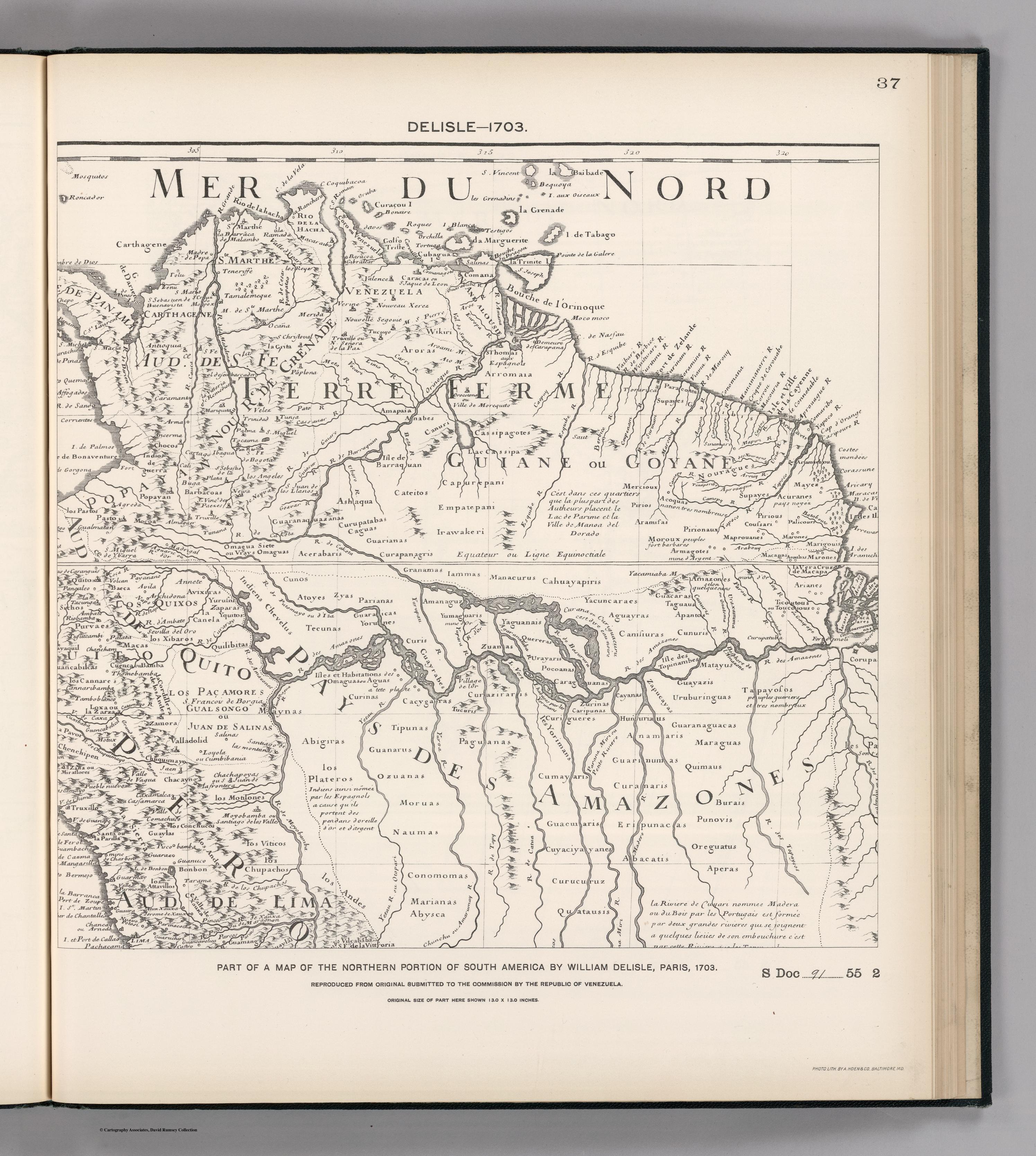
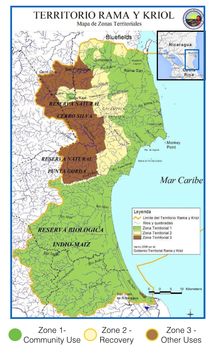
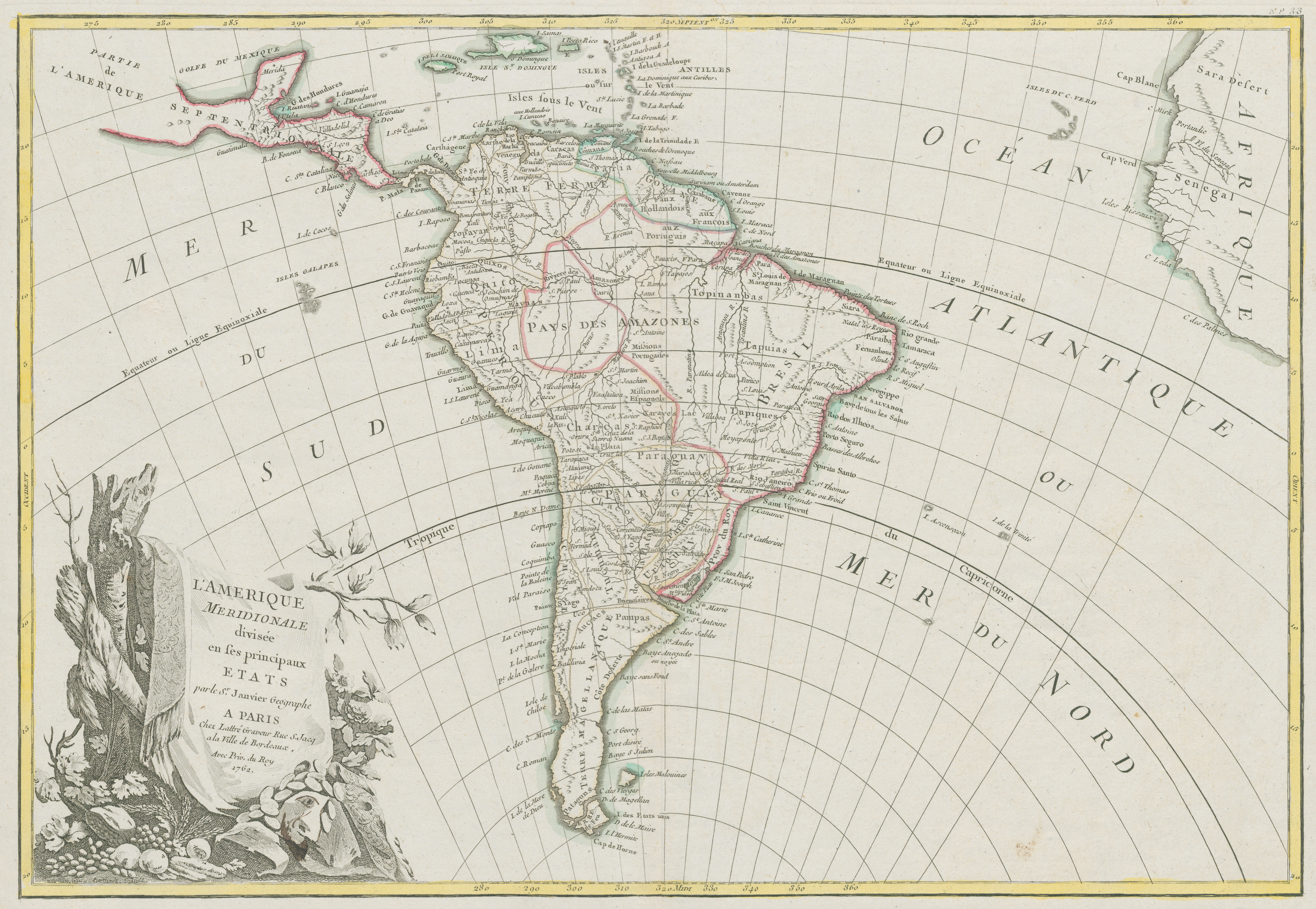
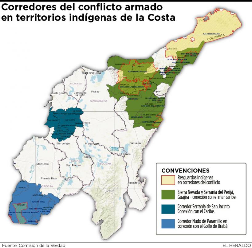
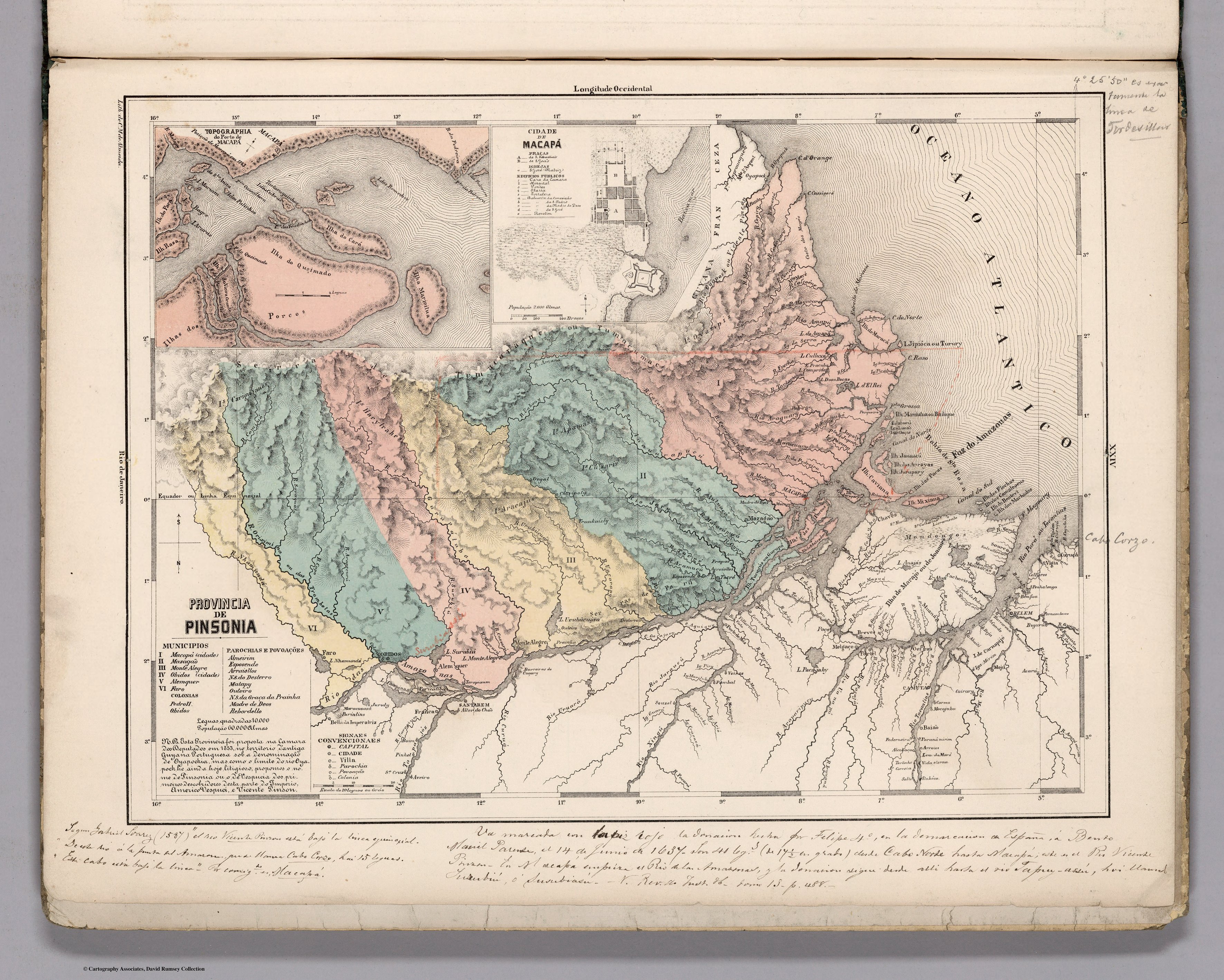
Dispossesions in the Americas

Dispossesions in the Americas

  • Home
  • Explore
  • About
  • Authors
  • Art
  • Bodies
  • Curricula
  • Cultural Heritage
  • Maps
  • Territories
Back to Explore
Map 1800 - 1850

PROVINCIA DE PINSONIA

  • MENDES, CANDIDO

Published: 1868

  • Download Image

Peoples

  • OYAMPIS
  • CUZARIS
  • APAMAS
  • HARYTRAHES
  • CARIGUANOS
  • ARACAJUS

Citation

Mendes, Candido. Provincia de Pinsonia. Map. Rio de Janeiro: Lithographia do Instituto Philomathico, 1868. Accessed August 15, 2023. https://www.davidrumsey.com/luna/servlet/detail/RUMSEY~8~1~305769~90076418.

  • Download Image

Reading in Spanish

Map 1800 - 1850

PROVINCIA DE PINSONIA

  • MENDES, CANDIDO

Published: 1868

  • Download Image
  • Download Image

Reading in Portuguese

Map 1800 - 1850

PROVINCIA DE PINSONIA

  • MENDES, CANDIDO

Published: 1868

  • Download Image

Peoples

  • OYAMPIS
  • CUZARIS
  • APAMAS
  • HARYTRAHES
  • CARIGUANOS
  • ARACAJUS

Citation

Mendes, Candido. Provincia de Pinsonia. Map. Rio de Janeiro: Lithographia do Instituto Philomathico, 1868. Accessed August 15, 2023. https://www.davidrumsey.com/luna/servlet/detail/RUMSEY~8~1~305769~90076418.

  • Download Image

Related Content

PUEBLOS DE INDIOS DE LAS INTENDENCIAS Y GOBIERNOS MILITARES DE LA NUEVA ESPAÑA EN 1800 (4,468 PUEBLOS DE INDIOS)

PUEBLOS DE INDIOS DE LAS INTENDENCIAS Y GOBIERNOS MILITARES DE LA NUEVA ESPAÑA EN 1800 (4,468 PUEBLOS DE INDIOS)

Map 1800
Sitios arqueológicos del Lago de Amatitlán, con lugares de ofrendas acuáticas.

Sitios arqueológicos del Lago de Amatitlán, con lugares de ofrendas acuáticas.

Map 2011
No Title

No Title

Map 2014
FACSIMILE: NORTHERN PORTION OF SOUTH AMERICA

FACSIMILE: NORTHERN PORTION OF SOUTH AMERICA

Map 1703
Territorio Rama y Kriol: Mapa de Zonas Territoriales. Three Zones proposed by the PADA to ensure a sustainable future for the communities of Rama and Kriol

Territorio Rama y Kriol: Mapa de Zonas Territoriales. Three Zones proposed by the PADA to ensure a sustainable future for the communities of Rama and Kriol

Map 2000
L'Amerique Meridionale divisée en ses principaux Etats

L'Amerique Meridionale divisée en ses principaux Etats

Map 1700 - 1800
Corredor del conflicto armado en territorios indígenas de la Costa

Corredor del conflicto armado en territorios indígenas de la Costa

Map 2020
A MAZO

A MAZO

Artwork

Dispossessions in the Americas

A project by

University of Pennsylvania

Copyright 2024

With support from

Mellon Foundation

Site design & development

Element 84

Art Credits

Mendes, Candido. Provincia de Pinsonia. Map. Rio de Janeiro: Lithographia do Instituto Philomathico, 1868. Accessed August 15, 2023. https://www.davidrumsey.com/luna/servlet/detail/RUMSEY~8~1~305769~90076418.

Site Pages

  • Home
  • Explore
  • About
  • Authors
  • Art
  • Bodies
  • Curricula
  • Cultural Heritage
  • Maps
  • Territories