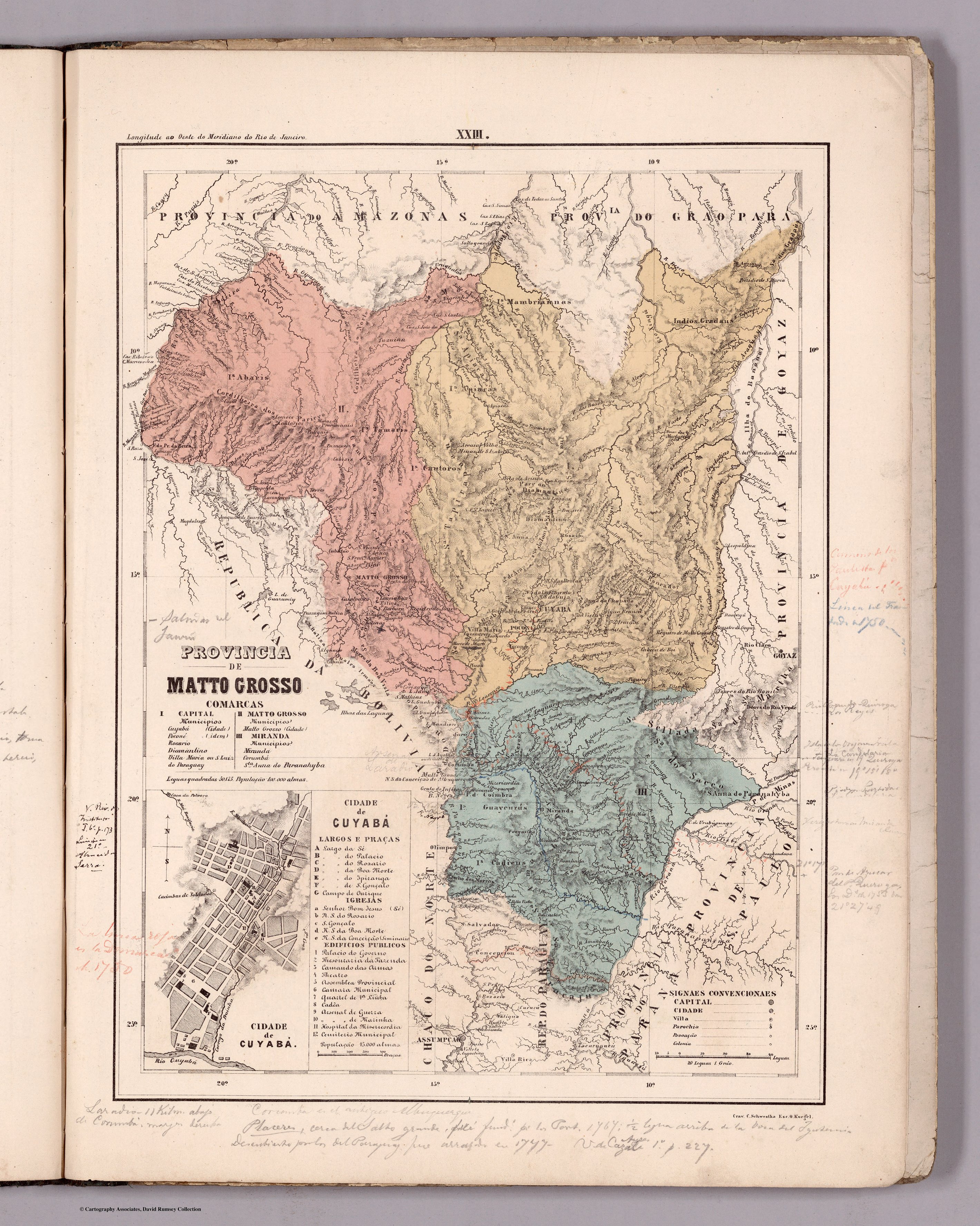
Dispossesions in the Americas

Dispossesions in the Americas

  • Home
  • Explore
  • About
  • Authors
  • Art
  • Bodies
  • Curricula
  • Cultural Heritage
  • Maps
  • Territories
Back to Explore
Map 1800 - 1850

PROVINCIA DE MATTO GROSSO

  • MENDES, CANDIDO

Published: 1868

  • Download Image

Peoples

  • GRADUS
  • MAMBRIANNAS
  • ABARIS
  • TAMARIS
  • CAUTOROS
  • APAICAS
  • GUAYCURUS
  • CADIEUS

Citation

Mendes, Candido. Provincia de Matto Grosso. Map. Rio de Janeiro: Lithographia do Instituto Philomathico, 1868. Accessed August 15, 2023. https://www.davidrumsey.com/luna/servlet/detail/RUMSEY~8~1~305768~90076419#.

  • Download Image

Reading in Spanish

Map 1800 - 1850

PROVINCIA DE MATTO GROSSO

  • MENDES, CANDIDO

Published: 1868

  • Download Image
  • Download Image

Reading in Portuguese

Map 1800 - 1850

PROVINCIA DE MATTO GROSSO

  • MENDES, CANDIDO

Published: 1868

  • Download Image

Peoples

  • GRADUS
  • MAMBRIANNAS
  • ABARIS
  • TAMARIS
  • CAUTOROS
  • APAICAS
  • GUAYCURUS
  • CADIEUS

Citation

Mendes, Candido. Provincia de Matto Grosso. Map. Rio de Janeiro: Lithographia do Instituto Philomathico, 1868. Accessed August 15, 2023. https://www.davidrumsey.com/luna/servlet/detail/RUMSEY~8~1~305768~90076419#.

  • Download Image

Related Content

Sementerio [Semen-tary]

Sementerio [Semen-tary]

Artwork
Localización de las áreas culturales de Venezuela prehispánica

Localización de las áreas culturales de Venezuela prehispánica

Map 1490
PROVINCIE DELLO SPIRITO SANTO E DI PORTO SICURO

PROVINCIE DELLO SPIRITO SANTO E DI PORTO SICURO

Map 1600 - 1699
An exact draught of the river of Bellese as high as the Barcadares. A new draught of the bay of Honduras by Capt. Nathaniel Uring

An exact draught of the river of Bellese as high as the Barcadares. A new draught of the bay of Honduras by Capt. Nathaniel Uring

Map 1726
THE AYMARA POLITY OF THE LUPAQA: COMMERCIAL DESTINIES AND VERTICALITY IN THE 16TH CENTURY

THE AYMARA POLITY OF THE LUPAQA: COMMERCIAL DESTINIES AND VERTICALITY IN THE 16TH CENTURY

Map 1500 - 1599
Territorios actuales de los pueblos indígenas en México

Territorios actuales de los pueblos indígenas en México

Map 2008
COLOMBIA;VENEZUELA;EQUADOR e BOLIVIA

COLOMBIA;VENEZUELA;EQUADOR e BOLIVIA

Map 1900 - 1999
NLE. GRENADE;VENEZUELA;EQUATEUR;GUYANES.

NLE. GRENADE;VENEZUELA;EQUATEUR;GUYANES.

Map 1860

Dispossessions in the Americas

A project by

University of Pennsylvania

Copyright 2024

With support from

Mellon Foundation

Site design & development

Element 84

Art Credits

Mendes, Candido. Provincia de Matto Grosso. Map. Rio de Janeiro: Lithographia do Instituto Philomathico, 1868. Accessed August 15, 2023. https://www.davidrumsey.com/luna/servlet/detail/RUMSEY~8~1~305768~90076419#.

Site Pages

  • Home
  • Explore
  • About
  • Authors
  • Art
  • Bodies
  • Curricula
  • Cultural Heritage
  • Maps
  • Territories