Peoples
- GAVIOES
Citation
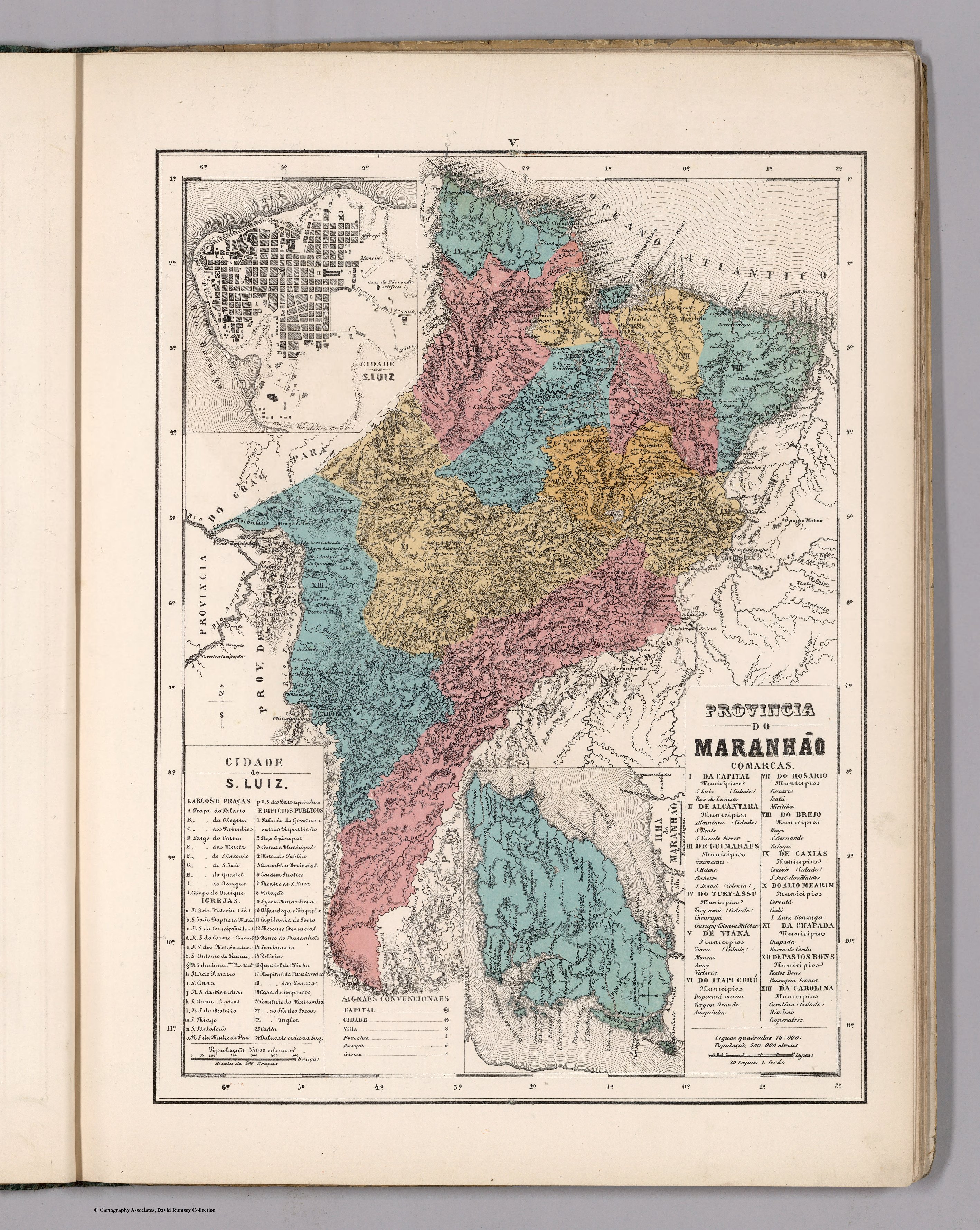
Mendes, Candido. Provincia do Maranhao. Map. Rio de Janeiro: Lithographia do Instituto Philomathico, 1868. Accessed August 14, 2023. https://www.davidrumsey.com/luna/servlet/detail/RUMSEY~8~1~305750~90076437.
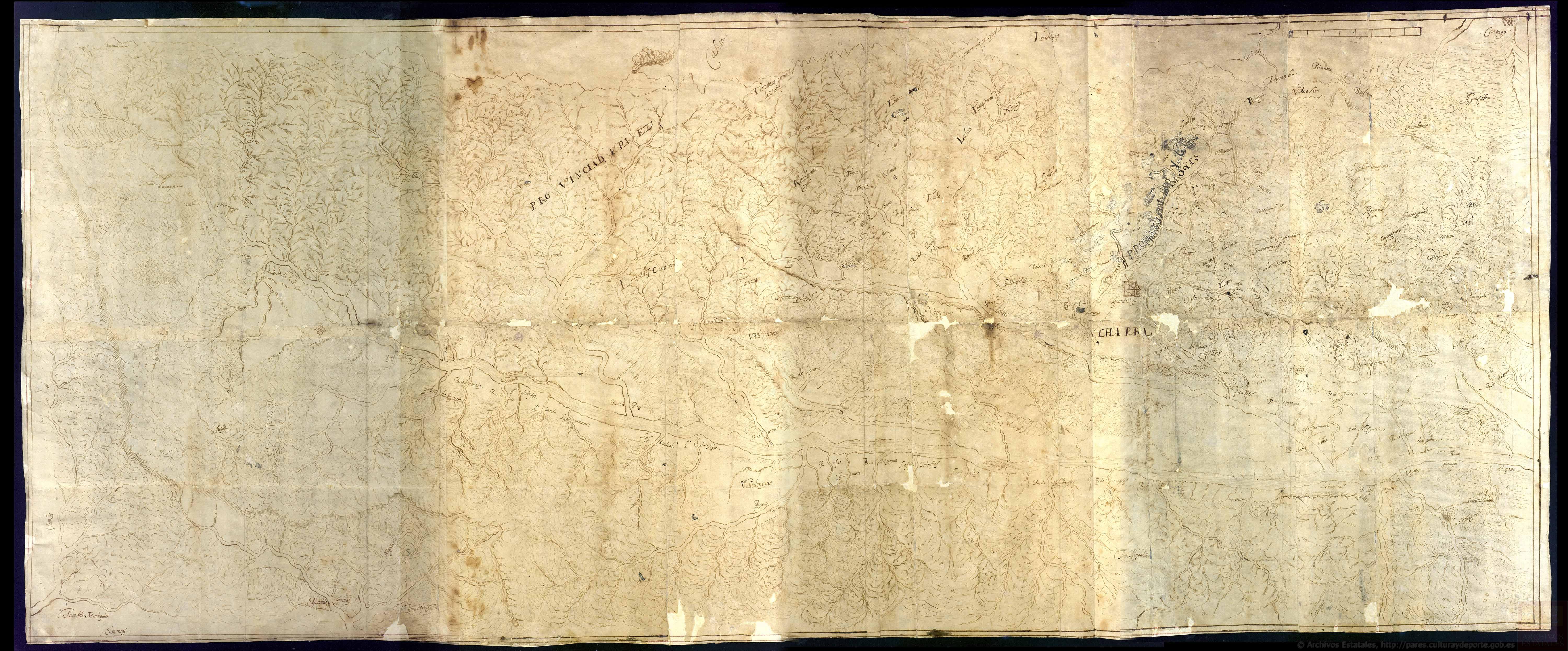
Discrepçion y mapa del territorio que ocupan los indios pijaos
Map 1608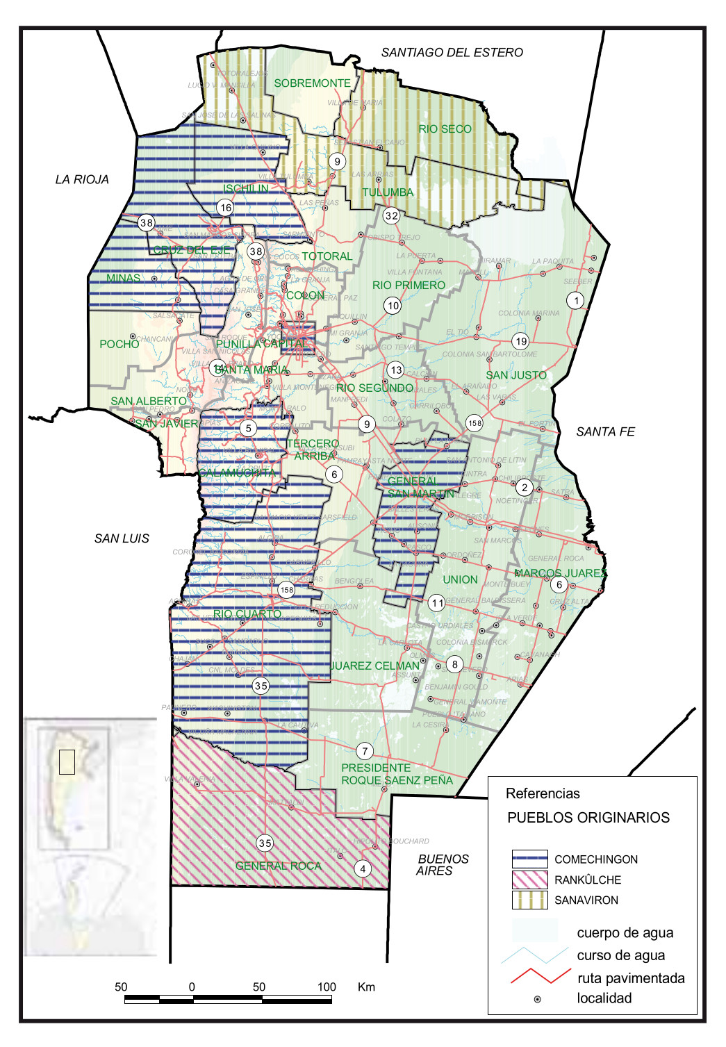
Pueblos Originarios, Córdoba
Map 2016![Veta Negra -Variación- [Black Vein - Variation -]](https://dnet8ble6lm7w.cloudfront.net/art_sm/AMEX001.png)
Veta Negra -Variación- [Black Vein - Variation -]
Artwork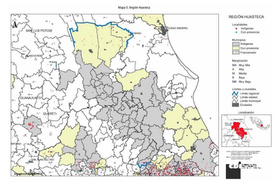
REGIÓN HUASTECA
Map 2000![Buscando a Bruno [Searching for Bruno]](https://dnet8ble6lm7w.cloudfront.net/art_sm/AMEX008.png)
Buscando a Bruno [Searching for Bruno]
Artwork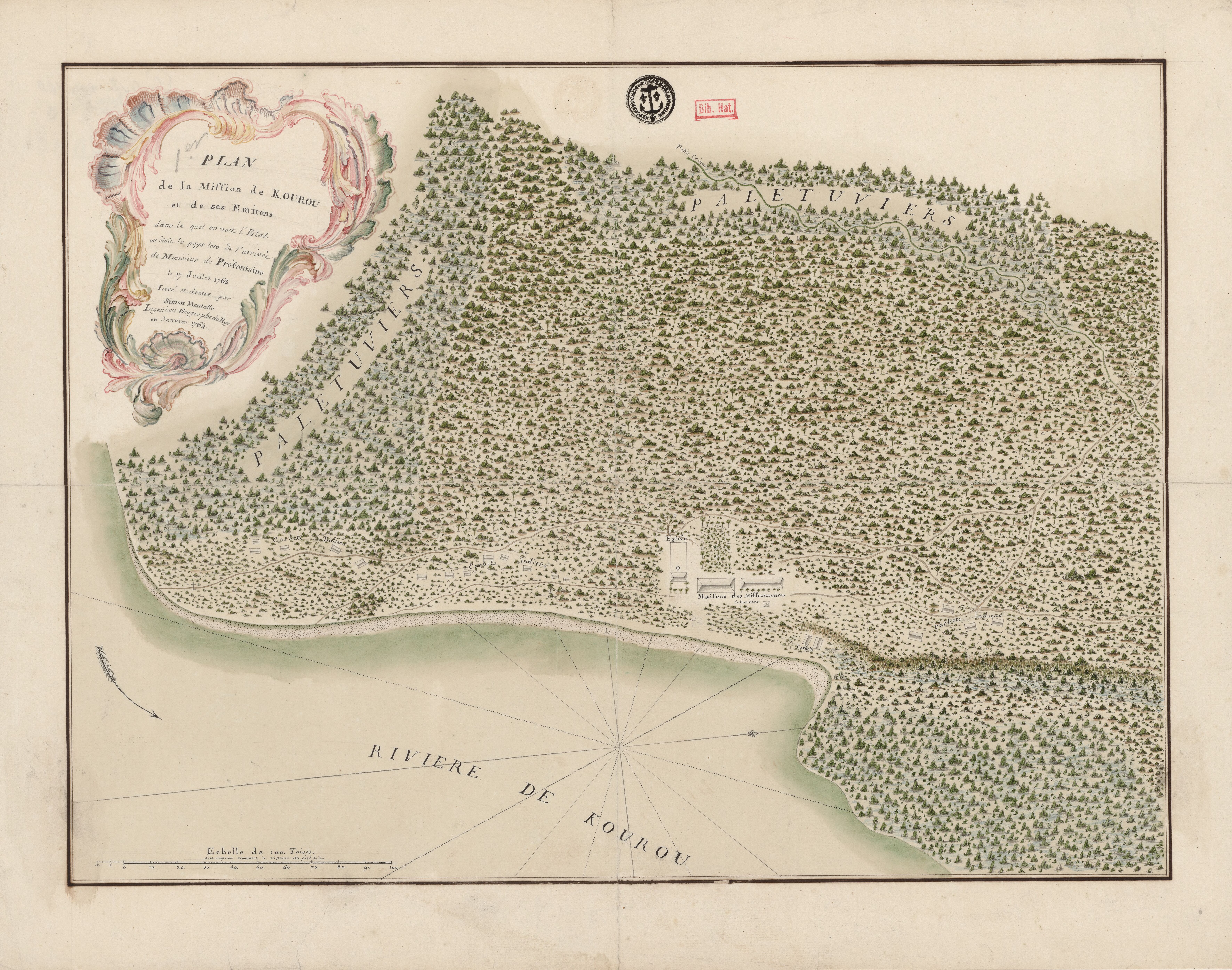
Plan de la Mission de Kourou et de ses Environs dans lequel on voit l'Etat dans lequel étoit le pays lors de l'arrivée de Monsieur de Préfontaine le 17 juillet 1763
Map 1763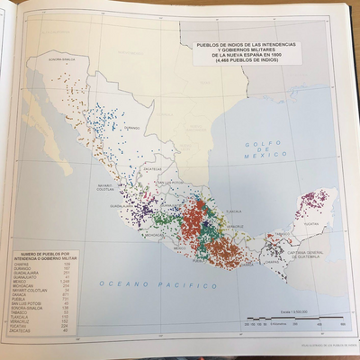
PUEBLOS DE INDIOS DE LAS INTENDENCIAS Y GOBIERNOS MILITARES DE LA NUEVA ESPAÑA EN 1800 (4,468 PUEBLOS DE INDIOS)
Map 1800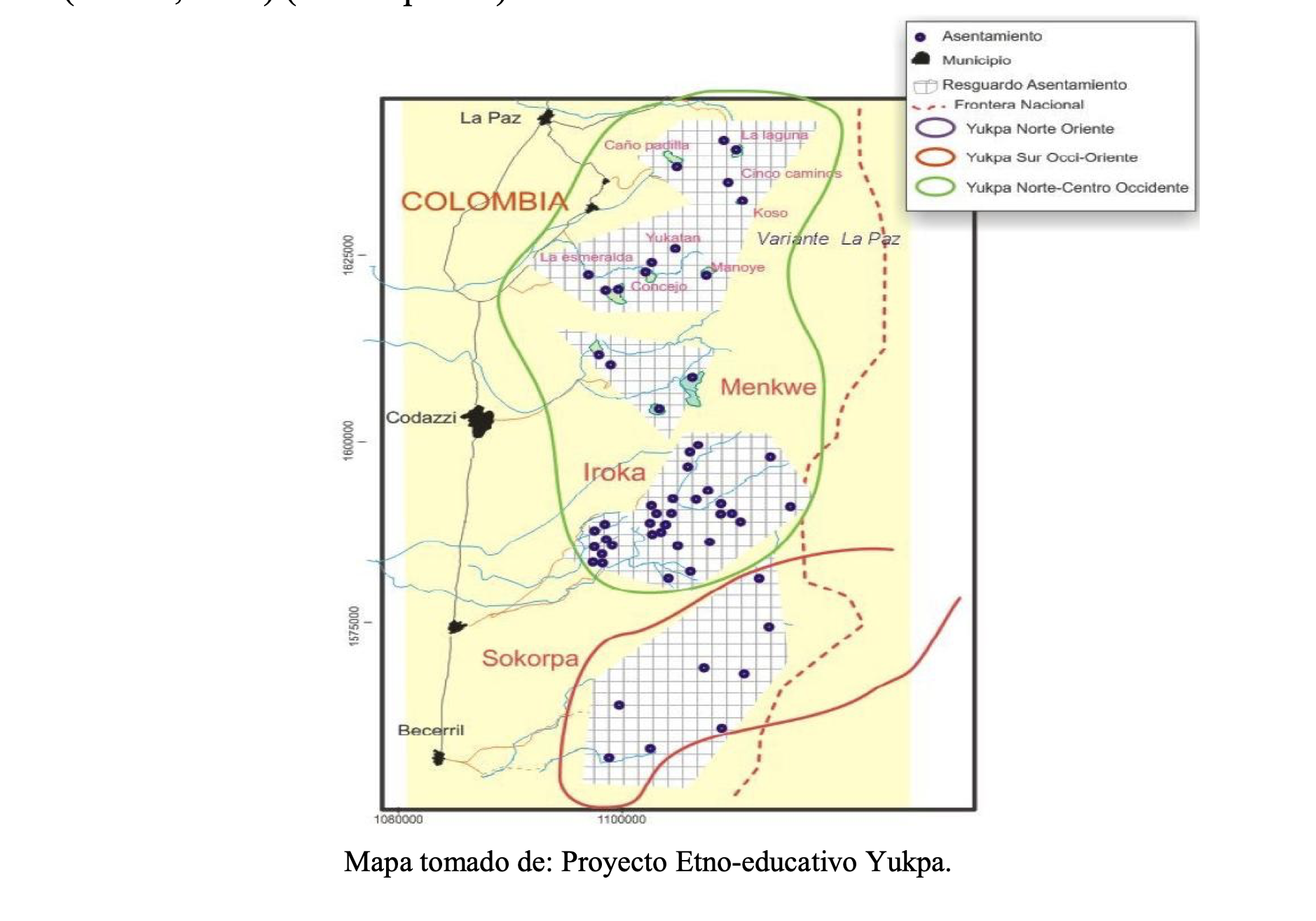
TERRITORIO DE YUKPA DE PERIJA
Map 2018