Peoples
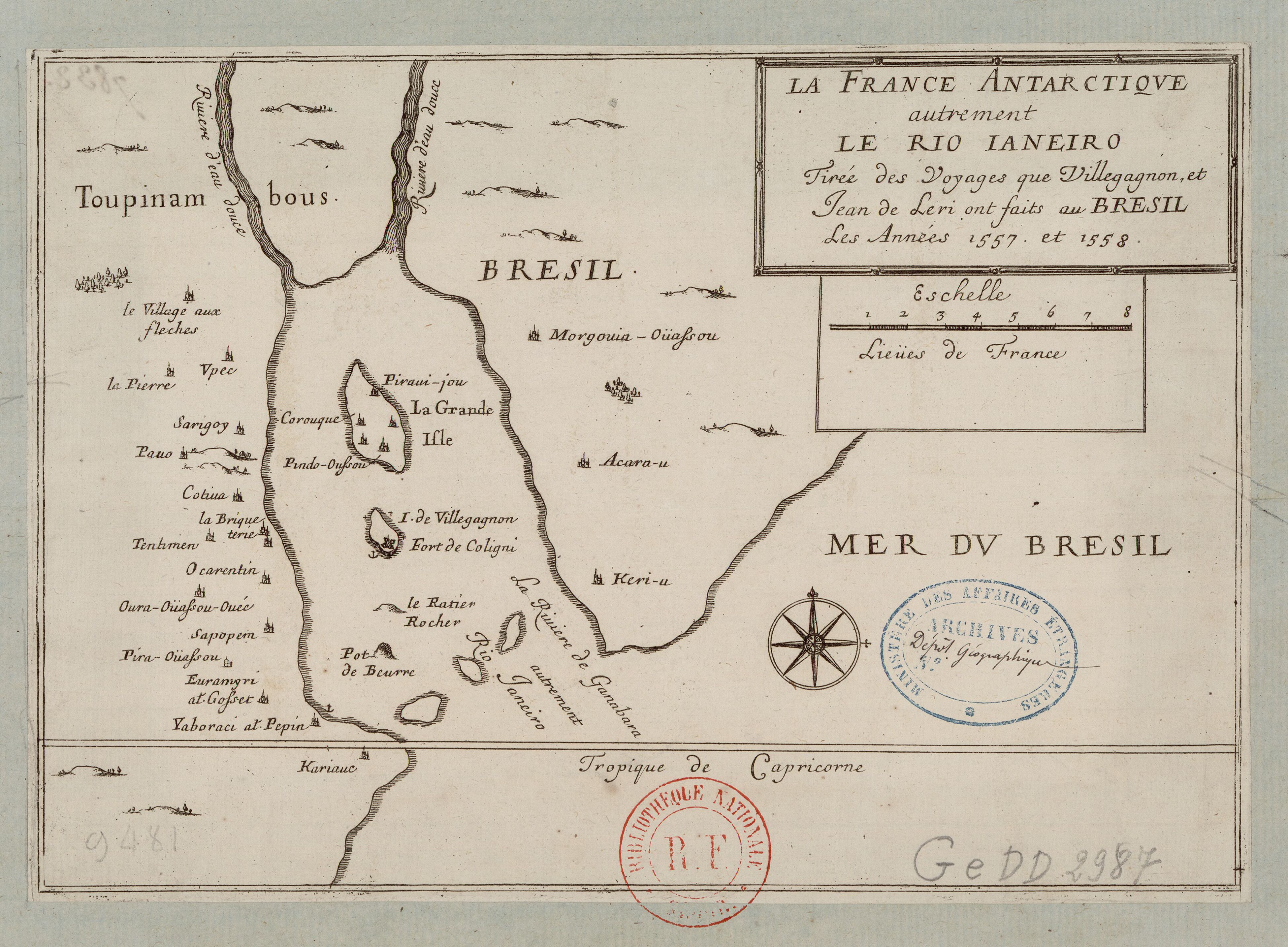
- TOPINAMBOUS
Citation
Villegagnon, Nicolas Durand de. "La France antarctique autrement le Rio de Janeiro." Map. 1558. Accessed August 6, 2023. https://gallica.bnf.fr/ark:/12148/btv1b8596692z?rk=7446388;4#.

Serie Fatherland / Padre Patria
Artwork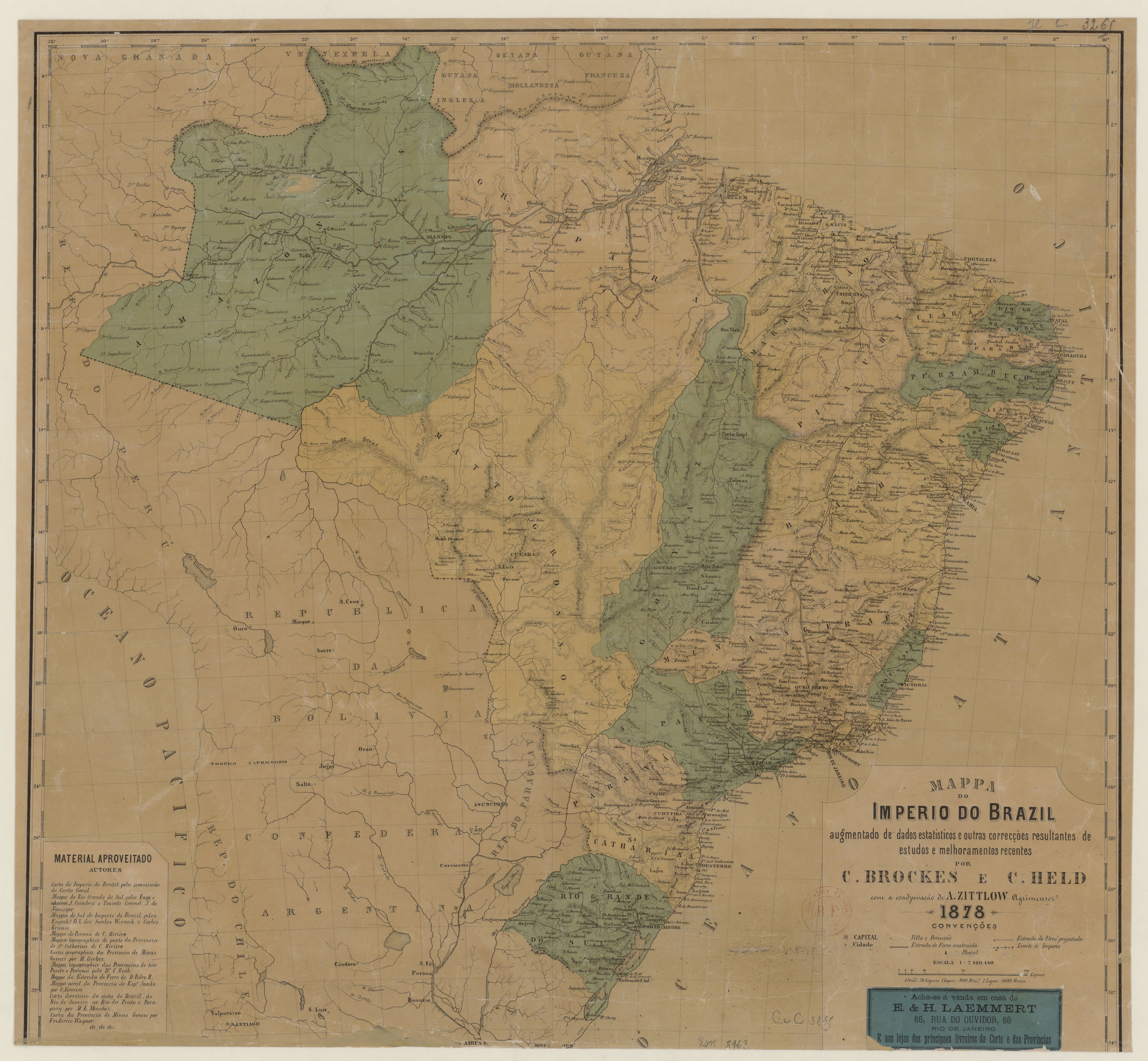
MAPPA DO IMPERIO DO BRAZIL
Map 1878
THE KARANQAS AYMARA POLITY - Instant shot of trans-border connections around 1900 (Google Earth adaptation)
Map 1860 - 1930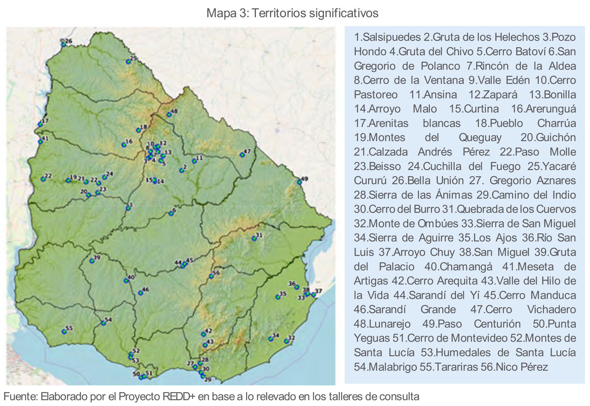
Territorios significativos
Map 2010 - 2020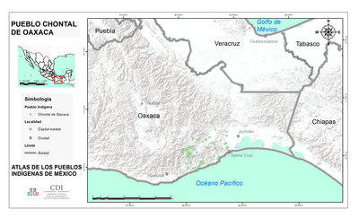
PUEBLO CHONTAL DE OAXACA
Map 2020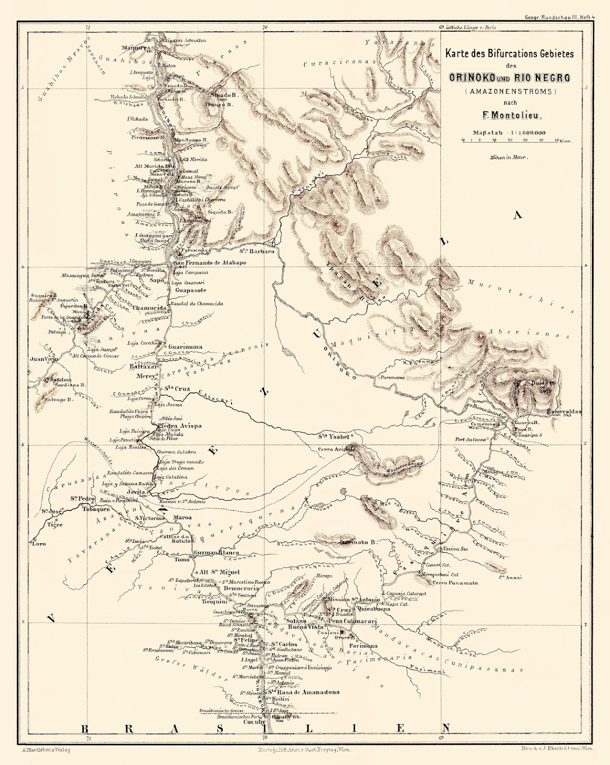
Karte des Bifurcations Gebietes des ORINOKO und RIO NEGRO (AMAZONENSTROMS)
Map 1881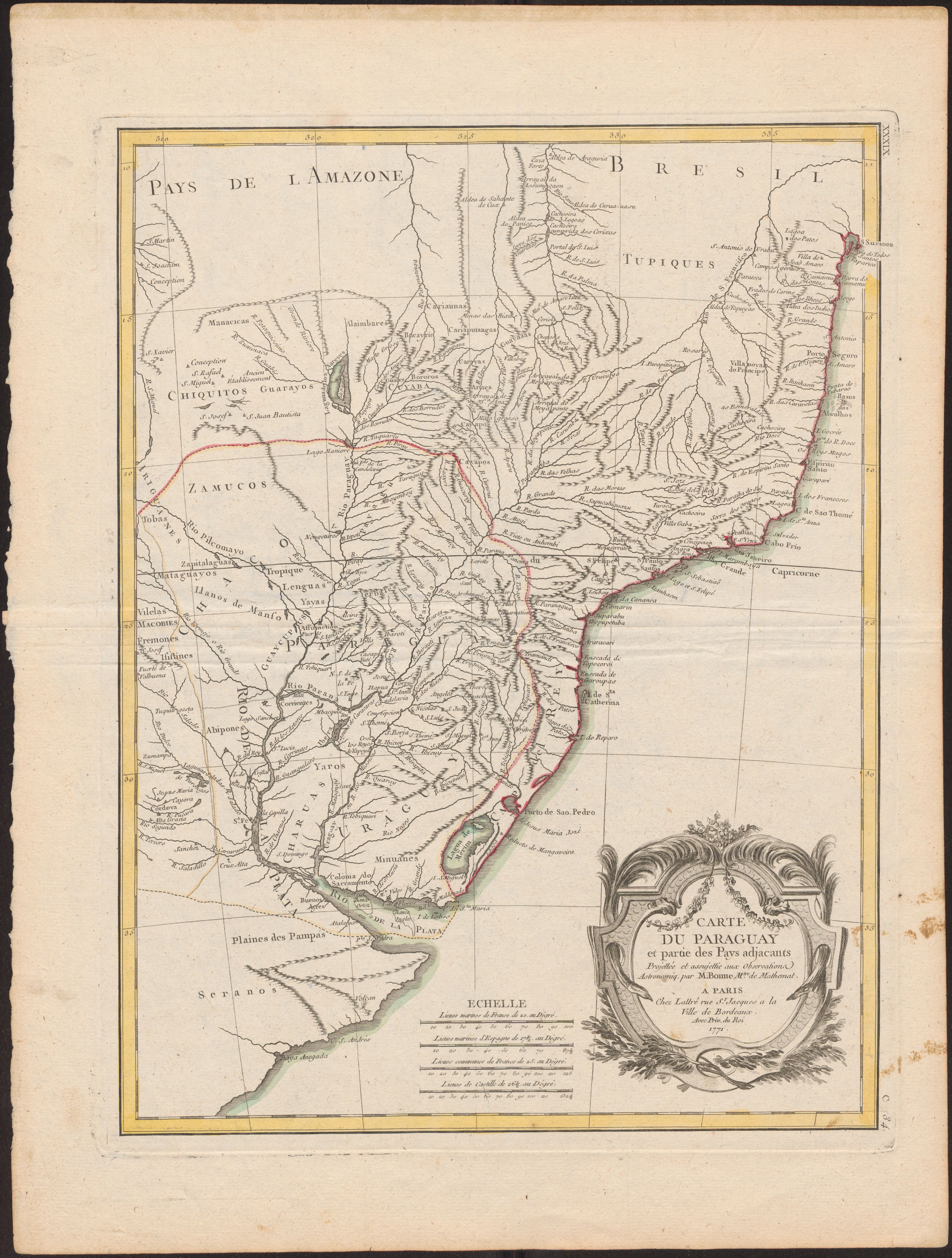
Carte Du Paraguay et partie des Pays adjacants
Map 1771
A Map of part of Yucatan or of that Part of the Eastern Shore Within the Bay of Honduras Alloted to Great Britain for the Cutting of Logwood, in consequence of the Convention Signed with Spain on the 14th July 1786.
Map 1700