Peoples
- TAPUYES
Citation
Bellin, Jacques-Nicolas. Suite du Brésil depuis la Baye de tous les Saints jusqu'a St. Paul. Map. 1764: J.N. Bellin, 1764. Accessed August 6, 2023. https://gallica.bnf.fr/ark:/12148/btv1b8596680r/f1.item.
Areas of Indian Culture and Principal Tribes in South America
Map 1500 - 1900
The Spanish and Musketor shore and the bay of Honduras and the islands adjacent
Map 1735![Sin título (Amante perfecto) [Untitled (The Perfect Lover)]](https://dnet8ble6lm7w.cloudfront.net/art_sm/ACOL021.png)
Sin título (Amante perfecto) [Untitled (The Perfect Lover)]
Artwork
Carta de la Costa de Mosquitos;con sus islas;cayos;bancos y bajos adyacentes entre dicha y la Isla de Jamayca
Map 1767 - 1781
CHART containing the greater part of the SOUTH SEA to the South of the LINE, with the ISLANDS dispersed thro' the same
Map 1794
Carte 23: Guyane
Map 1900 - 1999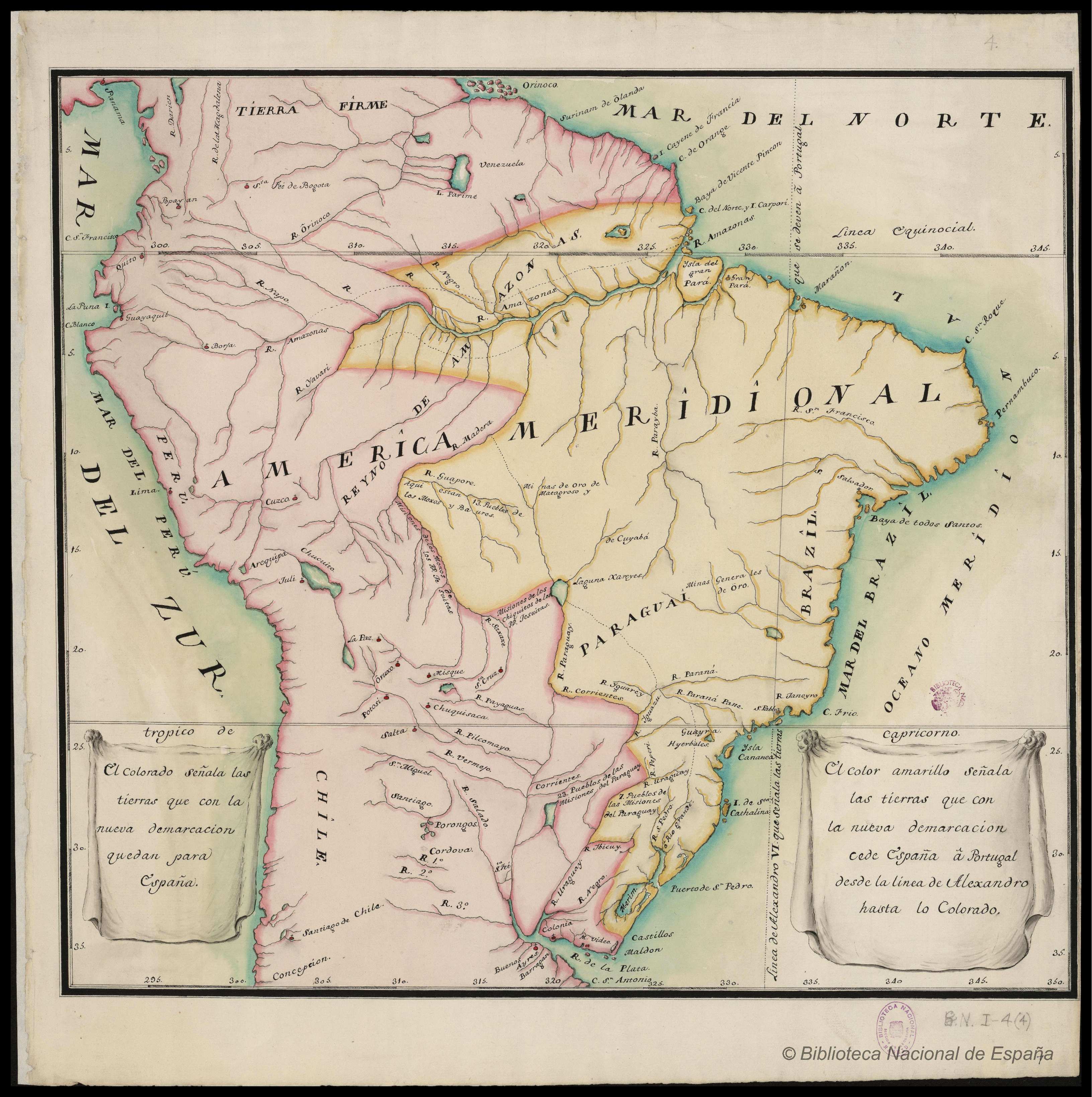
AMÉRICA MERIDIONAL : BIBLIOTECA ESPAÑA
Map 1662 - 1791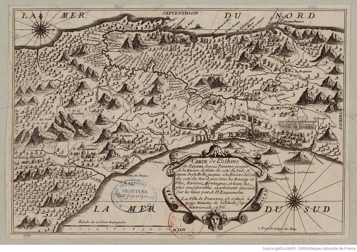
Carte de l'Isthme de Panama depuis Panama jusques à la Riviere de Nata du coté du Sud, et depuis Porto Betto, jusques à la Riviere de Codé du coté du Nord
Map 1686