Peoples
- INDIANS
Citation
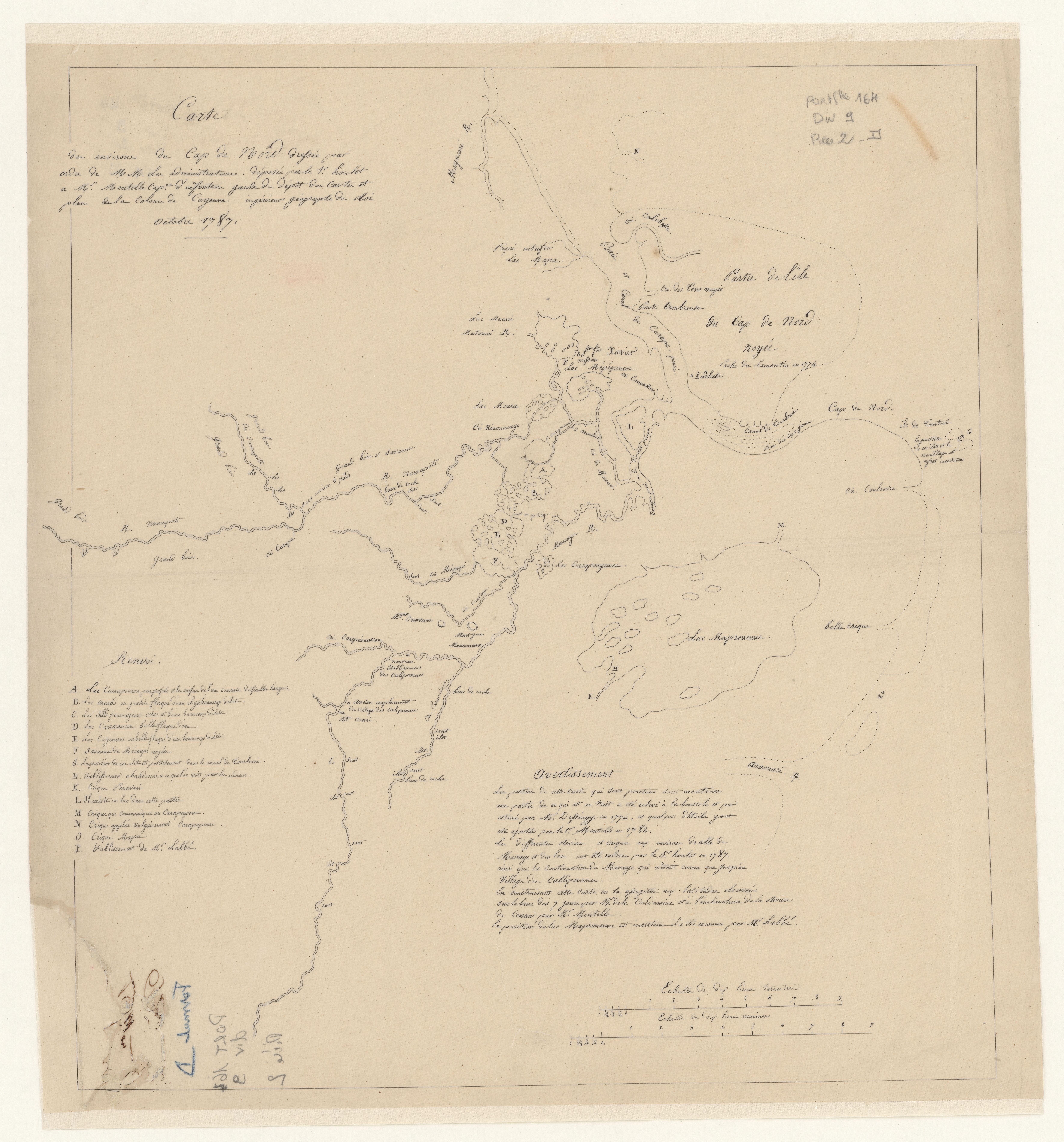
Mentelle, Simon, and Joseph-Charles Dessingy. "Carte des environs de Cap de Nord." Map. 1787. Accessed August 6, 2023. https://gallica.bnf.fr/ark:/12148/btv1b53103666z/f1.item.
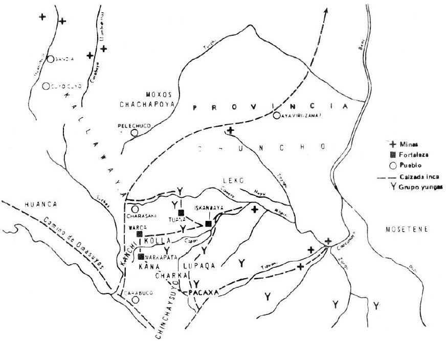
THE AYMARA POLITY OF THE LUPAQA: EASTERN INTER-ANDEAN VALLEY COLONIES UNDER INCA RULE 16TH CENTURY
Map 1560 - 1567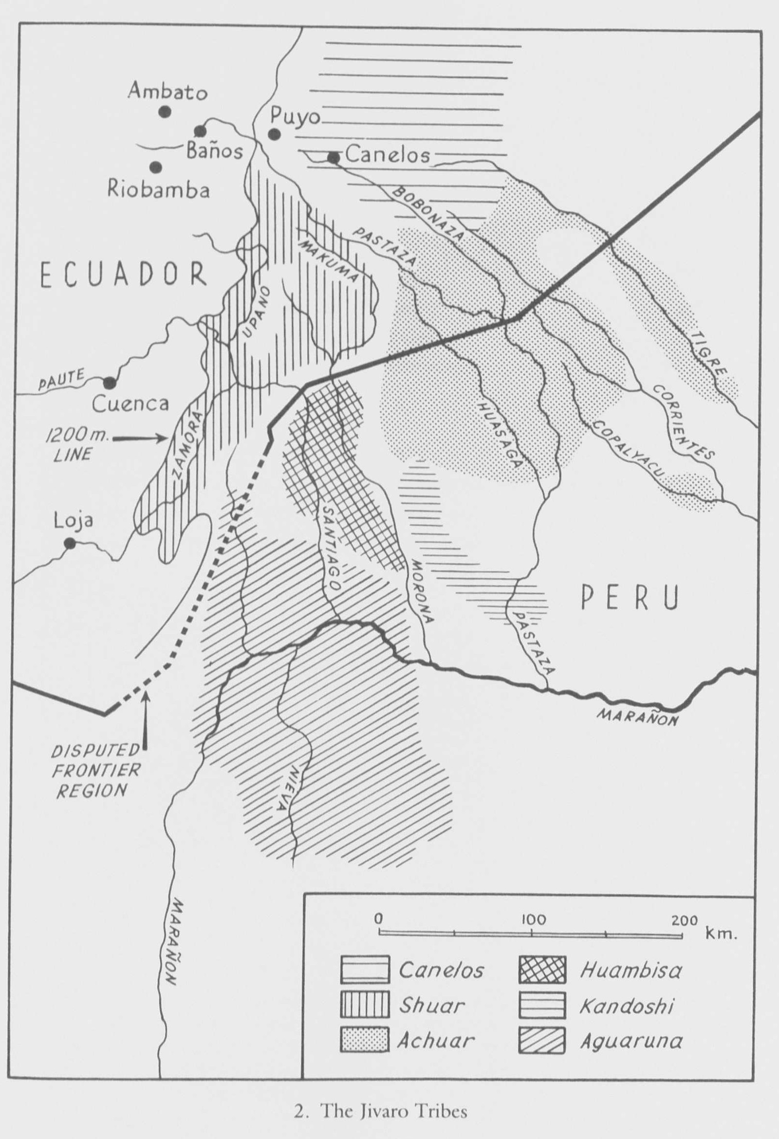
Jivaro country in Sad America
Map 1976 - 1978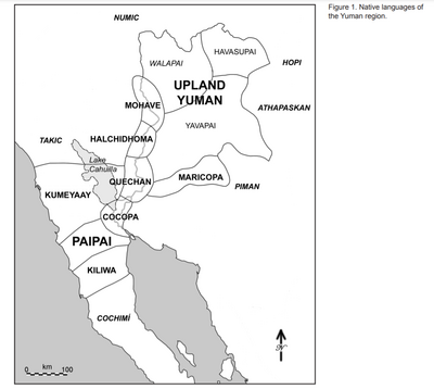
Native languages of the Yuman region
Map 2015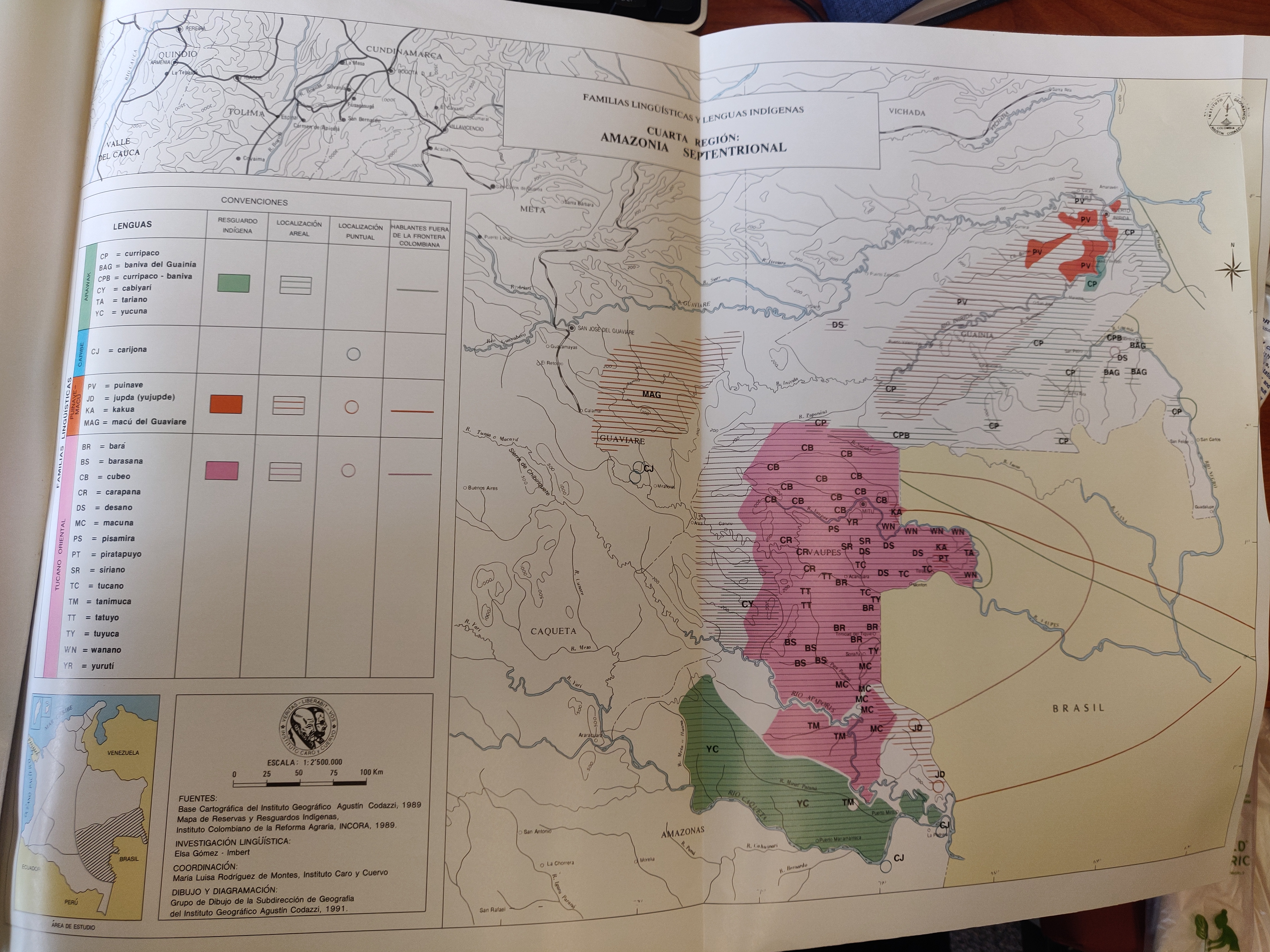
FAMILIAS LINGUÍSTICAS Y LENGUAS INDÍGENAS. CUARTA REGIÓN: AMAZONIA SEPTENTRIONAL
Map 1989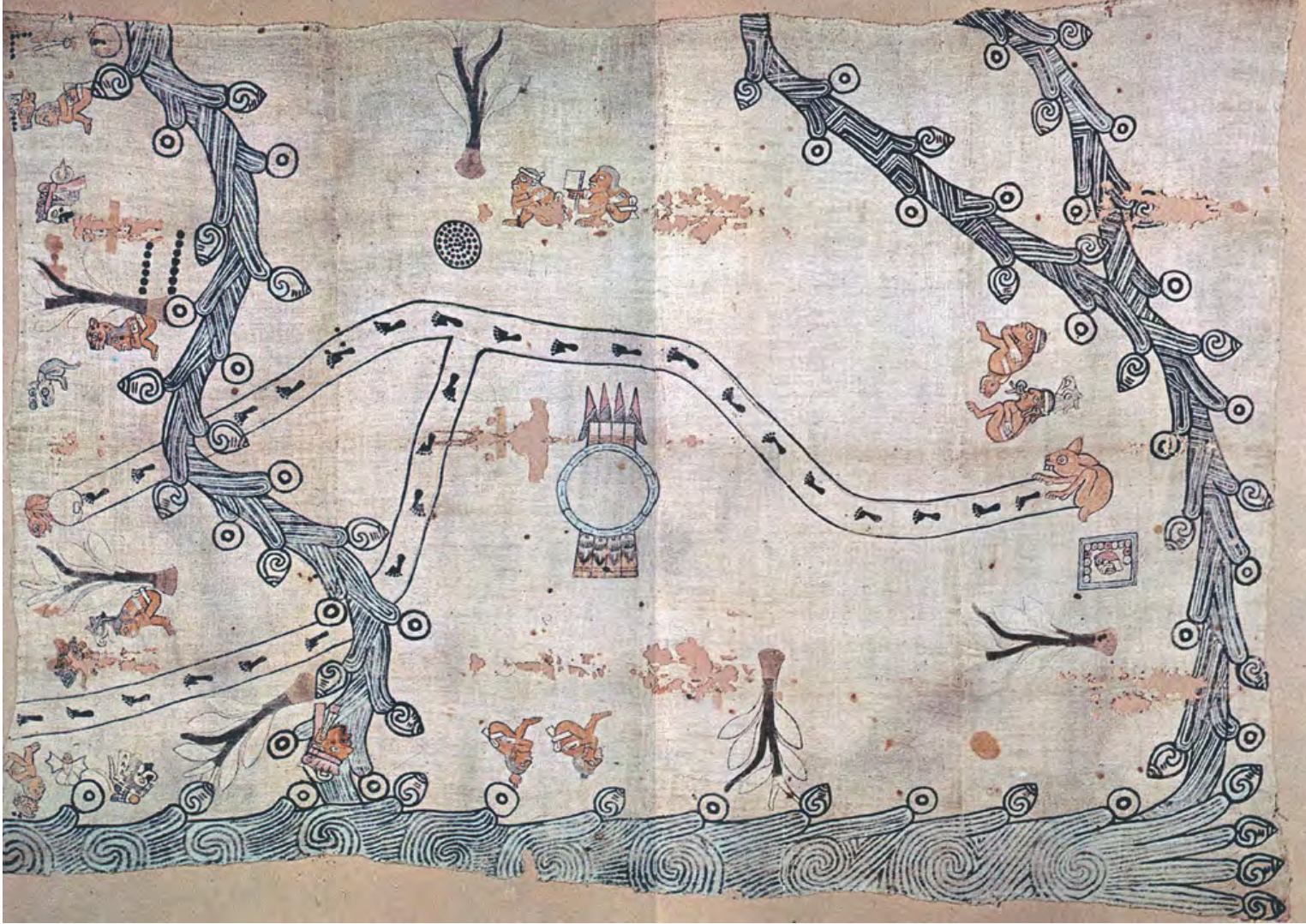
MAPA LOCAL DE TOCHPAN
Map 1400 - 1499
THE QULLASUYU IN THE 1530s – SOUTHERN DISTRICT OF THE INCA STATE
Map 1530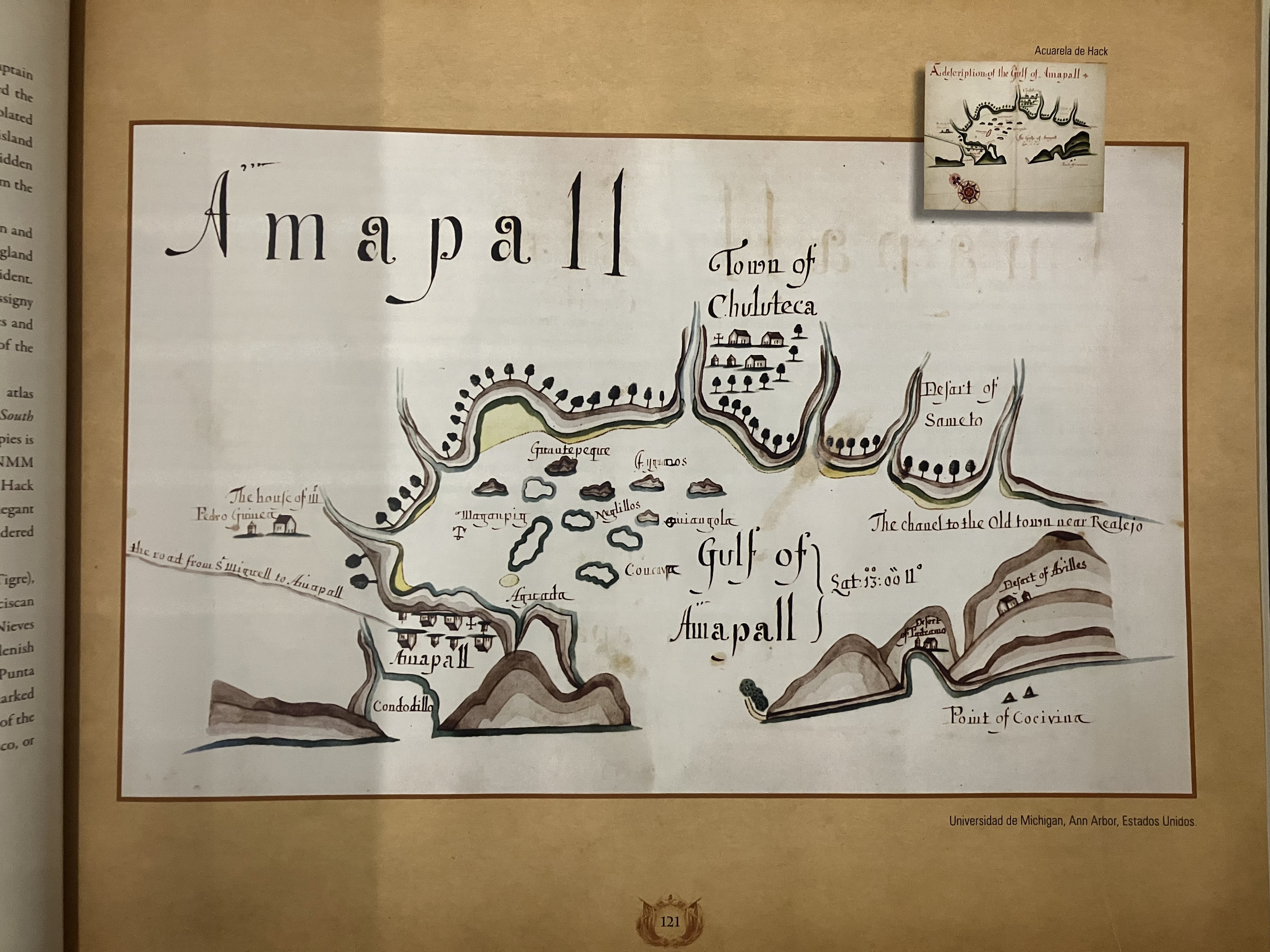
Gulf of Amapall
Map 1683 - 1685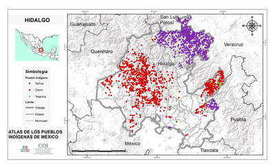
HIDALGO
Map 2015