Peoples
- INDIOS
Citation
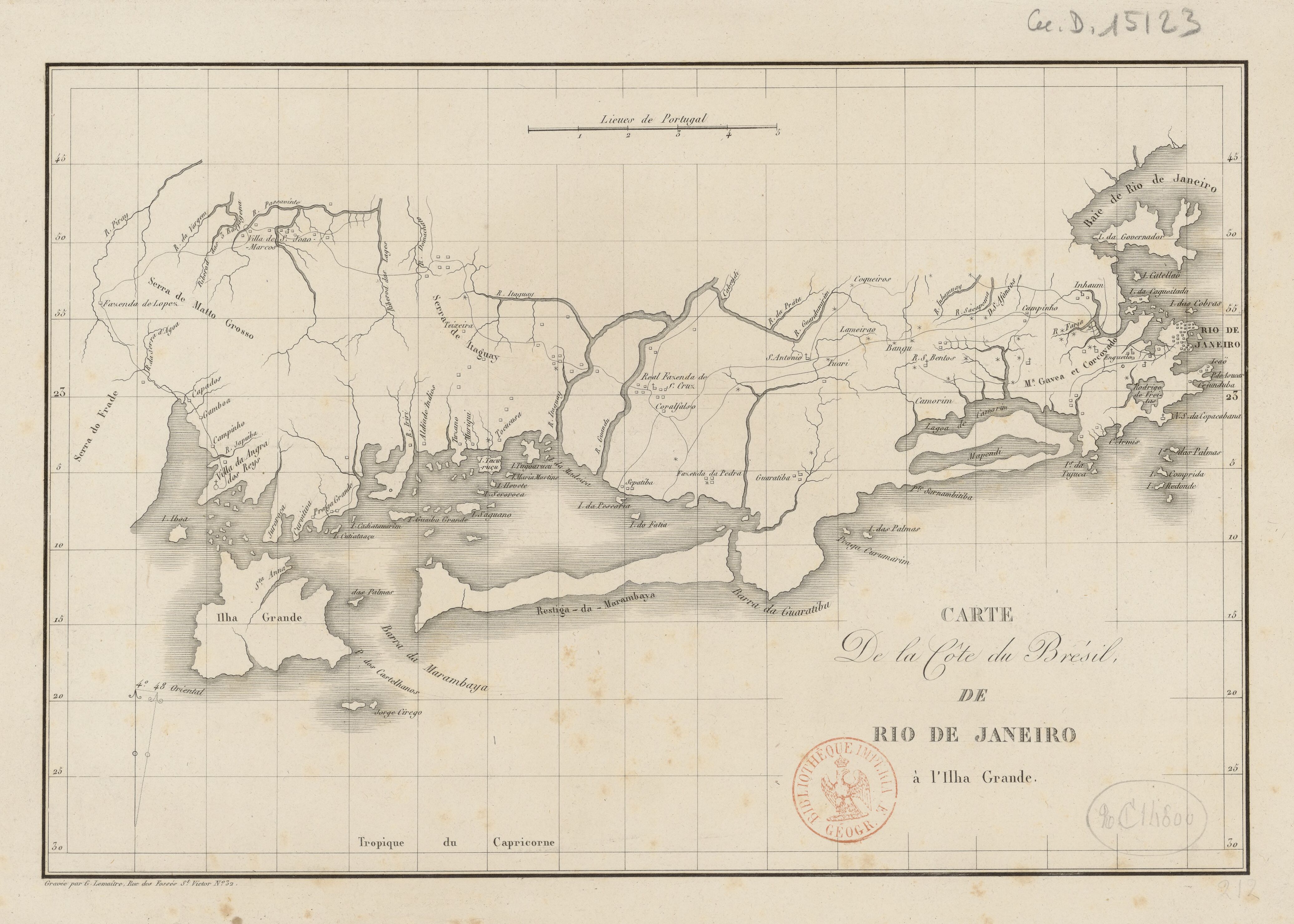
Lemaître, G. Carte de la côte du Brésil de Rio de Janeiro à l'Ihla Grande. Map. Paris, n.d. Accessed August 6, 2023. https://gallica.bnf.fr/ark:/12148/btv1b53033783g/f1.item.
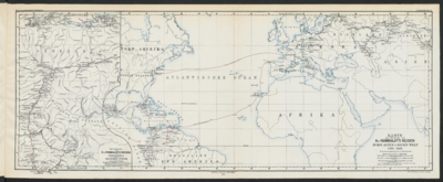
Specialkarte von A. v. HUMBOLDT’S REISEN in VENEZUELA und am ORINOKO-STROM
Map 1799 - 1800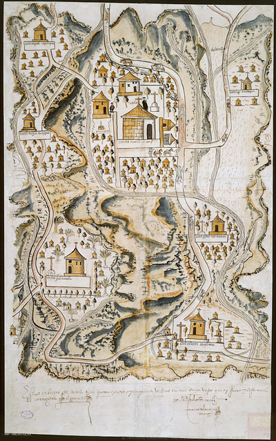
PUEBLO DE TETELA, PERTENECIENTE A LA CORONA, EN EL DISTRITO DE LA AUDIENCIA DE MÉXICO
Map 1581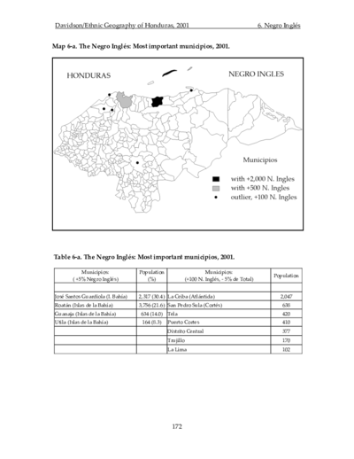
The Negro Inglés: Most important municipios, 2001
Map 2001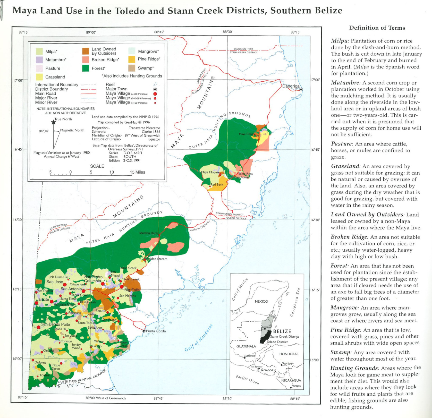
Maya Land Use in the Toledo and Stann Creek Districts, Southern Belize
Map 1997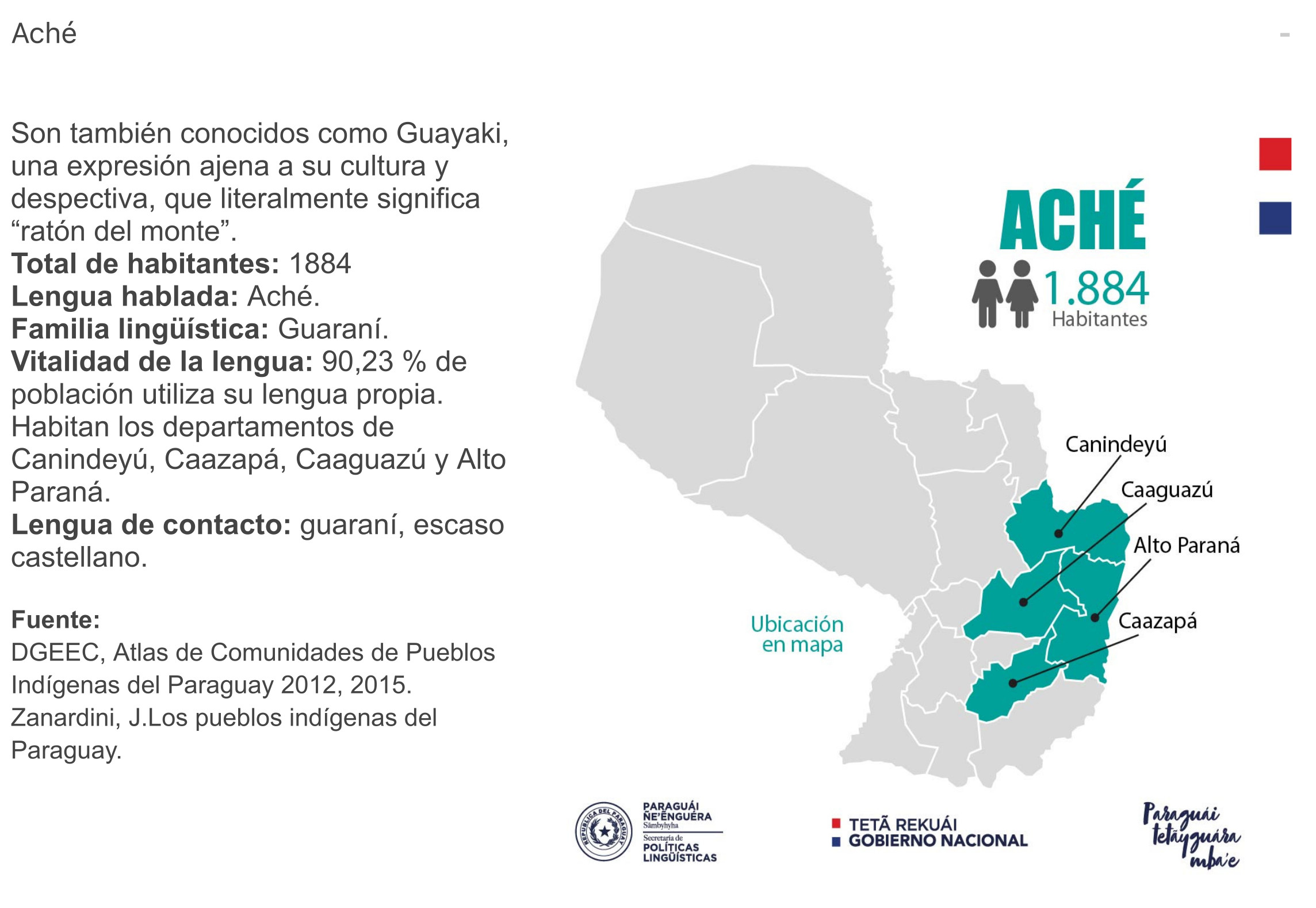
ACHÉ
Map 2015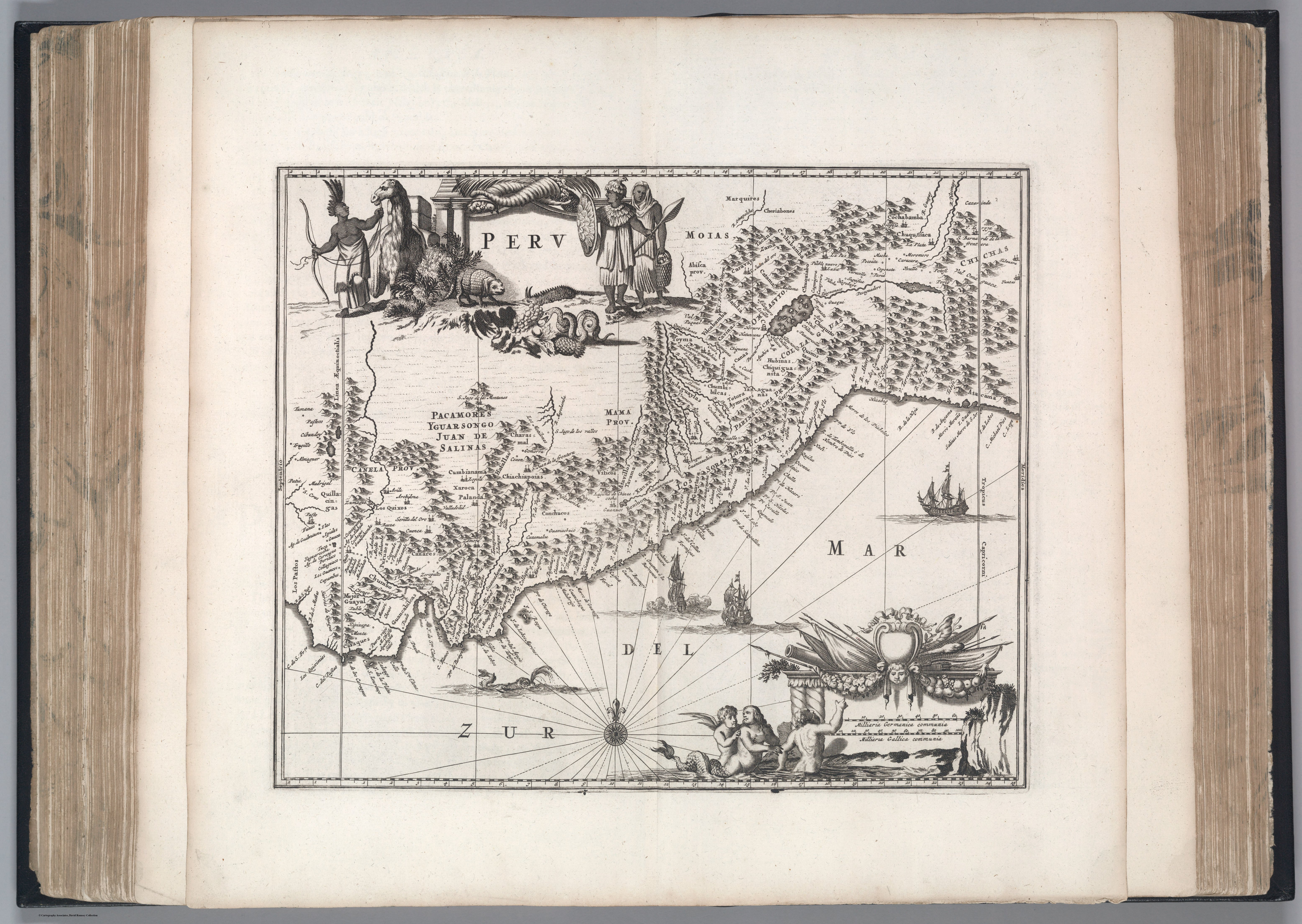
Peru
Map 1671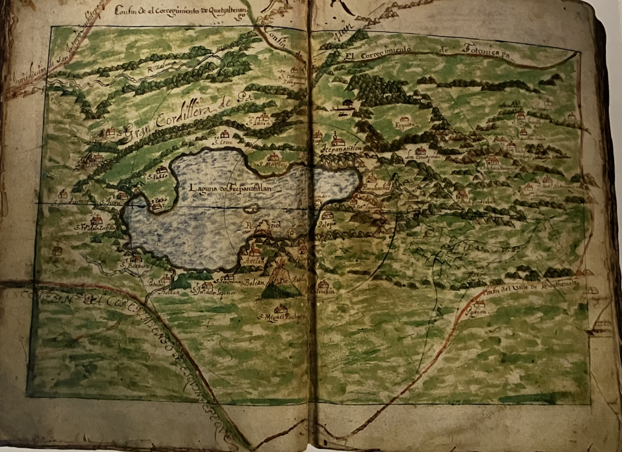
Mapa del Corregimiento de Tecpanatitlan
Map 1690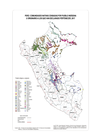
PERÚ: COMUNIDADES NATIVAS CENSADAS POR PUEBLO INDÍGENA U ORIGINARIO A LOS QUE HAN DECLARADO PERTENECER, 2017
Map 2017