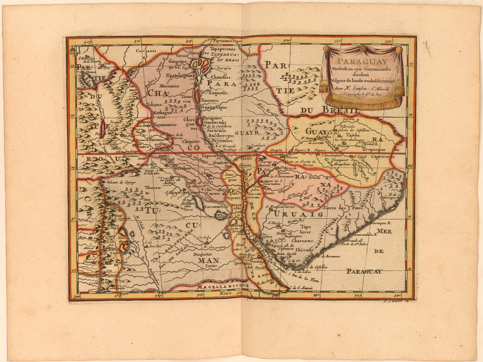
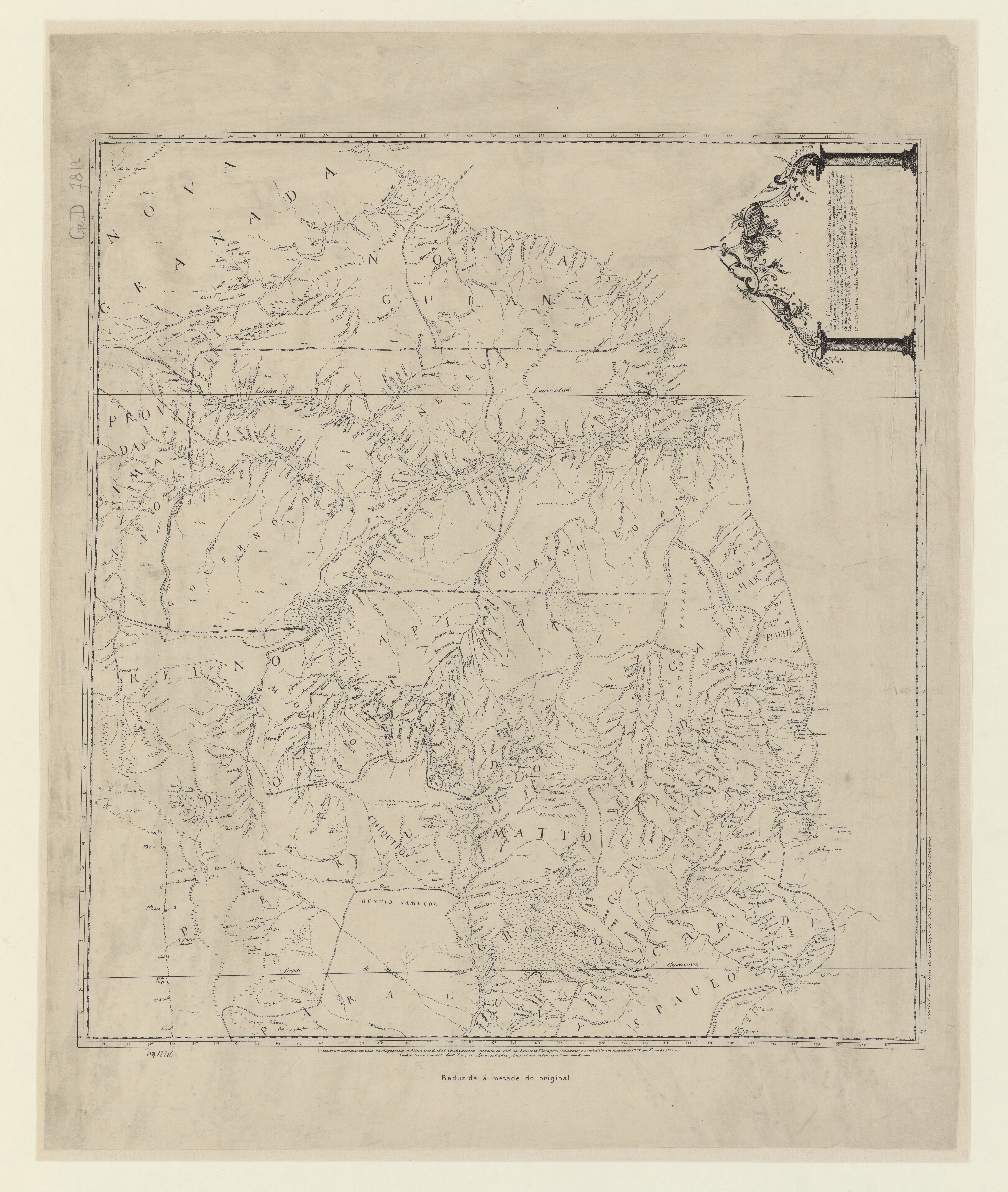
Dispossesions in the Americas

Dispossesions in the Americas

  • Home
  • Explore
  • About
  • Authors
  • Art
  • Bodies
  • Curricula
  • Cultural Heritage
  • Maps
  • Territories
Back to Explore
Map 1809

Carta geografica das capitanias do Para, Maranhao, Goias, e S. Paulo

  • COITINHO, LUIS PINTO DE SOUZA, ET AL.

Published: 1922

  • Download Image

Peoples

  • MURA
  • XAVANTE
  • CARUMARE
  • SAMUCOS

Citation

Coitinho, Luis Pinto de Souza, Joze Joze Pedro Cezar de, Eduardo A.G. Thompson, and Francisco Basto. Carta geografica das capitanias do Para, Maranhao, Goias, e S. Paulo. Map. Paris: Institut cartographique, 1922. Accessed August 4, 2023. https://gallica.bnf.fr/ark:/12148/btv1b530066692/f1.item#.

  • Download Image

Reading in Spanish

Map 1809

Carta geografica das capitanias do Para, Maranhao, Goias, e S. Paulo

  • COITINHO, LUIS PINTO DE SOUZA, ET AL.

Published: 1922

  • Download Image
  • Download Image

Related Content

Guatemala: From Official and Other Sources

Guatemala: From Official and Other Sources

Map 1900 - 1902
L'Amerique Meridionale divisée en ses principaux Etats

L'Amerique Meridionale divisée en ses principaux Etats

Map 1700 - 1800
FACSIMILE PART OF AMERICA BY DELISLE

FACSIMILE PART OF AMERICA BY DELISLE

Map 1722
Lago de Nicaragua

Lago de Nicaragua

Map 1748
CARTA del CANTON de CAYCARA de la Provincia de Guayana

CARTA del CANTON de CAYCARA de la Provincia de Guayana

Map 1840
Distribución  de  los  Grupos  Indígenas  de Bolivia

Distribución de los Grupos Indígenas de Bolivia

Map 2000 - 2010
WEST INDIES;CENTRAL AMERICA;COLUMBIA;VENEZUELA & BRITISH GUIANA

WEST INDIES;CENTRAL AMERICA;COLUMBIA;VENEZUELA & BRITISH GUIANA

Map 1876
Das obere Stromgebiet des RIO MADEIRA, nebst den agränzenden Ländern

Das obere Stromgebiet des RIO MADEIRA, nebst den agränzenden Ländern

Map 1800 - 1850

Dispossessions in the Americas

A project by

University of Pennsylvania

Copyright 2024

With support from

Mellon Foundation

Site design & development

Element 84

Art Credits

Coitinho, Luis Pinto de Souza, Joze Joze Pedro Cezar de, Eduardo A.G. Thompson, and Francisco Basto. Carta geografica das capitanias do Para, Maranhao, Goias, e S. Paulo. Map. Paris: Institut cartographique, 1922. Accessed August 4, 2023. https://gallica.bnf.fr/ark:/12148/btv1b530066692/f1.item#.

Site Pages

  • Home
  • Explore
  • About
  • Authors
  • Art
  • Bodies
  • Curricula
  • Cultural Heritage
  • Maps
  • Territories