Peoples
- AROANS
- SACACAS
Citation
Dos Reys, Ignacio, and Couvai. "Carte particulière de l'entrée du Para." Map. 1729. Accessed August 4, 2023. https://gallica.bnf.fr/ark:/12148/btv1b8596759p/f1.item.
MAPA DE LA REPÚBLICA DEL PARAGUAY
Map 1888
CHART containing the greater part of the SOUTH SEA to the South of the LINE, with the ISLANDS dispersed thro' the same
Map 1794
Provinces depéndant de la triple alliance
Map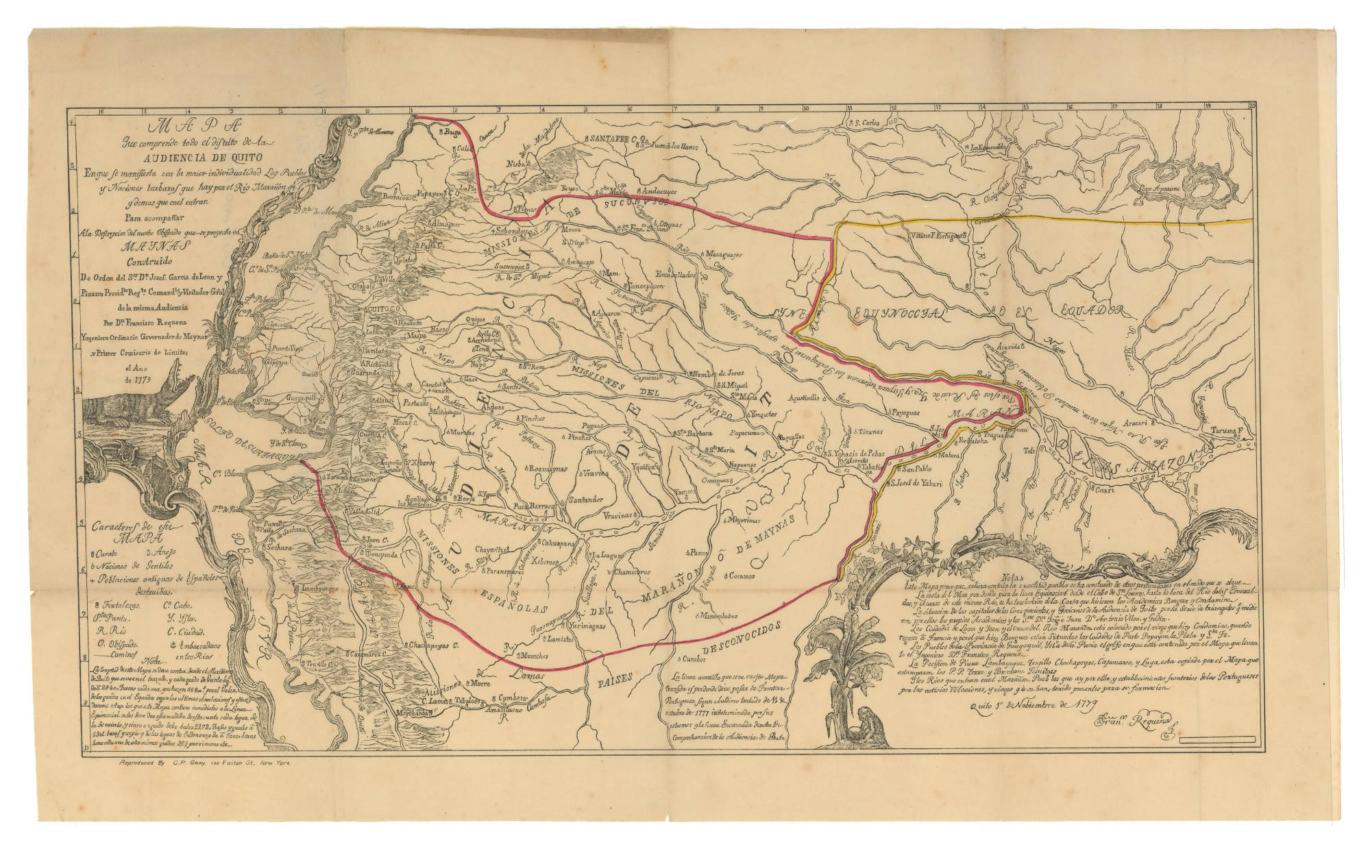
MAPA QUE COMPRENDE TODO EL DISTRITO DE LA AUDIENCIA DE QUITO
Map 1779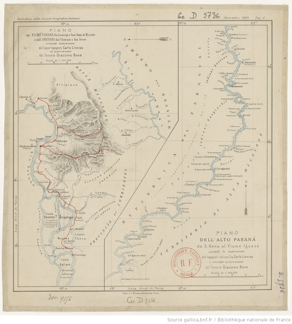
PIANO DELL'ALTO PARANA da S. Anna al fiume Iguazu
Map 1884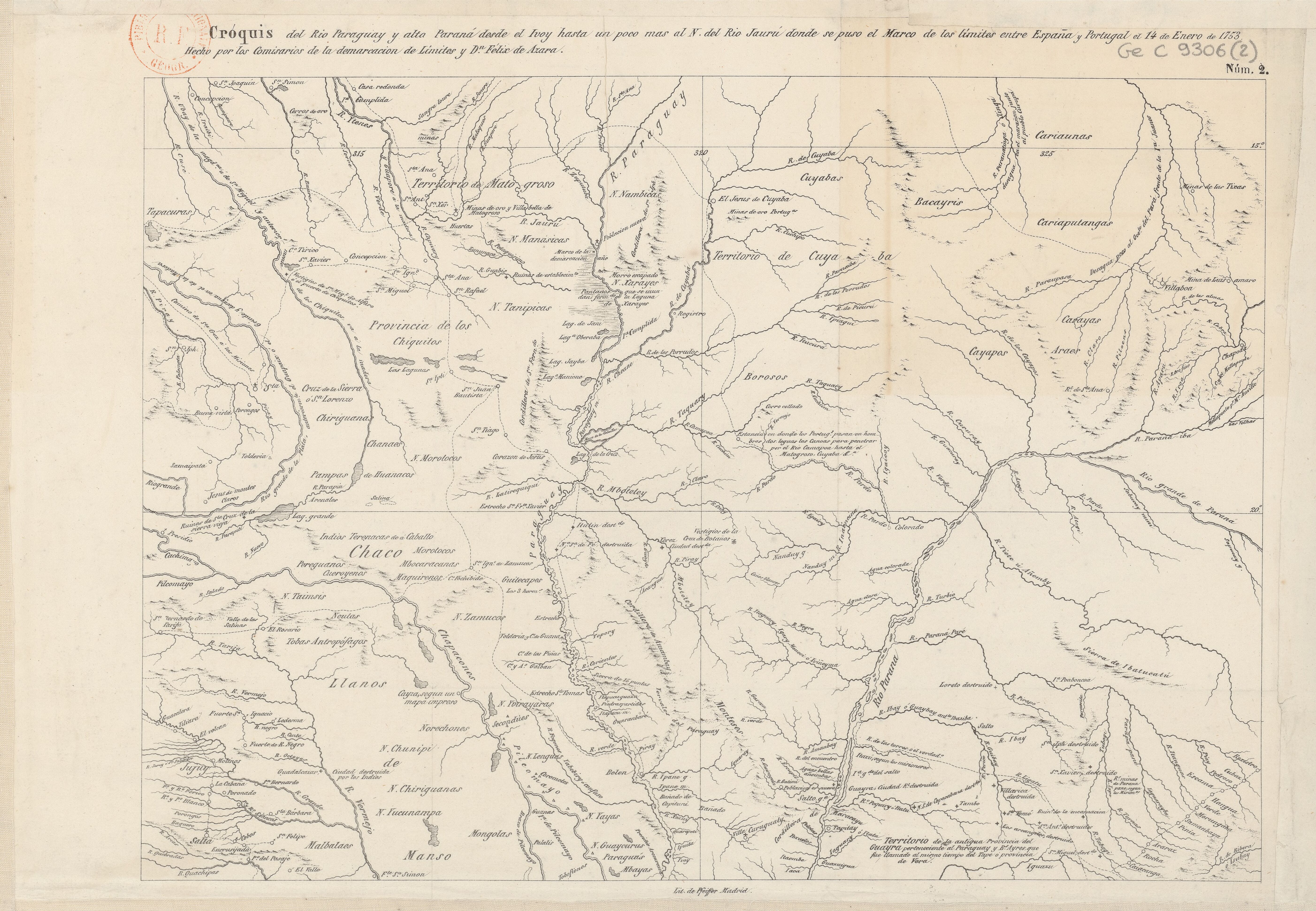
Cróquis del Rio Paraguay y alta Paraná desde el Ivoy hasta un poco más al N. del Rio Jaurú donde se puso el Marco de los límites entre España y Portugal el 14 de Enero de 1753.
Map 1750 - 1850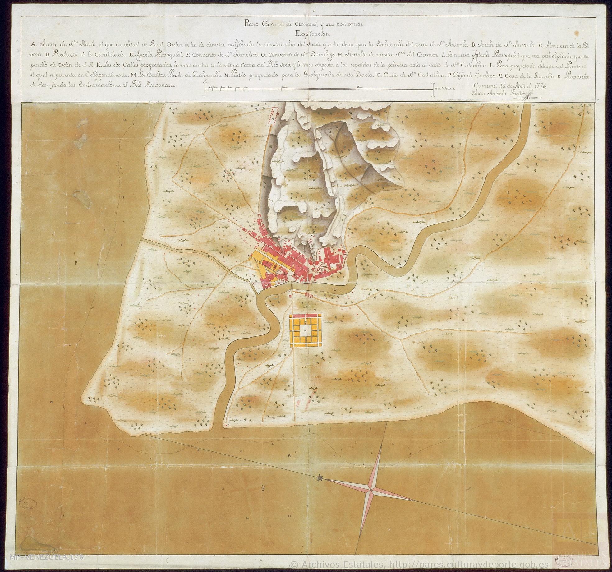
Plano general de Cumaná y sus contornos
Map 1774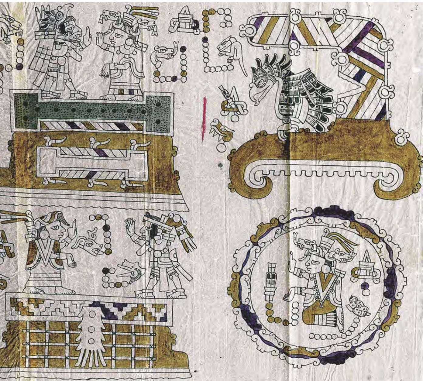
CÓDICE VINDOBONENSIS MEXICANUS 1, P.3
Map 1500 - 1599