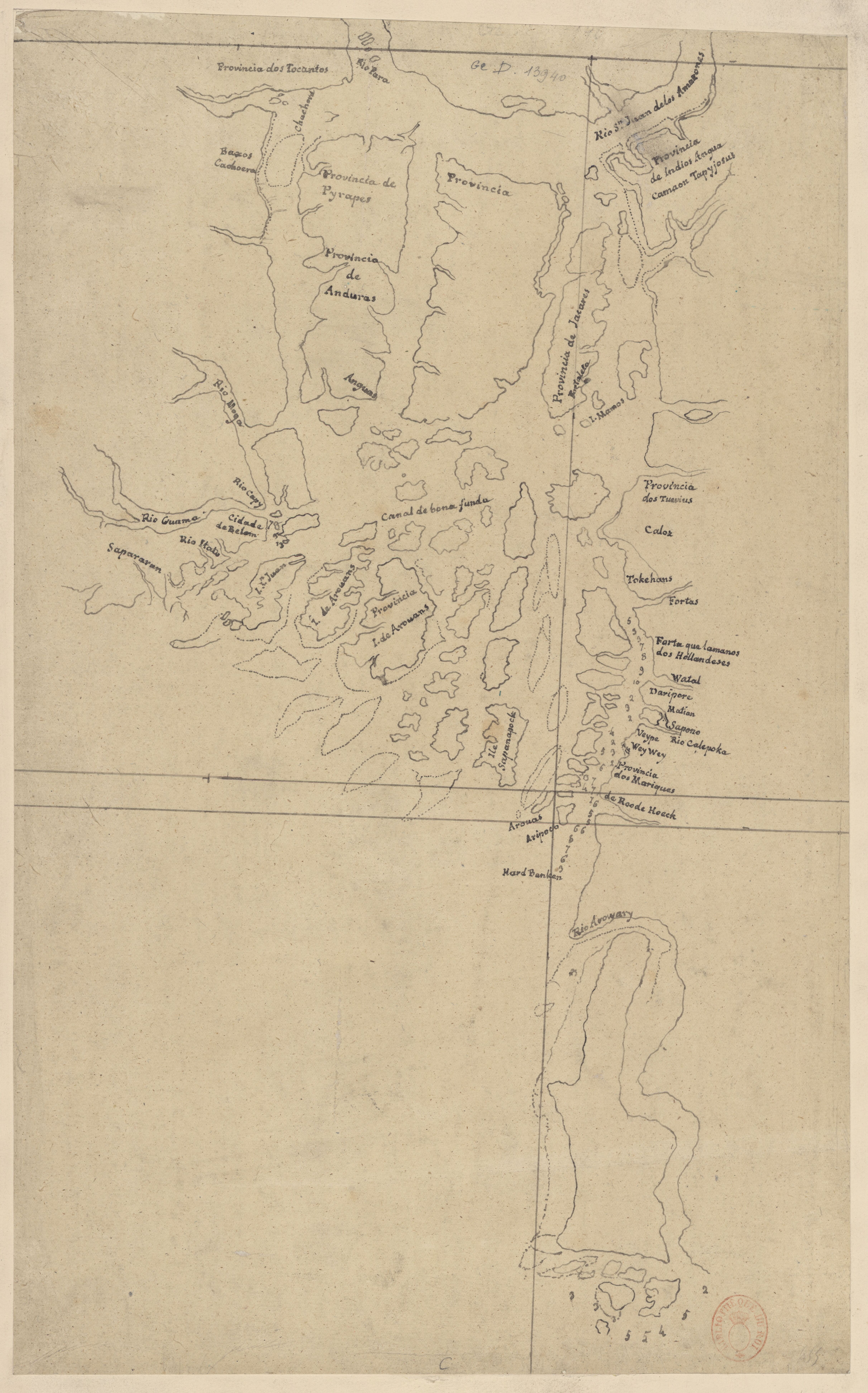
Peoples
- AROUAS
- ARIPOCO
- TAPYJOSUS
- JACARES
- PYRAPES
- ANDURAS
Citation
"Rio Para." Map. 1750. Accessed August 4, 2023. https://gallica.bnf.fr/ark:/12148/btv1b8491430c/f1.item.

"Territorio Indígena Kekoldi (Bribri)"
Map 2010![Seropositivo [Guestbook]](https://dnet8ble6lm7w.cloudfront.net/art_sm/ACOL011.png)
Seropositivo [Guestbook]
Artwork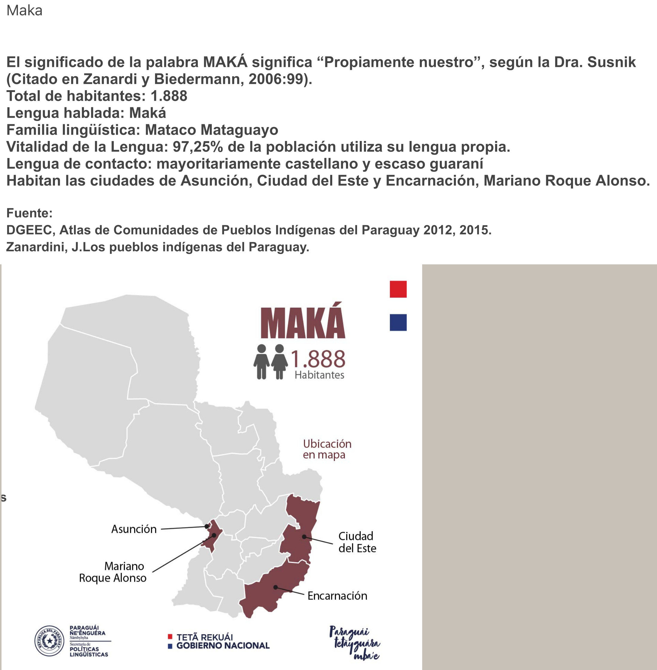
MAKÁ
Map 2015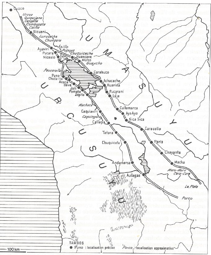
INCA ROADS AND TAMBOS in the 16th CENTURY
Map 1530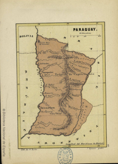
PARAGUAY
Map 1878
Embouchure de la Rivière des Amazones et partie de la coste de Guiane.
Map 1600 - 1699
OAXACA
Map 2015
Comunidad Aborigen Misión Federico Pérez - Pueblo Wichí
Map 2020