Peoples
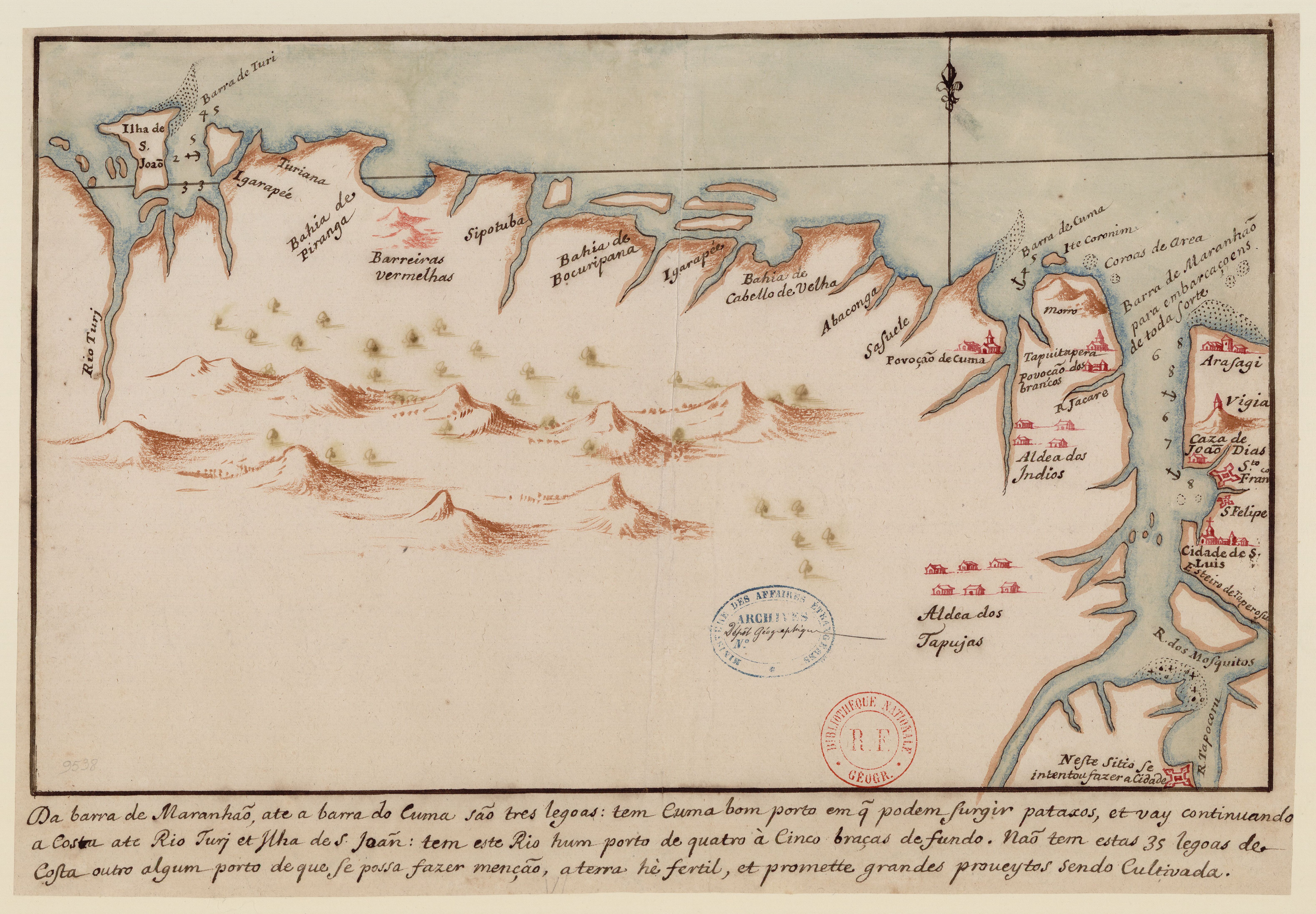
- TAPUJAS
Citation
Albernaz, João Teixeira. "Da barra de Maranhao, ate a barra do Cuma sao tres legoas." Map. 1640. Accessed July 31, 2023. https://gallica.bnf.fr/ark:/12148/btv1b8596747g/f1.item.
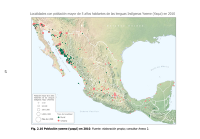
Población yoeme (yaqui) en 2010
Map 2010
CARTA GEOGRÁFICA DEL ECUADOR POR DR. TEODORO WOLF;PUBLICADA POR ORDEN DEL SUPREMO GOBIERNO DE LA REPÚBLICA Y TRABAJADA BAJO LAS PRESIDENCIAS DE LOS EE. SEÑORES DR. D.J.M. PLÁCIDO CAAMAÑO Y DR. D. ANTONIO FLORES. 1892 ... INSTITUTO GEOGRAFICO DE H. WAGNER & E. DEBES EN LEIPZIG. (WITH) LA REGION ORIENTAL DEL ECUADOR. (WITH) ARCHIPIÉLAGO DE GALÁPAGOS.
Map 1892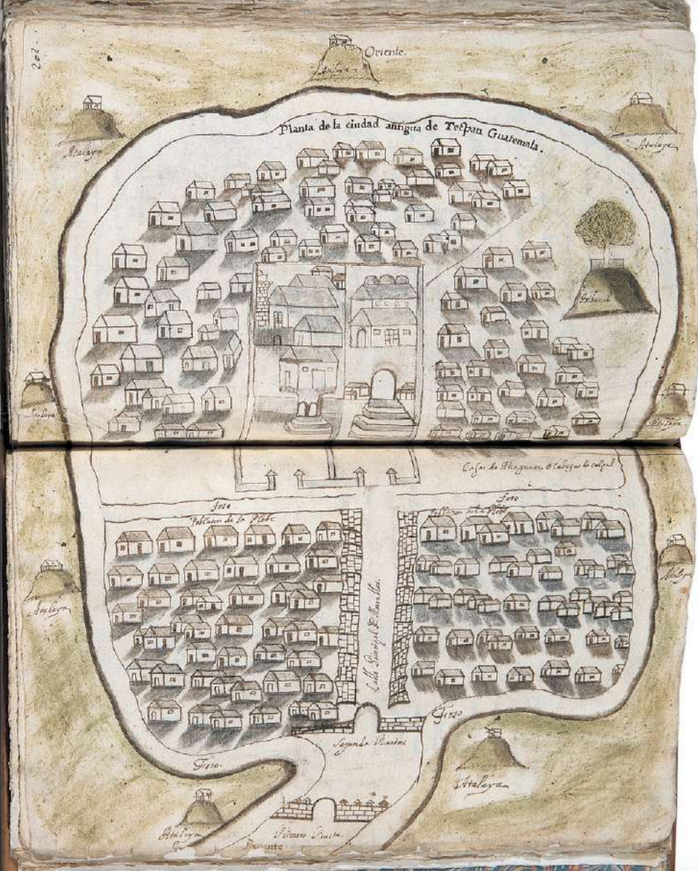
Planta de la ciudad antigua de Tecpan Guatemala
Map 1672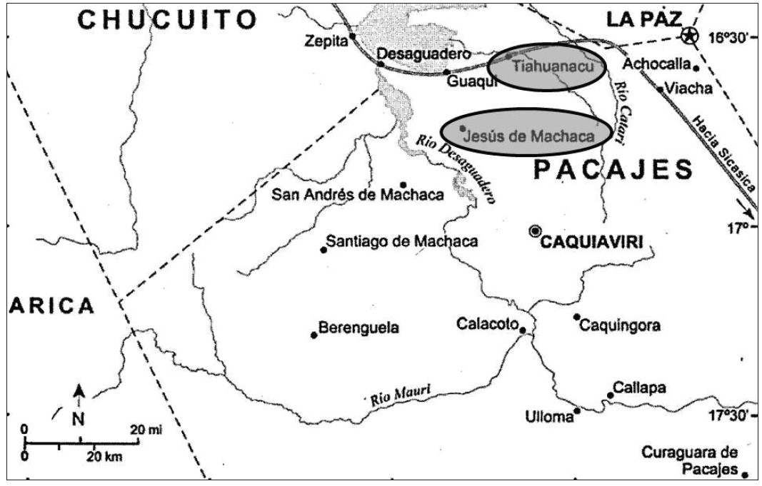
‘INDIAN ROYAL TOWNS’ (REDUCCIONES) IN THE PACAJES PROVINCE (CORREGIMIENTO) UNDER SPANISH COLONIAL RULE IN THE LATE 16TH CENTURY
Map 1570 - 1630
Geographical Distribution of the Huave
Map 1969
Orí Odé
Artwork
Colombia Prima or South America drawn from the large map in eight sheets by Louis Stanislas D'Arcy Delarochette
Map 1811
Pueblo Guaraní - Comunidad Kaa Puku - Campo Largo
Map 2020