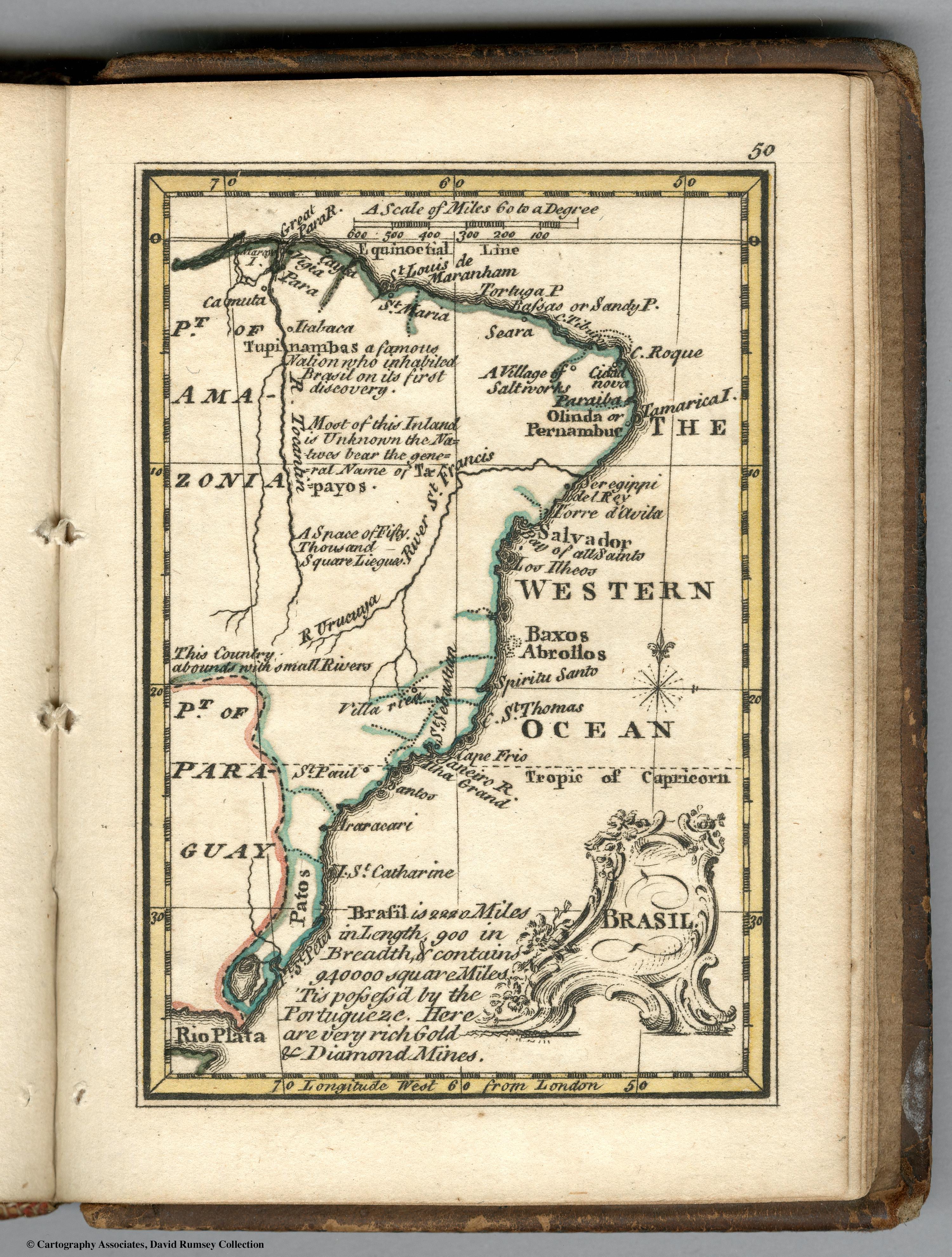
Peoples
- TUPINAMBAS
- TAPAYOS
Citation
Bowen, Emanuel, and John Gibson. Brasil. Map. London: J. Newberry, 1758. Accessed July 27, 2023. https://www.davidrumsey.com/luna/servlet/detail/RUMSEY~8~1~239216~5511691.
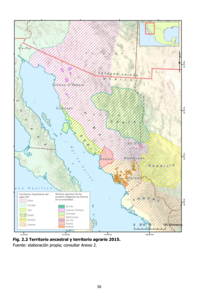
Territorio ancestral y territorio agrario 2015
Map 2015![1. Angustia #1
2. Angustia #2
3. Angustia #7
4. Angustia #8
5. Angustia #10
6. Angustia #12 [Anguish]](https://dnet8ble6lm7w.cloudfront.net/art_sm/ACOL025.png)
1. Angustia #1 2. Angustia #2 3. Angustia #7 4. Angustia #8 5. Angustia #10 6. Angustia #12 [Anguish]
Artwork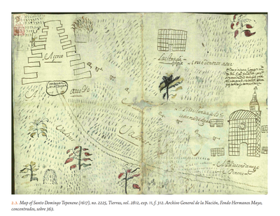
MAP OF SANTO DOMINGO TEPENENE
Map 1617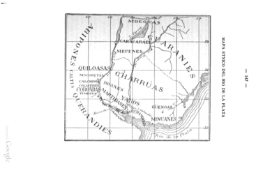
MAPA ÉTNICO DEL RÍO DE LA PLATA
Map 1500 - 1900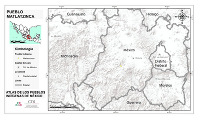
PUEBLO MATLATZINCA
Map 2020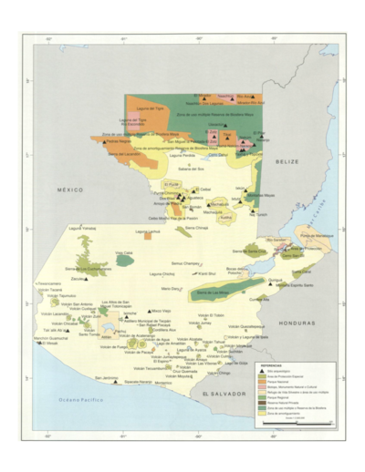
Sistema guatemalteco de áreas protegidas (SIGAP) y sitios arqueológicos en 2000.
Map 2000![Carte du Chili Méridional du Rio de la Plata, des Patagons, et
du Détroit de Magellan;Ce qui fait l'extremité Australe de l'Amerique
Merid[iona]le.](https://dnet8ble6lm7w.cloudfront.net/maps/ARG/ARG0069.jpg)
Carte du Chili Méridional du Rio de la Plata, des Patagons, et du Détroit de Magellan;Ce qui fait l'extremité Australe de l'Amerique Merid[iona]le.
Map 1779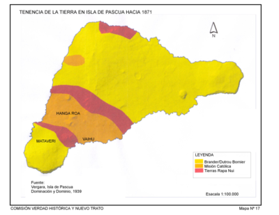
Tenencia de Tierra en la Isla de Pascua hacia 1871.
Map 1871