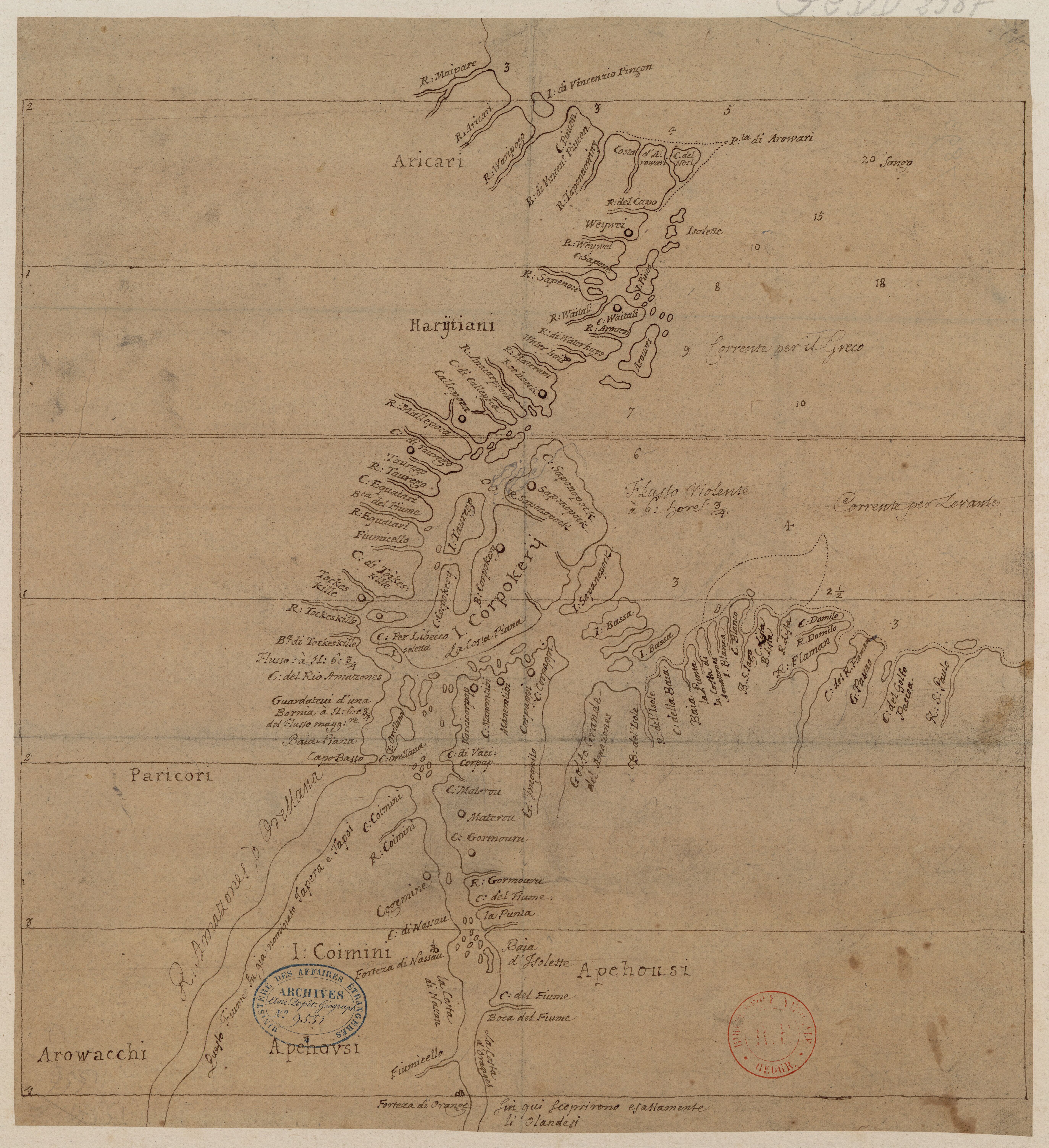
Peoples
- ARICARI
- HARYTIANI
- PARICORI
- AROWACCHI
- APEHOUSI
Citation
Dudley, Robert. "Carte de l'embouchure de l'Amazone." Map. Accessed July 28, 2023. https://gallica.bnf.fr/ark:/12148/btv1b8596757v/f1.item.
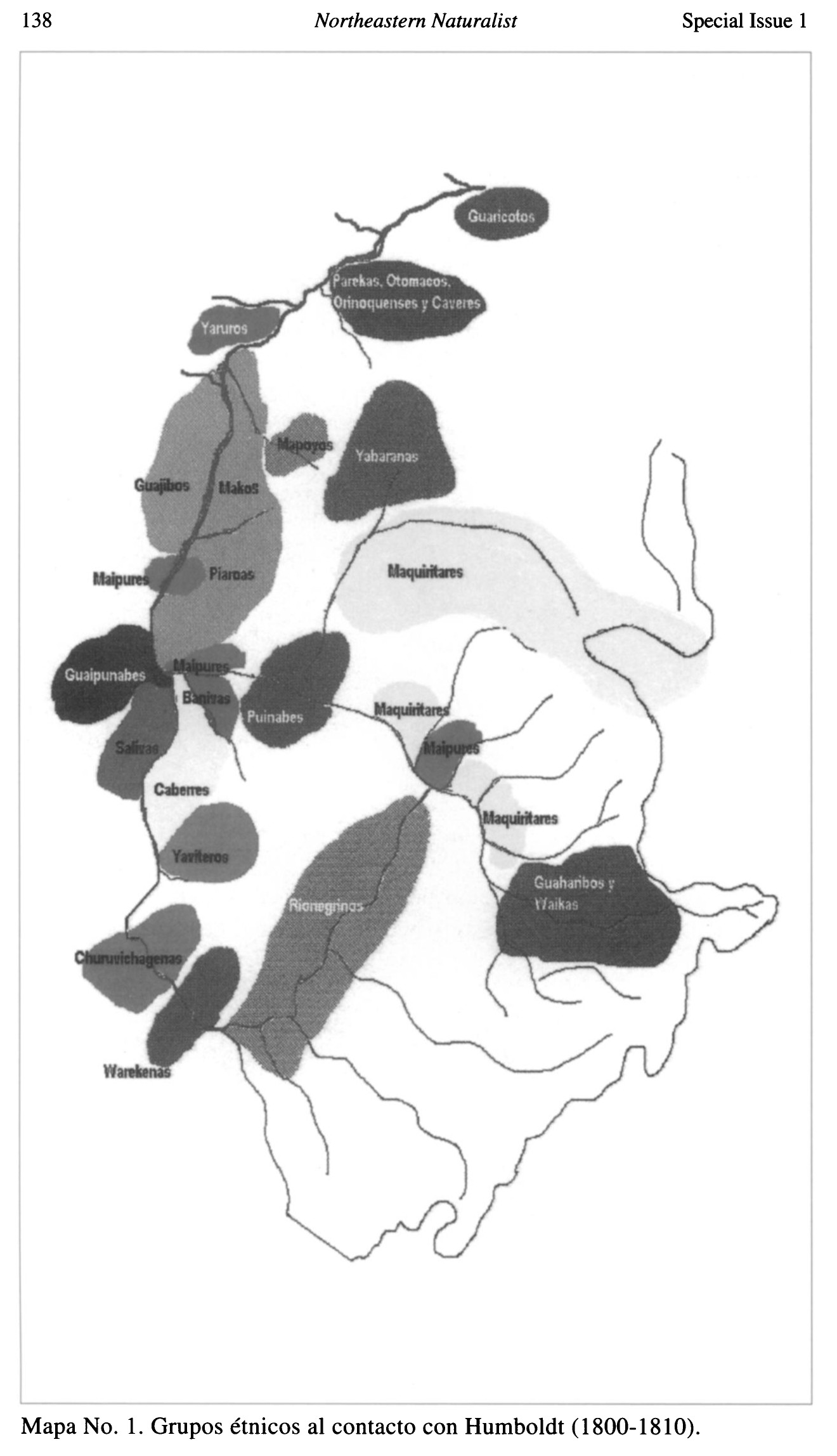
Grupos étnicos al contacto con Humboldt (1800-1810)
Map 1800 - 1810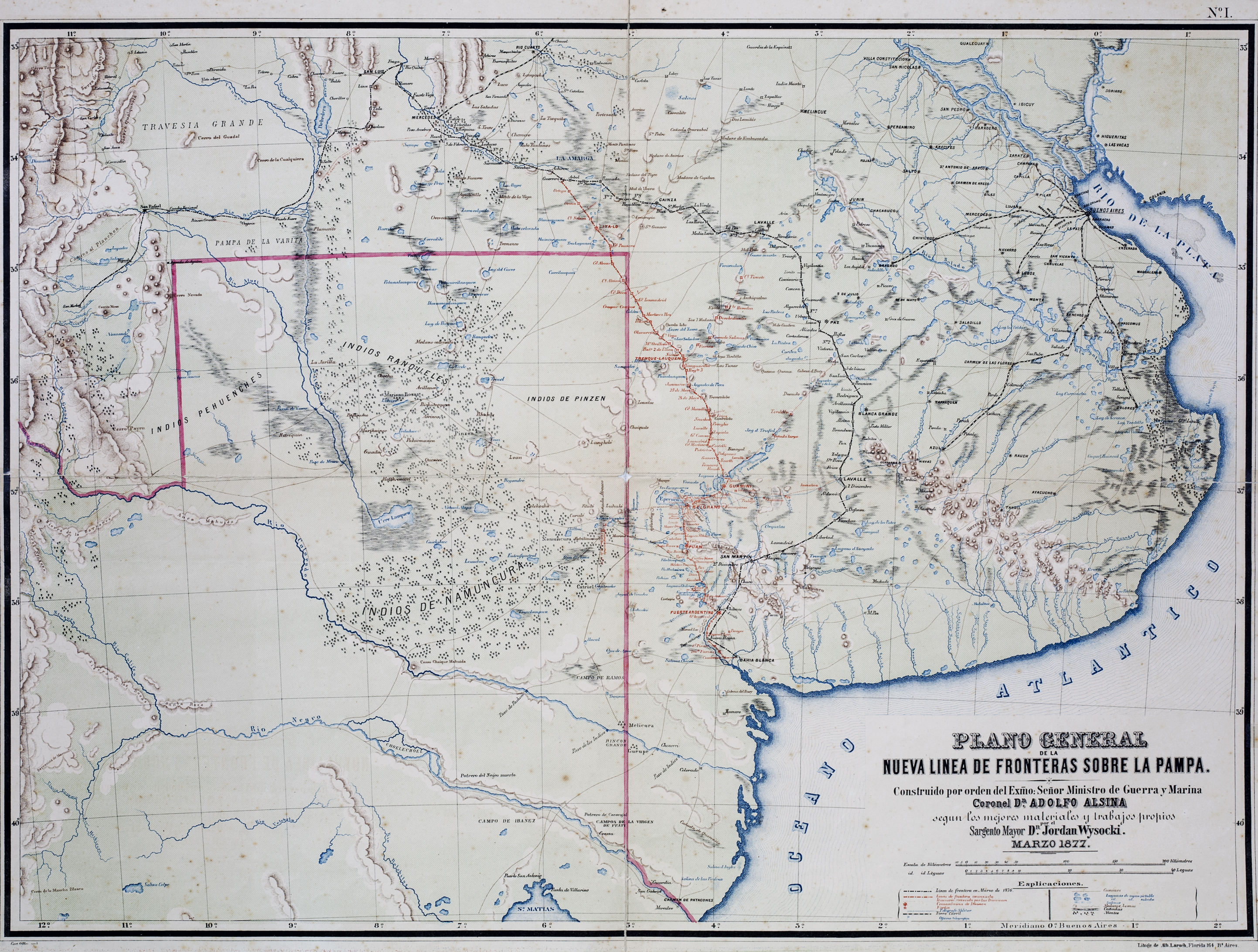
Plano General de las Nuevas Fronteras sobre La Pampa.
Map 1877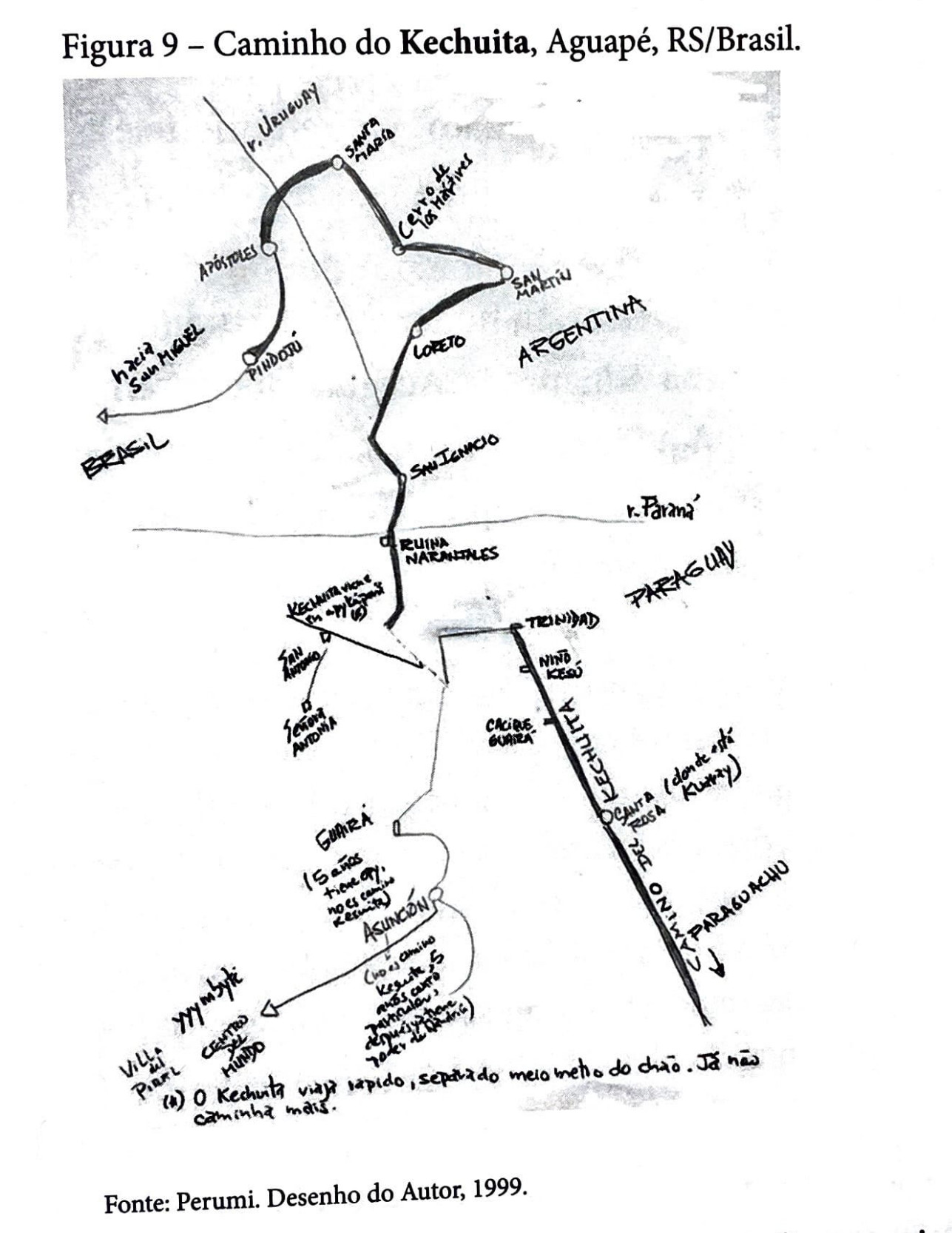
Caminho do Kechuita, Aguapé, RS/Brasil
Map 1999
CHILI AND PARAGAY
Map 1680
Mapa de costa comprendida entre Trujillo (Honduras) y la desembocadura del río de Matina.
Map 1768
A New Chart of Guayana with the colonies of Cayenne;Surinam;&c.
Map 1700 - 1799
Plano general de Cumaná y sus contornos
Map 1774![TAJO [SLASH]](https://dnet8ble6lm7w.cloudfront.net/art_sm/AMEX003.png)
TAJO [SLASH]
Artwork