Peoples
- PETIGUAR
- TOPIMANBAZES
Citation
Visscher, Claes Jansz. Afbeelding der stadt en fortressen van Parayba. Map. Amsterdam: C.J. Visscher, 1634. Accessed July 28, 2023. https://gallica.bnf.fr/ark:/12148/btv1b84390955/f1.item.
![Carte de la Guyane française (2ème édition). Service géographique des colonies. [Feuille 2]](https://dnet8ble6lm7w.cloudfront.net/maps_sm/FGU/FGU0012-0.png)
Carte de la Guyane française (2ème édition). Service géographique des colonies. [Feuille 2]
Map 1926
DISTRIBUCION DE GRUPOS CON LENGUAS CHIBCHAS
Map 2019
FAMILIAS LINGUISTICAS Y LENGUAS INDIGENAS - TERCERA REGION: AMAZONIA MERIDIONAL
Map 1989
MAPA Físico y Político DE LA REPÚBLICA DE VENEZUELA
Map 1840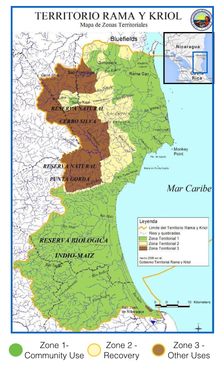
Territorio Rama y Kriol: Mapa de Zonas Territoriales. Three Zones proposed by the PADA to ensure a sustainable future for the communities of Rama and Kriol
Map 2000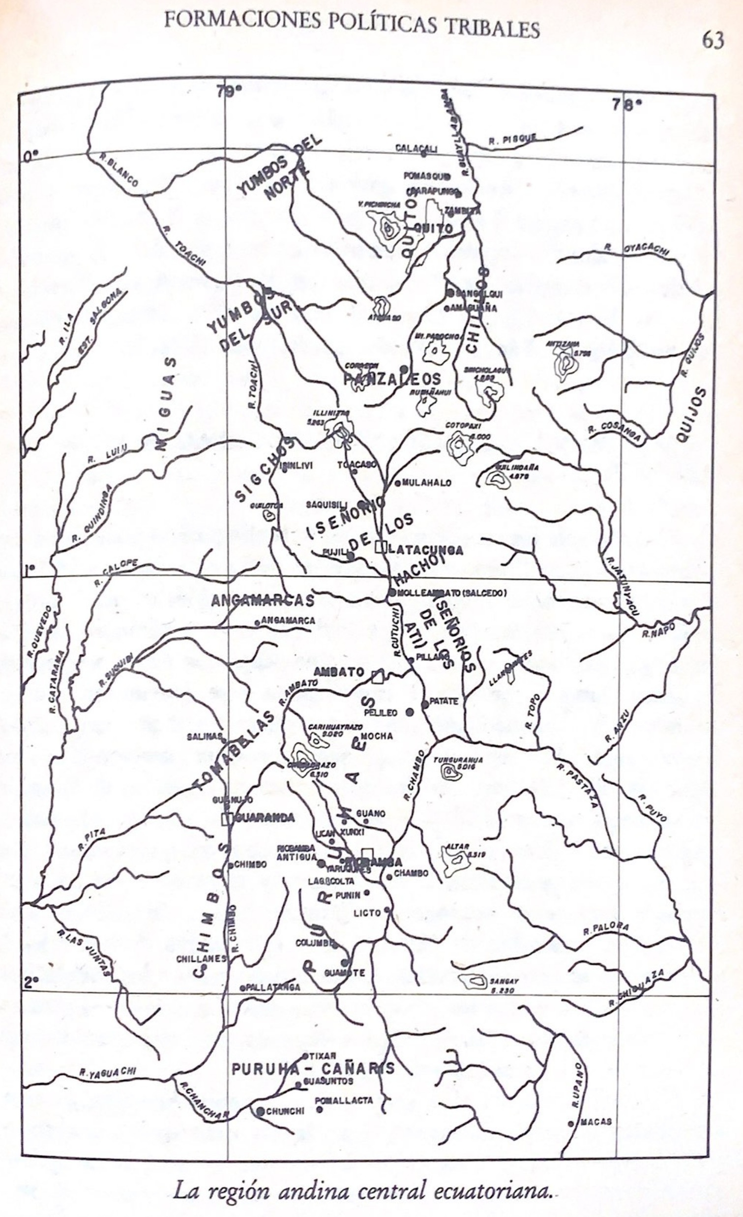
La región andina central ecuatoriana
Map -500 - 1550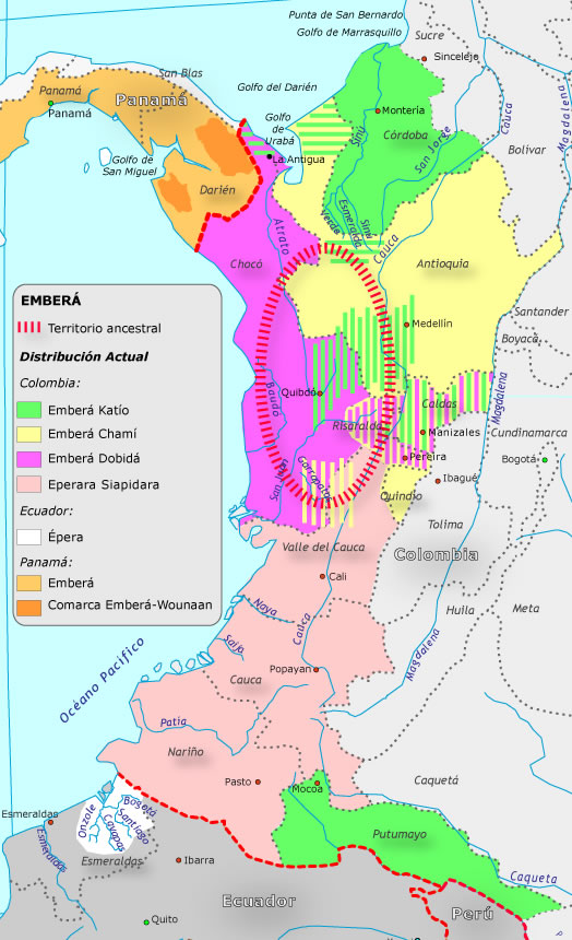
Grupo aborigen Emberá
Map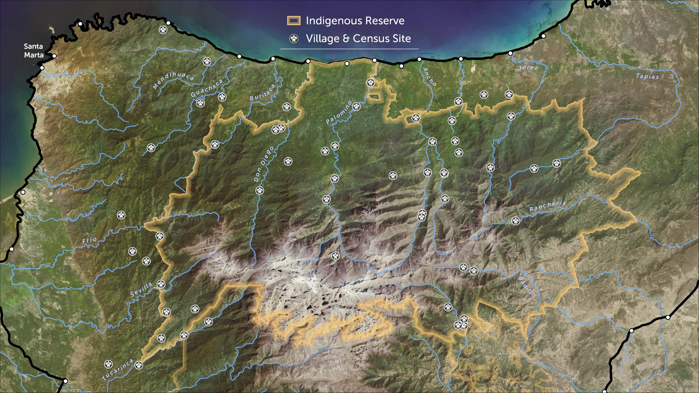
STRENGTHENING INDIGENOUS LAND RIGHTS IN COLOMBIA
Map 2019 - 2020