Peoples
- CULINOS
- MARAUA
- CATAUIXIS
- ARAUAS
Citation
Chandless, William. Map of the River Juruá. Map. London: John Murray, 1869. Accessed July 25, 2023. https://gallica.bnf.fr/ark:/12148/btv1b530067468/f1.item.
PARTIE DE LA COLOMBIE
Map 1827
Explorations de la Guyane par Henri Coudreau, 1887-89, 1889-91.
Map 1887 - 1891
Ethnographische Karte von Guatemala
Map 1884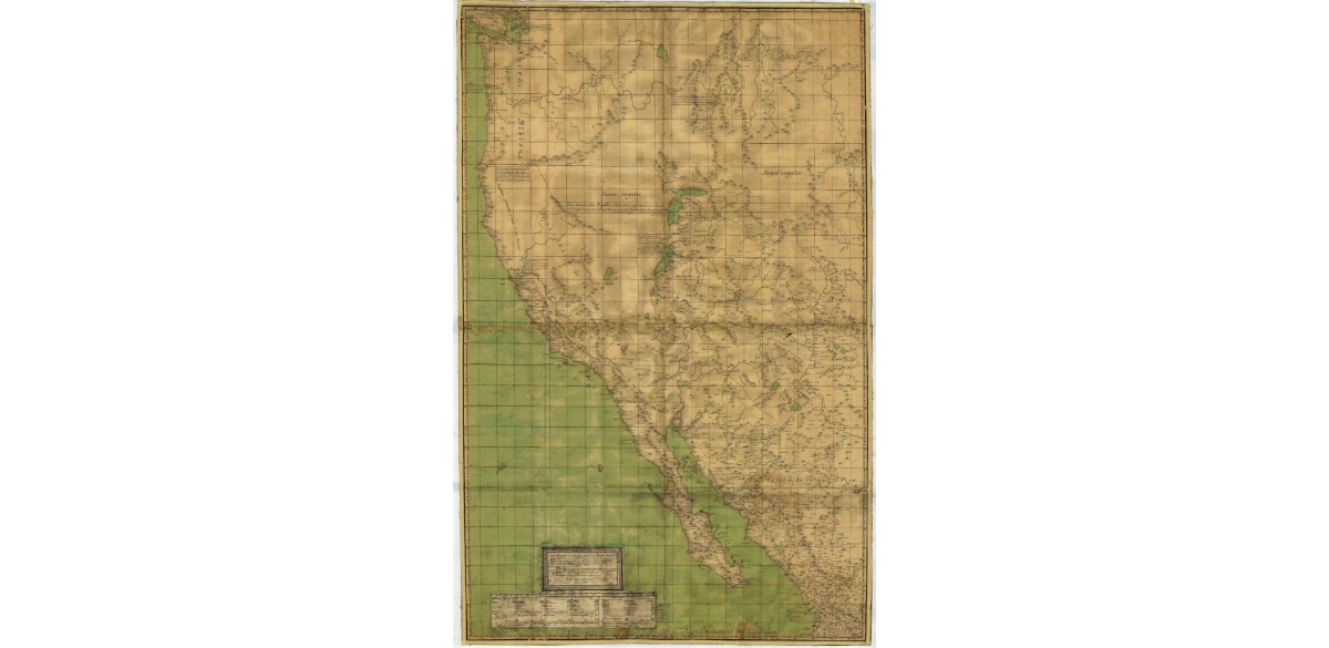
CARTA GEOGRÁFICA DE UNA GRAN PARTE DE LA AMERICA SEPTENTRIONAL
Map 1832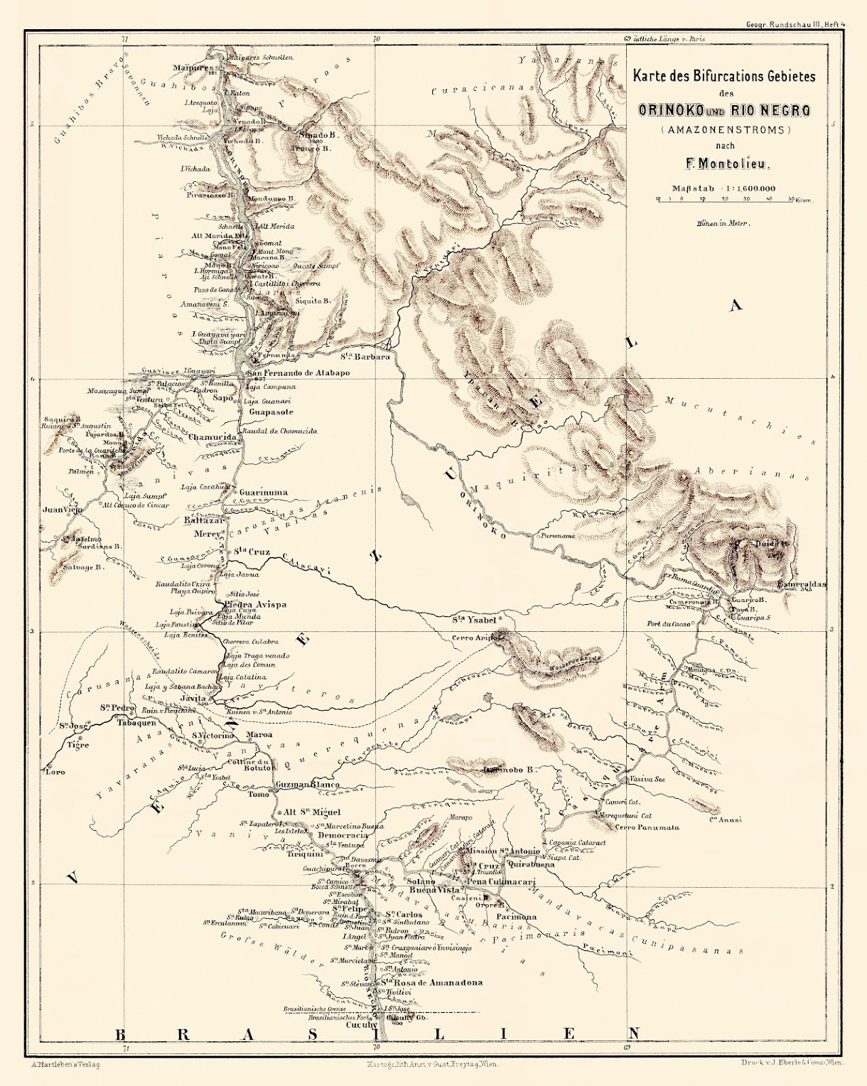
Karte des Bifurcations Gebietes des ORINOKO und RIO NEGRO (AMAZONENSTROMS)
Map 1881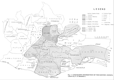
Geographic Distribution of the Zapotec, Oaxaca
Map 1969!["Senza titolo" ["Untitled"]](https://dnet8ble6lm7w.cloudfront.net/art_sm/ABRA015.png)
"Senza titolo" ["Untitled"]
Artwork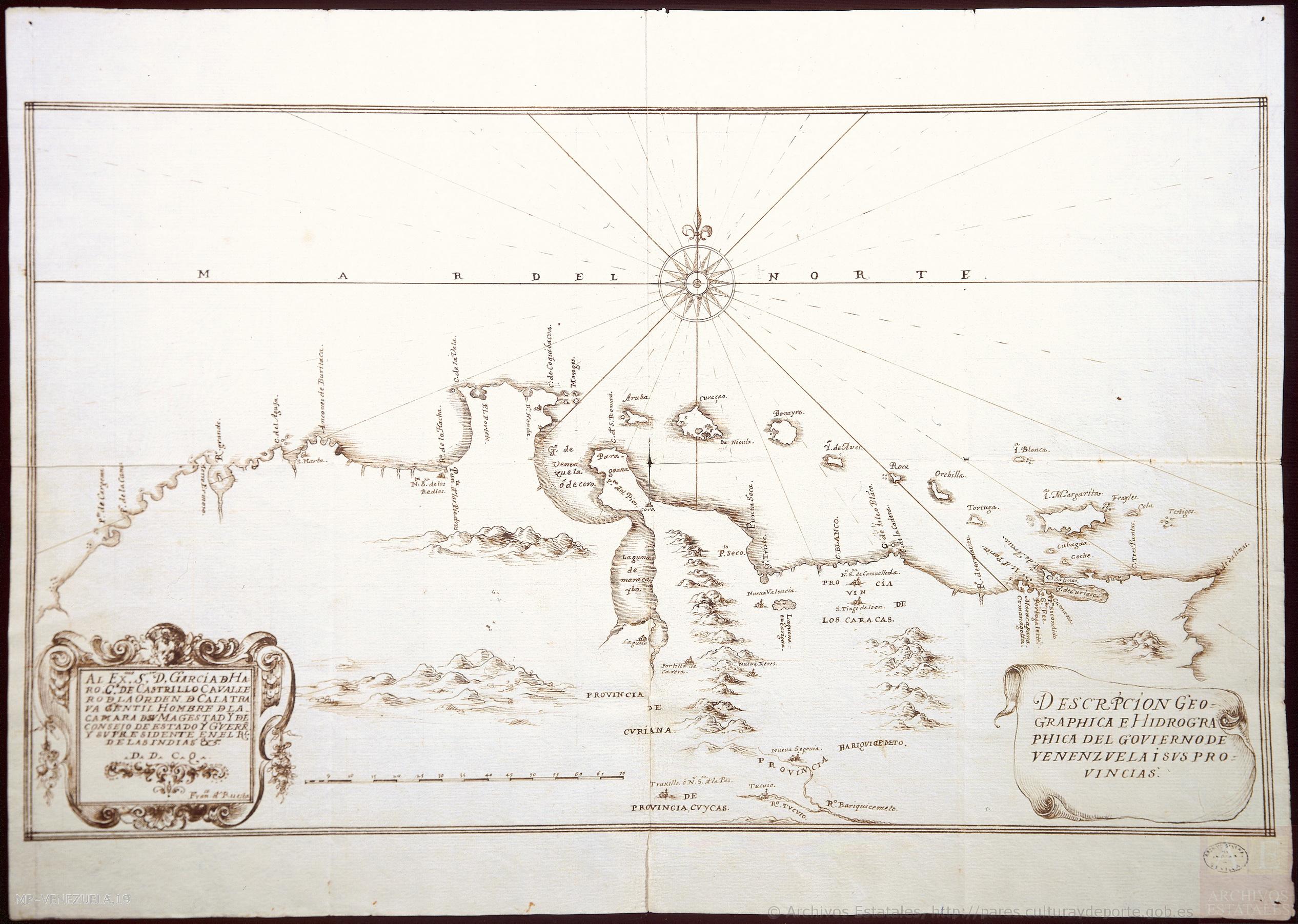
DESCRIPCIÓN GEOGRAPHICA E HIDORGRÁPHICA DEL GOVIERNO DE VENEZUELA I SUS PROVINCIAS
Map 1634