Peoples
- CAPECHENES
- HYPURINAS
Citation
Chandless, William. "Map of the River Aquiry (an Affluent of the Purûs)." Map. 1865. Accessed July 25, 2023. https://gallica.bnf.fr/ark:/12148/btv1b84411818/f1.item.
TERRARUM S: MICHAELIS oppidi Americae meridionalis in provincia olim Tape dicta, trans Flumen Vruguai siti, cum adjacentibus simul aliorum oppidorum terris & vicinia Lusitanorum, accurata descriptio.
Map 1750 - 1760
CONCENTRACIÓN DE POBLACION DE TRES Y MAS ANOS QUE HABLAN LENGUA INDÍGENA EN MÉRIDA, YUCATÁN, 2010
Map 2012
CARTA del CANTON de CAYCARA de la Provincia de Guayana
Map 1840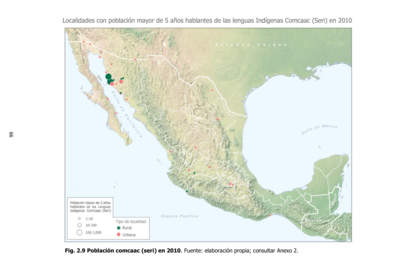
Población comcaac (seri) en 2010
Map 2010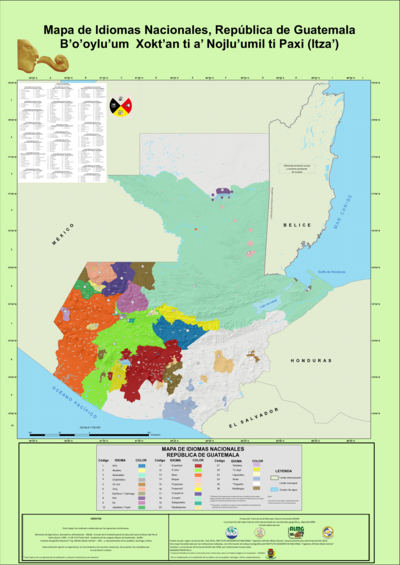
Mapa de Idiomas Nacionales, República de Guatemala B'o'oylu'um Xokt'an ti a' Nojlu'umil ti Paxi (Itza')
Map 2016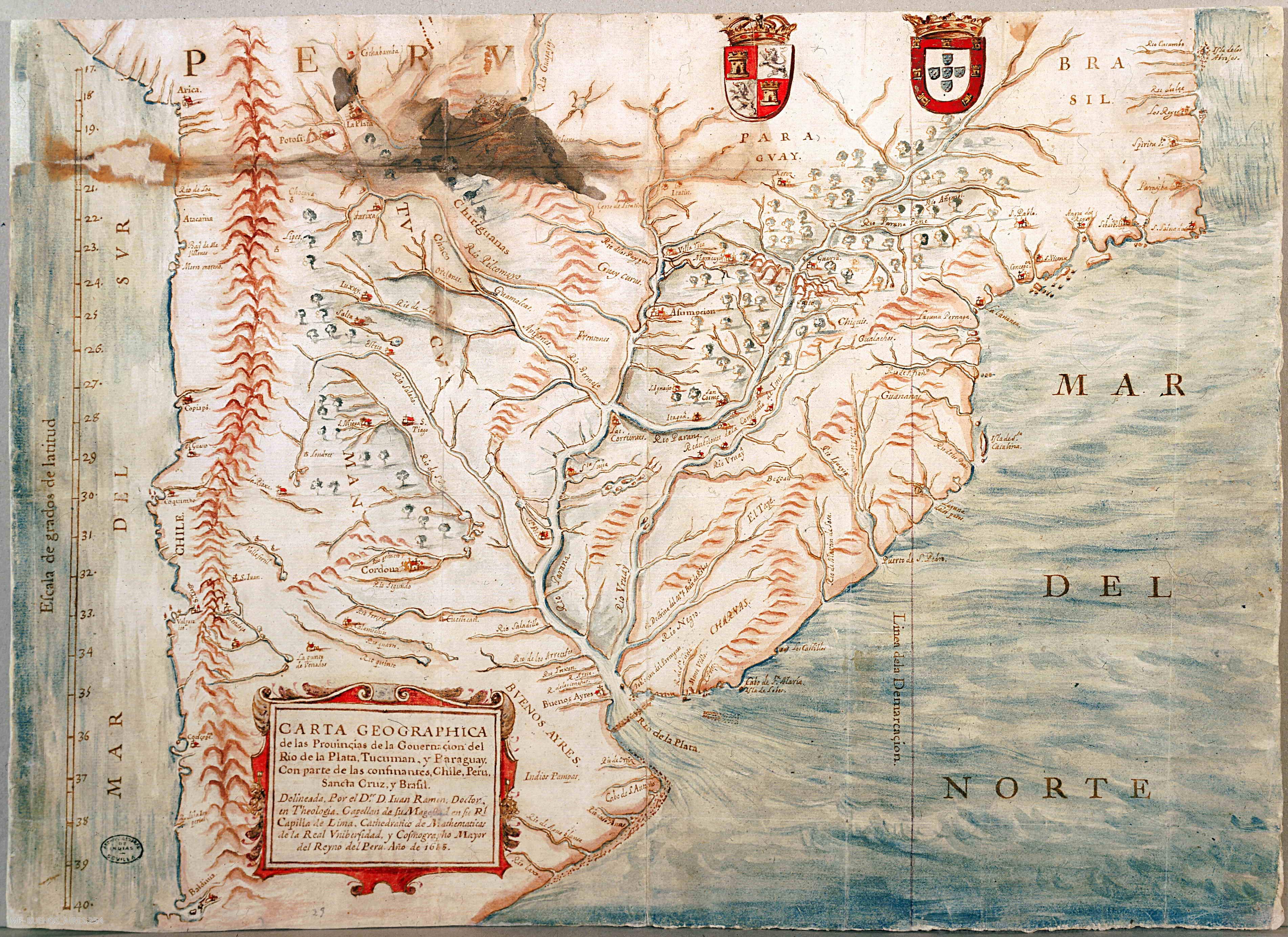
CARTA GEOGRAPHICA de las Prouinçias de la Gouernación del Río de la Plata;Tucumán;y Paraguay. Con parte de las confinantes;Chile;Perú;Sancta Cruz;y Brasil
Map 1683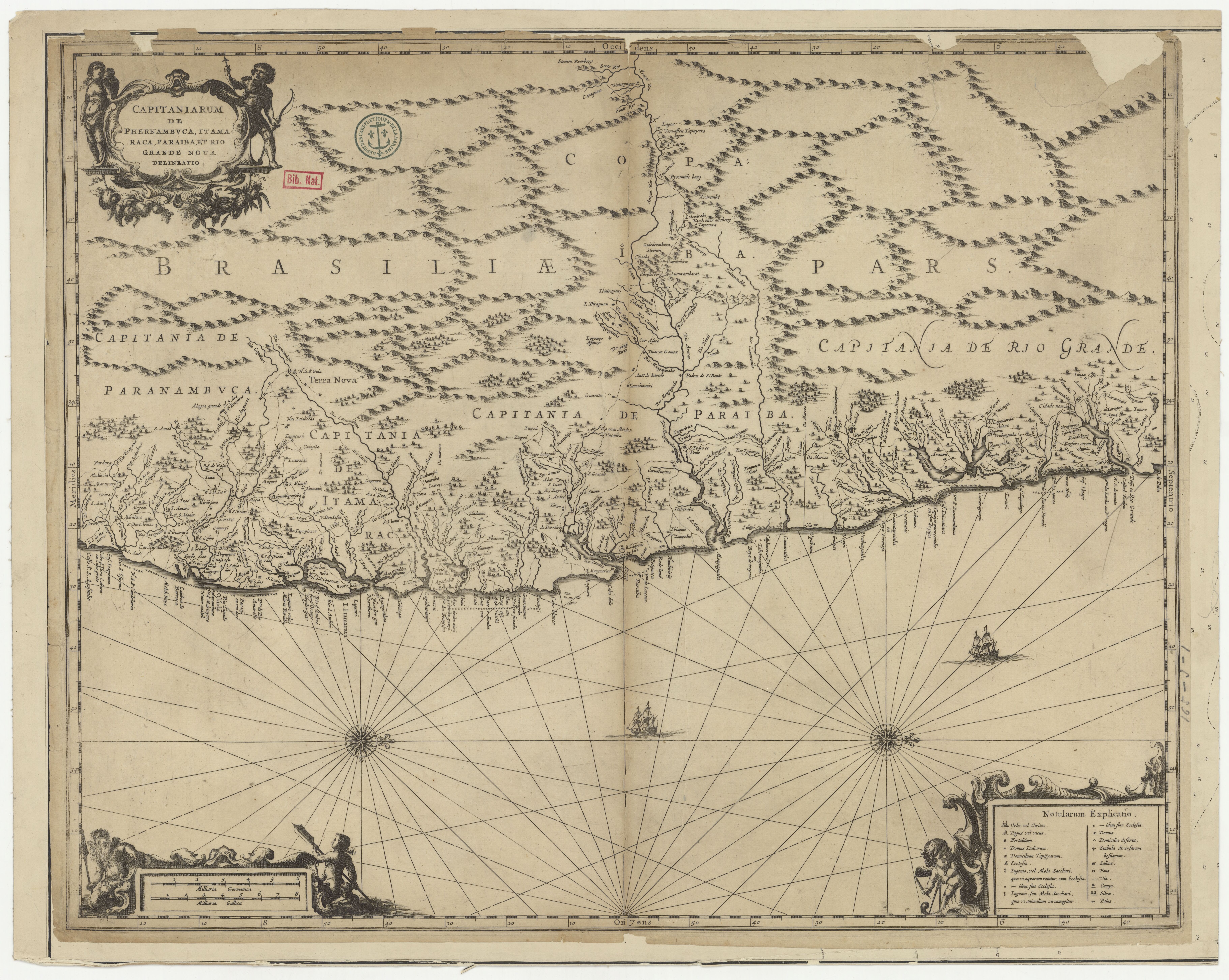
CAPITANIARUM DE PHERNAMBUCA, ITAMARACA, PARAIBA ET RIO GRANDE NOVA DELINEATIO
Map 1650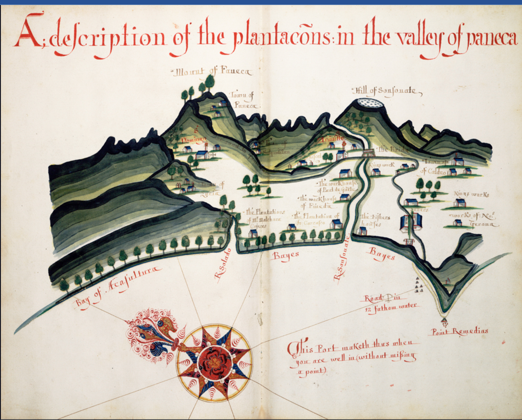
A Description of the Plantations in the Valley of Paneca
Map